
3h
各位
SquallLineのオタクさんにDMしまくってます。すみません。
関ケ原動員協力体制構築の為です。
お力添えのほどよろしくお願いします。
気になる方いましたらDMください。
よろしくお願いします。
3
215

#mistFES2026
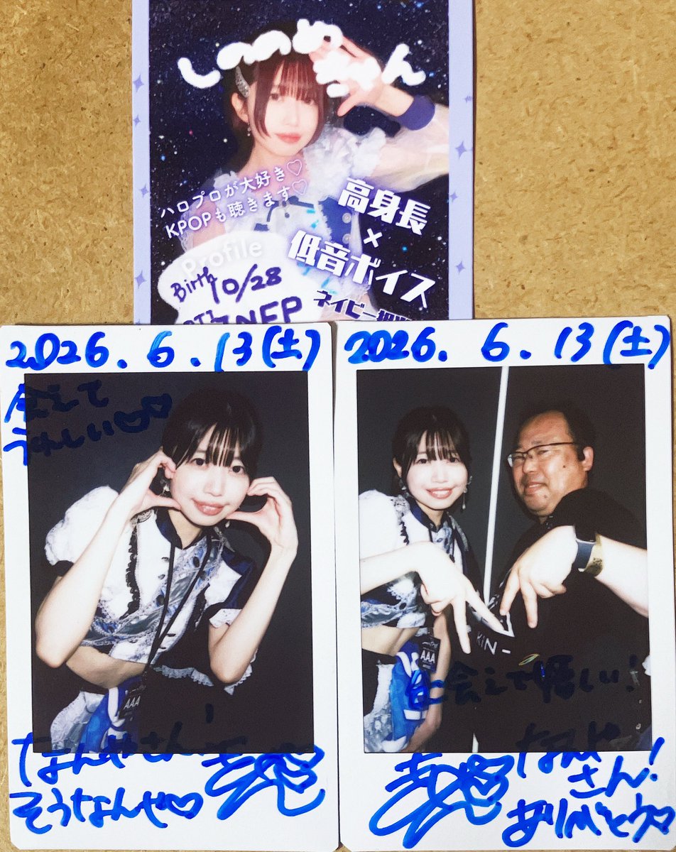
●SquallLine 🎤📷
💙東雲きゃんさん。お世話になっていた運営さんのおすすめでご挨拶!TOYSの3、4曲目が好みです
●Re:bellious 🎤📷
❤️しまったァァァァ、百合チェキレギュあるか聞くの忘れたぁw
●きっと大切だった🎤📷
🤍💙べ、べつに好きな曲は、茜色だけじゃ無いんだからね
2
90

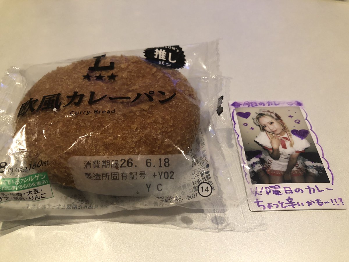
#兎咲とうか
#とかぴ
#観れば推したくなるアイドル
#兎中毒
#兎カレー中毒
#チェキタグ
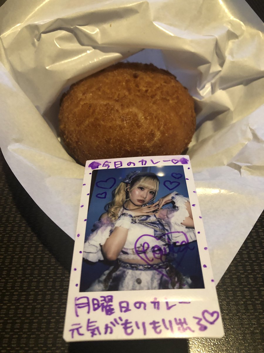
今日はとかぴのソロライブ前のカレーパン!とかぴ💜辛くはないよ笑笑
ひとつ言えることは普通に食べるより何倍も美味しいw
#ローソン
#横風カレーパン
#SquallLine #Squall_Line #スコライ #スコールライン
1
2
216
#兎咲とうか
#とかぴ
#観れば推したくなるアイドル
#兎中毒
#兎カレー中毒
月曜初のカレーチェキタグ!
カレーパンひとつでもとかぴにて仕事疲れからの元気もりもり!
スコライのライブ楽しめる!
#セブンイレブン
#お店で揚げたカレーパン
#SquallLine #Squall_Line #スコライ #スコールライン
1
1
2
301

Jun 14
The Dynamic Skies of June 13, 2026: A Case Study of Severe Weather Across the Central United States
On June 13, 2026, the central United States experienced a significant severe weather event. Scattered supercells evolved into a destructive squall line, bringing damaging winds, large hail, isolated tornadoes, and flash flooding. The episode highlighted rapid convective changes and the critical role of storm chasers and ground observers.
Meteorological Setup
The Storm Prediction Center issued an Enhanced risk for central and eastern Kansas, western Missouri, northeastern Oklahoma, and nearby areas. Primary threats were damaging winds, large hail, and a limited tornado risk. A cold front combined with instability and shear supported afternoon supercells that later organized into a linear mesoscale convective system.
Storm Evolution and Hazards
Storms began as localized clusters and intensified through the afternoon. By evening, they consolidated into a squall line that produced the main impacts.
• Tornadoes: A radar-confirmed tornado tracked through Missouri City, Liberty, and Excelsior Springs, Missouri. A visible landspout formed in Kansas and was observed directly by National Weather Service staff at Dodge City around 5:45 p.m. CDT.
• Hail: The largest hail measured 2.75 inches near Taylor, Nebraska.
• Winds: Peak gusts reached 96 mph northeast of Eva, Oklahoma, and 90 mph in Amarillo, Texas, with widespread damaging winds across the region.
• Rainfall and Flooding: Intense rates caused flash flooding, including 4 inches in one hour at Humansville, Missouri, and 5.61 inches in 12 hours at Hartville, Missouri.
Tornado watches covered parts of Kansas and Missouri, while numerous severe thunderstorm warnings were issued.
Field Reports and Impacts
Storm chasers provided essential real-time information. Live coverage documented the tornado-warned storm near Liberty, Missouri, and chasers tracked the shift from discrete cells to the squall line. National Weather Service personnel directly observed the Kansas landspout, and spotters reported hail sizes, wind damage, and rainfall totals that supported warning updates.
Impacts included downed trees and power lines from strong winds, localized damage along the Missouri tornado path, hail damage to property, and flash flooding in Missouri. In the Mid-Atlantic, gusts over 60 mph caused a building collapse, confirming the reach of linear convective threats.
Historical Context
This event differed from the June 11, 2026, outbreak, which featured multiple strong tornadoes across the Midwest. June 13 emphasized widespread straight-line winds within an organized squall line and isolated tornadoes. It aligned with classic High Plains patterns, where high-based storms generate intense outflow winds and occasional landspouts. The realized tornadoes despite modest probabilities illustrated the “sneaky” nature of boundary-enhanced threats seen in prior similar episodes.
Key Takeaways
The June 13, 2026, event demonstrated the atmosphere’s rapid evolution from supercells to a linear system. Damaging winds dominated, accompanied by hail, isolated tornadoes, and flooding. Storm chasers and spotters delivered vital observations that enhanced warnings and public safety.
This case study reinforces the need for preparedness across all hazard types and the continuing importance of integrated observation networks in understanding and mitigating severe weather.
#SevereWeather #StormChasers #Tornadoes #DamagingWinds #LargeHail #SquallLine #WeatherCaseStudy #Meteorology #WeatherAnalysis #StormReports #NWS #HistoricalWeather #CentralPlainsWeather #MissouriValleyStorms #June2026Weather

73

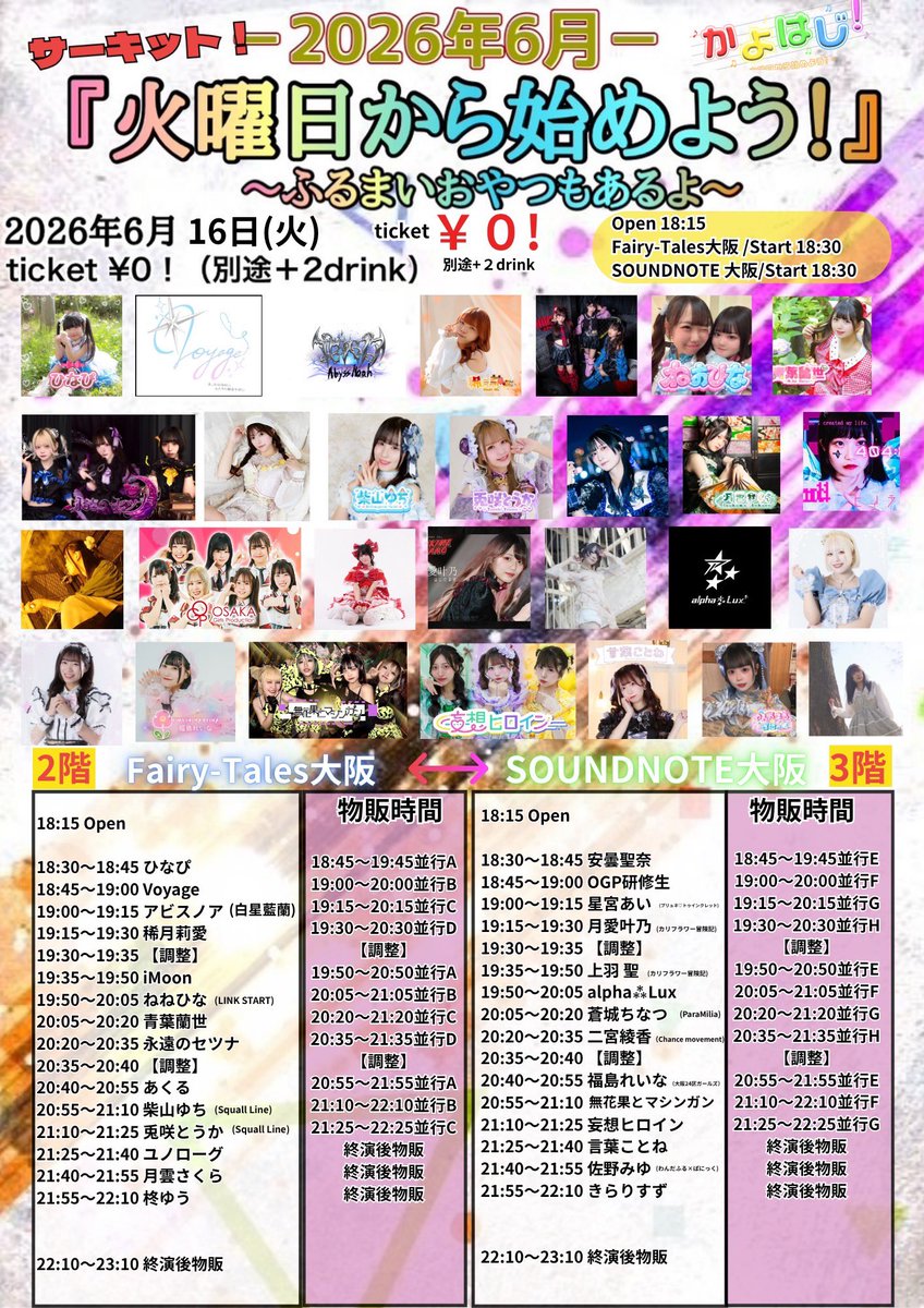
6月16日(火)火曜日から始めよう!
SOUNDNOTE OSAKA
Fairy−Tales大阪
18:15 open 18:30 start
¥0+2drink(¥1400別途必要)
tiget.net/events/498130
↑6/13 22:00予約開始
51

Jun 14
他にも物販のみもあるが色々と
#Cosmoslay
#涼音千晶
#みてみてりんね
#キミの主人公
#愛瀬なな
#愛瀬ななを愛せよな
#Ninechocolates
#花燈みゆう
#花燈成長記録
#OTOMICHI
#水瀬しおん
#しおるんをポケットに
#HarleyQueen
#北川らん
#らんらんるう
#SquallLine
#月守ゆら
#ぽむらにあん通信
ALT 涼音千晶ちゃん(Cosmoslay) 自分の主現場となかなか被らず会えない日が続いてたけどようやく会えました 次の機会、それから千晶ちゃんの綺麗なロングヘアの未来が楽しみです 愛瀬ななちゃん(キミの主人公) スケジュールの関係で物販のみですが顔出せてよかったです ツインテールとても長くて綺麗で眼福でした 花燈みゆうちゃん(Ninechocolates) 本来はライブも行きつつも物販の予定だったのにいろいろあって物販のみになってしまいました🙇♂️ みゆうちゃんの三つ編みとても長くて素敵でした

ALT 水瀬しおんちゃん(OTOMICHI) いつぞやのライブで被った時はスケジュールの関係でライブしか行けなかったので今回物販行けてよかったです またの機会を楽しみにしています

ALT 北川らんちゃん(Harley Queen) Xで流れてきた時から綺麗な黒髪ロングヘアだなとずっと気になってたのでやっとはじめましてできて嬉しかったです 後ろ姿の写メもありがとうございました とても眼福で満足です
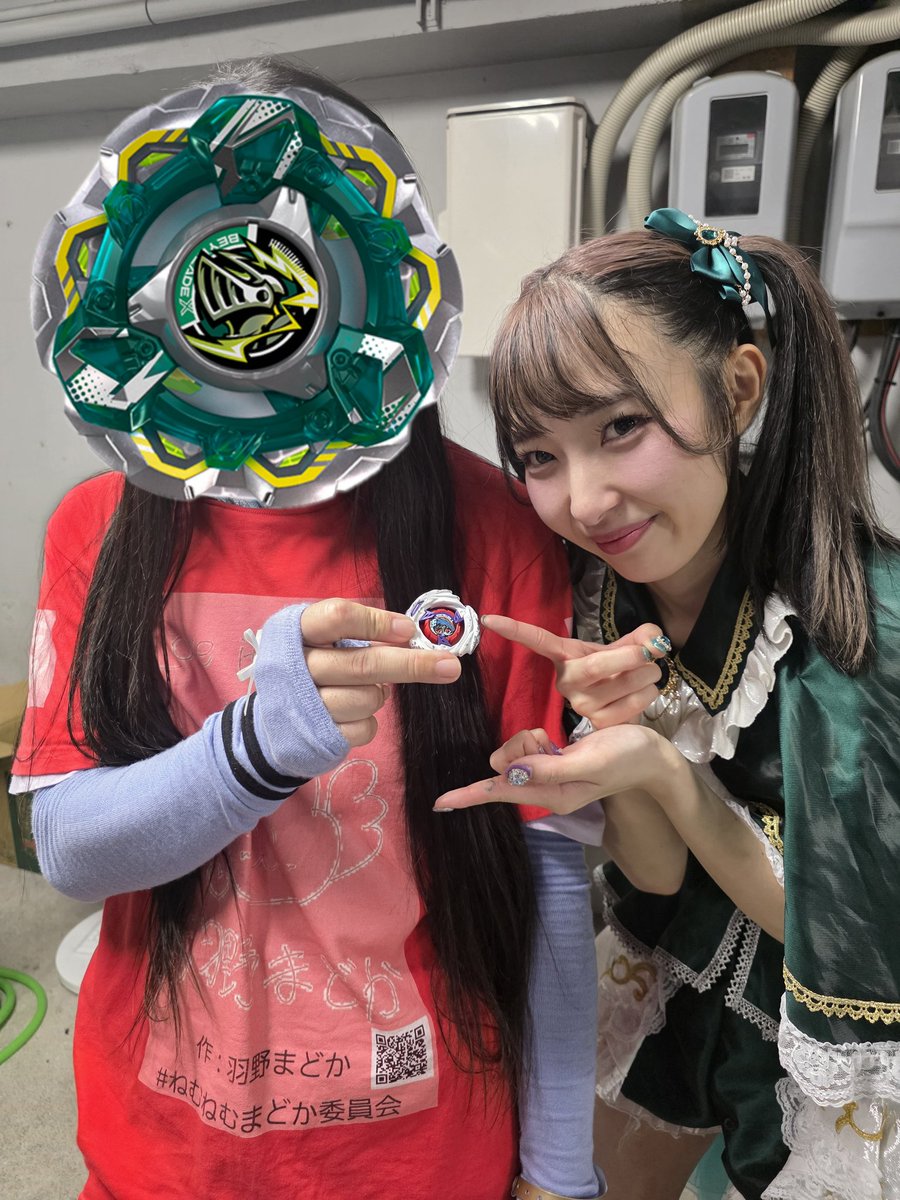
ALT 月守ゆらちゃん(Squall Line) 元々縁があったというのもあるけど、ベイブレードにハマってると知って余計話がしたかったので今回実現できて嬉しかったです 特典会でも話した通り、ベイブレードの企画やるなら優先順位を高くして予定立てたいと思うのでよろしくお願いします
1
7
238


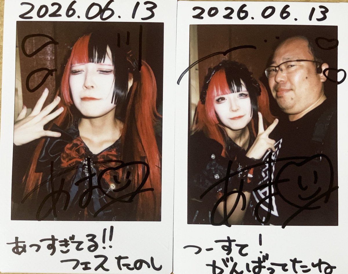
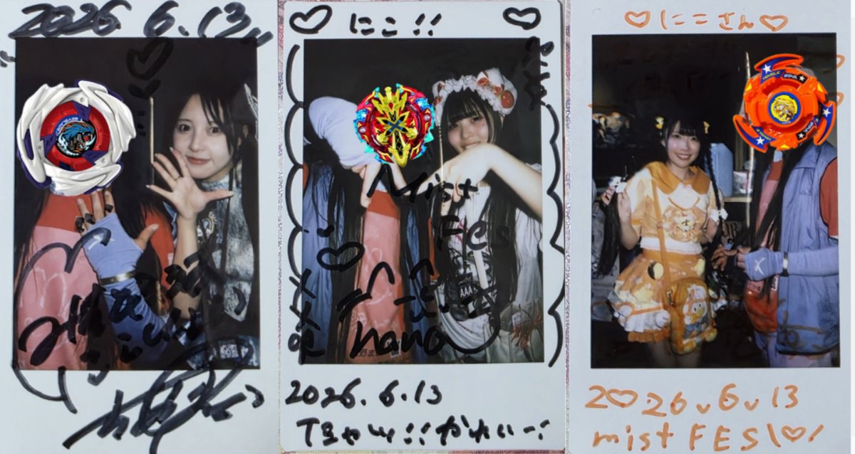
Jun 13
2026.6.13
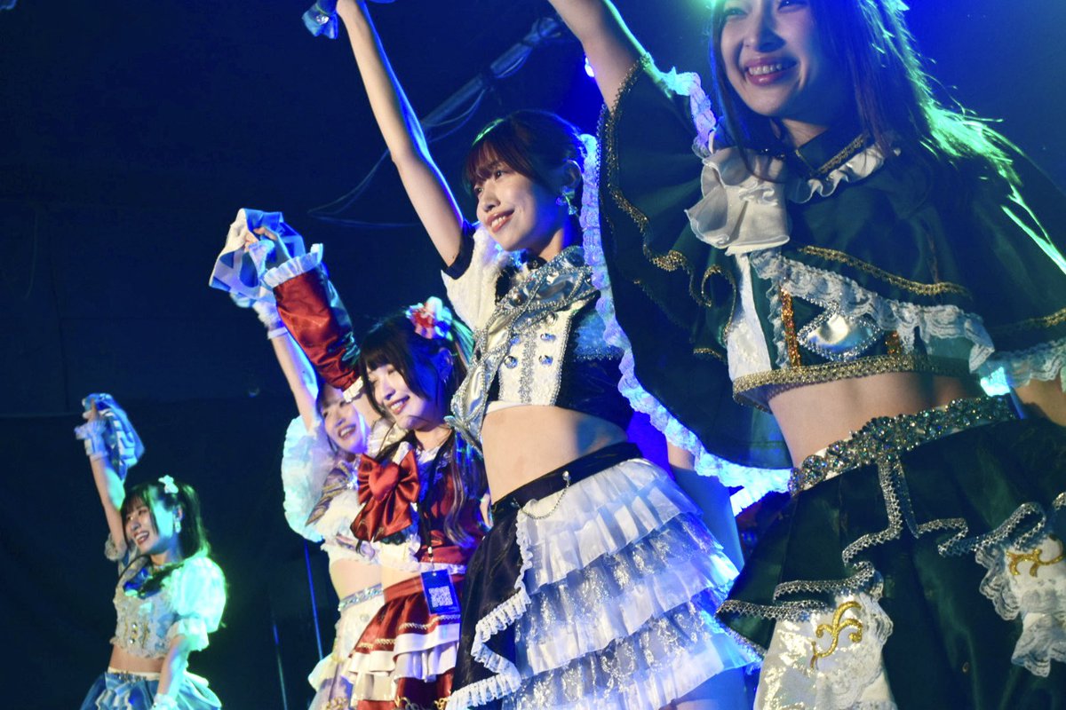
Squall line ステージ @ 大須TOYS
mistFES 2026
写真バージョン📷
〜上手最前からの景色〜
動画ver.はtiktokに掲載
#SquallLine
#スコールライン
#ミストフェス
#mistFES2026
#大須TOYS
7
223


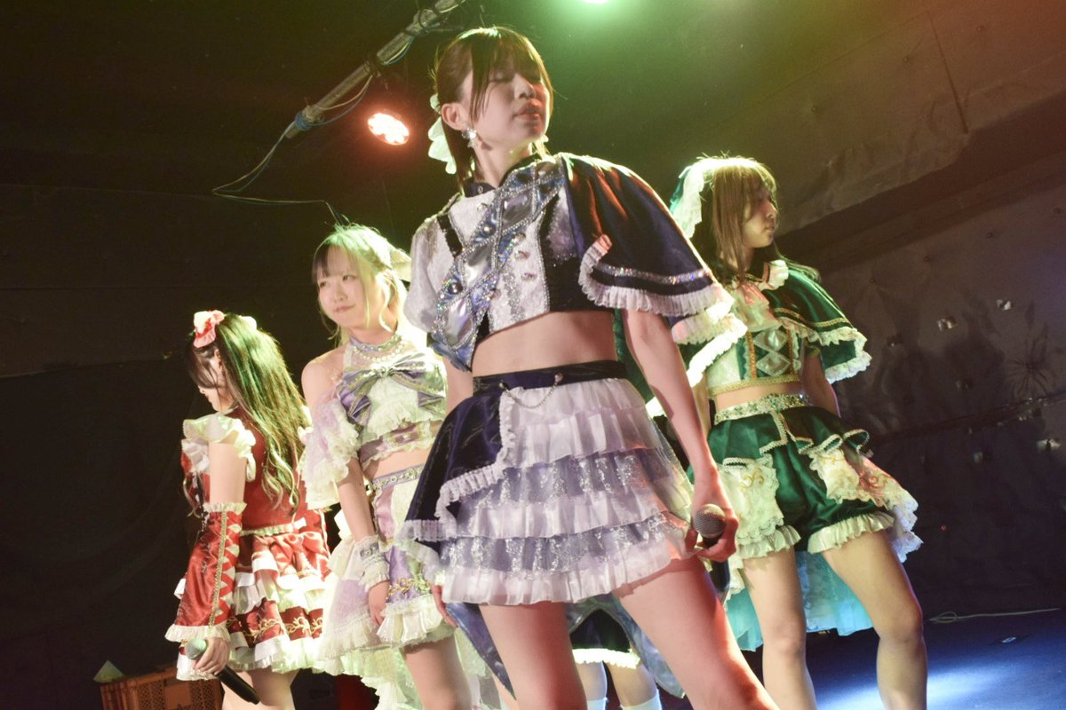
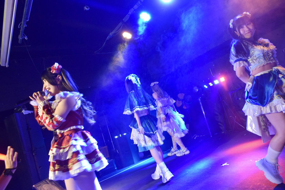
元々みんなレベル高かったけど、本当に歌上手くなったなぁ…🥲
今日この後の #mistFES セカンドステージ、21日の #関ケ原唄姫合戦 徳川ステージを賭けた決勝戦。そして来月の関ケ原本番へ、皆様Squall Lineの応援よろしくお願いします!!#SquallLine #スコールライン #SquallLineを徳川ステージへ

mistFES Squall L ineのファーストステージ!TOYSありがとうございました✨
初遠征にも関わらず、かなりの数のお客様が詰めかけてくださり本当に感謝です❤️🔥
この後静かの海にて特典会!
その後シアターZONE18:20からステージです!セトリもかなり変えてお待ちしております❤️🔥
1
240
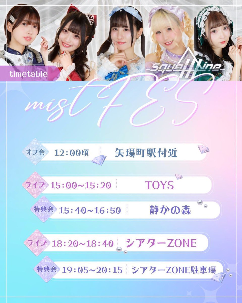
紅音(´・ω・`)あかねこ retweeted


6/13(土)☔
『mistFES2026 10th anniversary Supported by My-th』
🍤初!名古屋遠征🍤
☀1現場目☀
TOYS🎤15:00~15:20
静かの森📸15:40~16:50
🌙2現場目🌙
シアターZONE🎤18:20~18:40
シアターZONE駐車場📸19:05~20:15
⭐入場にはMy-thアプリが必要です!
アプリをダウンロードをして、事前準備をお願い致します。
アプリのインストールはこちら(HP)から my-th.jp
13日チケット
🎫user.my-th.jp/tickets/event/…
■料金 :【1日券】前売 税込7,700円(1D代600円含む)
Squall Line予約特典🎁
10秒動画orピン写メ3枚🎉
当日券購入可能!

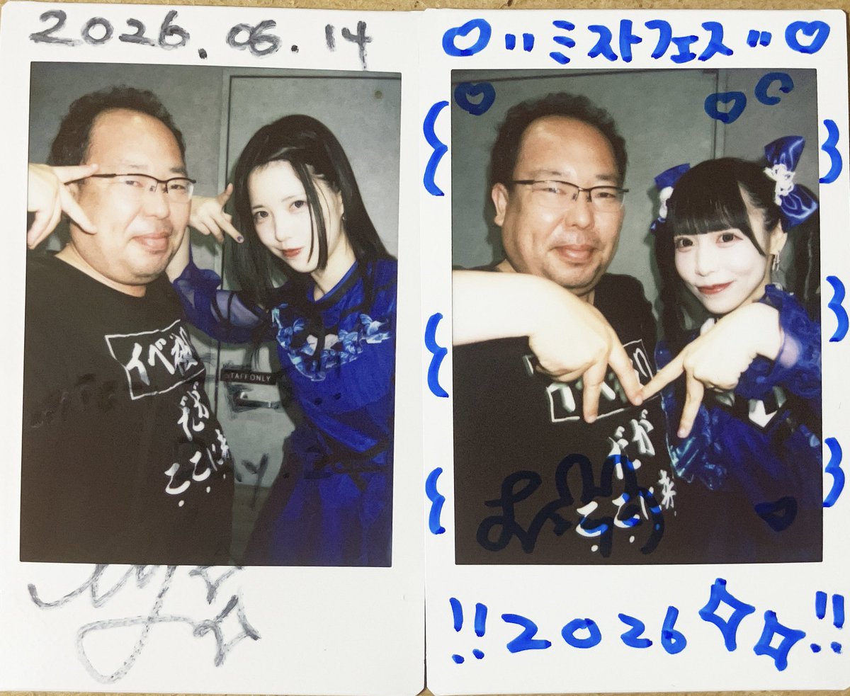
4
10
417

おはよーー‼️
この日ぶりのmistFES🥳🪄
今日は大阪のアイドルグループ🌟
Squall Lineとして出演☔️💚
緑色担当💚ゆらぽむです‼️
TOYS 🎤15:00と
シアターゾーン 🎤18:20で
まってます‼️ぶちかますぞ‼️
#SquallLine
#mistFES2026


4
7
26
2,374


Jun 12
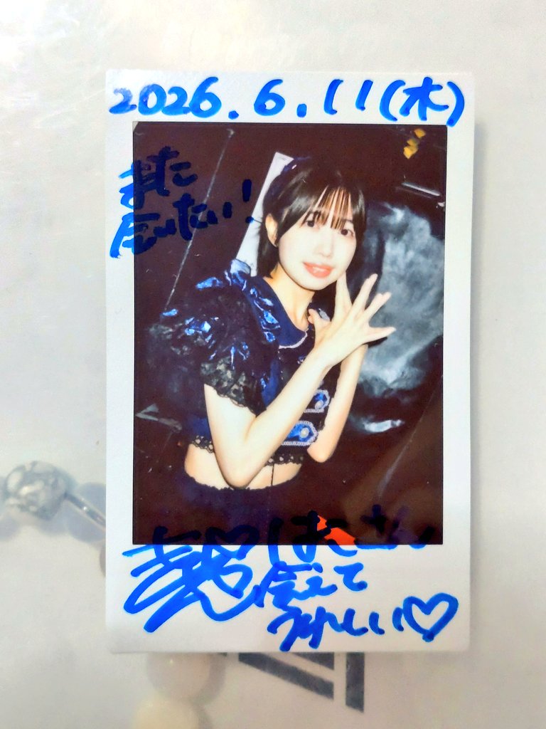
6月11日💎おちゃめなパーティーナイトvol.9④
#CDCBOX
#squallline 17
#きゃんかわいい
#しばやマニア
きゃんちゃんとゆっちゃん!
4ヶ月ぶりにStarting Rainも観れて
めちゃ楽しかった☺️
ゆちちゃんチェキ、約束から4ヶ月で
ようやく出来ました✨️

4
150
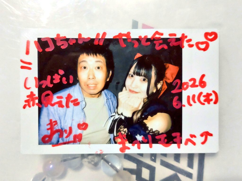
Jun 12
6月11日💎おちゃめなパーティーナイトvol.9③
#CDCBOX
#squallline 17
#神楽まつり
#まつり型ウイルス感染中
4ヶ月ぶり、今年2回目の
まつりわずらいでした☺️
めっちゃ会いたかった、
ようやく会えた!!
1
5
221