
Mar 27
VisionWave Holdings, Inc. (Nasdaq: $VWAV)
VisionWave Holdings has released findings from its latest internal research on innovative RF subsurface sensing systems tailored to advance offshore energy exploration in Liberia.
The paper evaluates architectures featuring advanced signal processing, specialized receiver arrays, and model-based inversion techniques aimed at providing greater precision in detecting geological boundaries and fracture networks.
Executive Chairman and CEO Douglas Davis highlighted the shift toward viewing subsurface challenges as opportunities for intelligence-driven sensing.
These ideas represent purely conceptual work and remain at an early developmental stage within the company’s ongoing technology development efforts.
Read more:
investorideas.com/CO/VWAV/ne…
@InvestorIdeas #SubsurfaceMapping #OffshoreExploration #StrategicEnergy
10
1
8
13,403

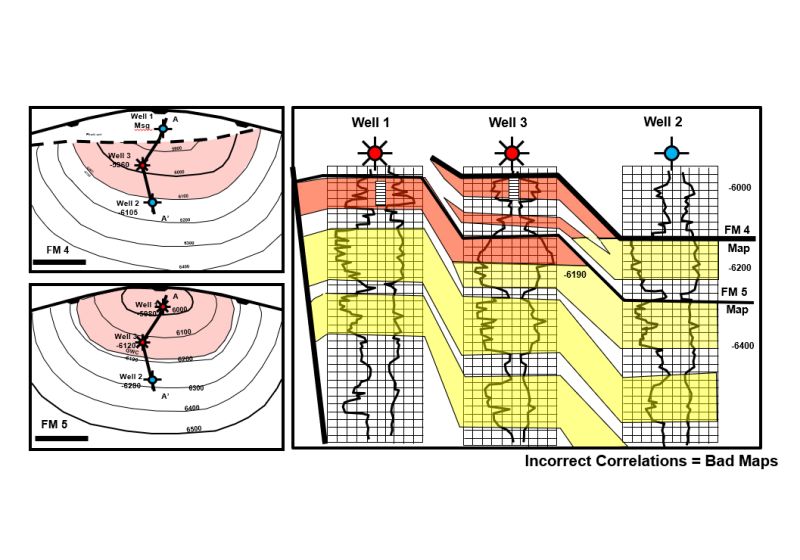
📷Learn to QA/QC Subsurface Maps with Confidence and Technical Rigor📷
Flagship Course Title: "Quality Assurance/Quality Control Skills (QAQC) in Subsurface Mapping" (bit.ly/4ah4BHa) #qualityassurance #qualitycontrol #SubsurfaceMapping #mapping #geology #lagos
3
1
2
44

16 Apr 2025
What you can achieve in less than one hour with the GS9000 Multichannel GPR and GPR Insights post-processing software?
Check out the incredible results of an Underground Storage Tank (UST) Detection at Gas Station in Dallas Texas.
Learn more about the GS9000: hubs.la/Q03g_VtM0
#SUE #subsurfacemapping #MCGPR
2
108

#SubsurfaceMapping is arguably one of the most tedious, error-prone and under-appreciated processes in all of #OilandGas exploration, but arguably the most important: no map, no drilling.
Read more: ow.ly/kxEl50UZBmO
5
5
843
This new World Oil exclusive explores the latest #ExplorationTechnology, specifically, subsurface mapping—a tedious and often under-appreciated aspect of #exploration and #drilling operations, but perhaps the most important. #SubsurfaceMapping
Read more: ow.ly/xX4t50UUgJa
1
3
7
1,004

15 Apr 2024
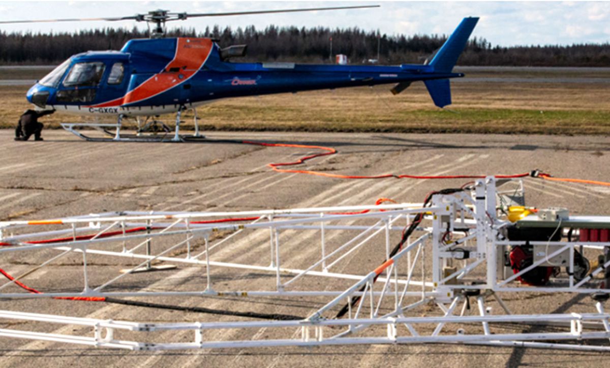
🛩️ Airborne Geophysical Surveys to Elevate Mineral Exploration and Environmental Studies 🛩️
🌐 Explore the pivotal role of airborne geophysical surveys in advancing mineral exploration and environmental monitoring. This article delves into how these surveys, conducted from aircraft or drones, use various geophysical methods like magnetic, electromagnetic, and radiometric to map the Earth's subsurface properties. Learn about the advantages of airborne surveys, including their ability to cover large and often inaccessible areas quickly and with high resolution. Discover how the data collected supports the mining industry in identifying potential mineral deposits and aids environmental scientists in assessing water resources and environmental impacts. Understand the challenges involved and the technological innovations that are enhancing the precision and efficiency of airborne geophysical surveys. 🌍🔍
👉 Read the full article on Highways Today: highways.today/2024/04/05/ai…
#Geophysical #Surveys #Mineral #Exploration #EnvironmentalMonitoring #HighwaysToday #AirborneTechnology #SubsurfaceMapping #ResourceManagement
4
3
54

17 Mar 2024
How will advanced subsurface mapping revolutionize our infrastructure and urban landscapes? #SubsurfaceMapping #UrbanDevelopment #InfrastructureRevolution
1
1
2
58
13 Feb 2024
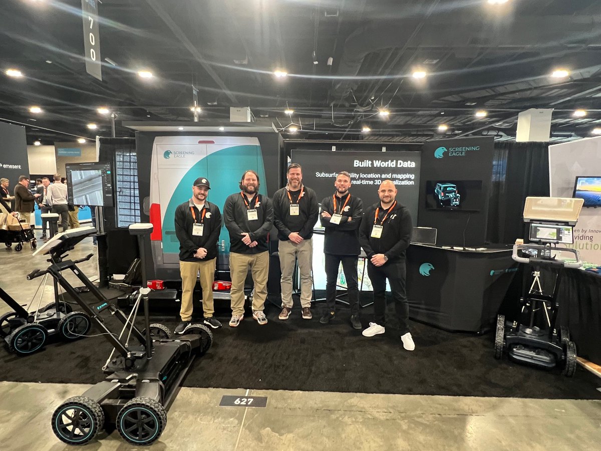
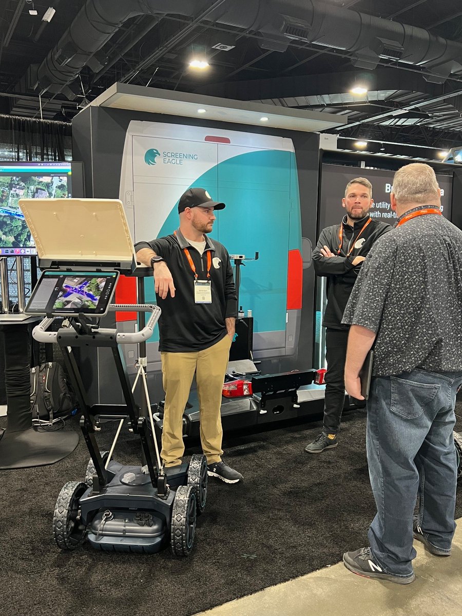
Still at @GeoWeekExpo, Colorado Convention Center! Booth #627 features game-changing multichannel #GPR systems, GS9000, and GM8000.😎 Revolutionize your #SubsurfaceMapping projects.👍Last day, hurry up!
#ScreeningEagle #infrastructure #engineering #structuralhealth #geomatics
1
69

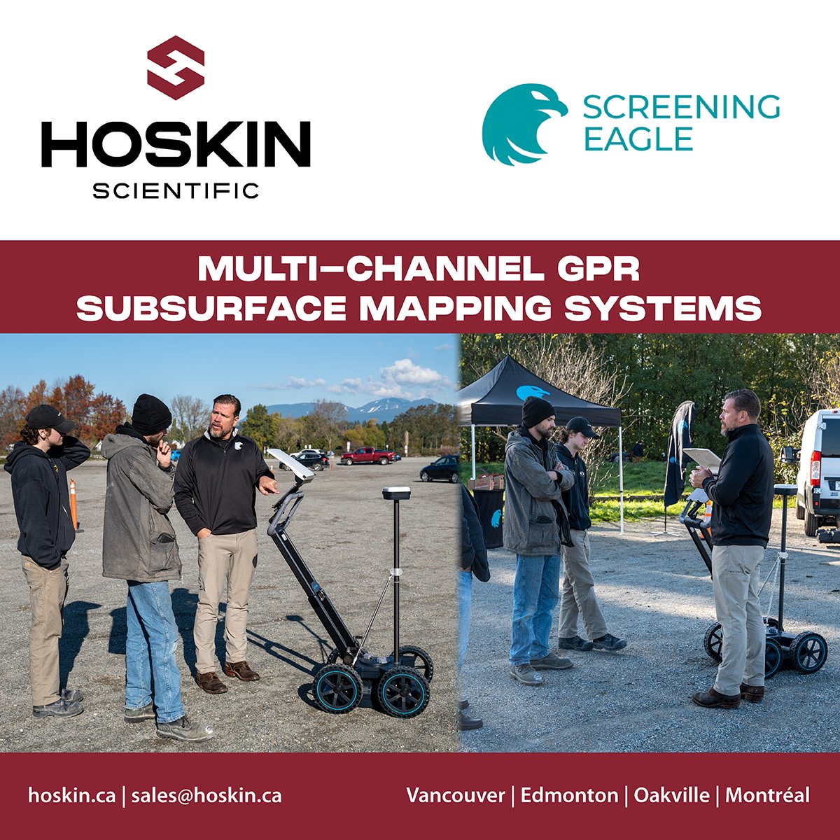
2 Nov 2023
A terrific day in Vancouver for our tech roadshow with Screening Eagle and the new multichannel GPR subsurface mapping systems! Thank you to all who joined us; we’ve had incredible feedback on the latest innovations.
#gpr #subsurfacemapping #roadshow #gs8000
3
39

2 Jun 2023
An underground mapping and scanning technology which uses artificial intelligence is being piloted by @nationalgrid in the United States
Full story: buff.ly/3MP90Fy
#subsurfacemapping #infrastructure
1
1
760

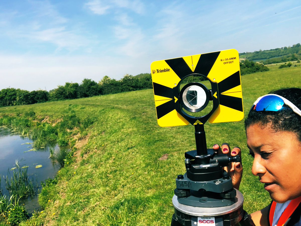
Understanding what lies beneath the ground is essential for the planning of any construction project. Accurate #subsurfacemapping can significantly reduce risk and cost of a project.
Get in touch:
Andy Kitson – akitson@murphygs.com (UK)
David Graham - dgraham@murphygs.ie (IRL)
1
4

14 Apr 2021
At RIC 2021, Dr. Kok-Kwang Phoon will deliver a Keynote Speech on ‘Advances in Data-Driven Subsurface Mapping’ on April 21st, 2021. We hope to see you there: rocscience.com/learning/rocs…
.
@NUSingapore #geotechnicalengineering #miningengineering #Rocscience #mining #subsurfacemapping

2
4

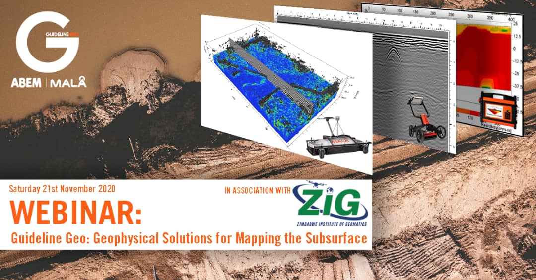
Join us & @ZimGeoIns for a webinar on #GeophysicalSolutions for #SubsurfaceMapping with #GuidelineGeo tomorrow from 1000HRS. To participate register at;
event.webinarjam.com/registe…
2
2

11 Oct 2019
Before you begin building anything above the ground, you need as much information as possible on what potential dangers are lurking below the surface. That's why @McCarthyBuild's McCarthy Mapping is such an innovative solution #construction #subsurfacemapping
10 Oct 2019

90 percent of all #construction projects don’t use comprehensive subsurface mapping before excavation. Learn why they should in this blog post and video: ow.ly/gqTp50wHHC7
#McCarthyInsights #McCarthyMapping
3

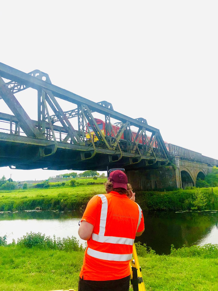
Severn Partnership has become a leading provider of Surveying, Mobile Mapping, Subsurface Mapping, 3D Modelling, Laser Scanning, Building Information Modelling and Visualisation services for infrastructure. #survey #scanning #mobilemapping #subsurfacemapping #bridgesurveys #rail
3
6
We’re looking forward to exhibiting @TallBuildingsC tomorrow @99CityRoad to discuss the unique #geospatial challenges, solutions & innovations to ‘build high-rise better’ #GeospatialCertainty #Monitoring #SettingOut #RightOfLight #SubsurfaceMapping murphysurveys.co.uk/tall-bui…

1
4

10 Dec 2018
Severn Partnership is a leading provider of #Surveying #mobilemapping, #SubsurfaceMapping #3DModelling #LaserScanning Building Information Modelling #BIM & #Visualisation services for #infrastructure. #better #faster #safer: bit.ly/2IVBuvW
3
3
We’re honoured to be the only survey company shortlisted for ‘Project of the Year’ at the inaugural Digital Construction Awards tomorrow #GoodLuck #DCW2018 #subsurfacemapping murphysurveys.co.uk/murphy-s…

3
8

5 Jul 2018
Buried railroad tracks (together with utilities and rebars) have been accurately mapped on these high-resolution subsurface images.
Data collected by T2 Utility Engineers using IDS GeoRadar STREAM C GPR solution. #utilities #groundpenetratingradar #subsurfacemapping
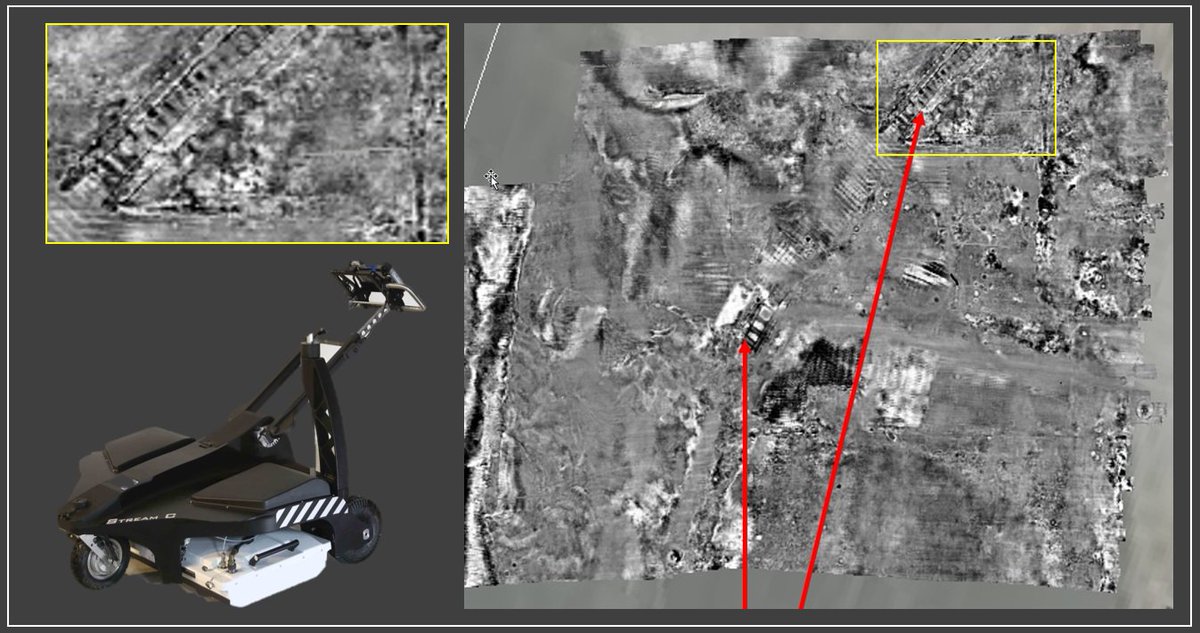
2
2
11 May 2018
Another huge project with #survey written all over it constructionenquirer.com/201… ideal for us with #monitoring #mobilemapping #subsurfacemapping #pway #topographic experience
1
4