
❗The #ZoomStack in action with the new #Zoom4S❗
In this #stroke case, the Zoom Stack works together seamlessly to travel to the face of an M1/M2 occlusion. Dr. Paul Schmitt applies Continuous Dual AspiraTion (#CDAT) using Zoom 4S as the inner catheter and Zoom 7X as the outer catheter.
The outcome? First pass, TICI 3 in 11 minutes with clot captured in both Zoom PODs.
Thank you for sharing this excellent case and your experience with the #ZoomStrokeSystem.
#stroke #neurointervention
Rx only. ISI: bit.ly/3yWkfEJ
1
3
201

Day 29 of the #30DayMapChallenge – Raster
We used OS Zoomstack to find lakes (>0.5 km²) in Cumbria, calculated cycle times to their centroids with TRACC, then styled the output as a raster with hillshading giving it an elevation-map feel.

1
2
112

16 Nov 2025
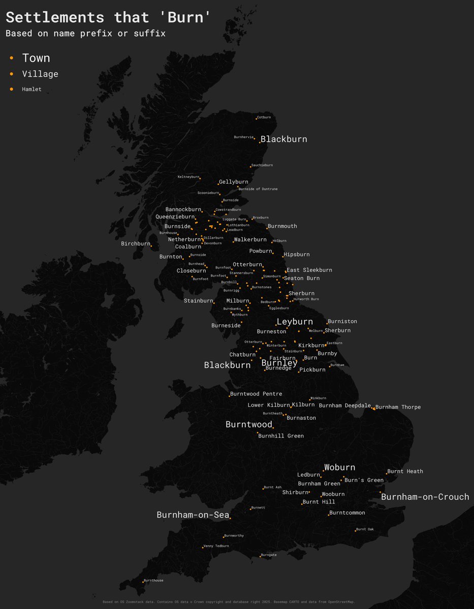
#30DayMapChallenge Day 15 – Fire.
I am still catching up so another simple one here. Place names in GB that begin with or end with 'burn'. Based on @OrdnanceSurvey #zoomstack data, made in #qgis.
1
3
14
1,362

11 Nov 2025
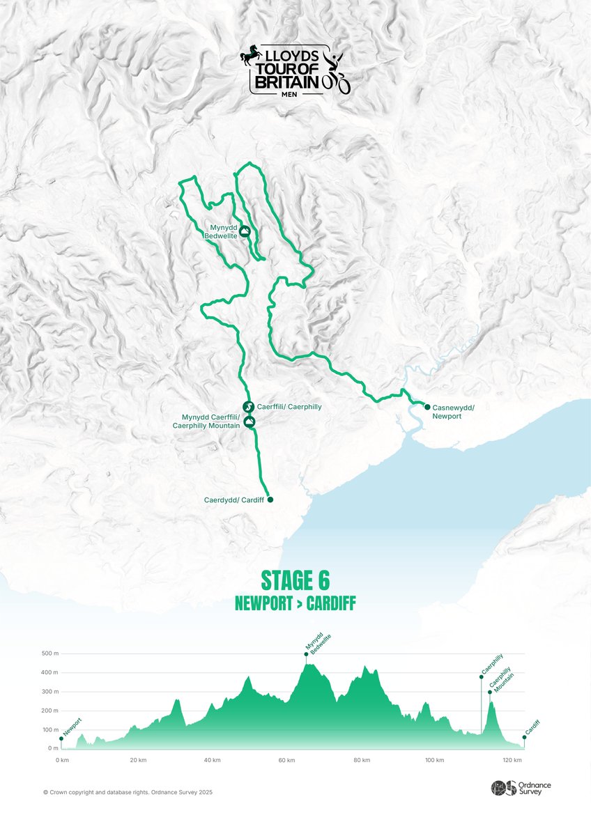
Geospatial Consultant Hannah Wright creates a striking minimalist map for Stage 6 of the Men’s @TourofBritain, using OS Terrain 50 and and Open Zoomstack data.
For Day 11 of the #30DayMapChallenge - Minimal Map, it turns race data into art.
1
1
21
1,524
7 Nov 2025
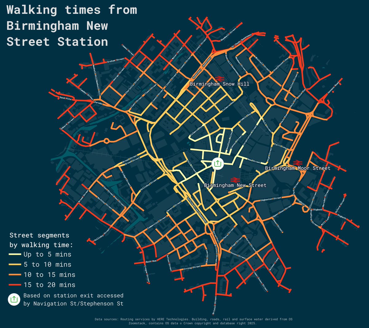
#30DayMapChallenge: Day 7: Accessibility
Walking times from Birmingham New Street. Made in #qgis with @OrdnanceSurvey #zoomstack data and using the @here maps routing API.
15
100
4,095
4 Nov 2025
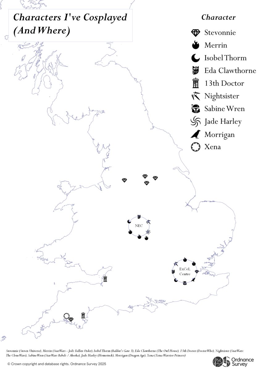
Day 4 - Data (My Data) of the #30DayMapChallenge!
Geospatial Analyst Hannah Brooks presents a cosplay journey across GB comic cons using OS Open Zoomstack and personal data. 🎭
9
1,671
3 Nov 2025
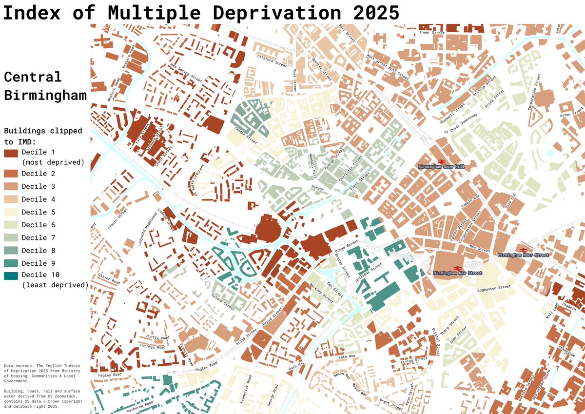
#30DayMapChallenge Day 3 - Polygons
Another play around with the new Index of Multiple Deprivation 2025, clipped to building polygons to show deprivation in #Birmingham city centre. Made in #QGIS with @OrdnanceSurvey #zoomstack buildings data.
2
8
1,187
24 Dec 2024
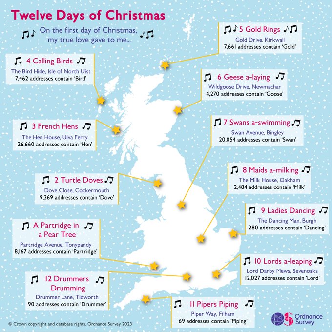
Merry #ChristmasEve! 🎅
Using OS Open Zoomstack and AddressBase Core data, we've mapped 12 songs to celebrate this festive period 👇
2
6
1,518
30 Nov 2024
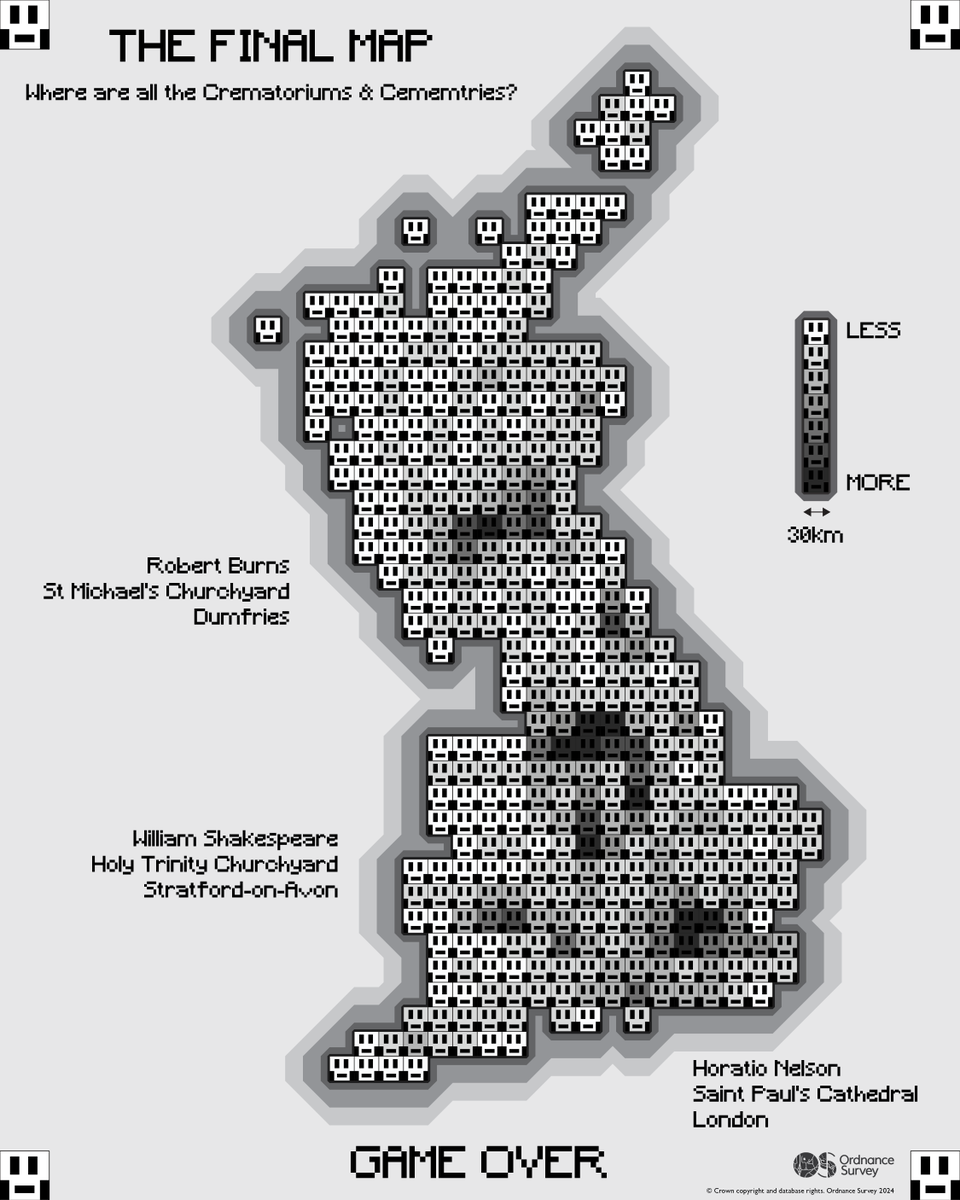
Created by GeoDataViz Lead Paul Naylor, this choropleth depicting the locations of all cemeteries and crematoriums within GB.
Including grave sites of notable historical figures using Using OS AddressBase and OS Zoomstack for Day 30 - Final #30DayMapChallenge.
5
33
2,478

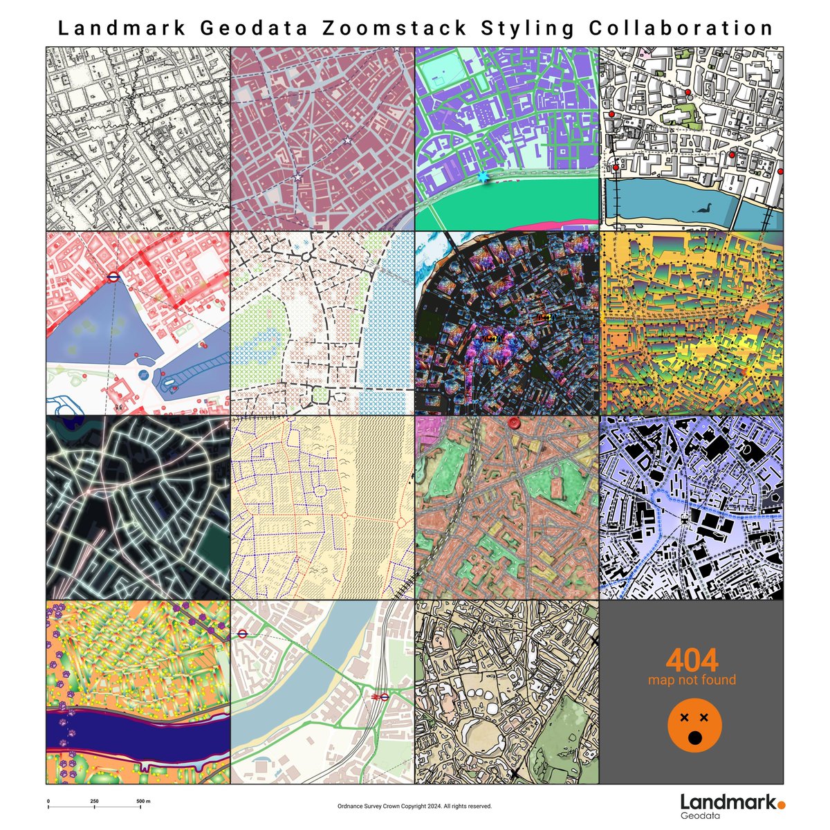
Today's #30DayMapChallenge is all about collaboration and working with others to create a single map.
Our collaborative creation uses an extract of OS Zoomstack, which has been split into 16 1km x 1km squares, with each square styled differently!
1
7
183

4 Nov 2024
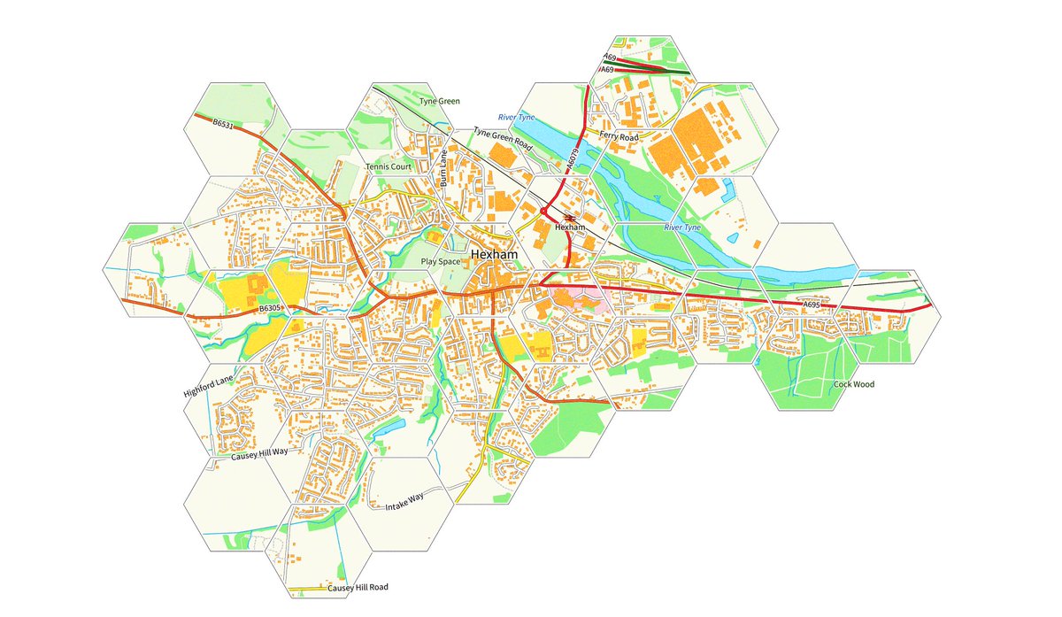
A hex map for today's #30DayMapChallenge hexagon theme - from the Hex capital of the world
(data from @OrdnanceSurvey OS Open Zoomstack)
1
5
51
5,052
3 Nov 2024
Using OS Open Greenspace and Open Zoomstack, Technical Relationship Consultant Jessica Baker identified and ranked the 10 largest parks in GB.
For Day 3 of the #30DayMapChallenge - Polygons. Check out the interactive ESRI Storymap: ow.ly/xC4S50TYec7
3
12
2,228
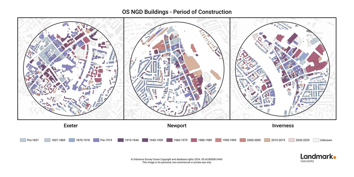
Day 3 of the #30DayMapChallenge is all about Polygons.
We've created a map based on OS NGD Buildings data. It's been styled by period of construction, with a simple background of OS Zoomstack Local Buildings and was created in QGIS.
1
138
8 Oct 2024
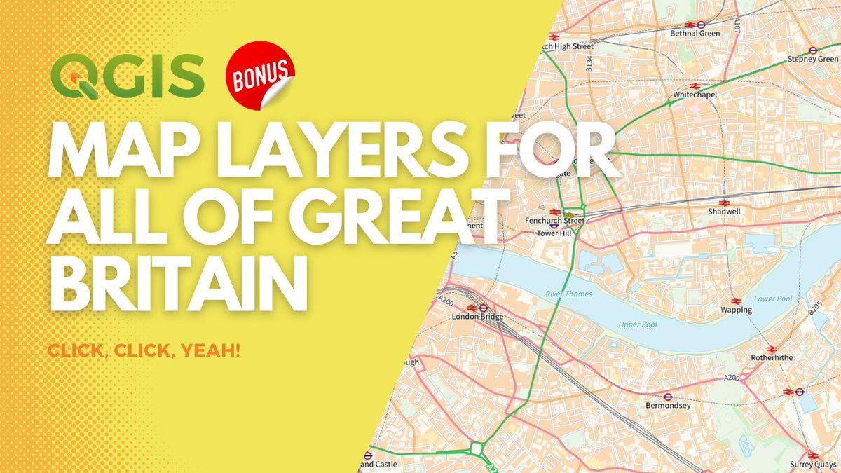
If you're doing any mapping of anywhere in Great Britain then you'll definitely benefit from using @OrdnanceSurvey OS Open Zoomstack - see the full demo in my new video, including link to data and style files #QGIS
youtu.be/yjGObg_PO4E?si=cbVj…
2
5
16
2,968

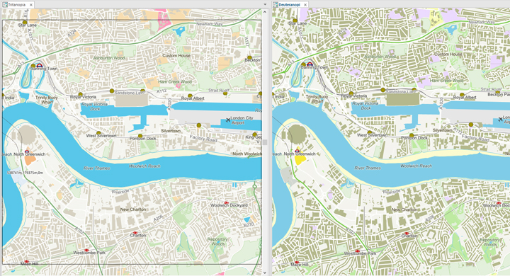
It's #ColourBlindAwarenessDay today, so here's a friendly reminder that @Cadcorp SIS supports @OrdnanceSurvey Open #Zoomstack data, including its Colour Vision Deficiency friendly styles - #GIS #Spatialinsight #FridayMapFun
5
10
1,605
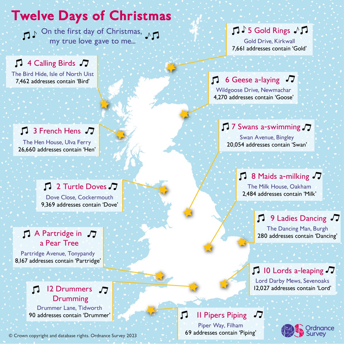
24 Dec 2023
On the first day of Christmas, my true love gave to me... 🎅 #ChristmasEve
Using OS Open Zoomstack and AddressBase Core data, we've mapped 12 songs to celebrate this festive period 👇
5
10
2,385

21 Nov 2023
For day 20 of #30DayMapChallenge, the theme is outdoors. This map started as an idea to stitch a route I'd run on a paper OS map, but I turned it into a digital version. I explored the @OrdnanceSurvey Open ZoomStack and "stitched" the @RaceMaverick Jurassic coast ultra route. 🏃♀️
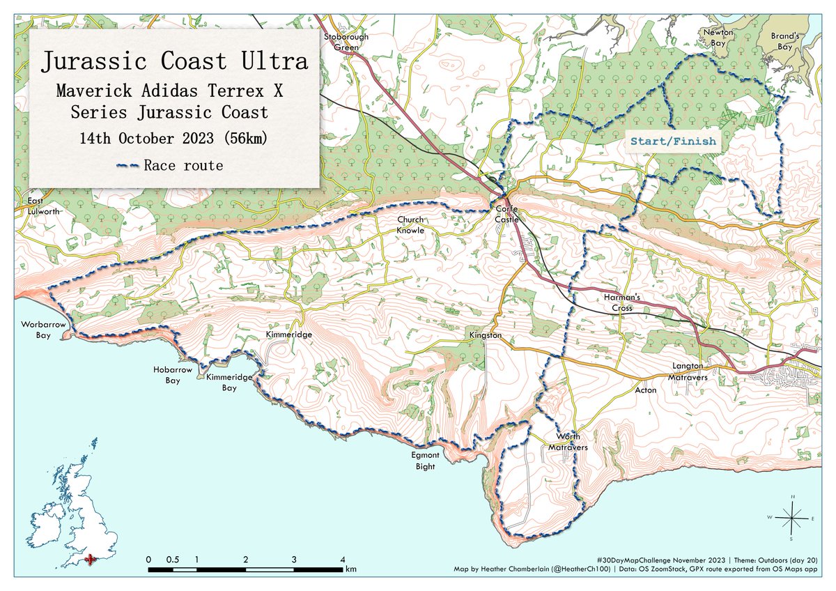
ALT A map of the Jurassic coast in the south of England. The map is styled similar to an OS 1:25,000 map, showing contours, roads, areas of forest and water. The route of an ultra race is overlaid with a stitch effect in blue 'thread'.
1
1
15
2,757
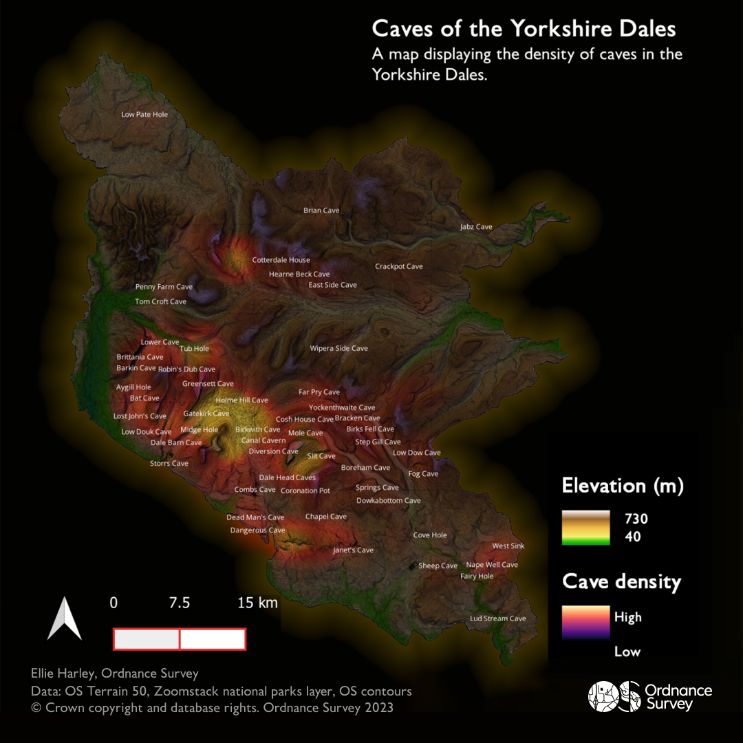
20 Nov 2023
For #30DayMapChallenge, Day 20 - Outdoors, OS Graduate Ellie Harley maps the current caves of the #YorkshireDales.
Created using OS Terrain 50, Zoomstack national parks layer, OS contours, and current caves were selected using the OS National Geographic Database.
5
10
2,312
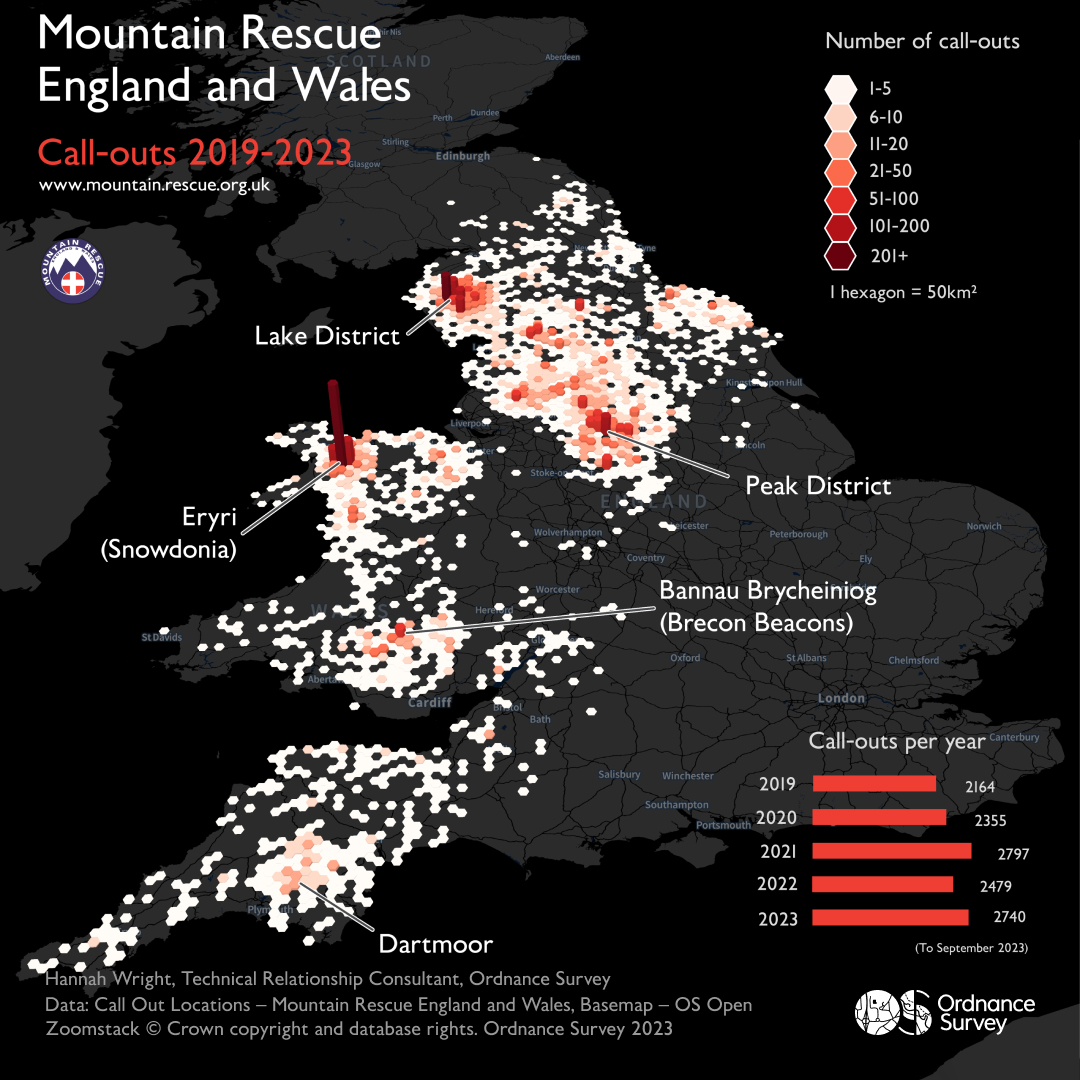
9 Nov 2023
Working with @MountainResqUK, OS Technical Relationship Consultant, Hannah Wright created this dataviz showing the hotspots for call outs for #30DayMapChallenge, Day 9 - Hexagons.
Using OS Open Zoomstack, @QGIS, Mapbox Studio and Adobe Illustrator.
9
29
5,533
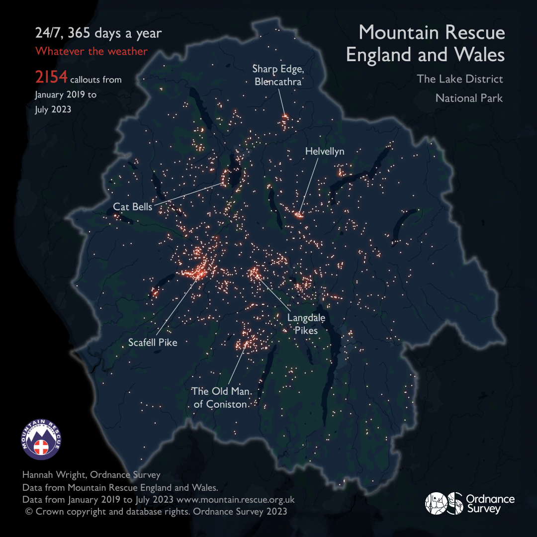
1 Nov 2023
For Day 1 of the #30DayMapChallenge - we highlight the extraordinary work of the volunteer @MountainResqUK teams who are on call 24/7, 365 days of the year.
The data visualisation uses OS Open Zoomstack in night style and was created in QGIS, finished off in Adobe Illustrator.
3
21
59
8,175