
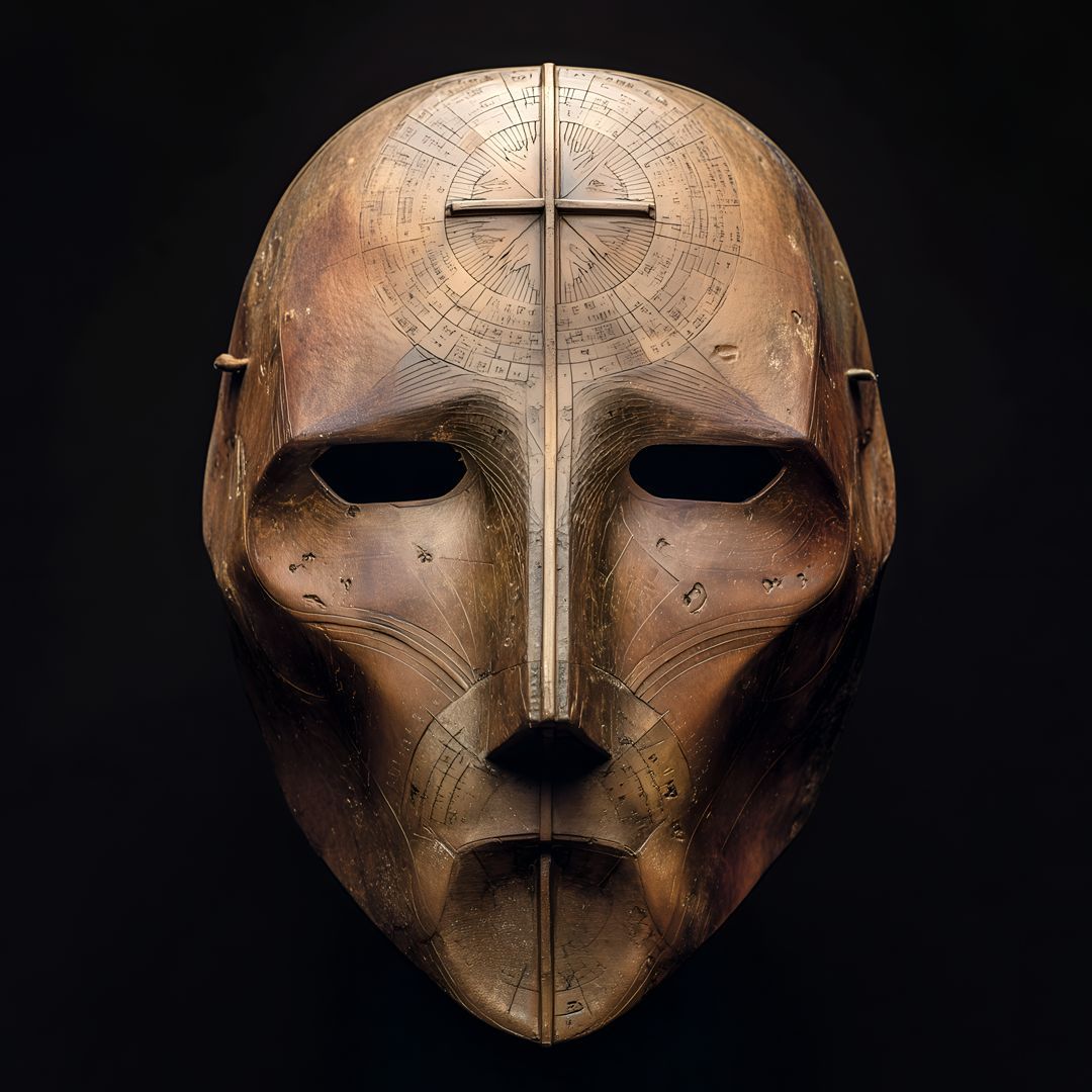
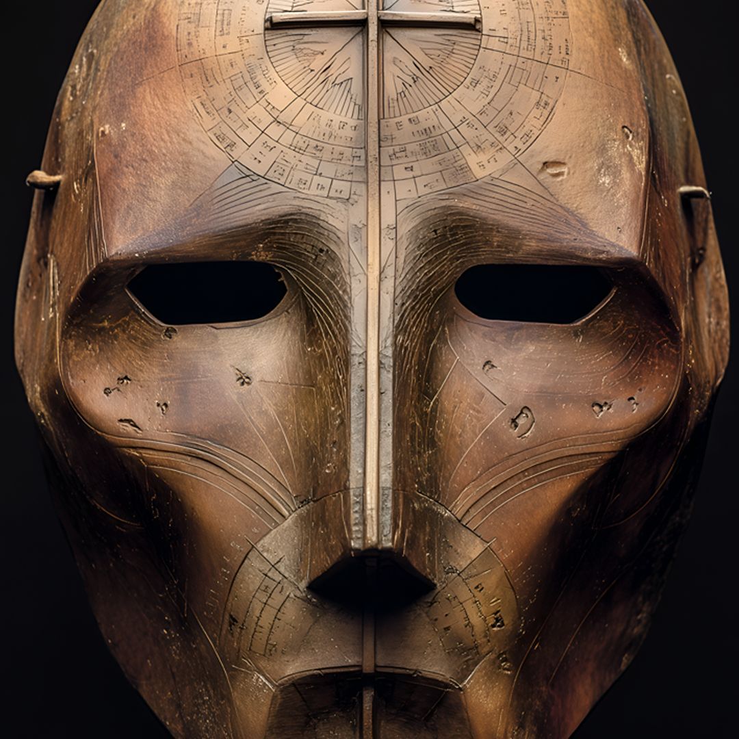
DAY 155, MASK 1 | APRIL 8, 2026
Kreda Chadian Saharan Astronomer Mask
The Kreda Celestial Tradition represents mastery forged in the central Sahara: profound astronomical knowledge; the synthesis of Islamic science with desert ecology; precise constellation mapping; raised cross-staff architecture for measuring stellar altitudes; and an intellectual vision that transformed the world's harshest landscape into a navigable homeland.
The warm-brown polished surface reflects centuries of trans-Saharan winds. Each engraved calendar line holds accumulated environmental wisdom. The deep-set eyes embody the infinite gaze of the desert guide—the intellect that distinguishes a master navigator from a lost traveler.
"Al-najm daliluna fi bahr al-rimal. The stars are our guide in the sea of sand. In each astrolabe curve resonates the unbreakable survival of the Kreda."
— Kreda Navigational Tradition
Token #216 | 0.008 ETH
manifold.xyz/@thefacelessart…
Journey deeper: thefaceless.art/portfolio/kr…
The mask chooses. 🩸
THE FACELESS ART / 365 Cultures. 365 Days.
#TheFacelessArt #KredaCulture #Chad #SaharanNomads #CelestialNavigation #DesertAstronomy #Astrolabe #Toubou
4
38

Feb 7
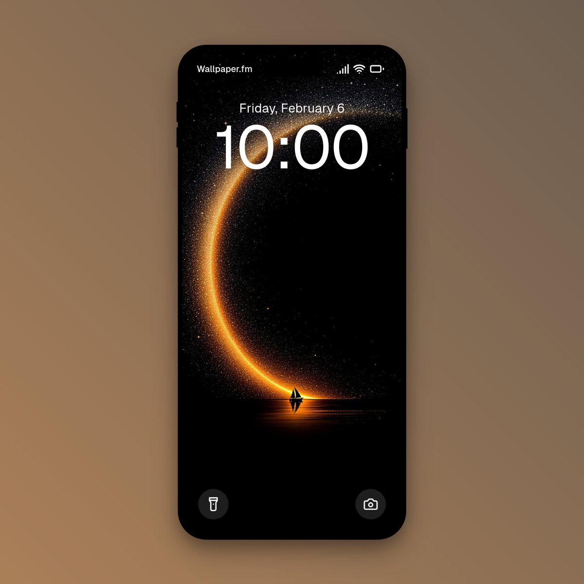
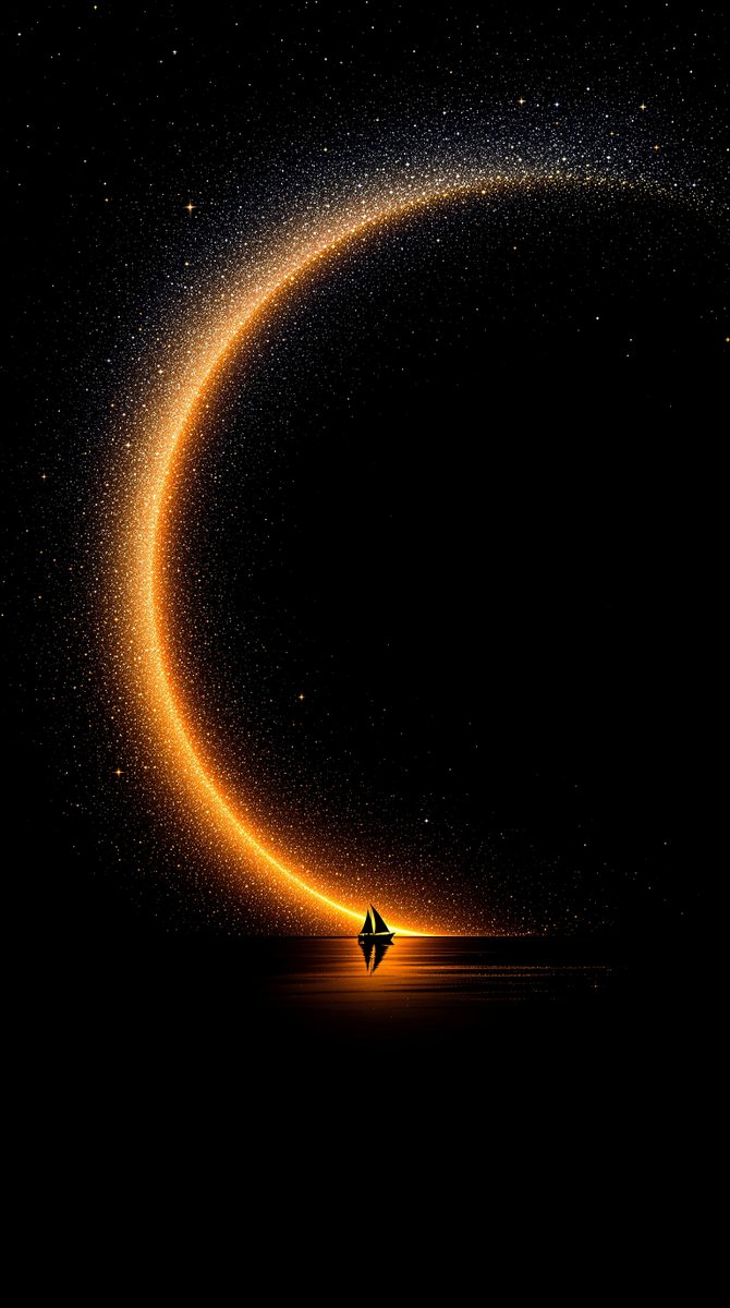
Beneath cosmic arcs, a lone vessel sailed into stardust, igniting paths of golden wanderlust.
#Wallpapers #Wallpapers4k #CosmicJourney #Stardust #VastHorizons #CelestialNavigation #Dreamscape
2
509

Jan 15
Aero Crew News Sky Watch:
From 35,000 feet, the night sky offers a clarity that ground-level observers can only dream of.
In the latest SkyWatch feature for Aero Crew News, Howard L.G. Parkin MBE takes readers on a celestial tour with "First Quarter Views from the Flight Deck." The article explores why the northern winter (and southern summer) provides the most spectacular astronomical displays of the year. From identifying the "Winter Hexagon" and the dazzling brilliance of Sirius (the Dog Star) to spotting the Pleiades—the "Seven Sisters" cluster—Parkin details how pilots can use their unique vantage point and high altitudes to navigate the stars.
Whether you’re a seasoned captain or an aspiring aviator, this guide explains how to use constellations like Orion as celestial signposts and offers tips for identifying the "stars of spring" as they begin to rise in the east after midnight.
Look up and learn how to identify the wonders of the first-quarter sky here: aerocrewnews.com/l6xz
#AeroCrewNews #SkyWatch #AviationEducation #PilotLife #Astronomy #NightFlight #AvGeek #CelestialNavigation #FlightDeckViews

1
2
519

9 Jul 2025
#WilliamFBuckley really was a "Renaissance man."
I only ever knew one person in my life who knew #CelestialNavigation-way over my head (pun intended).
How lucky for you LP that you got to have these wonderful experiences with WFB. Thanks for sharing them!
8 Jul 2025

I went sailing with William F. Buckley, Jr. a few times and he was one of the most passionate sailors of his time. Here's a classic video where he explains celestial navigation!
youtu.be/b5dIJsMCd2I?si=IoUn…
2
1
5
6,460

5 Jun 2025
Draper successfully tested its Assured Positioning, Navigation, and Timing (APNT) capabilities including an advanced airborne celestial navigation system (CNS). The airborne CNS is part of Draper’s APNT product portfolio. #PNT #celestialnavigation
draper.com/media-center/news…

ALT Photo of Draper's airborne CNS system mounted to the flight test aircraft with a fairing.
1
5
475

28 May 2025
They showed that:
• 🧭 Longitude-based scaling is accurate
• 🧠 Latitude distortion is expected due to projection format
•📏 Measurement ratios hold true using the map’s own nautical mile scale
And yes, the same coordinates work across different map designs (pyramid, sphere, disc) because coordinates are celestial, not terrain-based.
"Projection ≠ Reality."
"Utility = Understanding."
🗺 Still Used Today
The Azimuthal Equidistant (AE) projection isn’t obsolete:
✅ It’s used in aviation charts
✅ It’s on the UN logo
✅ It’s the default for radio propagation (e.g. HAM circles)
✅ It’s used in radar mapping and sonar design
Why?
Because when you want direction, central reference, and angular distance, AE works.
"Globe defenders mock AE....until they need to fly a plane or bounce radio off the ionosphere"
📚 Gleason’s Vision
From Is the Bible from Heaven? Is the Earth a Globe?, Gleason writes:
"Time is the shadow of the Sun on the Earth. Geography and time are one."
"No man has ever measured a curve upon land or water, and yet men talk about it as if it had been proved for centuries."
His aim wasn’t just visual,it was functional and cosmological.
He built the map to align Sun, time, and place in one working model.
And backed it with a patent, a book, and a legacy still valid today.
🎯 Final Take
The Gleason map works as it was intended:
✅ It tells time
✅ It tracks the Sun
✅ It divides zones logically
✅ It preserves longitude scaling
✅ It matches navigational reality
✅ It came with functional tools
✅ It aligns with nautical mile math
✅ It matches star-based navigation
✅ It explains solar motion and apparent Sun behavior
✅ It requires no spinning space rock
It’s not a toy.
It’s a functional solar timekeeping tool, and it still holds up today.
#FlatEarth 🌐
#GleasonMap 🕰️
#SunClock ☀️
#SolarSpiral 🌀
#LongitudeLogic 📏
#CelestialNavigation 🧭
#AsItIs 📚
3
5
13
772

8 May 2025
Spacecraft's Epic Orbit: Exploring the Frozen Frontier!
#SpacecraftJourney #InterstellarTravel #CosmicExploration #SpaceOrbit #IcyPlanet #CelestialNavigation #SpaceTechnology #BlueTrails #SpaceAdventure #ObjectiveReached
2
1,530

27 Feb 2025
How did sailors navigate before GPS technology? They used the stars! This 1866 volume from the Museum’s #RareBook Collection provides not only practical instructions on #CelestialNavigation, but also gorgeous charts of the night sky. #ThrowbackThursday #FromTheArchives
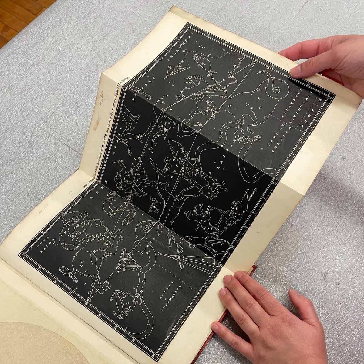
ALT Photograph depicting two hands holding a fold-out chart from a book on celestial navigation. The chart is black and white, and illustrates the Northern constellations and the Zodiac signs associated with them.

ALT Photograph depicting two hands holding a fold-out chart from a book on celestial navigation. The chart is black-and-white and illustrates the Northern constellations and the Zodiac signs associated with them.
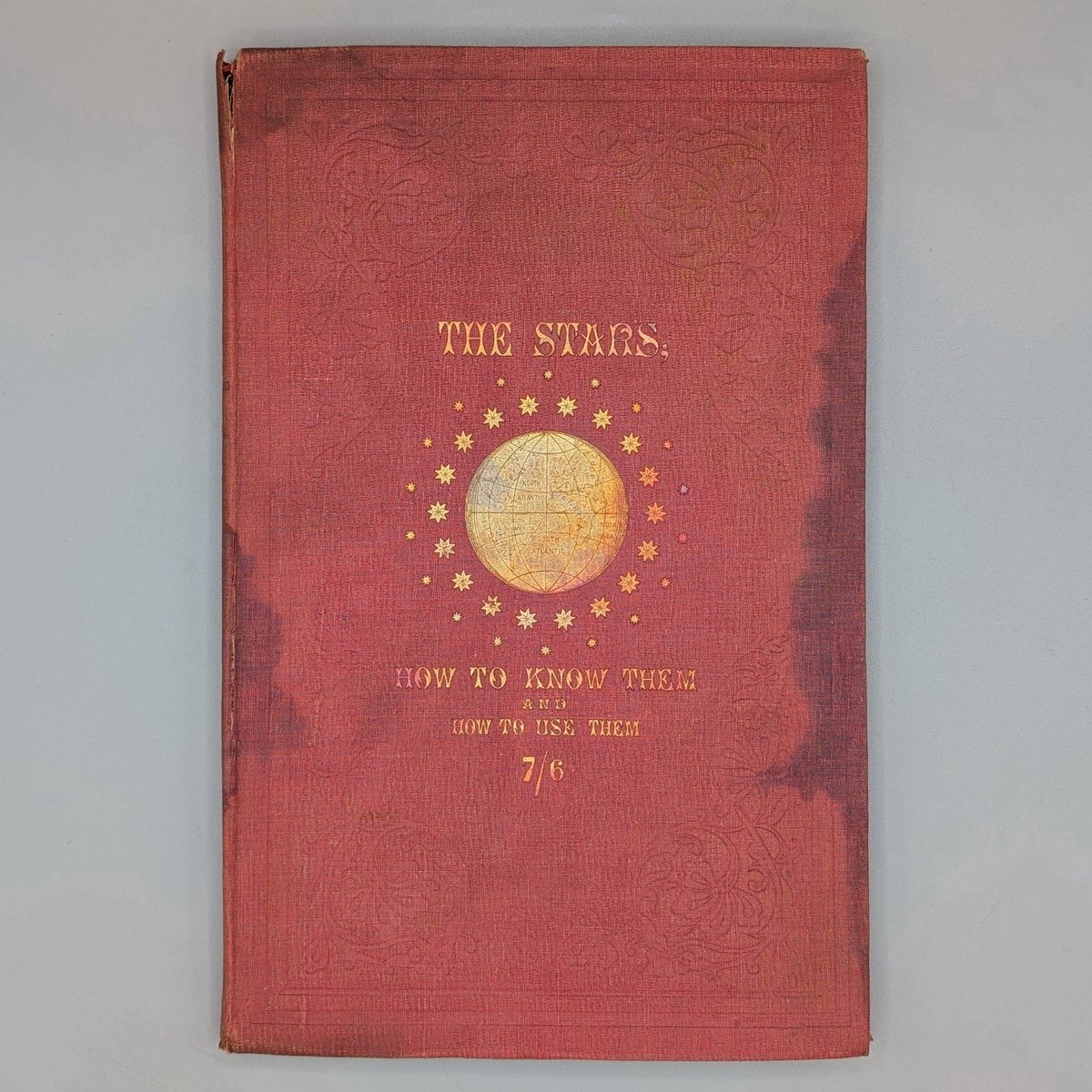
ALT Photograph depicting the red cover of a book, with the title in gold lettering and a gold illustration of a globe surrounded by stars.
1
2
118

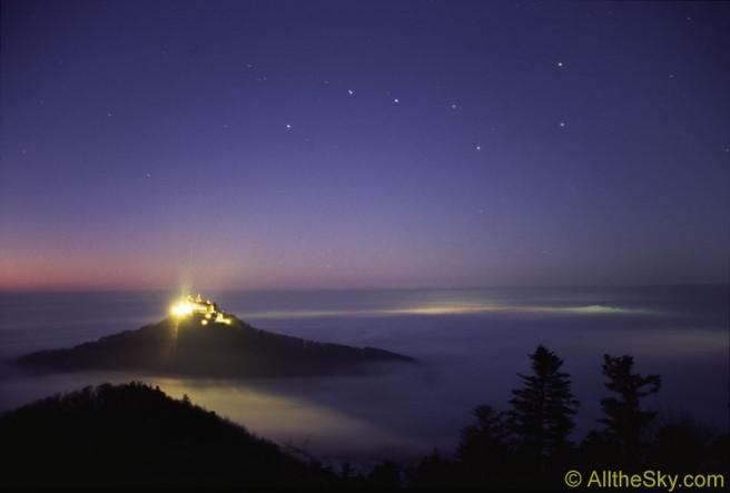
Astronomy Picture from 18/02/2005
Big Dipper Castle
Source: apod.nasa.gov/apod/ap050218.…
#BigDipper #UrsaMajor #NightSky #Stargazing #HohenzollernCastle #Germany #Astrophotography #CelestialNavigation #NorthStar #Polaris
1
1
82

11 Dec 2024
✨Name the star sailors used most often for #navigation?
💬Comment Below!
⚓Before #GPS, #sailors trusted the night sky to guide them through the vast oceans. A skillful blend of science & instinct.
👉 Follow for more #maritime insights!
#CelestialNavigation #Sailing #Seafarer
1
2
11
1,224

It's been a blustery Sunday here in London. As the curtains draw on the day with a Beef Bourguignon simmering away & plans plotting in my head for something else cooking, I share another clip from @heyhumanpodcast chat I had. bit.ly/4gqUGAg #Coldplay #CelestialNavigation
5
5
56
3,563

7 Dec 2024
moments from last night’s show
.
#seattle #Womencomposer #seattlemusic #celestialnavigation #theviolinlady #celestialnavigation #seattleband #seattlemusicscene #violinmusic #ballerina #ballet #balletdancer #balletmusic
1
3
118

5 Dec 2024
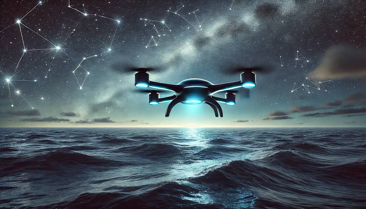
🌌 UAVs Navigating by the Stars When GPS Fails 🚀
📡 Discover how cutting-edge UAVs are harnessing celestial navigation to operate reliably when GPS signals are unavailable or compromised. This innovative approach ensures precision, resilience, and safety in challenging environments. 🌟
🔗 Read the full article on Highways Today:
highways.today/2024/12/03/ce…
#ConstructionNews #HighwaysToday #UAV #CelestialNavigation #Innovation #DroneTechnology #ResilientTech #FutureOfAviation
6
8
56
5 Dec 2024
live show Thursday 730
Sea Monster Lounge
.
#seattlemusic #celestialnavigation #theviolinlady #celestialnavigation #seattleband #violinsolo #seattlemusicscene #violinmusic #ballerina #ballet #balletdancer #balletmusic
1
2
116

27 Nov 2024
🎙️ "𝐎𝐥𝐝 𝐒𝐜𝐡𝐨𝐨𝐥 𝐂𝐚𝐩𝐭𝐚𝐢𝐧 𝐯𝐬 𝐌𝐨𝐝𝐞𝐫𝐧 𝐍𝐚𝐯𝐢𝐠𝐚𝐭𝐨𝐫" – 𝐀 𝐁𝐚𝐭𝐭𝐥𝐞 𝐨𝐟 𝐄𝐫𝐚𝐬! ⚓️
This is THE episode we’ve all been waiting for – a raw and unfiltered conversation between two generations of seafarers. On one side, we have 𝐂𝐚𝐩𝐭𝐚𝐢𝐧 𝐒𝐚𝐦𝐚𝐫𝐭𝐡 𝐒𝐢𝐧𝐡𝐚, the legendary "Old School Captain" who rose to fame on Instagram with his nostalgic 90s reels showcasing classic seamanship practices. On the other, it’s ME—your modern navigator—who relies on GPS and automation to navigate the oceans.
In this podcast, 𝐰𝐞 𝐝𝐢𝐯𝐞 𝐢𝐧𝐭𝐨 𝐚 𝐜𝐥𝐚𝐬𝐡 𝐨𝐟 𝐩𝐞𝐫𝐬𝐩𝐞𝐜𝐭𝐢𝐯𝐞𝐬:
🚢 Sailing the Pacific in the 90s vs. Modern Navigation Tools
🌊 How Celestial Navigation Saved Ships Before GPS
💨 Storm Stories: What Happens to a Car Carrier in Rough Seas?
📚 How Merchant Navy Education Has Changed Over the Years
🗺️ Shore Leaves Then and Now: The Loss of Freedom at Sea
🧠 Mental Health Then vs. Now: How Sailors Cope in Different Eras
❤️ Love, Relationships, and Life Lessons from a Captain’s Journey
Hearing Capt. Sams talk about his first Pacific voyage using a sextant to navigate while sharing anecdotes of life onboard in the 90s had me hooked. As a modern navigator, it felt like stepping into a time machine and seeing the challenges, grit, and camaraderie of that era.
One thing is certain: 𝐭𝐡𝐞 𝐨𝐜𝐞𝐚𝐧 𝐧𝐞𝐯𝐞𝐫 𝐜𝐡𝐚𝐧𝐠𝐞𝐬, 𝐛𝐮𝐭 𝐡𝐨𝐰 𝐰𝐞 𝐭𝐚𝐜𝐤𝐥𝐞 𝐢𝐭 𝐜𝐞𝐫𝐭𝐚𝐢𝐧𝐥𝐲 𝐝𝐨𝐞𝐬. 🌊
This episode isn’t just about nostalgia—it’s about learning, growth, and bridging the gap between the past and the future of seafaring.
The podcast goes live this Thursday at 7 PM. Get ready for a fascinating blend of humor, knowledge, and incredible stories that will leave you inspired!
📌 𝐖𝐡𝐨 𝐝𝐨 𝐲𝐨𝐮 𝐭𝐡𝐢𝐧𝐤 𝐰𝐨𝐮𝐥𝐝 𝐰𝐢𝐧 𝐢𝐧 𝐭𝐡𝐢𝐬 𝐛𝐚𝐭𝐭𝐥𝐞 𝐨𝐟 𝐞𝐫𝐚𝐬 – 𝐭𝐡𝐞 𝐎𝐥𝐝 𝐒𝐜𝐡𝐨𝐨𝐥 𝐂𝐚𝐩𝐭𝐚𝐢𝐧 𝐨𝐫 𝐭𝐡𝐞 𝐌𝐨𝐝𝐞𝐫𝐧 𝐍𝐚𝐯𝐢𝐠𝐚𝐭𝐨𝐫? 𝐋𝐞𝐭 𝐮𝐬 𝐤𝐧𝐨𝐰 𝐲𝐨𝐮𝐫 𝐭𝐡𝐨𝐮𝐠𝐡𝐭𝐬 𝐛𝐞𝐥𝐨𝐰!
#OldVsNew #KSNPodcastShow #LegendsAtSea #Seafarers #MaritimeLeadership #CelestialNavigation

2
16
836

21 Nov 2024
Arcturus to Merak, a celestial roadmap to Polaris! Straight on 'til morning... Someone is definitely onto something. #StairwayToPolaris #mynewPolaris #CelestialNavigation. If this was you in libation mode.. what about when you are in "Limitless" mode? 👀✌️
1
2
63

29 Oct 2024
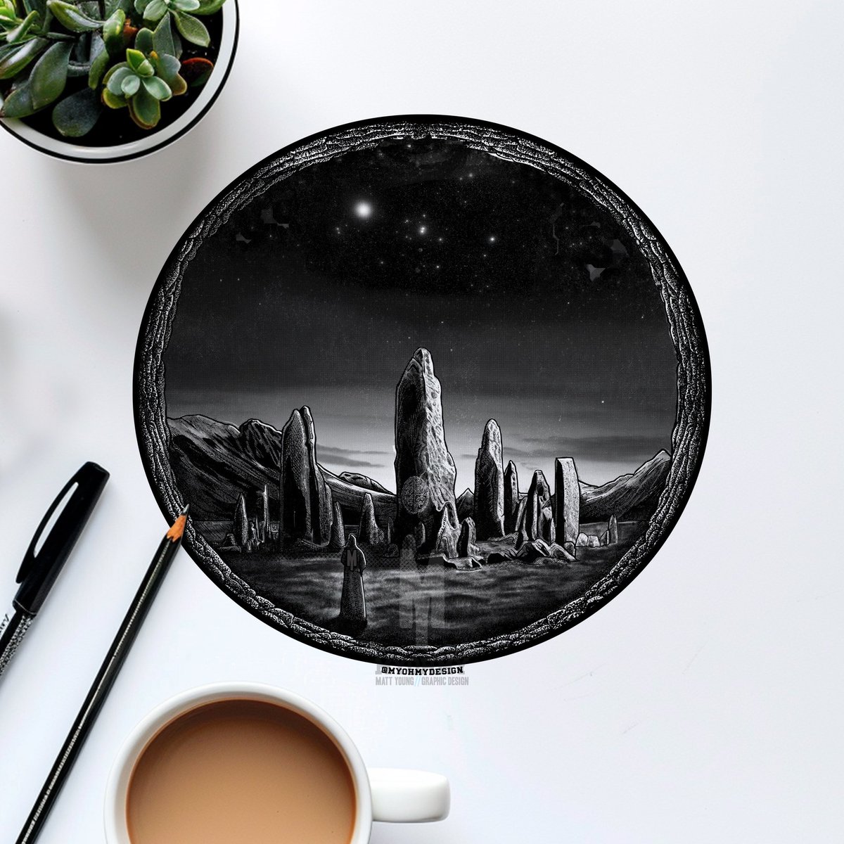
29/31 - NAVIGATOR ✨
.
.
.
.
.
.
.
.
@inktober
#pendrawing #inkdrawing #Inktober2024 #navigator #inktober2024Navigator #inktoberartists #darkartists #instafineliner #linedrawings #pendrawings #penandinkdrawings #celestialnavigation #Pagan #StandingStones #monolith
3
49

27 Oct 2024
1
2
21
909
22 Oct 2024
Natural navigation with moon shadows. #naturalnavigation #celestialnavigation instagram.com/reel/DBbsFA3oF…
2
359
16 Oct 2024
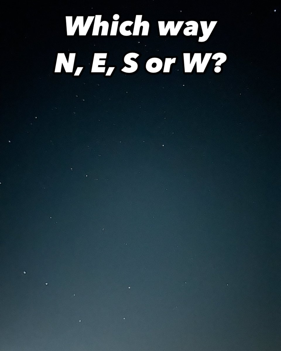
N, E, S or W?
Answer… spoiler alert…
The Plough / Big Dipper shows we are looking very close to North. More on this in this week’s newsletter (link below bio). #naturalnavigation #stargazing #celestialnavigation #navigation #bushcraft #northstar
1
15
778