Jan 26
🔥 A classic #EricDubay video: 200 Proofs Earth is Not a Spinning Ball 🔥 Several years ago I purchased a carved wooden replica of the #GleasonMap complete with dome. 🔥
3
1
6
442

28 May 2025
They showed that:
• 🧭 Longitude-based scaling is accurate
• 🧠 Latitude distortion is expected due to projection format
•📏 Measurement ratios hold true using the map’s own nautical mile scale
And yes, the same coordinates work across different map designs (pyramid, sphere, disc) because coordinates are celestial, not terrain-based.
"Projection ≠ Reality."
"Utility = Understanding."
🗺 Still Used Today
The Azimuthal Equidistant (AE) projection isn’t obsolete:
✅ It’s used in aviation charts
✅ It’s on the UN logo
✅ It’s the default for radio propagation (e.g. HAM circles)
✅ It’s used in radar mapping and sonar design
Why?
Because when you want direction, central reference, and angular distance, AE works.
"Globe defenders mock AE....until they need to fly a plane or bounce radio off the ionosphere"
📚 Gleason’s Vision
From Is the Bible from Heaven? Is the Earth a Globe?, Gleason writes:
"Time is the shadow of the Sun on the Earth. Geography and time are one."
"No man has ever measured a curve upon land or water, and yet men talk about it as if it had been proved for centuries."
His aim wasn’t just visual,it was functional and cosmological.
He built the map to align Sun, time, and place in one working model.
And backed it with a patent, a book, and a legacy still valid today.
🎯 Final Take
The Gleason map works as it was intended:
✅ It tells time
✅ It tracks the Sun
✅ It divides zones logically
✅ It preserves longitude scaling
✅ It matches navigational reality
✅ It came with functional tools
✅ It aligns with nautical mile math
✅ It matches star-based navigation
✅ It explains solar motion and apparent Sun behavior
✅ It requires no spinning space rock
It’s not a toy.
It’s a functional solar timekeeping tool, and it still holds up today.
#FlatEarth 🌐
#GleasonMap 🕰️
#SunClock ☀️
#SolarSpiral 🌀
#LongitudeLogic 📏
#CelestialNavigation 🧭
#AsItIs 📚
3
5
13
772


30 Nov 2024
Revisiting The Gleason Map - Time Calculations & Solstices
#gleasonmap #flatearth #researchflatearth
2
3
3
273
11 Aug 2024
Is The Bible From Heaven? Is The Earth A Globe? By Alex Gleason - Gleason Was A Flat Earther
#researchflatearth #biblicalcoology #flatearth #gleasonmap #thebible
1
3
107

16 Jun 2024
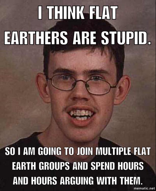
This is great, I'm always aslerp when the debates kick off, so I play catch up.
The globe is dead,and best way to promote it is find a triggerd dummie like this one @dsshake and he will promote it because he's to dumb to debate or reply to us in a intellectual adult way. Just use him as I have to promote flat earth as he not clocked on to the fact he's tagging flat earth in every reply.....🤭🤭🤭🤭🤣🤣🤣🤣🤣
#FEWINS #waterislevel #earthisflat #level #flat #flatearthwins #cantwinglobies #nasalies #noglobeevidence #gleasonmap #gullibleglobies #nothinginspace #crymoreglobtards #flatearth #researchflatearth
1
3
636

16 Jun 2024
Five Worst Arguments in Flat Earth Debate: Analysis
💥youtube.com/watch?v=26UkTow1…
#FEWINS #waterislevel #earthisflat #level #flat #flatearthwins #cantwinglobies #nasalies #noglobeevidence #gleasonmap #gullibleglobies #nothinginspace #crymoreglobtards #flatearth #firmament #dome #Eratosthenes #FlatEarth #FlatEarthers #MagicalThinkers #KJV1611 #history #GlobedEarth #Globests
1
221
28 Jan 2024
@Gurdur don't forget this, as your the big clever man....you wouldn't want to look foolish for challenging us and running would you....👇👇👇
#FEWINS #waterislevel #earthisflat #level #flat #flatearthwins #cantwinglobies #nasalies #noglobeevidence #gleasonmap #gullibleglobies #nothinginspace #crymoreglobtards
1
1
3
135
7 Jan 2024
Ha ha trolling my posts because you got ripped , you just promoted Falt earth by posting it.....🤦♂️🤣🤣🤣
Thank for sharing 🤡🤣🤣🤣
#FEWINS #waterislevel #earthisflat #level #flat #flatearthwins #cantwinglobies #nasalies #noglobeevidence #gleasonmap #gullibleglobies #nothinginspace #crymoreglobtards
3
1
6
345
6 Jan 2024
When all you got is abuse, you know your cause is lost.....
Why wint this man present any evidence, its just cheap insults and defecting......
This is why Flat earth won years ago, they can't debate.
#FEWINS #waterislevel #earthisflat #level #flat #flatearthwins #cantwinglobies #nasalies #noglobeevidence #gleasonmap #gullibleglobies #nothinginspace #crymoreglobtards
6 Jan 2024

Well thanks a bunch you bunch of twats @100KryptoKeyz @RifeTechnology
You allowing the horrific things and medical misinformation from the IDIOT Matthew Rife got me a strike.
Even though I was countering the stupid and harmful claims about curing cancer with sound/em fields.
Rife, I'm fucking coming for you

3
2
243

21 Nov 2023
U are yes 👍
M
U
T
E
Put your stupid comments below where I won't see it u 🤡
Or li block u and u can tell all your boyfriends iv blocked u.
And then u can feel clever.....instead of a dumb PEST 🪳🪳🪳🫵🤡🫵🤣🫵🤡
#FEWINS #waterislevel #earthisflat #level #flat #flatearthwins #cantwinglobies #nasalies #noglobeevidence #gleasonmap #gullibleglobies #nothinginspace #crymoreglobtards
1
3
70
17 Nov 2023
🤣🤣🤣🤣🤣🤣
It's 2023 for god sake, wake up
#FEWINS #waterislevel #earthisflat #level #flat #flatearthwins #cantwinglobies #nasalies #noglobeevidence #gleasonmap #gullibleglobies #nothinginspace #crymoreglobtards
1
2
2
64
16 Nov 2023
Triggered ha ha cry harder 😢 🤣 #FEWINS #waterislevel #earthisflat #level #flat #flatearthwins #cantwinglobies #nasalies #noglobeevidence #gleasonmap #gullibleglobies #nothinginspace

1
1
175
16 Nov 2023
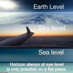
Or reality.....which blows your diagram out the water, wow u globies are in desperation mode, ......go take a photograph YOURSELF of curvature and post it.....prove me wrong with somthing that has substance, instead dragging out your humiliation....seriously 🙈🙈
#FEWINS #waterislevel #earthisflat #level #flat #flatearthwins #cantwinglobies #nasalies #noglobeevidence #gleasonmap #gullibleglobies #nothinginspace #crymoreglobtards
1
3
142
15 Nov 2023
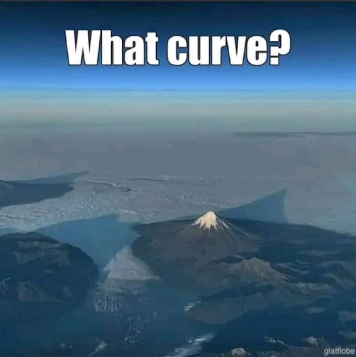
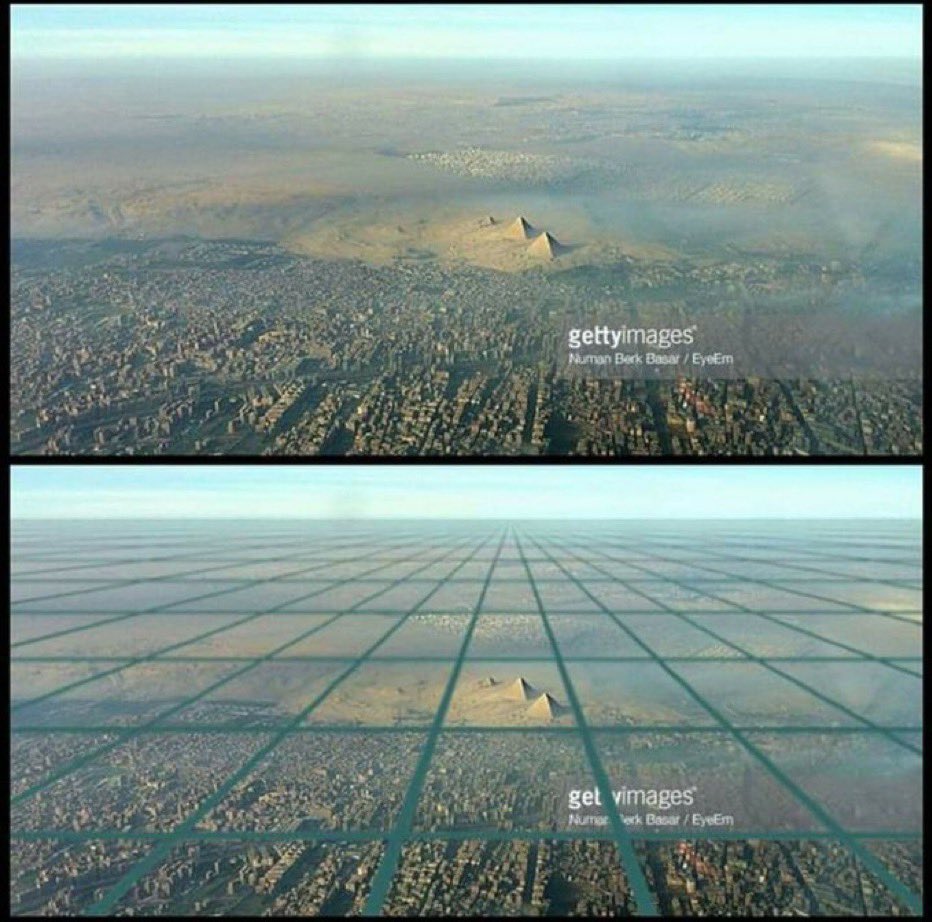
That proves FE, 🙈🤣🤣🤣
That clearly dose not display 8 inches per square mile.....are u seriously using this pic🙈🙈 Cornelius did the same thing, proved local sun and FE with one he posted....omg, you guys are brilliant 🙈🤣🤣🤣🤣
#FEWINS #waterislevel #earthisflat #level #flat #flatearthwins #cantwinglobies #nasalies #noglobeevidence #gleasonmap #gullibleglobies #nothinginspace #crymoreglobtards
2
42