
8 Oct 2024
@milos_agathon ,what do you think? I went with 🇹🇭 #Bangkok as my destination! 😎 This building height map within a 1km buffer is wild! 🌆
Skyscrapers stretching to the sky! 🌏✨
‼️ See Comment Below‼️
#BangkokBound #CityOfAngels #Urban #R #Datescience #Maps #EarthEngineAPI

ALT To create the Bangkok building height map, I utilized a combination of tools and data. First, I defined the city's coordinates and applied a 1km buffer around the central point. I then sourced building height data from Google's Open Buildings Dataset via the Earth Engine API using the rgee package. After filtering the data based on confidence levels, I masked unreliable data. I extracted the maximum building height for each building polygon and added road data from OpenStreetMap. Lastly, I visualized the results using rayshader for 3D representation.
7 Oct 2024

Thank you Sofia! I'm excited to see your building height maps!
2
1
7
1,904

30 Jul 2024
Postdoc (f_m_x) Researcher in Data Science and Forest Disturbance Monitoring - Potsdam, Germany - earthworks-jobs.com/jobs/gfz… - #jobs #research #postdoc #datescience #forestry #AI #remotesensing #earthobservation
2
662

Our #AI&DS 3rd-year students, Syed Maaz Ahmed & Syed Nazeer Ahmed achieved remarkable #Success at the #NISHKARSHANA2024 #IDEATHON #Event held at TKR College. They secured second place out of 38 competitive teams.
#MCET #Congratulations #ArtificialIntelligence #DateScience #Skills


2
3
102

22 Jul 2023
Choose your Focus!
Need a portable #workstation? May we suggest the M2 Gen 5.
Want an ultra-mobile #laptop? Check out the XE or Ir14.
Looking to replace your #desktop tower? See the compact NX.
Get going with a quality #Linux system configured your way! See them at: kfocus.org
#DevOps #ML #AI #Creators #Engineers #Developers #DateScience #Students #Build #IaaS

4
9
2,398

25 May 2023
I don't think... I mean, I dunno... what does this job entail, exactly, @NIHRresearch ? Should I be worried about the Twickenham team? #dateScience
1
1
220
20 May 2023
Choose your Focus!
Need a portable #workstation? M2 Gen 5.
Want an ultra-mobile #laptop? XE or Ir14.
Looking to replace your #desktop tower? NX.
Get a quality #Linux system configured your way! kfocus.org
#DevOps #ML #AI #Engineer #Developer #DateScience #IaaS

5
208

23 Feb 2023
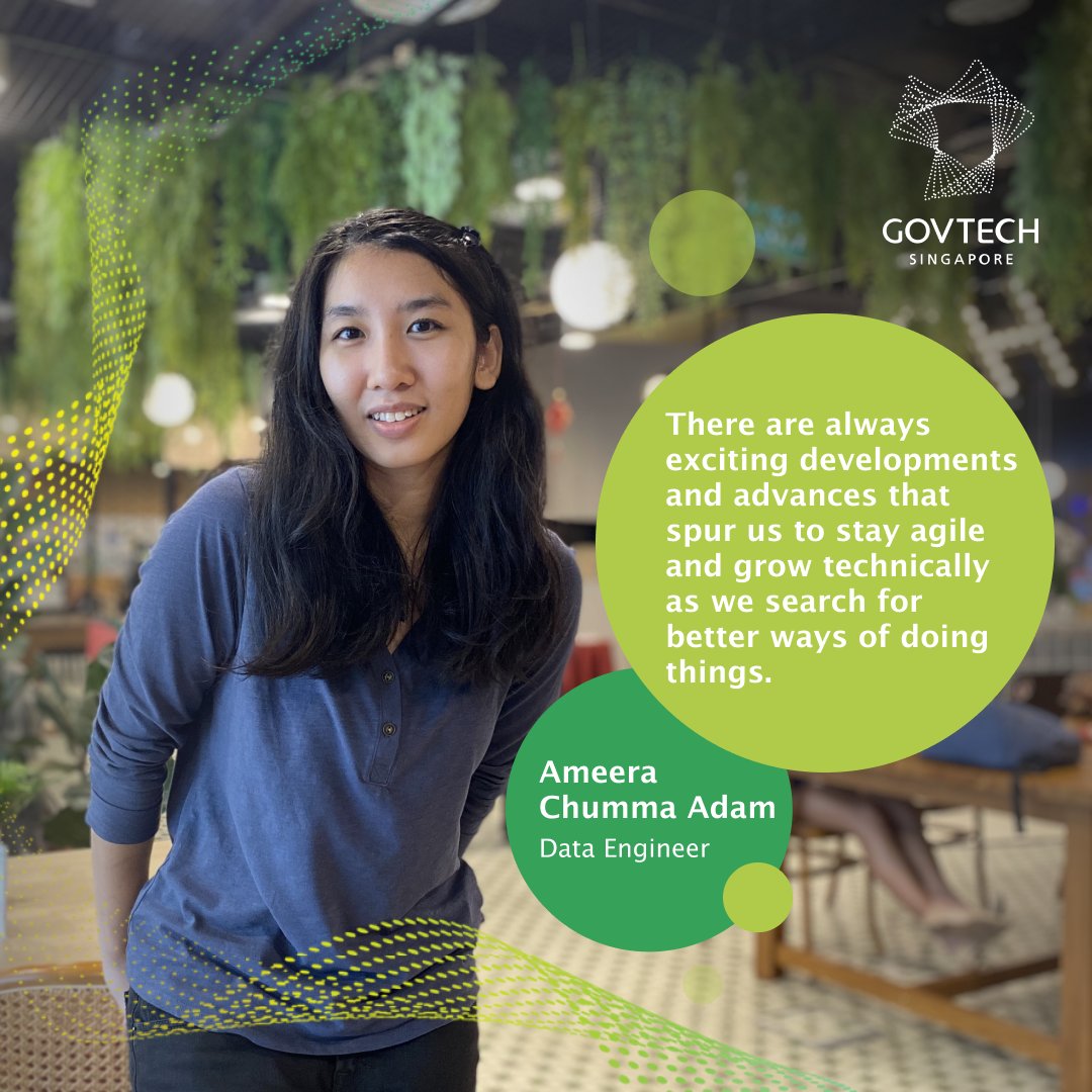
“My job allows me to work on projects that enable #TechForPublicGood while advancing the Singapore Government Tech Stack” - Ameera.
Explore a career as a #DataEngineer at go.gov.sg/govtechcareers!
#DateScience #PeopleOfGovTech #InsideGovTech
1
2
545

26 Jan 2023
【3/8オンライン開催~Women in datescience~】米国スタンフォード大学との連携で開催。若宮正子さんの講演や企業で活躍する女性データサイエンティストのパネルトークなど盛りだくさんの内容のようです。@WiDS_Tokyo wids-ycu.jp/sympo/
3
499
12 Jan 2023
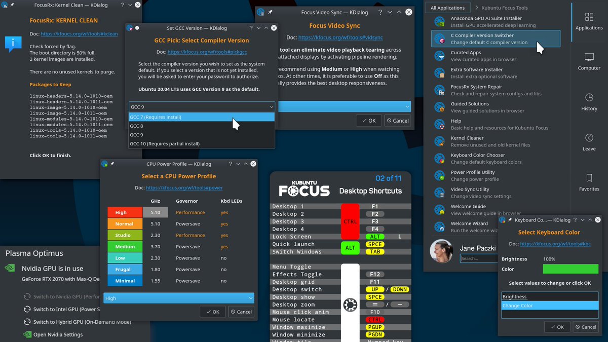
Tools, tools, and more tools! We strive to make working on a #KubuntuFocus easy with helpful tools at your fingertips.
See them at: kfocus.org/wf/tools
#Linux #DevOps #ML #AI #Laptop #Creators #Portable #Engineers #Developers #DateScience

4
152

26 Dec 2022
Saved this Tweet to your Notion database.
Tags: [Datescience]
6

10 Sep 2022
Tools, tools, and more tools! We strive to make working on a #KubuntuFocus easy with helpful tools at your fingertips.
See them at: kfocus.org/wf/tools
#Linux #DevOps #ML #AI #Laptop #Creators #Portable #Engineers #Developers #DateScience
2
2

30 Aug 2022
AI detects 20,000 hidden taxable swimming pools in France, netting €10m bit.ly/3e74ODE @TheRegister #ArtificialIntelligence #AI #taxation #publicsector #France #innovation #datescience
3
5
1 Jul 2022
Thank you to Beta News for this article! Give it a read, and then see more on our website at kfocus.org !
betanews.com/2022/05/01/gen4…
#ML #DevOps #Linux #Engineers #laptop #build #AI #Creators #Portable #Developers #DateScience
3
7
25 Jun 2022
Choose your Focus! Want an ultra-mobile XE or a portable workstation M2?
Get going with Jammy Jellyfish and enjoy using a laptop configured your way!
See them at: kfocus.org
#Linux #DevOps #ML #AI #Laptop #Creators #Portable #Engineers #Developers #DateScience

2
2

24 Jun 2022
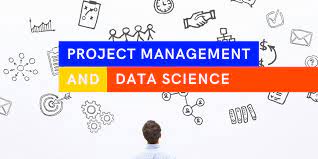
Project Management And Data Science Go Hand in Hand
The exchange of views turns into the additional skills that data scientists should have,
Know more about this blog click now:-bityl.co/Csji
#productmanagement #datescience #henryharvin #
3
7

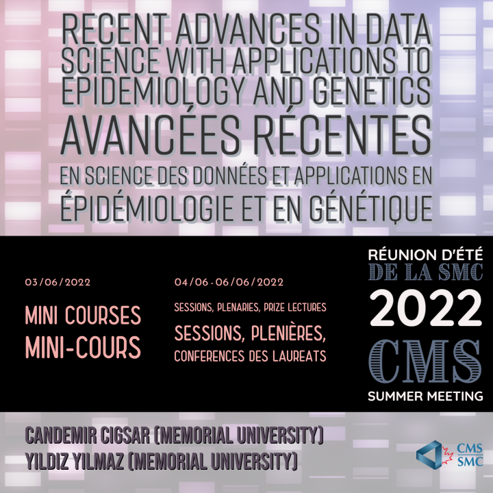
3 May 2022
We can't wait to learn more about this!
ow.ly/iE7J50IYwNZ
Nous sommes impatients d'en savoir plus!
ow.ly/faLe50IYwO1
#epidemiology #datescience #genetics #math #2022cmssummermeeting #conference
1
1

28 Mar 2022
Data scientists reveal roadblocks to digital transformation.
#DateScience #Technology #Science
Read more:
womeninscience.africa/data-s…

3

What's exciting @deanwampler in the world of #DataScience at the moment?
Check out this #grok, with lots more insights around #DateScience, #MachineLearning, #BigData, and more from Dean at grokswap.com/
#GrokSwap
3
1

17 Oct 2021
𝐃𝐚𝐭𝐚 𝐒𝐜𝐢𝐞𝐧𝐜𝐞 𝐓𝐫𝐚𝐢𝐧𝐢𝐧𝐠 𝐈𝐧 𝐃𝐞𝐥𝐡𝐢 𝐃𝐨𝐞𝐬𝐧'𝐭 𝐇𝐚𝐯𝐞 𝐓𝐨 𝐁𝐞 𝐇𝐚𝐫𝐝. 𝐑𝐞𝐚𝐝 𝐓𝐡𝐞𝐬𝐞 𝟔 𝐓𝐢𝐩𝐬
𝐂𝐚𝐥𝐥 𝐨𝐫 𝐖𝐡𝐚𝐭'𝐬 𝐀𝐩𝐩:- 𝟗𝟏-𝟗𝟖𝟕𝟑𝟗𝟐𝟐𝟐𝟐𝟔
shapemyskills.in/data-scienc…
#datescience #datasciencetraining #pythontraining
3