
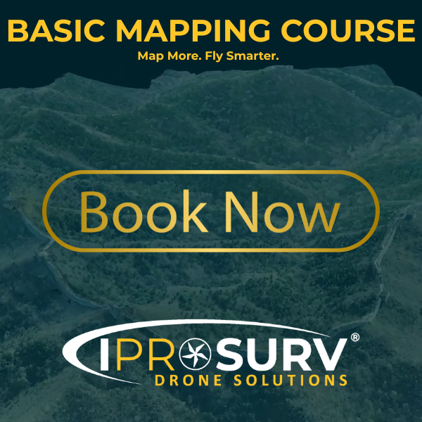
Turn your drone into a mapping powerhouse 🗺️
Learn aerial data capture & analysis in our 2-day Mapping Course – £299 VAT
📍 Rotherham | 📞 0114 4055 007
👉 zurl.co/POgX2
#DroneMapping #Photogrammetry #DroneTraining #Iprosurv #Dronesforgood #CAAApproved #Surveying
19
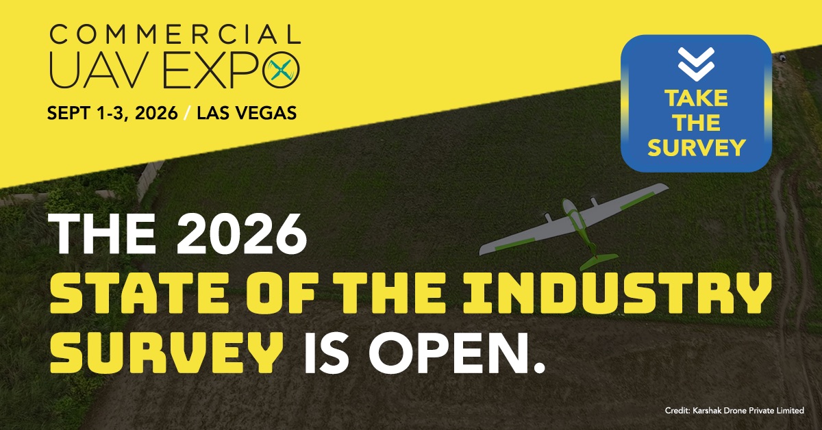
Calling all drone pros: pilots, fleet managers, service providers, and compliance leads. We want to hear from YOU
It only takes a few minutes, and your perspective genuinely shapes the conversation.
Take the survey: survey.divcom.com/s3/COMMERC…
#ExpoUAV #UAVExpo #DronesForGood #UAV
2
3
161

May 29
Live from Fuerteventura, Spain! 🇪🇸
Join cloudGCS Live and experience the performance of our VTOL UAV in real time.
#VTOL #UAV #Dronesforgood

2
3
73

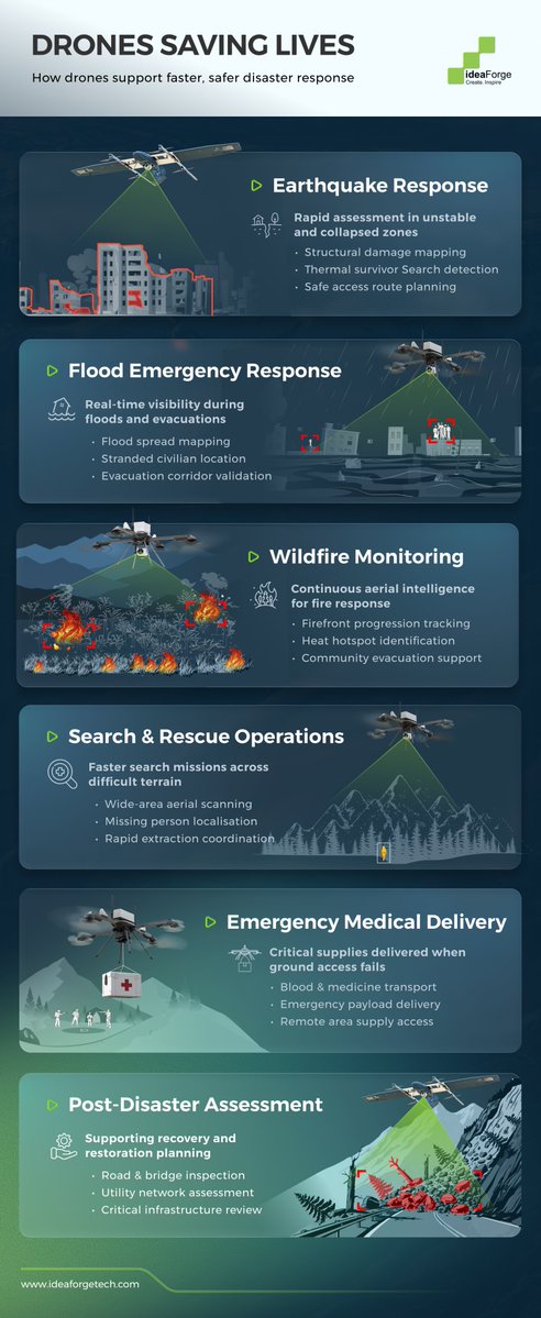
When disaster strikes, seconds matter. #Drone technology has become fundamental to emergency response and saving lives.
What began as aerial observation has matured into an integrated platform delivering real-time intelligence across mission-critical areas: from #earthquake response to #flood emergencies, #wildfire management to mountain rescue.
In this infographic, see how #humanitarian drone operations are transforming emergency response across damage assessment, survivor location, evacuation guidance, supply delivery, and post-disaster recovery.
Which application do you think saves the most lives?
To explore UAV solutions for emergency response, visit ideaforgetech.com/
#HumanitarianTech #DisasterResponse #SaveLives #DronesForGood #EmergencyResponse #DroneInnovation
1
2
12
459

Apr 23
@AirdataUAV 's new integration with BRINC automatically captures and organizes flight data from the Lemur 2 and Responder drones, eliminating manual recordkeeping for public safety agencies.
commercialuavnews.com/airdat…
#dronesforgood #publicsafety #UAS
1
2
91

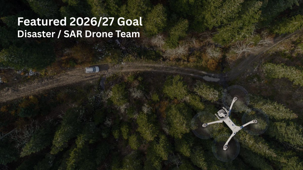
One of the goals we have for this year is to purchase our first commercial drone and get a team of five volunteers certified as commercial remote pilots (drone pilots).
Many people still think of toys or novelties when they imagine drones, but they are a force multiplier when it comes to damage assessment or search and rescue.
They allow more square mileage to be covered by fewer volunteers, and faster, than any ground mission could accomplish.
Drones with thermal imaging sensors are able to locate victims through smoke, fog or tree cover. The cooling of rapidly expanding gasses even allows thermal drones to detect disaster-related gas leaks before an explosion can happen.
We plan to use grants to cover the bulk of the expense of starting our drone program. We already have grant applications submitted to several corporate donors to fund the drone purchase and initial training. The only category that most grants won't cover is training related travel expenses, so there's always a need for private donors.
If becoming a disaster / search & rescue drone pilot is something that interests you, and you are located in FEMA regions six or nine (CA, NV, AZ, NM, TX, OK, AR or LA), email droneprogram@veteransrespond.org. We will launch the program in those regions first, followed by the rest of the country next year.
If you want to help fund the program, please email giving@veteransrespond.org
#DronesForGood #Drone #UAV #SearchAndRescue #Disaster
4
20
64
6,541

Apr 7
We are the official drone partner of FDIC 2026! Stop by our booth at Lucas Oil Stadium to say hi, then head out to the HEAT to experience our live drone demo. We can't wait to see you there!
Learn more about Paladin: paladindrones.io
#DFR #DronesForGood #FDIC2026

ALT A DJI M30 drone on a smoky tinted orange, white and blue background. Text on the left reads, "Find Paladin at FDIC International, Indianapolis, IN, April 20-25, Lucas Oil Stadium, Booth #3408. The Paladin logo and FDIC logo are in the top right corner.
1
3
4
244
Mar 25
We asked the commercial UAV community what you actually need from a conference. Your answer was clear: actionable insights you can use immediately. That feedback is shaping the 2026 program. Here’s an early look! tinyurl.com/mab3m2vy
#ExpoUAV #UAVExpo #DronesForGood #UAV #UAS

2
3
94
#Publicsafety operations today require faster response, better visibility, and smarter coordination.
With FLYGHT Patrol, we are enabling law enforcement and public safety agencies to deploy advanced #drone capabilities without the need for capital investment.
Through the Drone-as-a-Service (DaaS) model, agencies can access on-demand aerial intelligence for traffic monitoring, crowd management, disaster response, and crime prevention - helping improve situational awareness and operational efficiency when it matters most.
Already deployed across various states, #FLYGHTPatrol has supported operations during large religious gatherings such as #KanwarYatra and #PandharpurYatra, while also assisting authorities in #encroachment monitoring, #trafficmanagement, and automated #challan issuance.
With real-time monitoring, AI-driven insights, and rapid aerial deployment, our drone-as-a-service solution FLYGHT Patrol is helping security agencies strengthen public safety and improve operational effectiveness.
Watch how #FLYGHTPatrol is redefining aerial support for modern policing. Learn more about FLYGHT Patrol - ideaforgetech.com/flyght/fly…
💬 How do you see drones transforming public safety and law enforcement operations in the coming years?
#ideaForge #DronesForGood #PublicSafety #DroneAsAService #SmartPolicing #DroneTechnology
4
3
16
970
Mar 11
The latest Uncrewed Views episode features Linda Montgomery and Philander Franklin from ZenaTech, who break down 20 acquisitions, drone-as-a-service growth, and their path forward in the commercial and defense markets. Listen now.
commercialuavnews.com/podcas…
#UAS #Dronesforgood
3
4
1,024

Mar 11
There’s a lot going out there in the world right now, but here’s a heartwarming story about yet another #DronesForGood use case: thedronegirl.com/2026/03/09/…
1
1
6
313

Mar 4

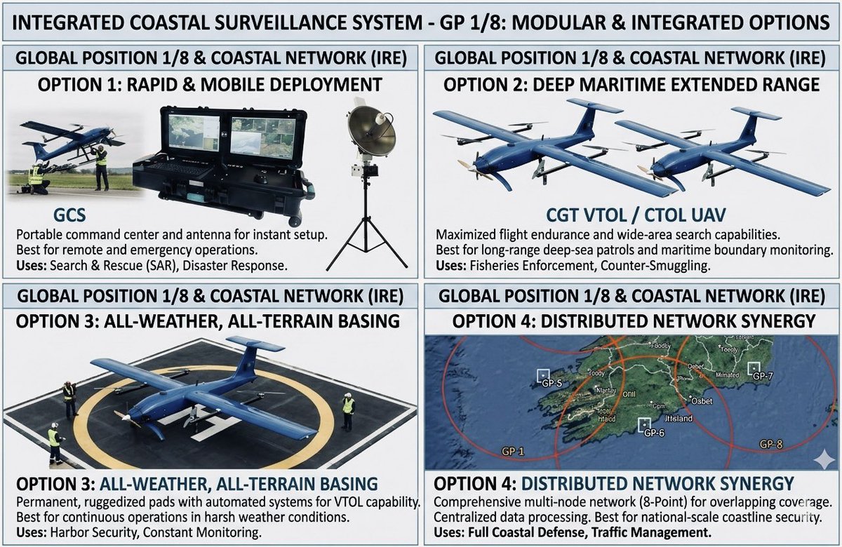
GUARD Post Deployment for Ireland's Maritime Security & Awareness
1. GUARD Post & GP Networks
The initial deployment phase will establish a minimum of eight GUARD Posts (GP1–GP8) along Ireland’s coastline and islands. These locations will be selected to create overlapping surveillance areas, ensuring full coverage of Ireland’s territorial waters and Exclusive Economic Zone (EEZ).
Each GUARD Post will function as a fully equipped, self-sustaining, and high-readiness operational base, capable of supporting both routine and emergency UAS missions, and will constitute the foundational layer of Ireland’s multi-layered maritime surveillance architecture.
👉 Learn more about how the CGT50 VTOL UAV can enhance your maritime missions — DM/contact our team today to explore tailored solutions.
#vtol #uav #maritime #surveillance #Navy @Entirl #IrishNavy @IRLDeptDefence
1
4
43
Conservation works best when the entire ecosystem is protected - wildlife, forests, and the communities around them.
From preventing human–wildlife conflict to detecting #forestfires, #poaching, and illegal activity, #aerialmonitoring is helping forest teams respond faster and safeguard fragile habitats.
This #WorldWildlifeDay, we’re proud to support forest officials across multiple states in India with #UAVs built for real-world conservation missions.
Learn how our Forest Solutions, powered by #DGCAcertified UAVs, #SWITCH and #Q6 - are strengthening wildlife and habitat protection - ideaforgetech.com/solutions/…
#WildlifeConservation #ForestProtection #DronesForGood #IndiaThroughDrones #AtmanirbharBharat
@moefcc @ntca_india @wii_india @ForestSurvey @WWFINDIA @UNEP
1
9
553

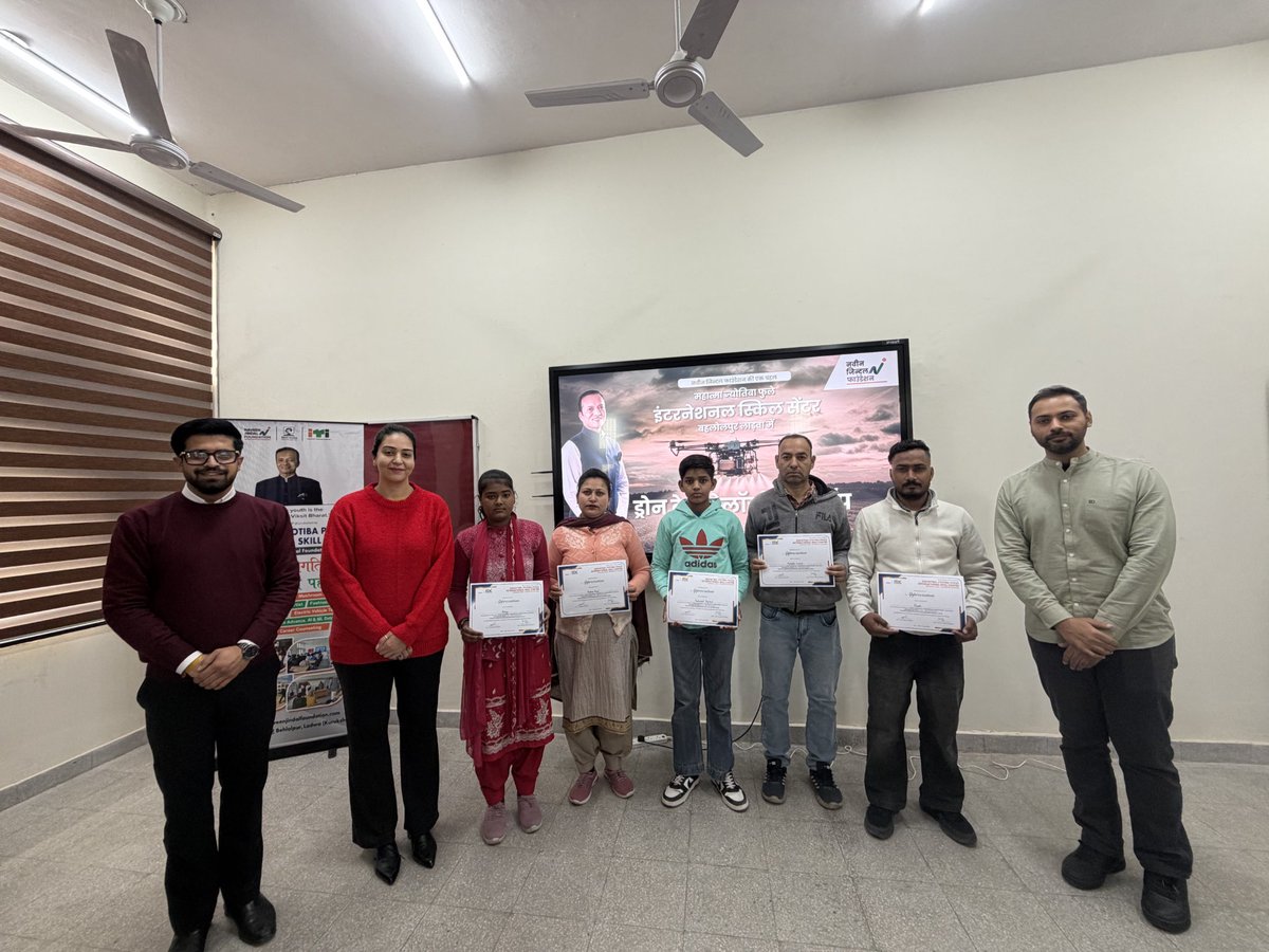
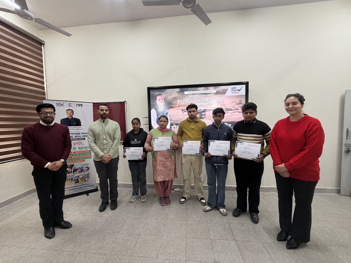
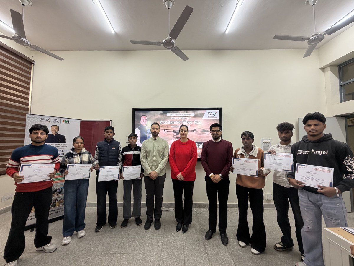
Learning drone technology isn’t just technical — it’s Exciting, Engaging, and Fun.
Students left with smiles and skills that last.
#Dronetechnology #droneworkshop #skilldevelopment #NaveenJindalFoundation #Youthempowerment #dronesforgood

1
2
6
Our #SkillDevelopment workshops extend beyond drone flights.
It strengthens confidence, encourages teamwork, and prepares students with the future-ready skills they need.
#Dronetechnology #YouthEmpowerment #dronesforgood
2
2
8

Jan 27
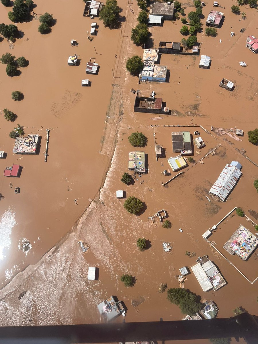
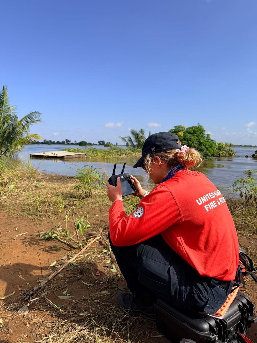
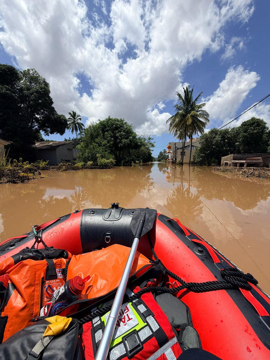
Using specialist equipment, including drones, teams are supporting situational awareness by identifying isolated communities and individuals in need of assistance or rescue. This intelligence is then used to prioritise boat-based and ground operations, ensuring help is directed where it is needed most.
These conditions remain challenging, but coordinated working, accurate information, and the right equipment are enabling responders to reach people who would otherwise remain cut off.
Our thoughts remain with all those affected, and with the local responders continuing this work alongside international teams.
#UKISAR #FloodResponse #SearchAndRescue #DronesForGood #MultiAgency #EmergencyResponse #LifeSafety
@UKinMozambique
@FCDOGovUK
4
17
1,088

Jan 25
Runaway recovered safely thanks to a drone and a dedicated team on the ground. 🛰️🚓
Suwannee County Sheriff’s Office recently used their UAS unit to help locate a missing juvenile and guide deputies in for a safe recovery. This is what #Dronesforgood looks like in public safety: faster searches, better awareness, and safer outcomes for everyone involved.
When every minute matters, putting smart eyes in the sky can be the difference between uncertainty and bringing a kid home.
#DFR
1
116

Jan 21
Drone team assisted at a Ten pump fire in the early hours in Bacup. Images show the great work by crews, whilst assisted by the drone, to prevent surrounding buildings being involved.
#dronesforgood @LancashireFRS
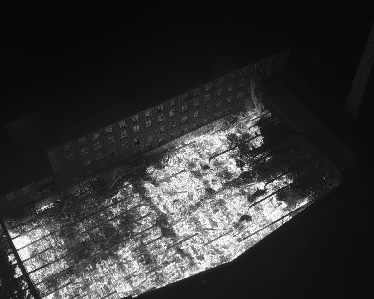
ALT Thermal image showing fire and close vicinity surrounding properties
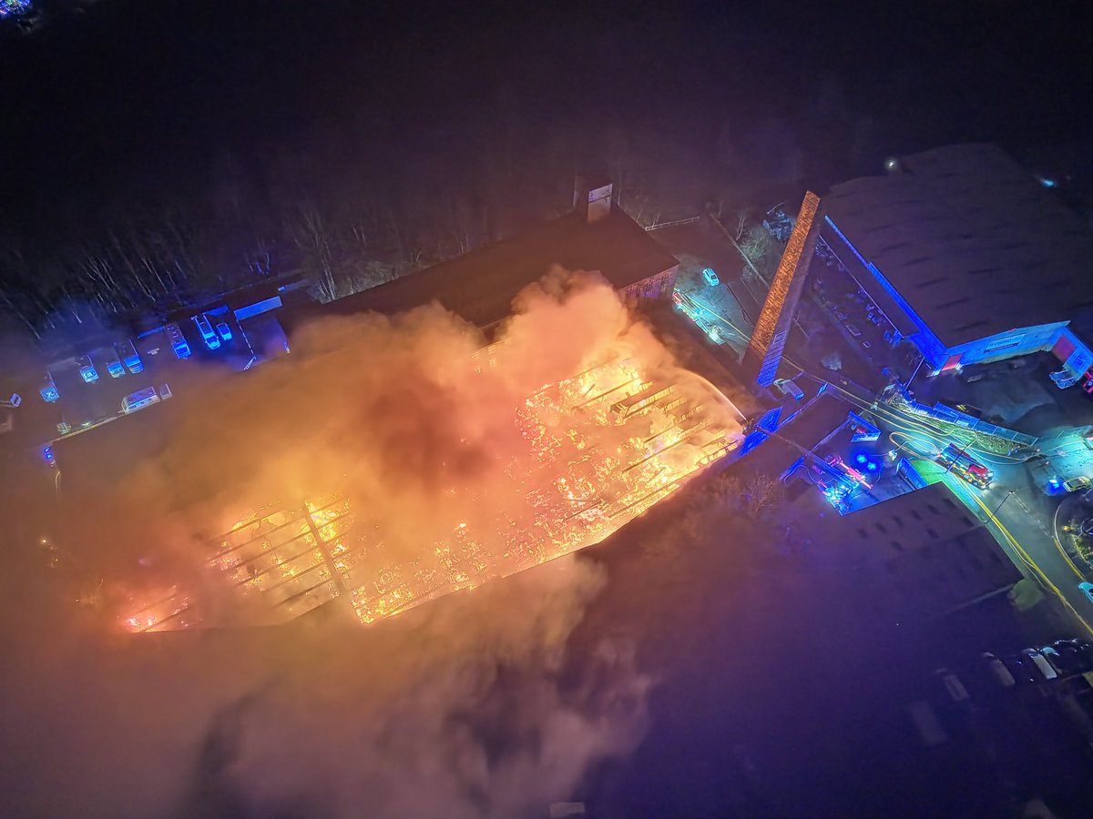
ALT Image showing fire and close vicinity surrounding properties

ALT Aerial ladder platform protecting uninvolved building from fire
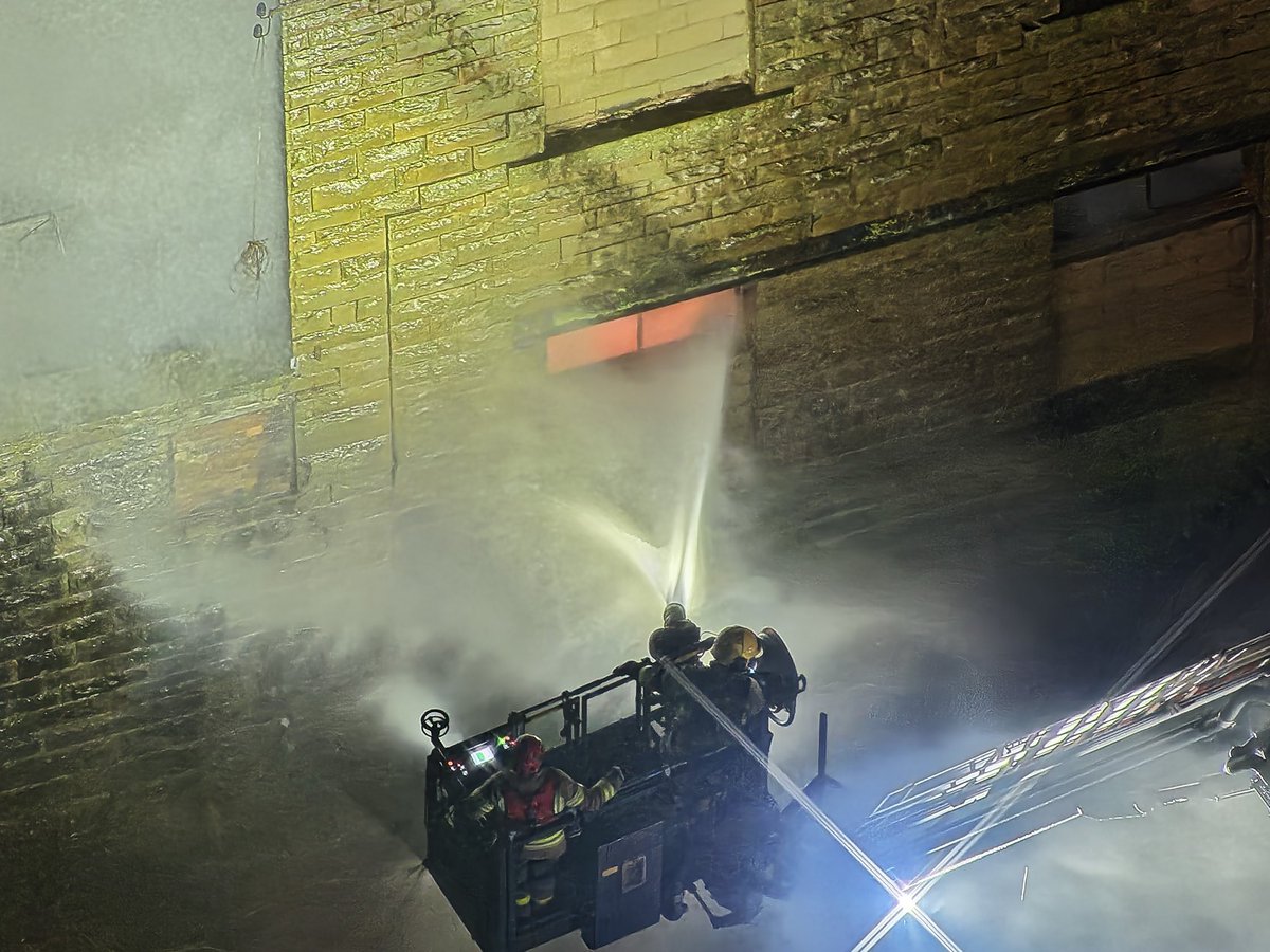
ALT Aerial ladder platform directing jet onto fire through window
5
276
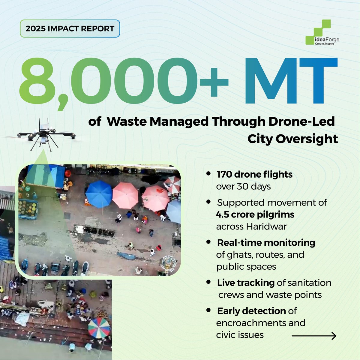
India Through Drones | 2025 Impact Edition
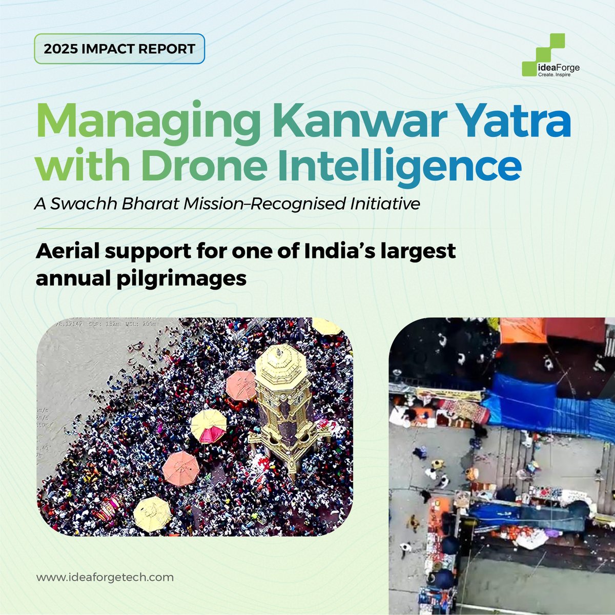
Large public events demand visibility that matches their scale.
During the #KanwarYatra in Haridwar, drone-led aerial oversight supported the Municipal Corporation in monitoring sanitation, crowds, ghats, and key routes in real time. Live drone feeds enabled faster coordination on ground and cleaner, better-managed public spaces.
Over 30 days and 170 drone flights, operations were supported for 4.5 crore pilgrims, with 8,000 metric tonnes of waste managed. The initiative was recognised by the #SwachhBharatMission (Urban) as an example of technology-led civic management.
Download the case study to see how drone intelligence supports large-scale public operations - tinyurl.com/bdfzzkta
#indiathroughdrones #publicsafety #aerialintelligence #dronesforgood #indigenoustechnology
1
1
11
656