
Jun 12
You don’t notice drainage issues when they start.
You notice them when they’re already a problem.
Seeing them earlier changes how decisions are made.
🌐 terralynx.ai
📩 info@terralynx.ai
#WaterManagement #GeospatialData

3

This year's Desertification and Drought Day (17 June) is taking place in Kenya. Are you planning an event? Log it here:
ow.ly/GCji50Zb2Kq
#DesertificationAndDroughtDay #ClimateChange #LandDegradation #GeospatialData
26

New WSF Tracker platform maps urban growth in hazard-prone areas... Read more: smartcitiestech.io/2026/06/n…
#EarthObservation #GeospatialData #UrbanDevelopment #ClimateResilience #DisasterRiskReduction #SatelliteData #WorldSettlementFootprint @esa

18
Moses Mwania retweeted

Today's #student spotlight #highlights Mary #geospatialdata #scientist #Kenya visit her #ePortfolio marymuthee.vercel.app/engage… Erasmus Mundus Joint Master #EMJM co-funded by the European Union master-cde.eu COPERNICUS MASTER IN DIGITAL EARTH #universitätsalzburg #UBS #UPOL

1
4
197

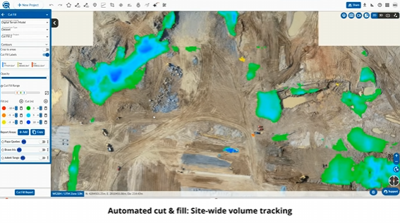
"The Cut & Fill Tools in #Trimble Mine Insights Allows You to Automate Site Comparisons by Selecting Your #GeospatialData!"
linkedin.com/posts/the-cut-a…
#PLI #Geospatial #SurveyLife #Surveying #LandSurveying #MineLife #MiningLife #Mining #MiningIndustry #MiningOperations #NSPS #PLS
26

Aerometrex NSW Government contract puts $AMX in focus as MetroMap public-sector momentum builds business-news-today.com/aero… #AMX #Aerometrex #MetroMap #GeospatialData #AerialImagery #ASX #NSWGovernment #NewSouthWales #ASXstocks
21

Tutorial about Assessment of Urban Heat Island (UHI) Using Remote Sensing Imagery & GIS Technology. Tutorial Link: youtube.com/live/zUsTrmZyRsk…
Registration link: studyhacksgeospatial.com/pro…
#googleearthengine #GeoAI #remotesensing #geospatialdata #EarthEngine

4
11
513
Vegetation change detection using Google Earth Engine.
The tutorial link: youtu.be/eEZJBKN17AQ?si=bLXK…
Registration link: studyhacksgeospatial.com/pro…
#googleearthengine #remotesensing #GIS #geospatial #geospatialdata #satelliteimagery
15
42
2,107

May 18
Mapping smarter decisions: How geospatial data is transforming evidence-informed governance in South Africa 🌍
The Geospatial Information Management Strategy (GIMS), developed by @DpmeOfficial, highlights the growing role of geospatial technologies, spatial data, and analytics in strengthening government planning, monitoring, and evaluation: online.fliphtml5.com/xdpr/rr….
Designed to improve evidence-based planning and decision-making, GIMS also aims to strengthen spatial governance, enhance data integration, and support more coordinated and responsive public service delivery.
For the evidence-informed decision-making (EIDM) community, particularly #AENmembers, the strategy demonstrates how innovative data systems can improve policy responsiveness, accountability, and developmental impact.
The initiative is especially relevant for professionals working in monitoring and evaluation, governance, health systems, climate adaptation, urban planning, and public policy, as it reinforces the importance of integrating diverse forms of evidence into decision-making processes across Africa.
#Accountability #AfricaLovesEvidence #AfricanEIDM #DataForDevelopment #DigitalGovernance #EvidenceUse #GeospatialData #InnovationInPolicy #PublicSectorInnovation #SpatialAnalytics
May 18

WHAT IS GIMS?
GIMS is a strategic framework developed by the @DpmeOfficial to strengthen the use of geospatial technologies, spatial data and analytics in government planning, monitoring & evaluation.
#DpmeGIMS @eThekwiniM @GCIS_KZN @kzngov @SeisoMohai

3
3
185

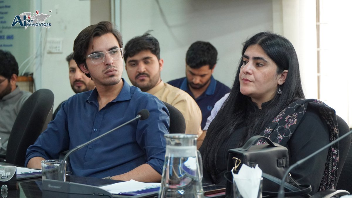
Knowledge sharing and collaboration remain essential for advancing geospatial innovation and evidence-based planning.
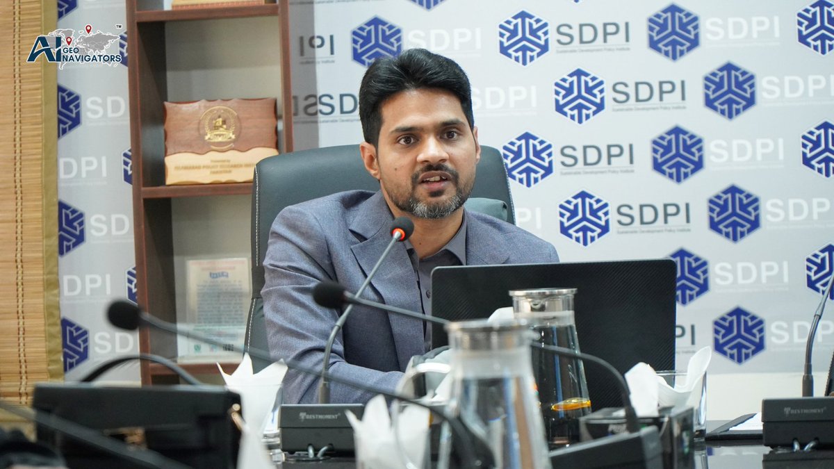
Proud to see Dr Muhammad Sajjad, Research Assistant Professor at The Chinese University of Hong Kong and Scientific Advisor (R&D) at AI Geo Navigators, contributing to this engaging session hosted by Sustainable Development Policy Institute.
An insightful discussion on the role of GIS, spatial analytics, and geospatial data in shaping impactful research and development proposals.
@SDPIPakistan
#GeospatialData #GIS #GeoAI #AIGeoNavigators #SDPI


3
55

#Mining operations generate some of the most complex terrain challenges in any industry. Active extraction changes surface geometry continuously, waste dumps shift, voids deepen, and closure planning demands volume accuracy that conventional surveying cannot reliably deliver at scale.
Aerial #LiDAR mapping gives mining and reclamation teams centimetre-accurate terrain data across active pits, waste dumps, and closure zones, supporting extraction planning, regulatory compliance, and land restoration with #survey-grade confidence.
With #Q6V2Geo integrated with #Shodham payloads and insights delivered on #FlyghtCloud, ideaForge's aerial LiDAR solution brings high-density point cloud data to every phase of the mining lifecycle.
Sign up today to see how LiDAR-powered mapping and analytics come together on Flyght Cloud: shorturl.at/JhqrQ
#GeospatialData #MiningTech #Mapping #UAV #DroneMapping
3
19
633
Registration link: studyhacksgeospatial.com/pro…
For Registration, Contact this Email: rmijanur10266@gmail.com
Or WhatsApp 24/7: 8801780942798
#googleearthengine #GIS #remotesensing #GeoAI #geospatialdata #geospatialintelligence #EarthObservation

1
1
8
433

Join us for the ArcGIS Online Essentials webinar as we explore practical ways organizations can use cloud-based GIS to support smarter, faster decision-making.
🔗 𝐑𝐞𝐠𝐢𝐬𝐭𝐞𝐫 𝐡𝐞𝐫𝐞: research.net/r/AGOLwebinar
#RCMRD #ArcGISOnline #GIS #Webinar #GeospatialData

1
3
11
391

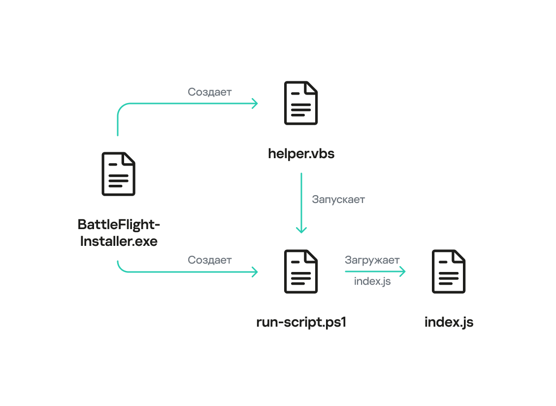
HeartlessSoul is targeting aviation and industrial sectors to steal maps and infrastructure schematics. Learn how they use ZDI-CAN-25373 to hide their tracks.
#HeartlessSoul #CyberEspionage #AviationSecurity #GeospatialData #APT #Infosec
securityexpress.info/heartle…
1
5
360

May 1
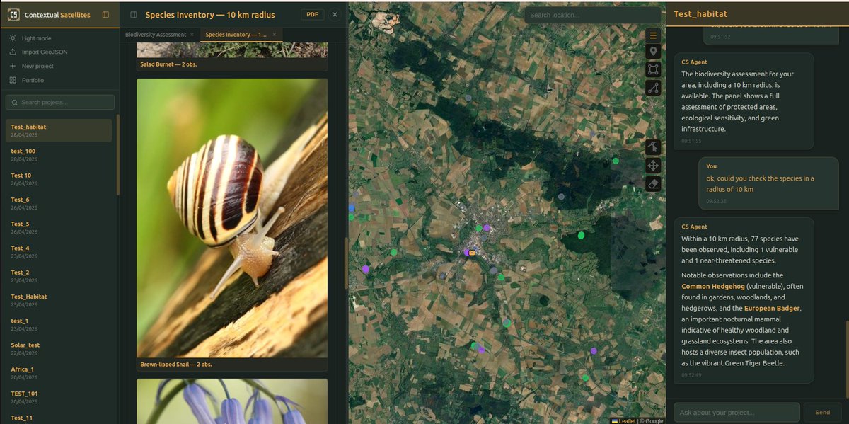
Quick CS update : species service is now integrated.
once cross-referenced with land use and habitat data, this will unlock real ecological insight straight from orbit.
species presence context = signal, not just observations.
#BuildInPublic #Startup #GeospatialData

2
89

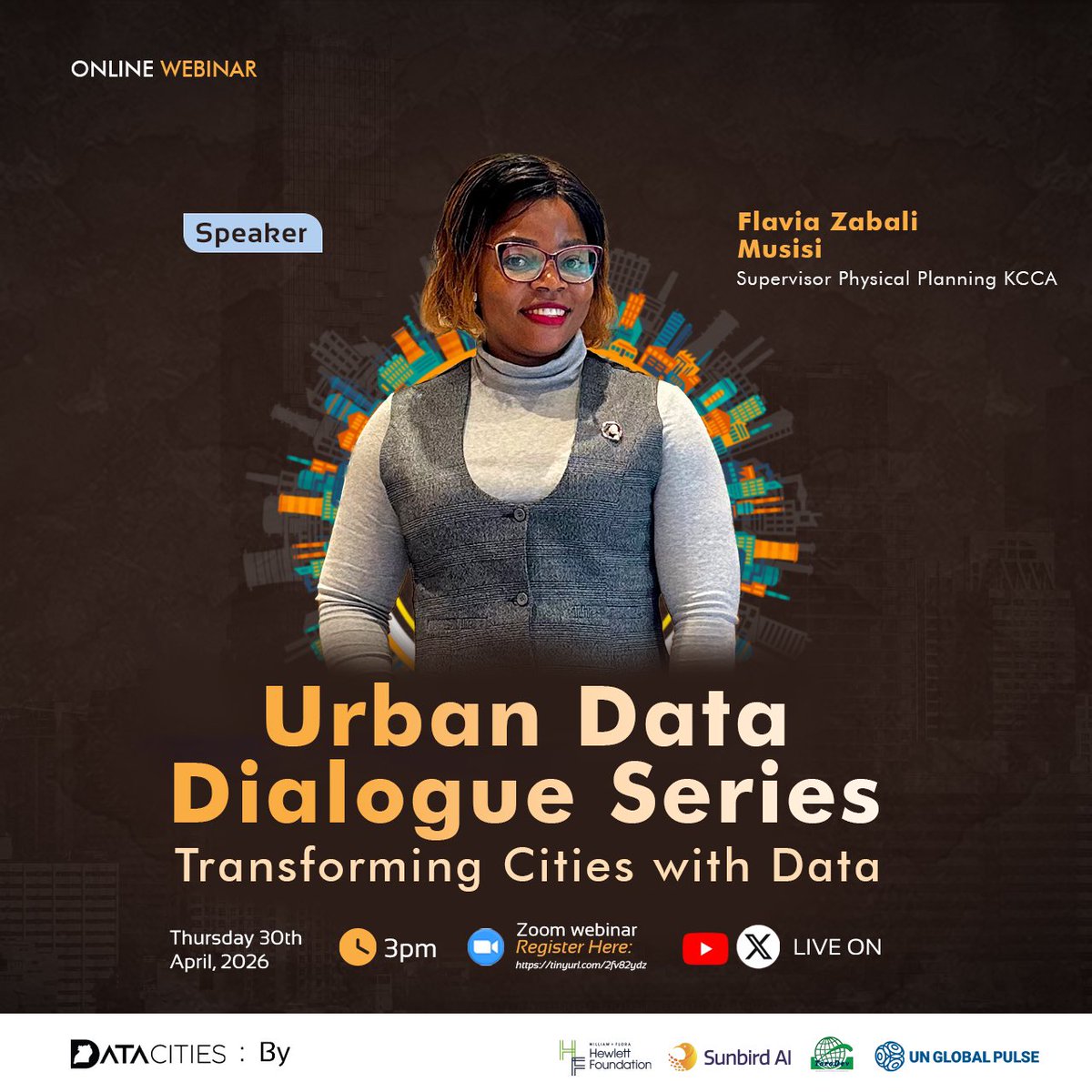
It’s today! 📍
Join us for Episode 2 of the Urban Data Dialogue Series — Boosting City Revenue & Service Delivery with Data.
🗓 30th April 2026
⏲️3:00 PM EAT
If you haven’t registered yet, there is still time. 👇
tinyurl.com/2fv82ydz
#UrbanDataDialogue #DataForGood #GIS #GeospatialData #SpatialData
2
4
138

Apr 30
🚨 Quick Reminder
Today at 3:00 PM, I’ll be joining @DataCitiesUg, @UNGlobalPulseUG, @ChristineKayon2, Prof. @iBaino & @johnstonebk for Episode 2 of the Urban Data Dialogue Series.
We’ll explore how data can transform city revenue collection and improve service delivery.
Bring your questions, experiences & ideas!
Register here 👉 tinyurl.com/2fv82ydz
#UrbanDataDialogue #DataForGood #SmartCities #GIS #GeospatialData #SpatialData
Apr 29

Excited to join @DataCitiesUg @UNGlobalPulseUG @ChristineKayon2, Prof. @iBaino and @johnstonebk as a panelist for Episode 2 of the Urban Data Dialogue Series tomorrow at 3:00 pm.
We’ll be diving deep into how data can transform city revenue collection and improve service delivery.
Special invitation to my social media team and all colleagues grappling with data challenges in revenue mobilization, this is your space!
Come with your questions, experiences, and ideas. Let’s learn together and find practical solutions.
Register now and save your spot 👉 tinyurl.com/2fv82ydz
#UrbanDataDialogue #DataForGood #RevenueCollection #SmartCities #GeospatialData #SpatialData #GIS
3
10
175
🚨Tomorrow is the day!
We are just 1 day away from the Urban Data Dialogue Series.
Be part of the conversation on how data is transforming city revenue & service delivery.
Save your spot 👉tinyurl.com/2fv82ydz
#UrbanDataDialogue #DataForGood #RevenueCollection #GeospatialData #SpatialData #GIS

2
6
110
Apr 29
Excited to join @DataCitiesUg @UNGlobalPulseUG @ChristineKayon2, Prof. @iBaino and @johnstonebk as a panelist for Episode 2 of the Urban Data Dialogue Series tomorrow at 3:00 pm.
We’ll be diving deep into how data can transform city revenue collection and improve service delivery.
Special invitation to my social media team and all colleagues grappling with data challenges in revenue mobilization, this is your space!
Come with your questions, experiences, and ideas. Let’s learn together and find practical solutions.
Register now and save your spot 👉 tinyurl.com/2fv82ydz
#UrbanDataDialogue #DataForGood #RevenueCollection #SmartCities #GeospatialData #SpatialData #GIS
1
5
15
376