
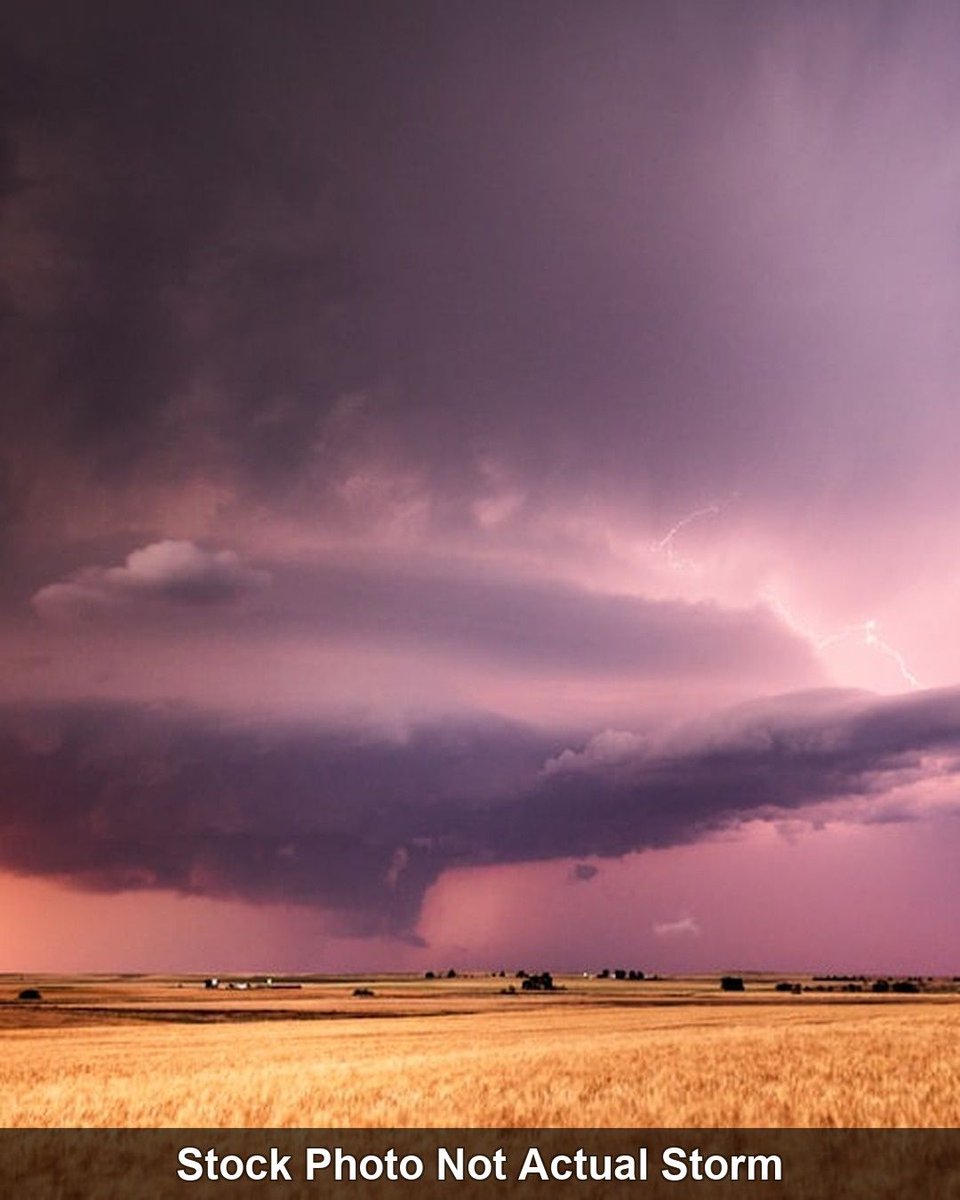
Would love to head out and try and grab some lightning photos, this storm heading toward Philly is a bit intense! 😳 It’s actually not as humid or hot in Philly like it was earlier.
Tornado warning embedded in Lancaster Co.
#PAWX #SevereWX #Tornadowarning #weather
1
2
388
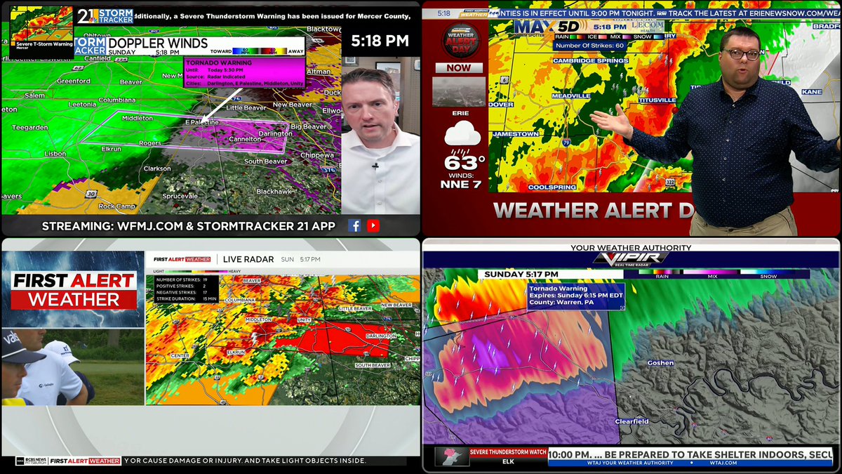
🚨 TORNADO WARNING — Lycoming & Sullivan Co PA! Rotation confirmed over Loyalsockville, moving NE at 50 mph. Mobile homes will be DESTROYED. SHELTER NOW! #PAwx #TornadoWarning #SevereWeather
133

June 14 @ 749pm EDT:
Tornado Warning for... Northwestern Centre County in central Pennsylvania... East central Clearfield County in central Pennsylvania... West central Clinton County in north central Pennsylvania...Until 800 PM EDT.
At 723 PM EDT, severe thunderstorms capable of producing both tornadoes and extensive straight line wind damage were located over Karthaus, moving east northeast at 45 mph.
Locations impacted include... Karthaus, Pine Glen, and Lecontes Mills.
Take cover now!
#TornadoWarning
122

21

WOW! Myranda captured this tornado in Punxsutawney, Pennsylvania, as it touched down in a forest in the distance from a supercell. Hopefully Punxsutawney Phil is all okay! Thank you for sharing, Myranda Phillips (FB)! 🌪️ ⚠️
#PAwx #Pennsylvania #Tornado #TornadoWarning
3
23
133
7,357
June 14, 2026:
This is a severe weather update for the Ohio Valley, Northeast and mid Atlantic, where we are currently seeing some tornadic thunderstorms moving through Western and Central Pennsylvania, as very unstable air is currently, with twisting of the winds as you go up and height.
A tornado watch was just issued in the last couple minutes for western and Central Pennsylvania, just including Pittsburgh, and east of State College, PA. I am continuing to see tornado warned storms form, and stay tornado warned. There is also a line of Strong to severe thunderstorms, still making their way through eastern Ohio, also into western Pennsylvania, moving Eastward out ahead of the trough and cold front that will eventually make it its way through later tonight.
There is another severe thunderstorm watch for Central and western Maryland down into Central Virginia, including Central and Northern West Virginia. We have seen some severe thunderstorms, and strong thunderstorms, traverse to the northeast in this watch area, but your severe thunderstorm watch is until 11 PM in Maryland and Virginia, and until 8 PM in West Virginia. We will see if that needs to be extended until later in the evening.
Western NY, your Severe Thunderstorm Watch is until 10pm tonight. Dew points are in the 50s there, with a little less buoyancy, but still the potential for strong to severe thunderstorms today.
I explain what is going on regarding the satellite imagery and why the air is so unstable right now.
Let’s break it down…
#severeweather #SevereThunderstormWatch #TornadoWatch #TornadoWarning #SevereThunderstormWarning
146
Multiple #TornadoWarning s and #severethunderstormwarning s are occurring in Western Pennsylvania Right NOW.
#Beaver County, #Clearfield County, and #Warren County are the #Tornado Warned counties.
This entire line will go through the #Pittsburgh area in the next 2 hours. 1/2
1
2
210
🚨 CONFIRMED TORNADO ripping through Clearfield County PA RIGHT NOW! Moving NE at 30mph toward Rockton. This is NOT a drill — get to shelter IMMEDIATELY! #PAwx #TornadoWarning #SevereWeather

1
1
4
827
A Dude Called Parker retweeted

2
1
9
664


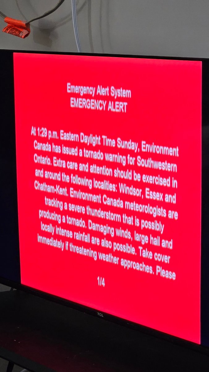
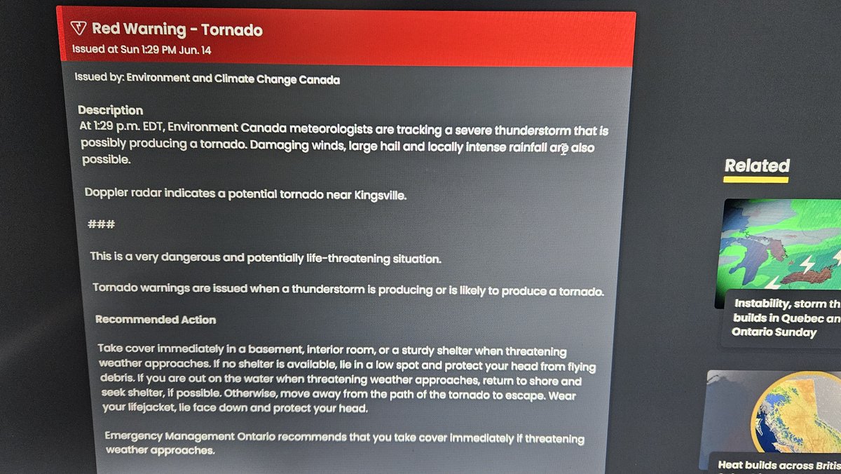
#ONstorm #Windsor #onwx #yqg #tornadowarning @alluringstorms @1Weathercanada
Got a Tornado Warning. Anyone know where it is or have eyes on it?
2
1
6
1,295


استيقظت مدينة كانساس سيتي صباح الأحد على أجواء عاصفة شديدة ترافقت مع إصدار تحذير من إعصار قمعي، وسط مشاهد توثق قوة الأحوال الجوية. 🇺🇸🚨
#USA #KansasCity #TornadoWarning #SevereWeather
 Micky Jnr
16
47
5,210

Tornado Warning Issued for Benton as Radar Detects Dangerous Rotation #TornadoWarning #Arkansas #WeatherAlert #SevereWeather #BreakingNews
flashnews24.site/2026/06/Tor…
18
🚨 TORNADO WARNING Carroll County AR — rotation confirmed south of Eureka Springs moving 50 mph! Midnight supercell is NOT playing. Seek shelter NOW! #ARwx #TornadoWarning #SevereWeather

1
188

Jun 14
🚨 TORNADO WARNING NOW — Rotation confirmed near Sarcoxie, MO moving east 40 mph. Newton, Jasper, Lawrence counties TAKE COVER IMMEDIATELY. This is not a drill. #MOWx #TornadoWarning #SevereWeather

82

Jun 14
I love when people go on Twitter and Complain about the news stations interrupting their sporting event/show for #TornadoWarning coverage.
Im sorry @kmbc and @fox4kc
#MOwx #KCwx #wx #wxtwitter #KSwx #NBAFinals #FifaWorlCup2026 #NYKvsSAS


2
4
602