
We help organizations understand and improve transportation networks, digitally. Specialists in GTFS and multi-modal trip planning. Maintainer of @Transitland.
Joined January 2018
- Tweets 191
- Following 3
- Followers 414
- Likes 23
35 Photos and videos


Pinned Tweet

29 Nov 2022
For the latest updates from Interline, you can now follow our blog using an RSS feed reader: interline.io/blog/interline-…
2
5 Oct 2022
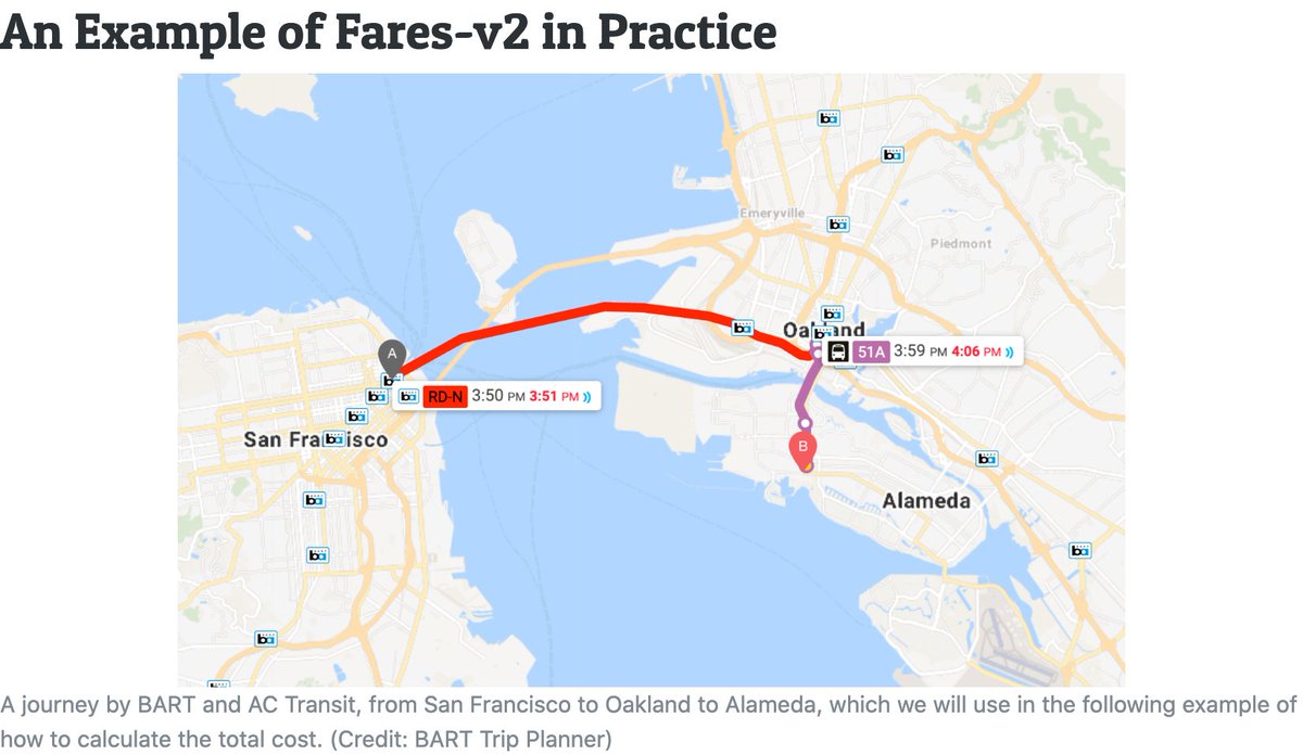
We're now providing fares and transfer discounts for 35 transit agencies in the SF Bay Area in collaboration with @MTCBATA. This data is represented in the newly adopted GTFS-Fares v2 "base implementation" along with extensions. More info on our blog at: interline.io/blog/mtc-region…
6
Interline Technologies retweeted

3 Oct 2022
We've added new documentation covering the Transitland v2 REST API "stop departure" endpoint, which can be used to see when buses/trains/subways/ferries/etc serve a given stop: transit.land/documentation/r…
1
1
2
Interline Technologies retweeted

29 Sep 2022
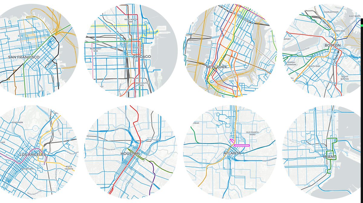
today I learned about transit.land/map:
A COMMUNITY-EDITED DATA SERVICE AGGREGATING TRANSIT NETWORKS ACROSS METROPOLITAN AND RURAL AREAS AROUND THE WORLD.
via @burritojustice on @RollOverEasy
Pictured is some U.S. cities compared at the same scale:
5
16
7 Sep 2022
The @FTA_DOT is proposing that American transit agencies submit URLs for GTFS feeds in their reports to the US National Transit Database. This is a great idea. We're pleased to share some feedback based on the experience of operating @Transitland: interline.io/blog/us-ntd-rep…
1
4
16
Interline Technologies retweeted

22 Aug 2022
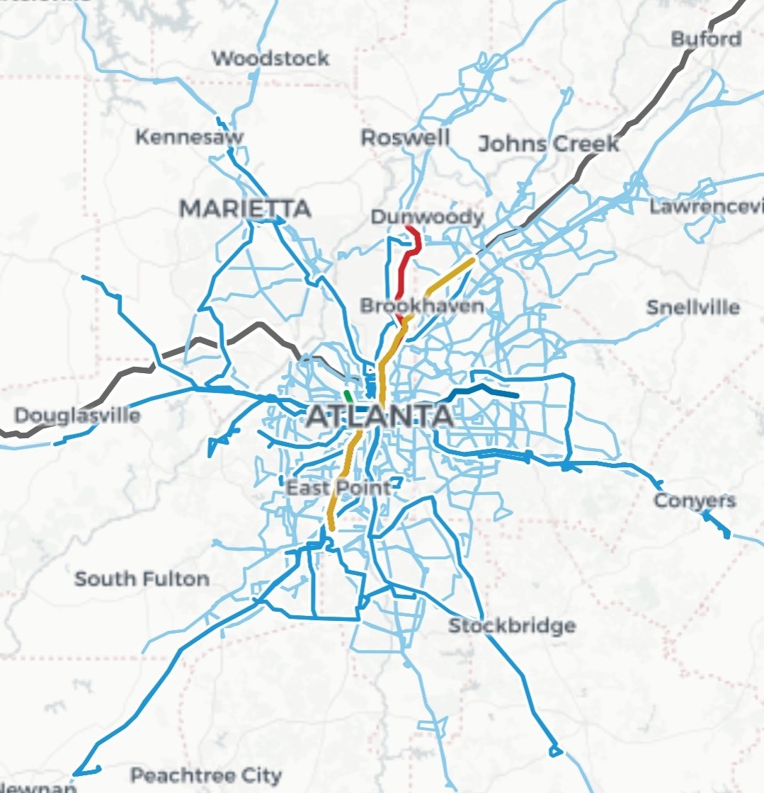
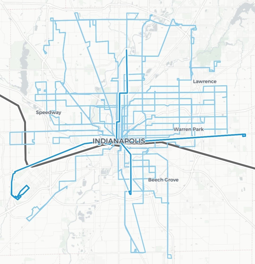
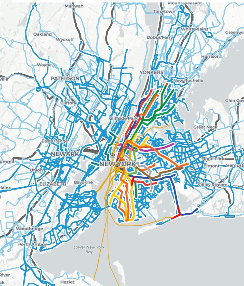
Using @transitland to compare service provided in the four main cities I've lived in. Baltimore, Atlanta, Indianapolis and New York City. Transitland is an open data platform that collects GTFS, GTFS Realtime, and other open data feeds from transit providers around the world.

3
10
104
18 Jul 2022
Our latest data release in collaboration with @MTCBATA: "stop observations" based on GTFS Realtime transit trip updates and vehicle positions across the SF Bay Area interline.io/blog/mtc-region…
3
Interline Technologies retweeted
11 Jul 2022
Transit agency staff who are unfamiliar with GitHub are also welcome to email us information about their feeds to hello@transit.land
1
1
Interline Technologies retweeted
11 Jul 2022
As always, we welcome the contribution of more open GTFS and GTFS Realtime feeds to the Transitland Atlas feed registry: github.com/transitland/trans…
1
2
3
Interline Technologies retweeted
11 Jul 2022
We just ran the numbers:
- 5,762 transit operators in Transitland
- 226 transit operators with both GTFS and GTFS Realtime feeds
1
2
6
13 Jun 2022
Need to extract a single agency from a large #GTFS feed? Florian Baierl's blog post provides instructions for how to do so using the transitland-lib library: medium.com/@fbaierl1/how-to-…
1
Interline Technologies retweeted
10 Jun 2022
Since releasing Transitland's global transit map and v2 Vector Tiles API last year, we've added a variety of improvements in functionality and in rendering: transit.land/news/2022/06/10…
1
1
22 Apr 2022
Interline's OSM Extracts service is temporarily having problems serving some extracts to users. We'll post an update when it's fixed and back up to "cruising altitude."
1
25 Apr 2022
Interline's OSM Extract should now be serving all requests with up-to-date data once more: interline.io/osm/extracts/
1
Interline Technologies retweeted
20 Apr 2022
We've been making some little improvements to the Transitland documentation, and also updating the technical architecture diagram to reflect the latest "Transitland v2" functionality. Have a look at: transit.land/documentation/i…

ALT screenshot of Transitland documentation website
1
1
8 Apr 2022
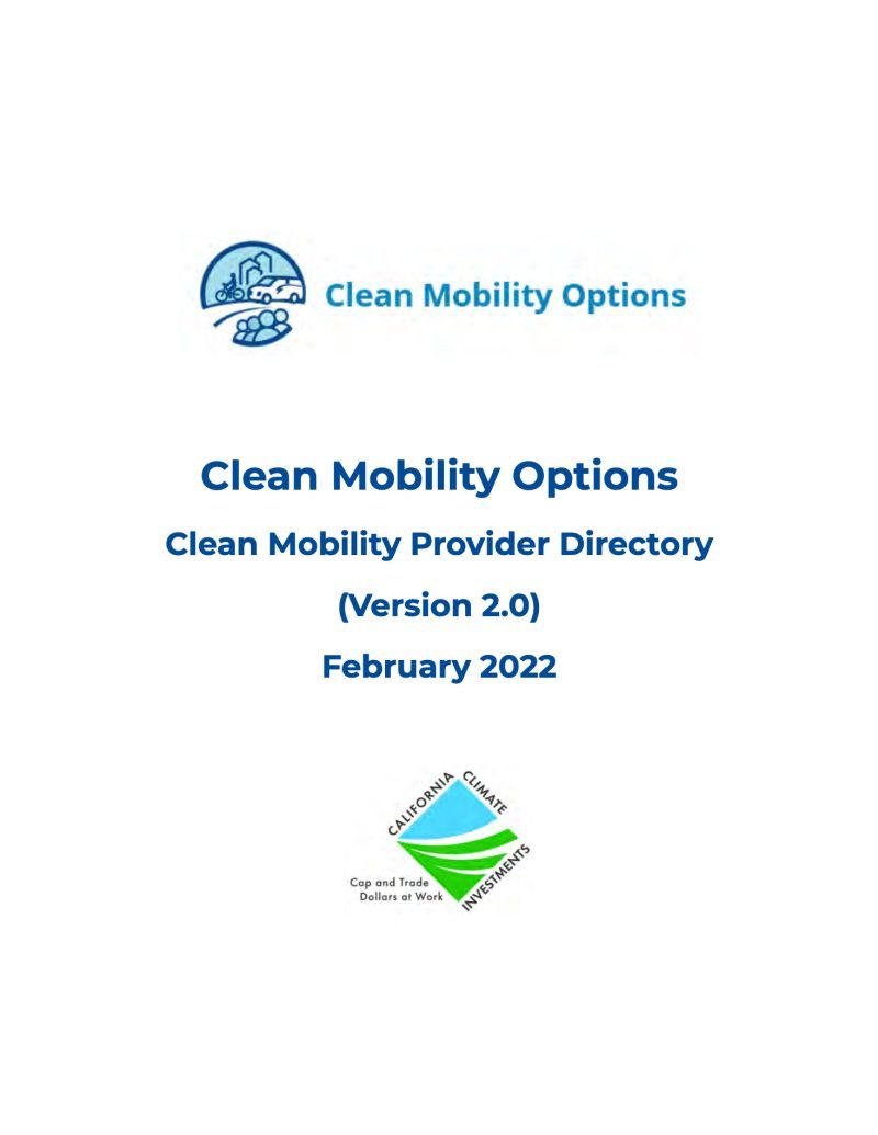
Interline is pleased to be listed as a software provider in the Clean Mobility Options Mobility Provider Directory, capable of supporting mobility projects for California's under-served communities sponsored by California Cap-and-Trade funds: cleanmobilityoptions.org/dir…
ALT cover of the Clean Mobility Options - Clean Mobility Provider Directory Version 2.0
11 Mar 2022
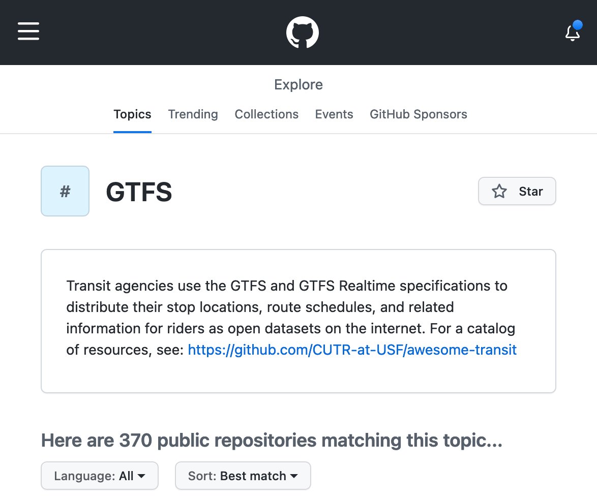
Thanks to GitHub for taking our little pull request, so now there's some extra context for developers encountering this four-letter acronym for the first time: github.com/topics/gtfs
1
14
9 Dec 2021
Joining @benjiedlp and partners to discuss the newly released #InteroperableMobility Principles. Interline is pleased to be one of many transit tool-making organizations that have signed on: interline.io/blog/mobility-d…
2
Interline Technologies retweeted
3 Dec 2021
Yes, we guess you could call our global transit layer "chaotic neutral":
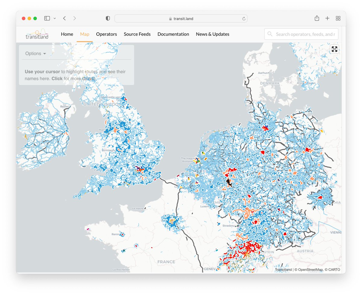
ALT https://www.transit.land/map#4.91/52.13/2.91
3 Dec 2021

Yesterday at @stamen we were discussing all the various kinds of basemap variants (light mode vs dark mode, satellite vs street map, navigation vs terrain maps, etc) and things got a little silly. What's your #Basemap #AlignmentChart look like? #gischat #cartography #maptime
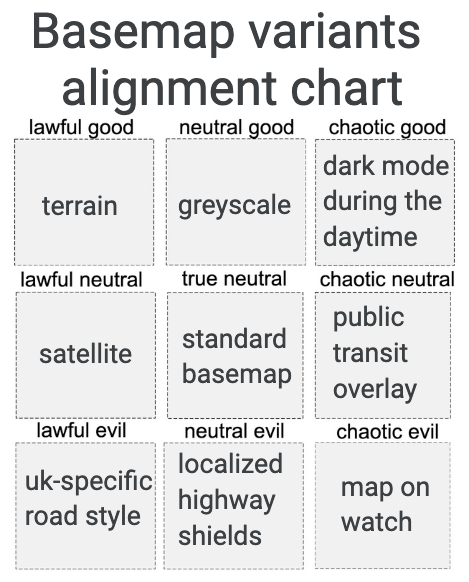
ALT Basemap variants alignment chart. Lawful good: terrain. Neutral good: greyscale. Chaotic good: dark mode during the daytime. Lawful neutral: satellite. True neutral: standard basemap. Chaotic neutral: public transit overlay. Lawful evil: uk-specific road style. Neutral evil: localized highway shields. Chaotic evil: map on watch.
3
8