@Ginger_Zee I would’ve been so mad at myself if I got it wrong so I had to noodle it out 😅 thank you for watching and supporting fellow female Mets! Enjoy the Queen City 👑
Good morning @madithemet - you are fantastic! My favorite part was the real moment figuring out insubstantial vs unsubstantial. From my brief search I think IN is best choice… keep up the great work. Looking forward to a nice day here 🙌
For those of you wondering if it'll ever snow again, we have news for you. The ridge over us will shift east this weekend, ushering in a cooler and more unsettled pattern beginning early next week. How much snow and where? That's still a bit murky. #utwx#wywx
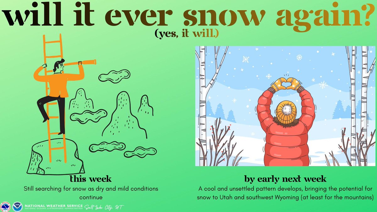
ALT This graphic has a green background and the title "Will it ever snow again? (Yes, it will.) On the left is a cartoon of a man climbing a ladder, looking around with a telescope. The text below him says "This week: Still searching for snow as dry and mild conditions continue." On the right is a cartoon of a person looking at a snowy field and making a heart symbol with their hands while their arms are stretched out over their head. The text below says "By early next week: A cool and unsettled pattern develops, bringing the potential for snow to Utah and southwest Wyoming (at least for the mountains).
🌧️KSLC recorded it's 2nd wettest day in history yesterday with 2.47" (2.61" storm total)! This is the most 1-day rain ever recorded at the airport location because the instrumentation in 1901 was in downtown SLC. Here is a list of areawide totals: forecast.weather.gov/product…#utwx
In addition to a Flood Watch, Avery, Watauga, Caldwell, and Burke are now under a Tropical Storm Watch warning of sustained winds over 39 MPH. We don't often see calls like this in Western Carolina, so its time to get prepared @wsoctv#Helene
Poor @deneigebroom…missed the ‘pleather’ email 😂. Highs will still trend below average, but they will be warmer than the past 48hrs! Conditions will improve for the weekend ahead ☀️@GinaWSOC9@wsoctv
One day I’ll remember 🐈⬛! Clouds will linger throughout the day, but it does look like that rain will stay off to the east for the @Panthers home opener! @GinaWSOC9 and I will be with you until 8A then we’ll be back at 11A and 12P!
It’s been so fun working with the weekday crew these past couple of mornings! Charlotte will hang on to this mild pattern for the next 48 hrs before seeing minor impacts from Francine🌀@deneigebroom@DamanyWSOC9@TrafficTeam9
Although Panthers are playing in NOLA this afternoon, it will be a great day to watch the game outside here in the Queen City! We are well on our to way to a really nice stretch of some early fall weather 🏈⛅🍂 @panthers
I’m not as cool as Ginger Zee, but you’re rocking it per usual @madithemet! Thanks for the high country forecast! Waking up to some brisk temps this am as you said. ⛰️
TAG TEAMING weather this evening. What a pleasure working with @madithemet this evening as we talk about “too much rain” and we answer the question “when do we dry out”? Join us @wsoctv.
Elevated Flood Risk: There are several counties across the region at risk for seeing over 2" of rain today. Early totals has many across the Carolinas getting over 4" within the next 5 days @wsoctv
SEVERE THUNDERSTORM WATCH! Strong to severe thunderstorms will be moving through the region this evening. If you haven't already, make sure to download the WSOC-TV weather app @WSOC-TV
Ground Stop: Departures to Charlotte Douglas are grounded due to thunderstorms until 6:30P.
Ground Delay: Departures to Charlotte Douglas International are delayed on average about 50 mins due to severe weather until 10P @wsoctv
Good morning, QUEEN! It's going to be another absolutely perfect day 🤩! Take advantage of the next 48 hrs -- a more summer-like pattern will return to the Carolinas early next week @wsoctv
WOW!!! Look at that start -- with highs in the upper 70s and dry skies, it is going to be a really nice weekend ahead. Join us until 8A and then again at 12P @wsoctv