
Chief Meteorologist (CBM 573), WECT, Wilmington, NC... Wilmington, DE native... PSU ‘03... Eastern NC life, family, work since ‘04... #FlyEaglesFly 🦅
Joined May 2009
- Tweets 11,617
- Following 1,854
- Followers 5,450
- Likes 15,518
6,338 Photos and videos


The first "real" heat wave of 2026 continues this Sunday, but it appears to have crested. Along with the temps, the heat index should taper from near 105 Sunday afternoon to near 100 Monday to 90 or 95 Tuesday.
1
1
28
Gannon Medwick retweeted

Jun 9
Good morning! Little Blue Heron @EdPiotrowski @medwick @DylanHudlerWXII @jamiearnoldWMBF @LeeHaywoodWX @dogwoodblooms @marioncaldwx @JustinMcKeeWx @StarboardRail @Jimmydreamsmb @CMorganWX @Christina4casts @AndrewWMBF @ScottyPowellWX @jgreenhillwx @TimBuckleyWX @clairefrywx

1
6
31
543

Jun 8
Hot west winds will shift to [slightly] cooler easterlies this Monday. There's a chance for a lucky few popup showers and thundershowers on the nose of that shift.
2
102
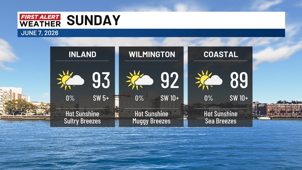
Jun 7
If Wilmington does manage 92, Sunday'll be the hottest day so far in 2026 (previous: 91, May 28). In any case, it's going to be very toasty, so stay cool, my friend!
5
1,196
Jun 4
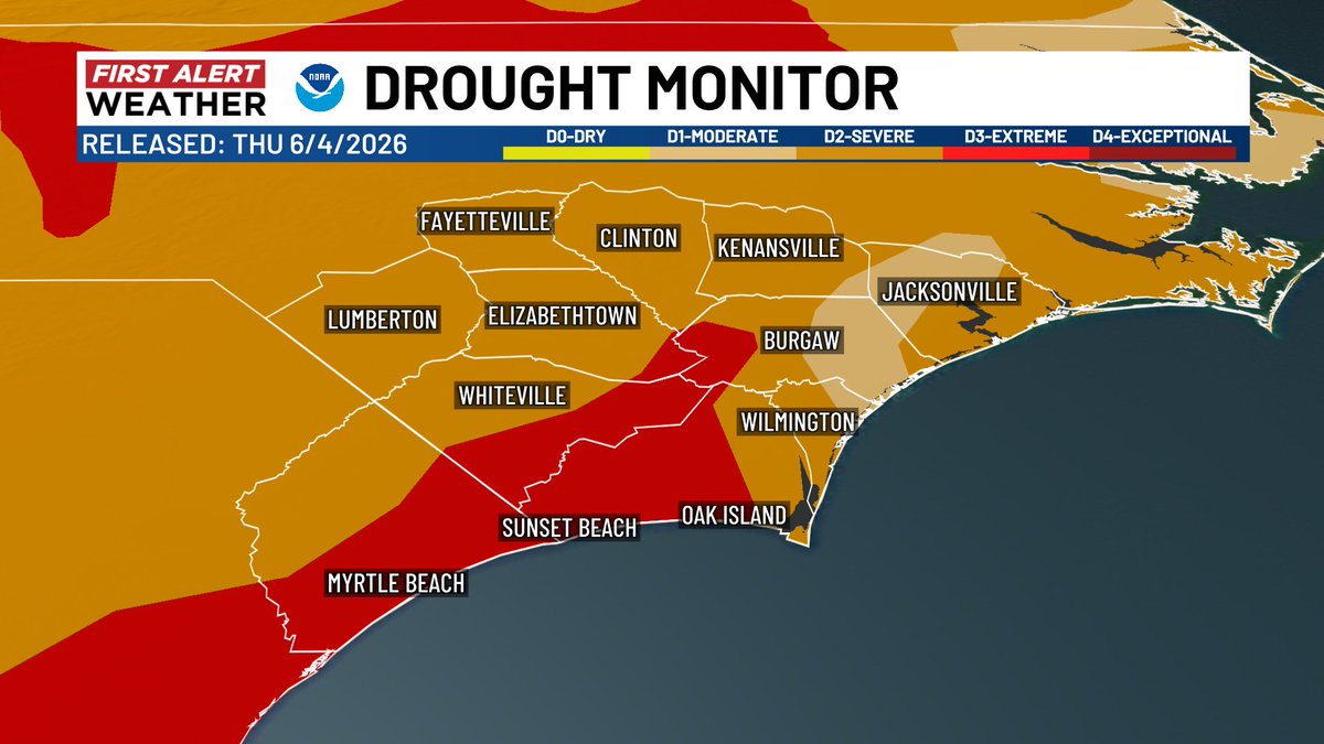
Recent rains have eased the drought - slightly - for about a 15-mile radius around Hampstead. For the most part, though, it continues in a severe to extreme fashion, and it'll likely be around a long while longer.
1
2
113
Jun 3
Good morning, Cape Fear! Your Wednesday's starting unusually cool with temps in the 40s and 50s. Heading for near 80 this afternoon...
2
5
166
Jun 2
Check out this scheme for sunrise Wednesday. Will you be rolling out with a sweatshirt?
1
7
195
Jun 1
In a similar setup to Saturday, keep an eye out for some spotty showers and storms this Monday (activity may briefly organize into a line late).
1
5
275
May 28
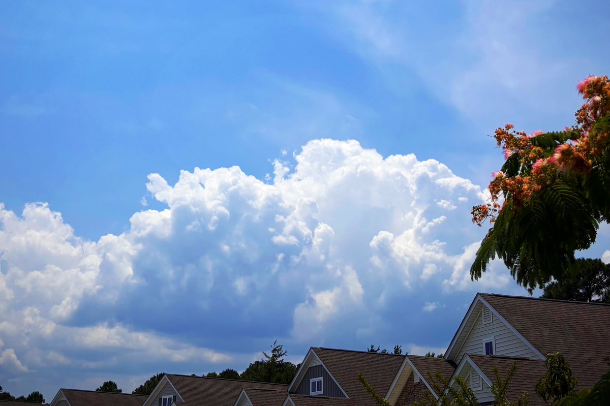
Storms firing on another hot day... As expected, the flow pattern is directing them more toward the coast than on previous days. Keep an eye out!
1
1
7
508
May 27
More popup storms... With a front pressing in, you'll note a better chance that some cells jump the sea breeze and reach the beaches.
1
4
602
Gannon Medwick retweeted
May 26
Good morning! #Calabash @EdPiotrowski @medwick @DylanHudlerWXII @jamiearnoldWMBF @LeeHaywoodWX @dogwoodblooms @marioncaldwx @JustinMcKeeWx @StarboardRail @ThePhotoHour @CMorganWX @Christina4casts @AndrewWMBF @ScottyPowellWX @jgreenhillwx @TimBuckleyWX @matt_wx @clairefrywx
3
13
57
1,603
May 25
Steamy sun over a recent downpour... South-facing beaches like Ocean Isle have a moderate rip current risk this Memorial Day. For east-facing beaches, that risk's even a little higher. Have a safe time!
1
1
7
802
Gannon Medwick retweeted

May 21
@medwick this lone rain shower in SE Brunsco…it was so tiny but dumped just under 0.2” of rain on us.

1
2
151
Gannon Medwick retweeted

May 19
Better photo #Wildfire in Waccamaw Wildlife Refuge near Longwood Landing. #MyrtleBeach
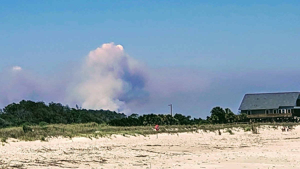
ALT Wildfire in Waccamaw Wildlife Refuge near Longwood Landing.
1
3
8
859
May 19
Might's well put the humidity to work, no? Rain chances close into the Cape Fear as soon as Thursday. Our in-house model even "likes" a small, subtropical looking low (see that swirl?) to enhance the odds. We'll look out, for now, most models aren't too excited about it.
4
1
12
3,158