
12 Photos and videos


Necip Enes Gengeç retweeted

Mar 7
Ülkedeki düşük zekalı büyük bir grup trafik cezalarının ceza olduğunun farkında bile değil. Adam emniyet şeridinden gitmek 20 bin olur mu diye ağlıyor. Ödediği cezayı emniyet şeridi kullanma ücreti falan sanıyor. Bu kadar zam olur mu diye isyan ediyor. Emniyet şeridinden gitmenin suç olabileceği ihtimalini bile düşünmüyor. Kırmızı ışık cezasını kırmızı ışıkta geçme önceliği ücreti sanıyor. Ehliyetsiz veya alkollü olarak cüzi bir ücret ödeyerek trafiğe çıkabileceğini düşünüyor. Hız cezası ceza değil hızlı gitme ücreti mesela. Parasını veren basabilir.
131
755
6,153
204,417

Today, we're introducing AlphaEarth Foundations from @GoogleDeepMind , an AI model that functions like a virtual satellite which helps scientists make informed decisions on critical issues like food security, deforestation, and water resources. AlphaEarth Foundations provides a powerful new lens for understanding our planet by solving two major challenges: data overload and inconsistent information.
1️⃣ It combines information from dozens of sources to analyze the world's land and coastal waters in 10x10 meter squares, allowing for remarkable precision while tracking changes over time.
2️⃣ The system's key innovation is creating a highly compact summary for each square. These summaries require 16x less storage than those produced by other AI systems and enables scientists to create detailed, consistent maps of our planet, on-demand.
AlphaEarth Foundations represents a significant step forward in understanding the state and dynamics of our changing planet. 🌎🌎🌎
141
420
2,500
130,190
Necip Enes Gengeç retweeted

28 Mar 2025
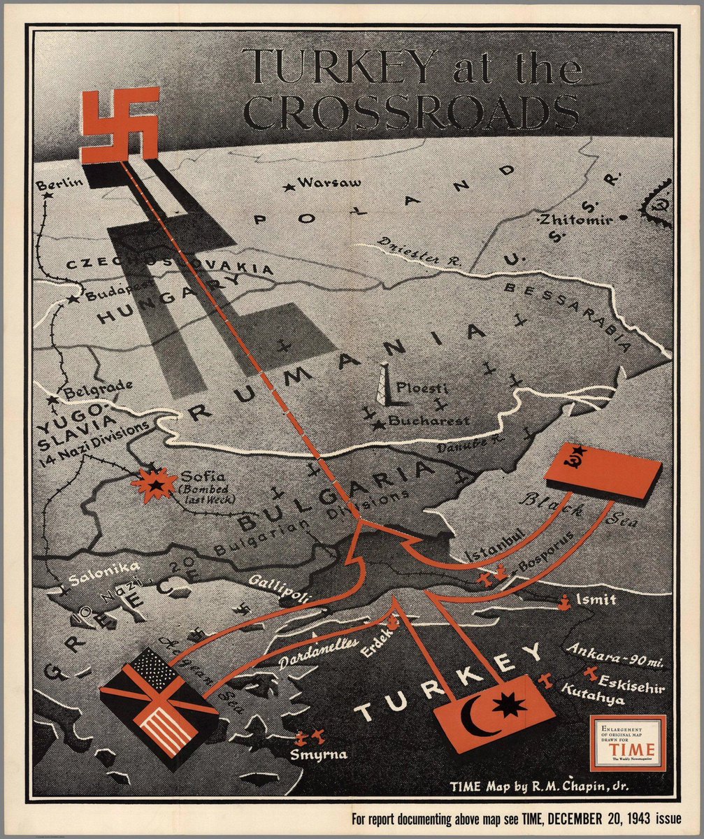
Marvelous vintage map “Turkey at the Crossroads” (Time Magazine, 20 December 1943). I always enjoy maps showing the world from a country’s unique perspective.
14
69
458
40,978
Necip Enes Gengeç retweeted

25 Feb 2025
Practice lots of ML and Data Science related Leetcode problems which is sorted properly in this website.
Visit & start practicing.
Link: deep-ml.com/

1
15
71
5,345

Prof. Dr. Behçet Yalın Özkara: "Trafikte bekliyorum, arabanın biri gelip önüme giriyor.
Bir yerde duruyorum, ceza yiyorum. Başkası kaldırıma çıkıyor, ceza yok.
Borçlarımı zamanında ödüyorum, af geliyor ödemeyen kâra geçiyor.
Mal gibi hissediyorum." x.com/StockDatabock/status/1…
8
57
711
76,497
Necip Enes Gengeç retweeted

10 Oct 2024
🌳 Did you know? Türkiye🇹🇷 lost over 1,000,000 hectares of forest 2001-2023, a staggering 7.4% of its 2000 forest cover of 14 million hectares! Meanwhile, it regained an estimated 1.2% of its 2000 cover between 2001-2012. Can you spot the most affected areas on my new map?

7
66
264
29,691
Necip Enes Gengeç retweeted

16 Sep 2024
Excited to share our publication in 𝘙𝘦𝘮𝘰𝘵𝘦 𝘚𝘦𝘯𝘴𝘪𝘯𝘨 𝘰𝘧 𝘌𝘯𝘷𝘪𝘳𝘰𝘯𝘮𝘦𝘯𝘵, focused on automated road mapping in tropical forests with satellite imagery and AI.
PAPER: sciencedirect.com/science/ar…
1
18
76
6,241
Necip Enes Gengeç retweeted

5 Sep 2024
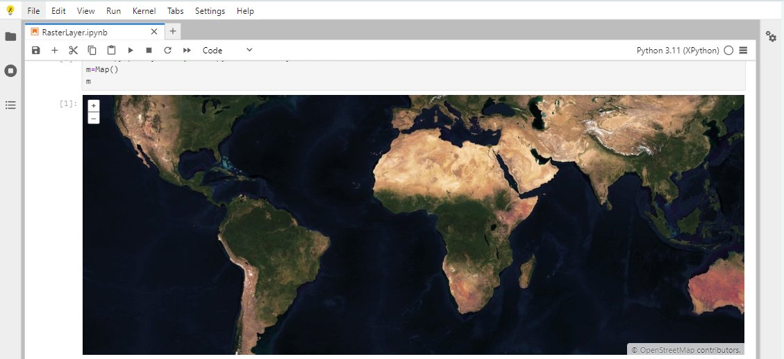
Explore the power of interactive maps within your Jupyter Notebooks with the new ipyopenlayers library! Discover how this tool integrates OpenLayers, bringing your geospatial data to life. Read more in our latest blog post! blog.jupyter.org/interactive…
38
90
10,707
Necip Enes Gengeç retweeted

5 Jul 2024
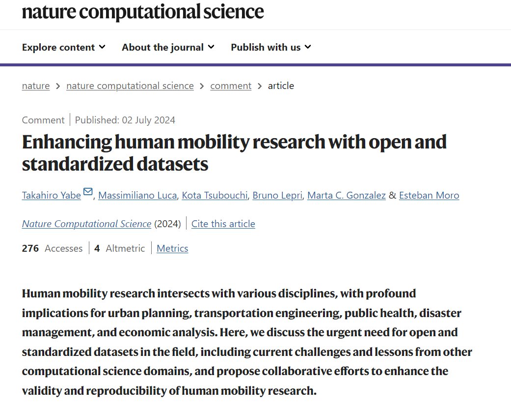
🚨New Comment in @NatComputSci !!
Following our open human mobility data in @ScientificData, we wrote a Comment arguing for more open and standardized human mobility datasets.
w/ @luca_msl @brulepri @martikagv @estebanmoro and Kota Tsubouchi (Yahoo)
nature.com/articles/s43588-0…
2
17
82
6,868
Necip Enes Gengeç retweeted

3 Jul 2024
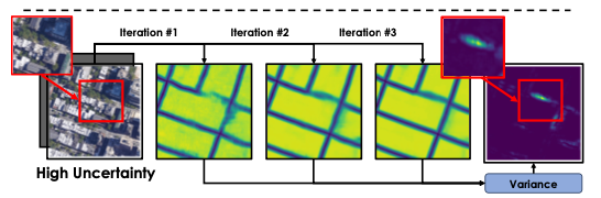
In recursive neural networks, the rate of convergence is highly correlated with the prediction accuracy. We exploit this insight in a paper to be presented at ICML to predict uncertainty. arxiv.org/abs/2403.16732
#deeplearning #computervision
3
15
109
10,885
Necip Enes Gengeç retweeted

4 Jul 2024
Very interesting ICLR **tiny** paper: openreview.net/forum?id=vHOO…
It computes a loss for all possible subsets of the dataset at the same time which has a very elegant solution: softplus of the negative log likelihood per sample, which essentially drops outliers 🤯
@mtetelman
5
47
372
32,967
Necip Enes Gengeç retweeted
13 Jun 2024
🎉 Great news for the #GIS and #Jupyter communities! The @ESA is funding a project by @QuantStack and @simula_research to bring collaborative editing to GIS workflows in JupyterLab. Let's explore new ways of working with geospatial data! 🚀 blog.jupyter.org/jupytergis-…
3
74
263
46,990
Necip Enes Gengeç retweeted
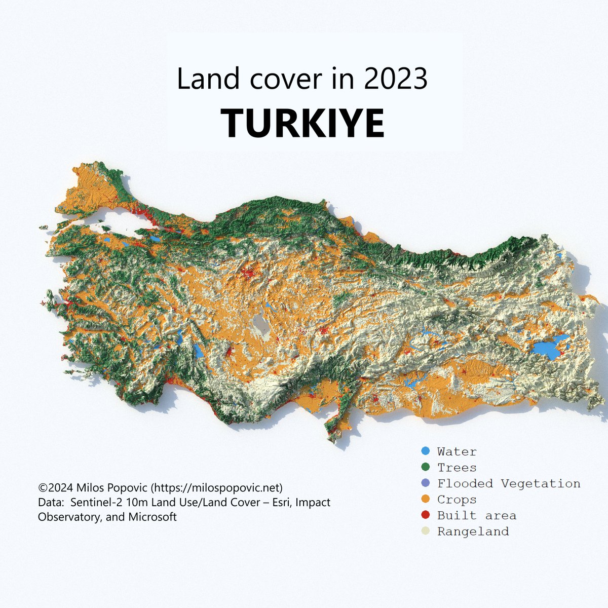
25 May 2024
Delighted to showcase my latest work: a 3D land cover map of Turkiye. Created with the Esri dataset, it highlights the country's rich landscapes and land classes.
Map enthusiasts, check out my tutorial for tips and start mapping: youtu.be/y_Kzg24Ciuo
33
249
2,858
1,395,141
Necip Enes Gengeç retweeted

26 Apr 2024
Honored welcome a legendary scientist: @EAKrup
26 Apr 2024

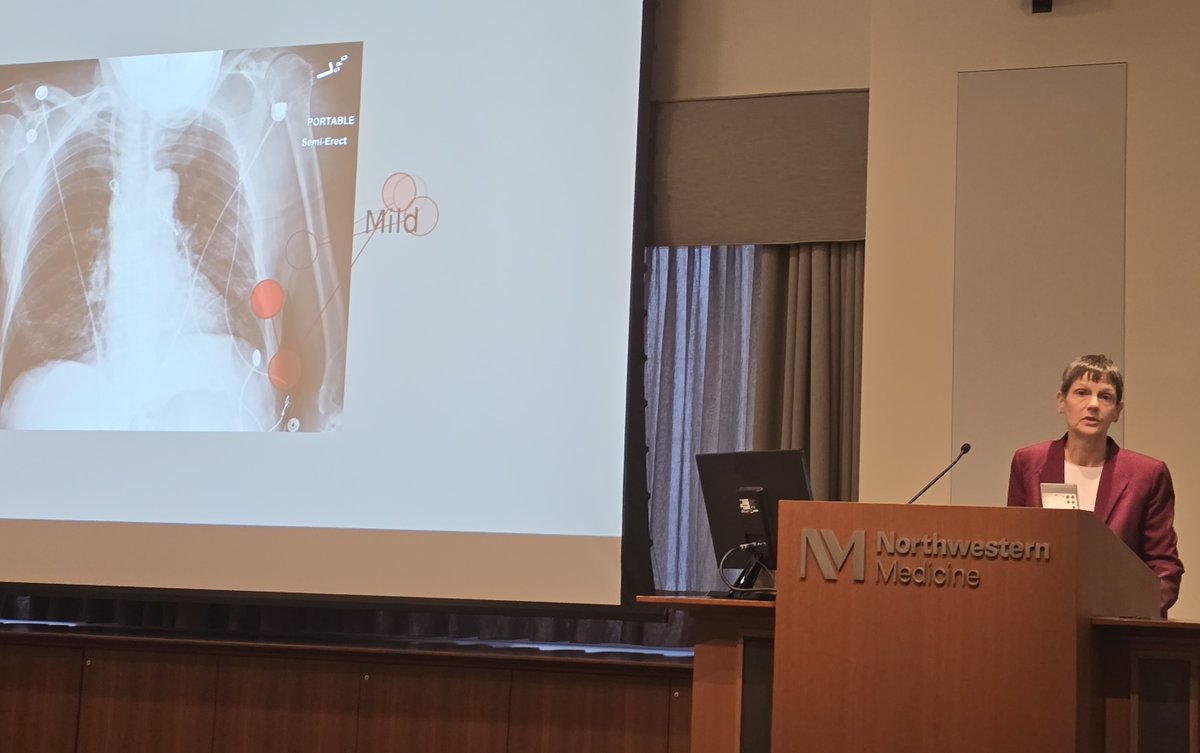
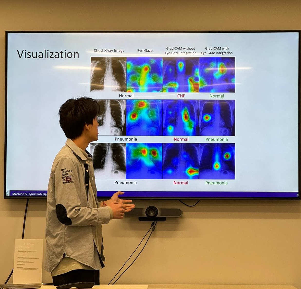
Dr. Elizabeth Krupinski visited Bagci Lab and PhD student Bin Wang presented the lab's findings from a top-tier AI conference at which the team collaborated with Dr. Krupinski. @ulasbagci #AI #radiology

2
8
628
Necip Enes Gengeç retweeted

22 Apr 2024
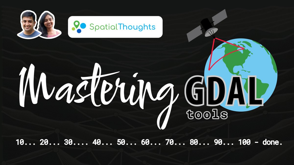
My "Mastering #GDAL Tools" course is now available on YouTube! This course is the result of my 20 years of experience processing large volumes of imagery and building data pipelines. Check out the playlist at youtube.com/playlist?list=PL… . More in the thread below (1/n)
3
83
306
18,812
Necip Enes Gengeç retweeted

5 Mar 2024
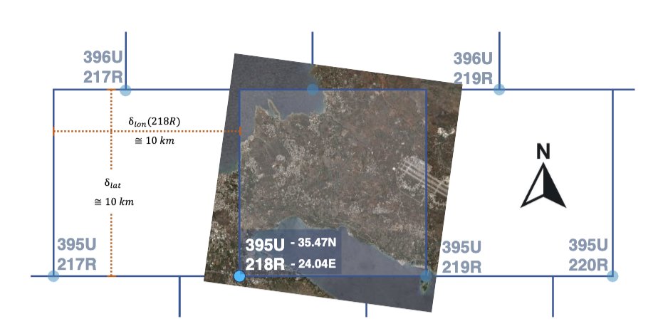
We collaborated with the European Space Agency to open-source the largest ever earth observation dataset: Major TOM Core!
About half of the entire planet is covered. That's 2,245,886 patches of 1068 x 1068 pixels. At 10m resolution, we've got 256 million square km with over 2.5 trillion pixels.
More datasets from different satellites are in preparation and anyone can join this collaborative effort thanks to their organization on Hugging Face: huggingface.co/Major-TOM.
Quoting @mikonvergence @esa: “democratizing Earth Observation model development and deployment with transparent, reproducible, and traceable tools - starts with the data!”
You can explore the data here huggingface.co/spaces/Major-… & access the dataset here: huggingface.co/datasets/Majo…
23
213
855
129,756
Necip Enes Gengeç retweeted

5 Mar 2024
🚨RECORD-BREAKING 🌍EO DATASET in partnership with @huggingface
Introducing 🗺️MajorTOM-Core: the largest ML-ready Sentinel-2 dataset🤯
We tried to cover... every single point on Earth captured by @esa @CopernicusEU Sentinel-2, and we got pretty close!
More info in thread 🧵
5
32
137
29,751

NBA Players of the Week for Week 11.
West: Alperen Sengun (@HoustonRockets)
East: Jalen Brunson (@nyknicks)


326
1,492
15,066
1,871,477

3 Jan 2024
Our new paper, co-authored with Ergin Tari and Ulaş Bağcı (@ulasbagci), "AI powered road network prediction with fused low-resolution satellite imagery and GPS trajectory", is now available online. We conducted a comprehensive analysis comparing early and late fusion of...
2
2
13
906
3 Jan 2024
both datasets, employing various model architectures, fusion settings, and loss functions. The evaluation involved comparing the results using overlap and boundary-based metrics on datasets from Istanbul, Turkey, and Montreal, Canada...
1
4
534
3 Jan 2024
Paper: link.springer.com/article/10…
Code: github.com/nagellette/sentin…
Data: github.com/nagellette/sentin…
4
127