
CE Specialist, Professor at Berkeley. Lover of Maps. Exploring CA landscape change with spatial analytics. @ucanr @ESPM_Berkeley
Joined April 2013
- Tweets 3,148
- Following 1,631
- Followers 1,721
- Likes 17,094
263 Photos and videos


Maggi Kelly retweeted

Jun 11
Okay, folks: The big El Niño update is now out on Weather West! This sure looks like it's going to be a dramatic year from a global climate perspective, and there are major implications for extreme events (across California, the U.S. West, & well beyond). weatherwest.com/archives/438…
12
156
737
129,613

Jun 2
Kate Atkinson something! Life After Life or A God in Ruins would be great.
17
Maggi Kelly retweeted

High 🖐️!
So proud of our All-American Bears!
Congrats to Julia, Despi, Eszti, Fe and Abbi!
📰: calbea.rs/4nBOqug
#GoBears 🐻

1
4
19
659
Maggi Kelly retweeted
¡Benvinguda a Berkeley, Julia!
Cal has a Spanish talent joining the Bears!
🗞️: calbea.rs/4tB1ced
#GoBears 🐻

3
21
828
May 4
Red Hot Atomic Fireballs. You can still get them at a few places here.

It's @aisforapplepod time again! A new episode has just landed. The topic was aromatics...all beginning with C is of course!
What would you have chosen? I chose caraway, @Dr_Alessandra_P picked curry and @mrssbilton went for cinnamon.
Enjoy!
podcasts.apple.com/gb/podcas…
1
1
94


Apr 27
That was a hilarious one! Good ideas too. Gonna get the book.
Apr 27
New podcast episode out now! Retro Foods with @brionymaybakes
Briony’s book 'The Retro Food Society' is out now!
'The British Food History Podcast' is available on all podcast apps.
podcasts.apple.com/gb/podcas…
1
1
113
Maggi Kelly retweeted
It was an all-out battle to the end.
Bears finish second after tremendous run at the NCAA tournament.
#GoBears 🐻
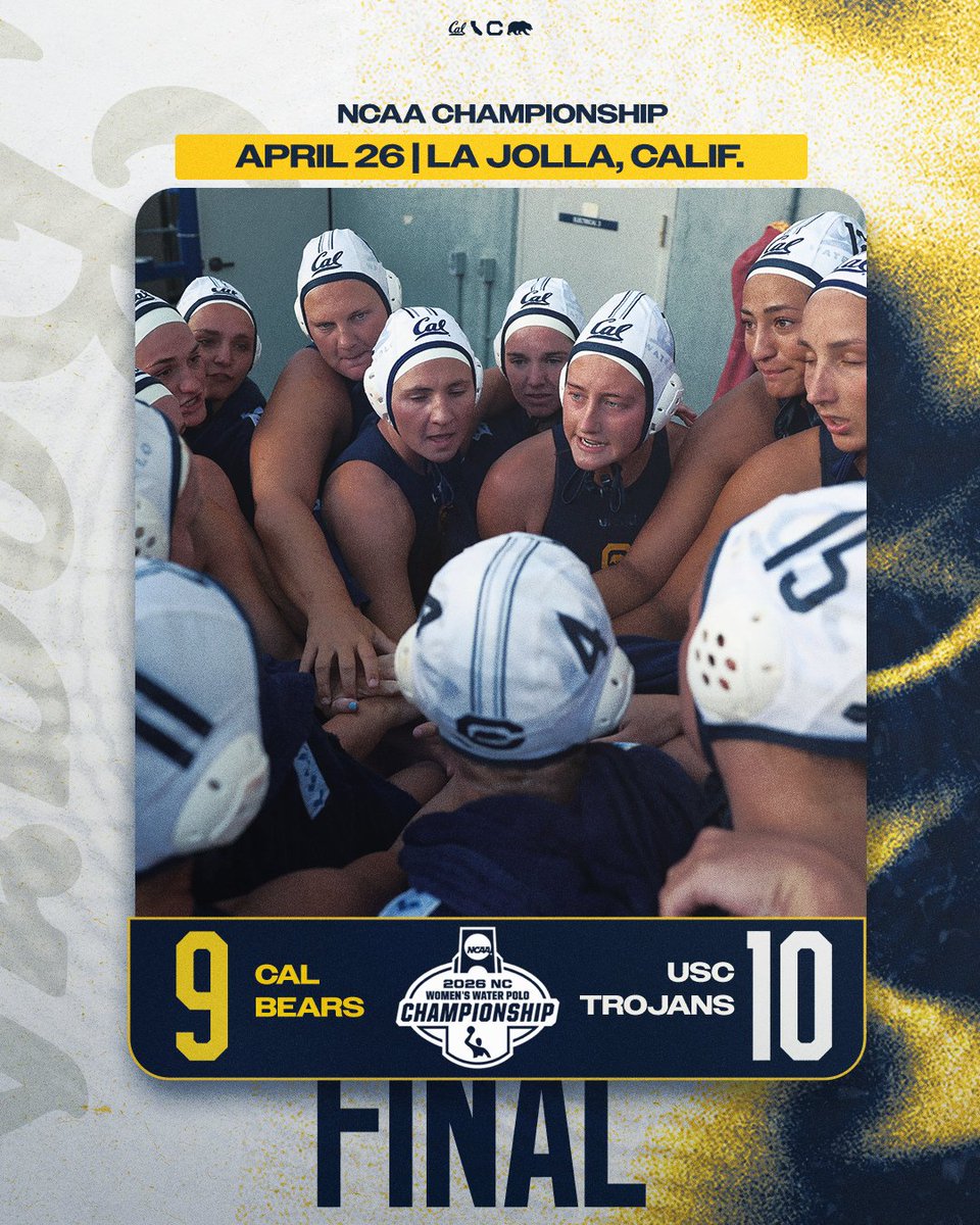
6
12
71
2,132


Maggi Kelly retweeted
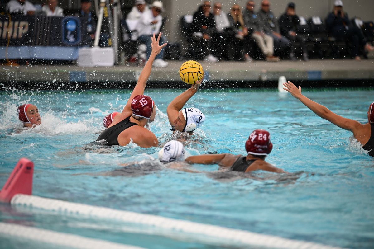
Eszti doing a bit of everything out there!
Bears build a four-goal lead entering the fourth here in La Jolla!
NCAA SEMIFINAL
END P3: Cal 12, Stanford 8
📺: ncaa.com/game/6597553
#GoBears 🐻
2
3
13
517
Maggi Kelly retweeted
BEAR VICTORY!
Cal takes down Stanford to take a spot in the NCAA final!
#GoBears🐻


6
25
117
20,382
Maggi Kelly retweeted
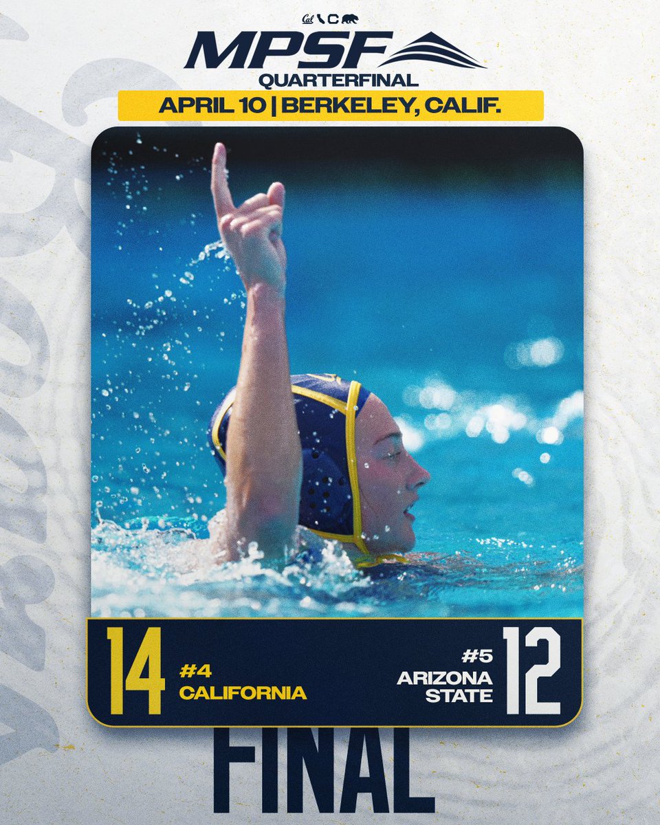
Cal punches that 🎟️ to the NCAA semis with a well-rounded win over the Rainbow Wahine!
#GoBears 🐻


1
4
17
1,177
Apr 13
Great episode!
Apr 13
A new episode of The British Food History podcast has just gone live: 'The Traditional Food of Derbyshire with Mark Dawson'.
Mark's book 'Lumpy Tums: Derbyshire's Food & Drink' is out on 15 April, published by @amberleybooks
podcasts.apple.com/gb/podcas…
1
1
80
Maggi Kelly retweeted

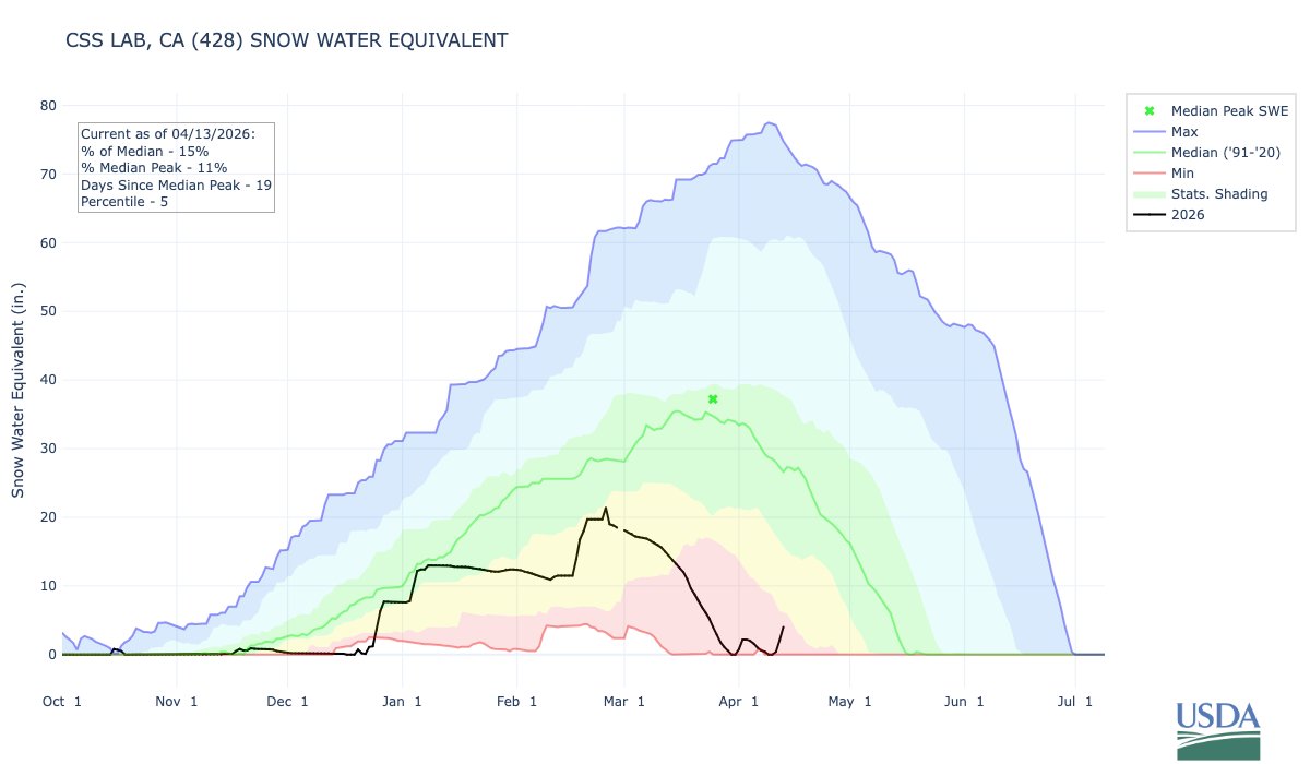
4/13/26 9:45am Update:
1-day ❄️: 21.1" (20 cm)
2-day ❄️: 34.6" (34.5 cm)
3-day ❄️: 42.5" (53.5 cm)
This has been great to create a late-season snowpack. Unfortunately, record warm temps this winter means that we're still well below average for the water year.
#CAwater #weather

6
22
144
10,866
Maggi Kelly retweeted

Apr 10
Alum Dean Tanioka struggled to navigate UC Berkeley when he transferred in 2016. Now, through a program he co-founded, he helps first-generation and non-traditional students find community and thrive on campus. news.berkeley.edu/2026/04/08…
2
5
27
3,183
Maggi Kelly retweeted
Cal captures that semifinal ticket!🎟️
ℹ️: calbears.com/feature/2026MPS…
#GoBears 🐻
5
12
333
Maggi Kelly retweeted

#UCANR leaders are driving real impact in California’s rural communities. Ricky Satomi is advancing forest health & wildfire resilience while Brent Holtz revolutionized #almond farming with Whole Orchard Recycling. @UCBerkeley
news.berkeley.edu/2026/03/26…
2
4
139
Maggi Kelly retweeted
Apr 1
Most grads head to big cities—but some UC Berkeley alumni are choosing rural communities, where their impact can be immediate, visible and deeply personal. news.berkeley.edu/2026/03/26…
7
10
1,338
Maggi Kelly retweeted

Mar 28
This can be a useful dataset for training and validating algorithms for estimating tree canopy cover, height, canopy complexity, biomass, etc from high-resolution satellite data (e.g., optical, lidar, microwave).
Mar 27

Just discovered that Berlin has a publicly accessible tree database for all trees within the city.
There are 839,693 trees in the database. You can view the trees on a map with details of every single tree, like the species & dimensions.

1
5
342
Mar 20
It was great!

On Gone Medieval today, the brilliant Todd Ferguson joins me to talk about an unexpected Viking move that would redefine Scottish history - the 870 Siege of Dumbarton.
podfollow.com/gone-medieval/…
#history #podcast #medieval #newepisode
1
33