
94 Photos and videos


Pinned Tweet

Mar 16
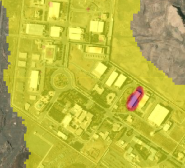
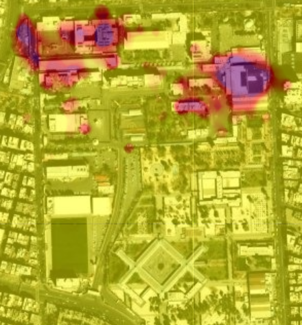
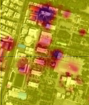
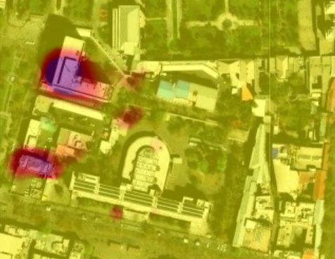
Private satellite imaging companies are restricting access to imagery over Iran, making it difficult to verify destruction caused by U.S./Israeli strikes. I developed a method to detect building damage in open source radar imagery, now peer reviewed:
sciencedirect.com/science/ar…
17
121
374
30,846
Ollie Ballinger retweeted

Apr 7
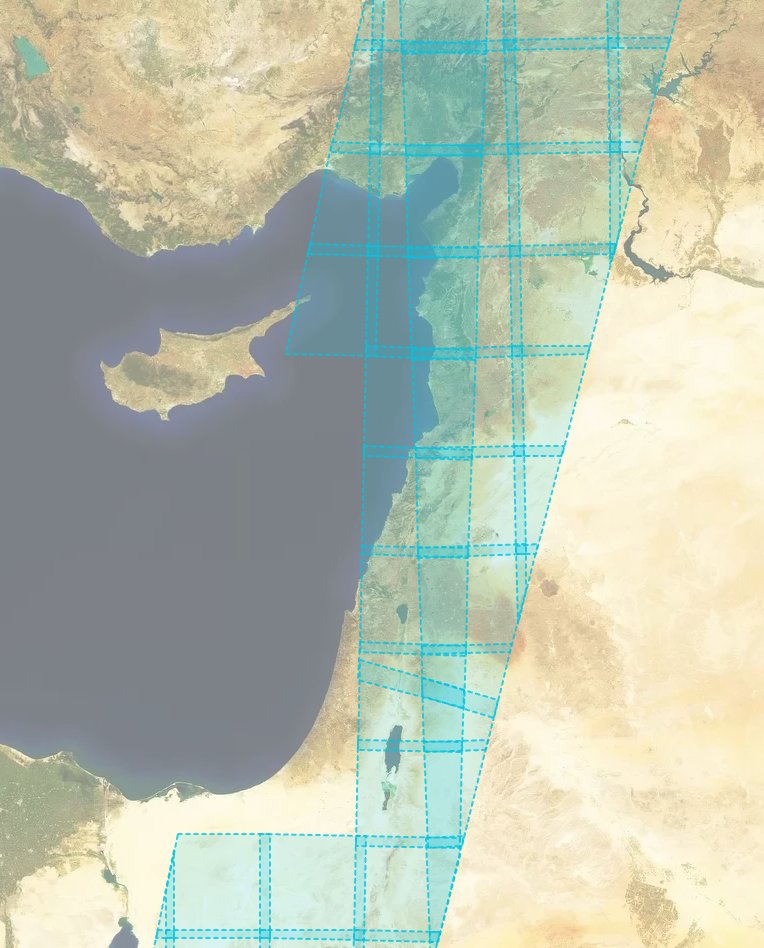
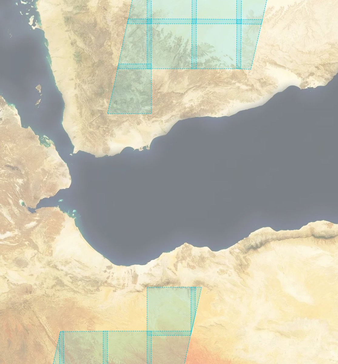
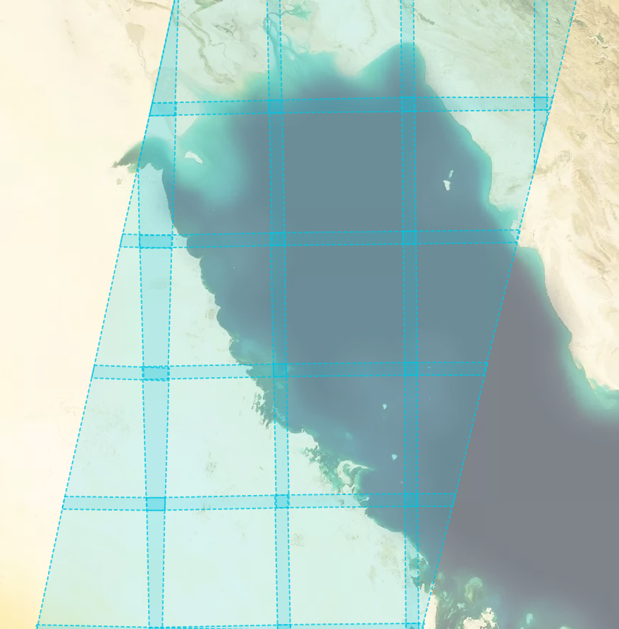
🛰️GEOINT: Mapping the Satellite Data Blackouts
For a while now, we've tracked a deliberate day-delay of Sentinel-2 data over the Red Sea, the Gulf of Aden, and the Northwestern Arabian Sea (specifically from Socotra Island up to Duqm). Expanding the map reveals how dynamic these boundaries are becoming.
🌍The New Gap: Massive, unnatural acquisition gaps have now appeared directly over the Eastern Mediterranean.
🌍The Persian Gulf: Fully illuminated and fine. This makes strategic sense—major coalition surface combatants have likely vacated this confined water space entirely.
🌍The Anomaly: The Gulf of Oman also remains unrestricted. This is highly curious, as any incoming amphibious force would likely need to transit or stage in those waters.
When you stack these targeted medium-res Sentinel-2 gaps on top of recent commercial high-res imagery pauses (Planet/Vantor), the information environment is clearly being locked down.
This localized "fencing" begs a massive question for the OSINT community: Are we looking at dynamic boundaries designed specifically to mask incoming naval assets? If so, when will the Gulf of Oman go dark?

5
41
165
49,116
Ollie Ballinger retweeted

Apr 4
This access change includes Gaza and Lebanon, not just Iran and Gulf states with US bases. Planet has been absolutely amazing, and their imagery has led to dozens of stories/scoops, with Gaza/Lebanon in particular.
Apr 4

Planet appears to be ending all access to imagery in the Middle East indefinitely. This will make understanding what’s happening in this conflict far more difficult.

17
314
757
264,011

Putting out a wish to the universe.
I need more compute, if I can get more I will make sure every machine from a small phone to a bootstrapped RTX 3090 node can run frontier intelligence fast with minimal intelligence loss.
I have hit page 2 of huggingface, released 3 model family compressions and got GLM-4.7 on a MacBook huggingface.co/0xsero
My beast just isn’t enough and I already spent 2k usd on renting GPUs on top of credits provided by Prime intellect and Hotaisle.
———
If you believe in what I do help me get this to Nvidia, maybe they will bless me with the pewter to keep making local AI more accessible 🙏
Mar 18

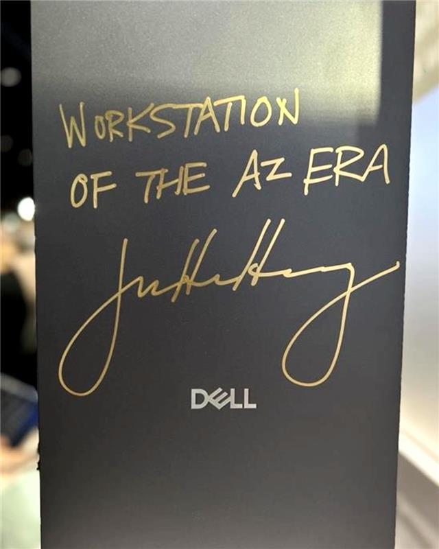
Jensen Huang is loving the new Dell Pro Max with GB300 at NVIDIA GTC.💙
They asked me to sign it, but I already did 😉
177
468
4,055
928,791
Mar 16
Private satellite imaging companies are restricting access to imagery over Iran, making it difficult to verify destruction caused by U.S./Israeli strikes. I developed a method to detect building damage in open source radar imagery, now peer reviewed:
sciencedirect.com/science/ar…
17
121
374
30,846
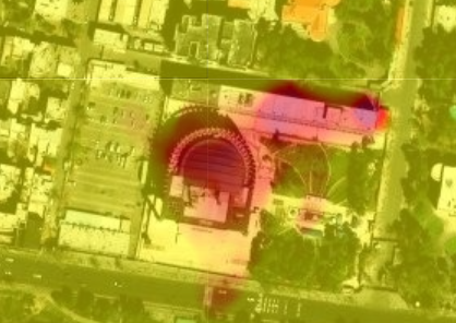
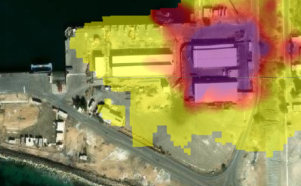
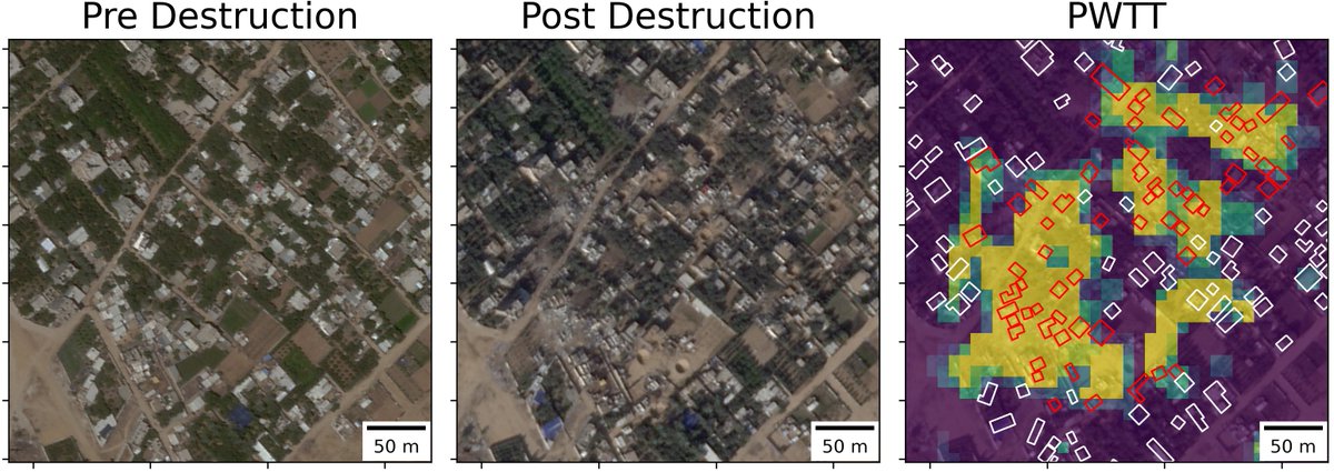
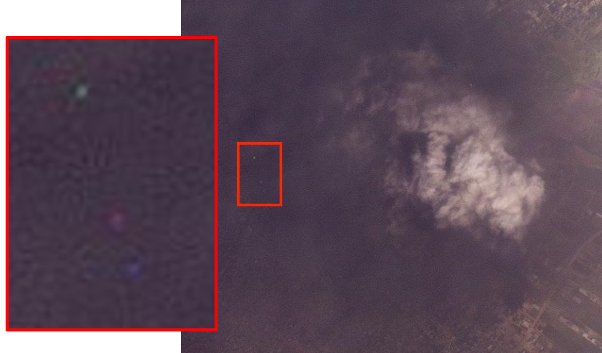
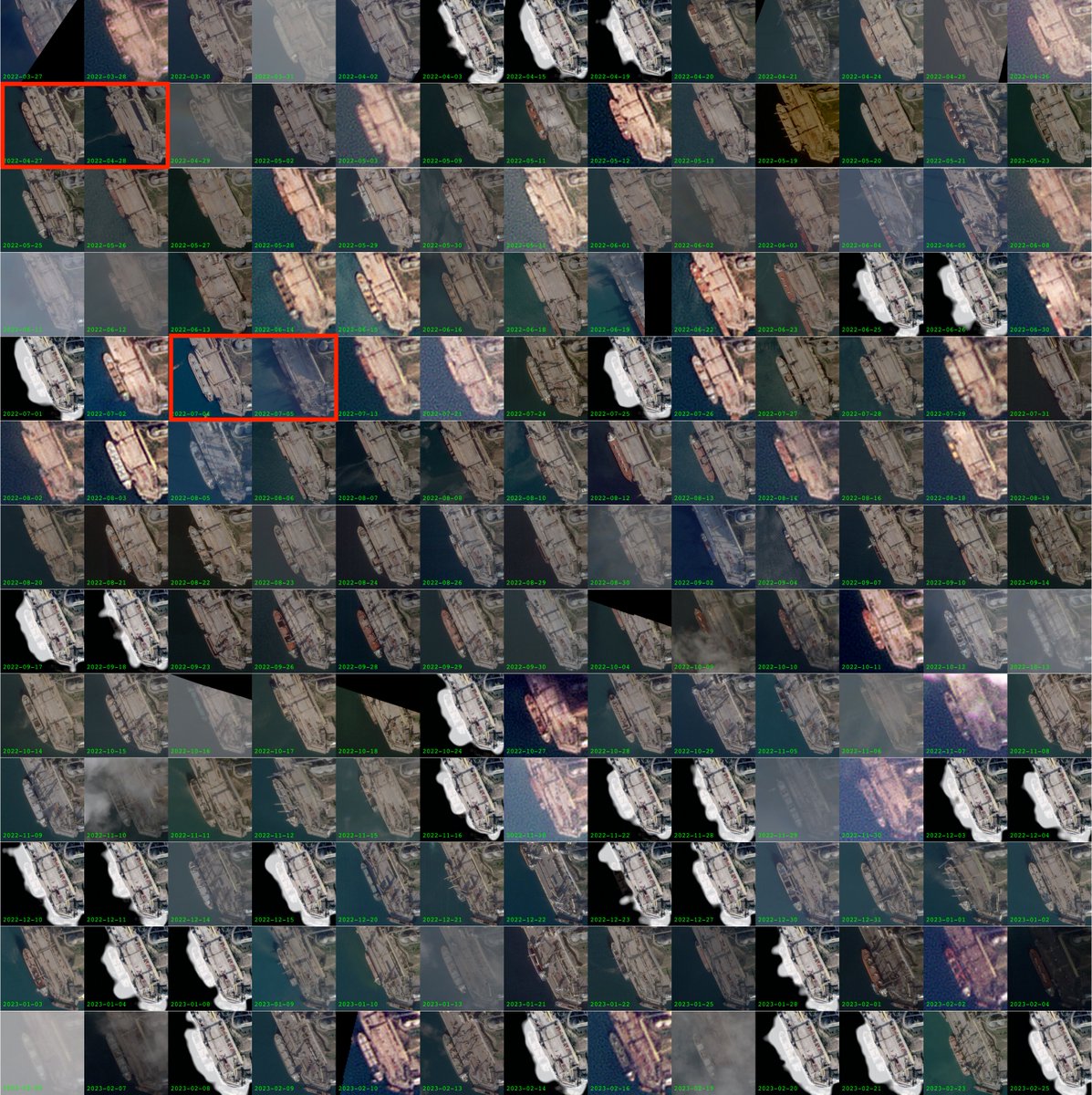
Mar 16
It's not perfect but it works; in the paper, accuracy is assessed using >2 million labeled building footprints across 30 cities across Palestine, Ukraine, Sudan, Syria, and Iraq, with building-level damage AUC = 0.87. Code and inputs fully open source:
github.com/oballinger/PWTT/t…
1
4
20
1,175
Mar 16
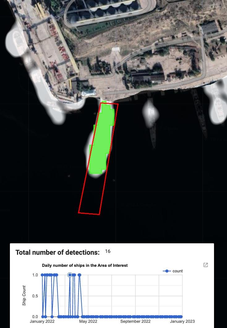
The results above can be replicated in the notebook below. To conduct damage assessment in a new area, just change the bounding box coordinates.
colab.research.google.com/dr…
3
5
26
1,798
Ollie Ballinger retweeted

2 Dec 2025
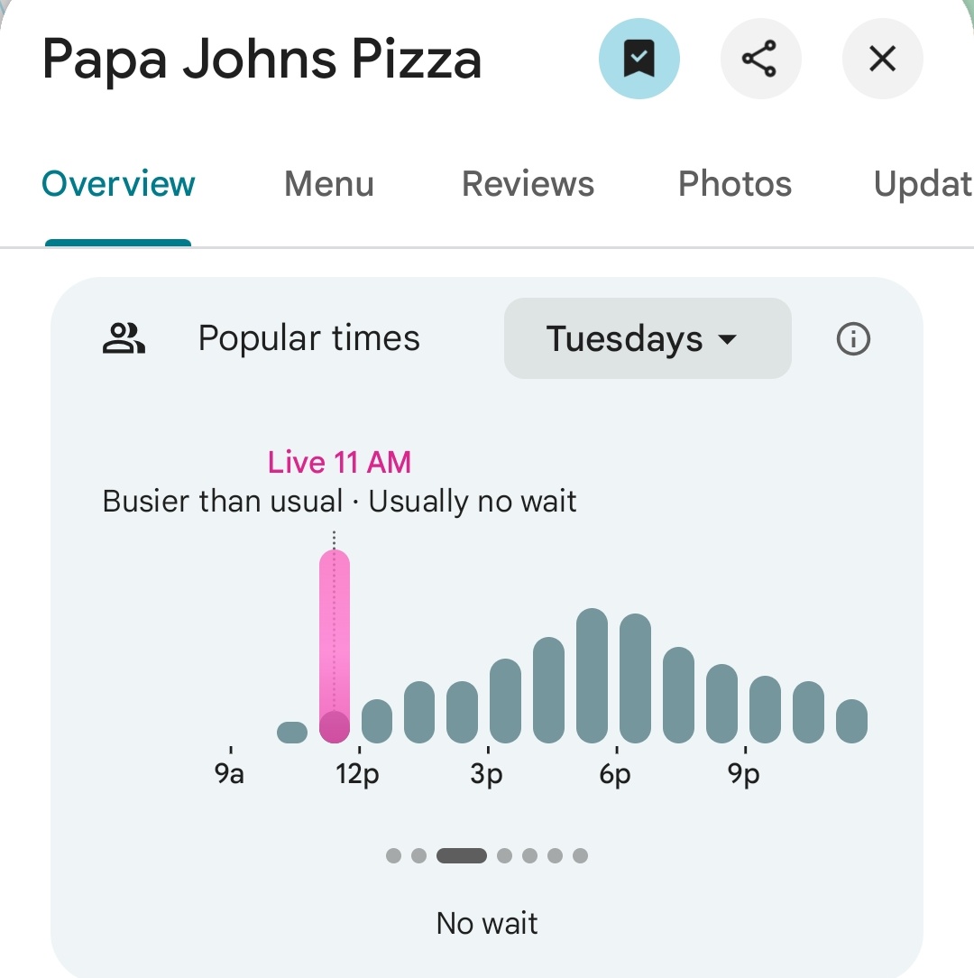
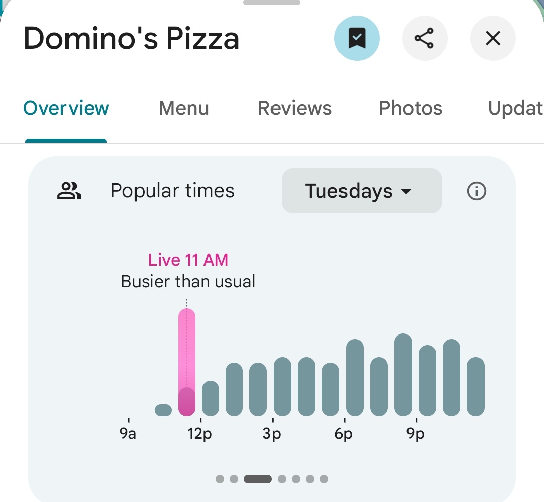
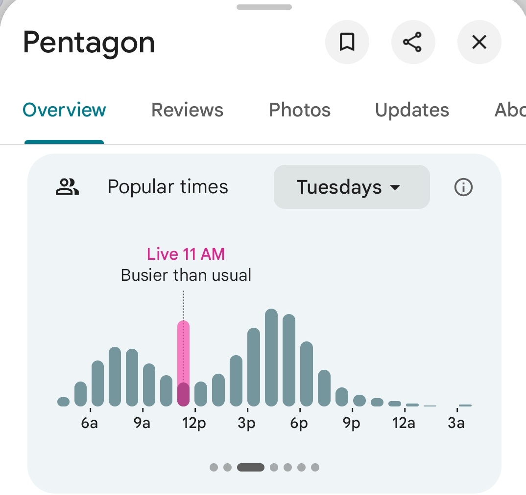
Various pizzerias nearby the Pentagon are already reporting high traffic.
The Pentagon subway station also has high traffic.
As of 11:50am ET

30
149
900
64,152
Ollie Ballinger retweeted

27 Nov 2025
🚨Breaking | Israeli occupation forces executed two young Palestinians in Jenin in cold blood, even after they had turned themselves in. An outright extrajudicial killing in blatant violation of international humanitarian law.
16
75
85
15,189
Ollie Ballinger retweeted

28 Nov 2025
Israeli forces fatally shot two Palestinian men at point-blank range moments after they appeared to surrender in the northern West Bank city of Jenin on Thursday in an incident captured on camera. wapo.st/4roPymr
411
674
1,555
89,635

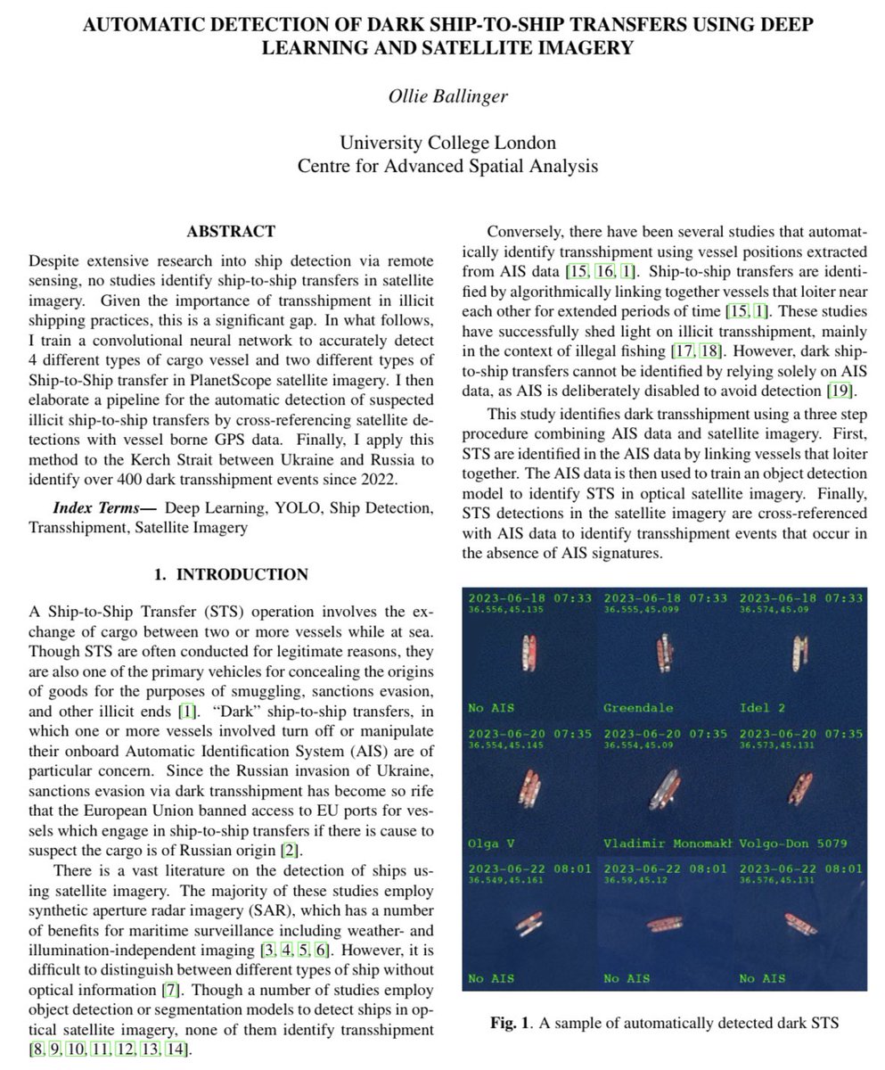
Over the past year, our team reviewed hundreds of clips of airstrikes released on social media by the IDF - systematically geolocating them and matching them to the civilians who were actually killed.
The result is our most powerful investigation to date.
idf-tweets-gaza.airwars.org/
23
760
1,335
144,431
Ollie Ballinger retweeted

30 Sep 2024
Full arms embargo to Israel NOW.
3,120
6,034
40,597
1,548,557