
maps, web apps and data visualisation
Joined May 2009
- Tweets 52
- Following 24
- Followers 565
- Likes 4
27 Photos and videos


Pinned Tweet

16 Aug 2019
Interactive 3D map of all 10 million buildings in the Netherlands showing the year of construction: bit.ly/3D-BAG #builtwithmapbox @tudelft3d
52
594
1,610
parallel.co.uk retweeted

24 Sep 2021
📢Calling all front end developers!
We have an exciting opportunity for a full time, experienced #FrontEndDeveloper to join our small, supportive team with the benefits and backing of a Times Top 100 company.
Interested? Read more: apply.workable.com/sewell-gr…
1
4
parallel.co.uk retweeted

26 Mar 2021
The new version of the 3D BAG is out! With many new features, more detail and a brand new 3D viewer.
@ylannl , @liberostelios , Jordi van Liempt , @jantienstoter , @BalazsDukai
3dbag.nl
3
16
39

Check out Trailblazing maps – entire regions into a single map. by Greg Newman on @Kickstarter kickstarter.com/projects/gom…
1
27 Sep 2019
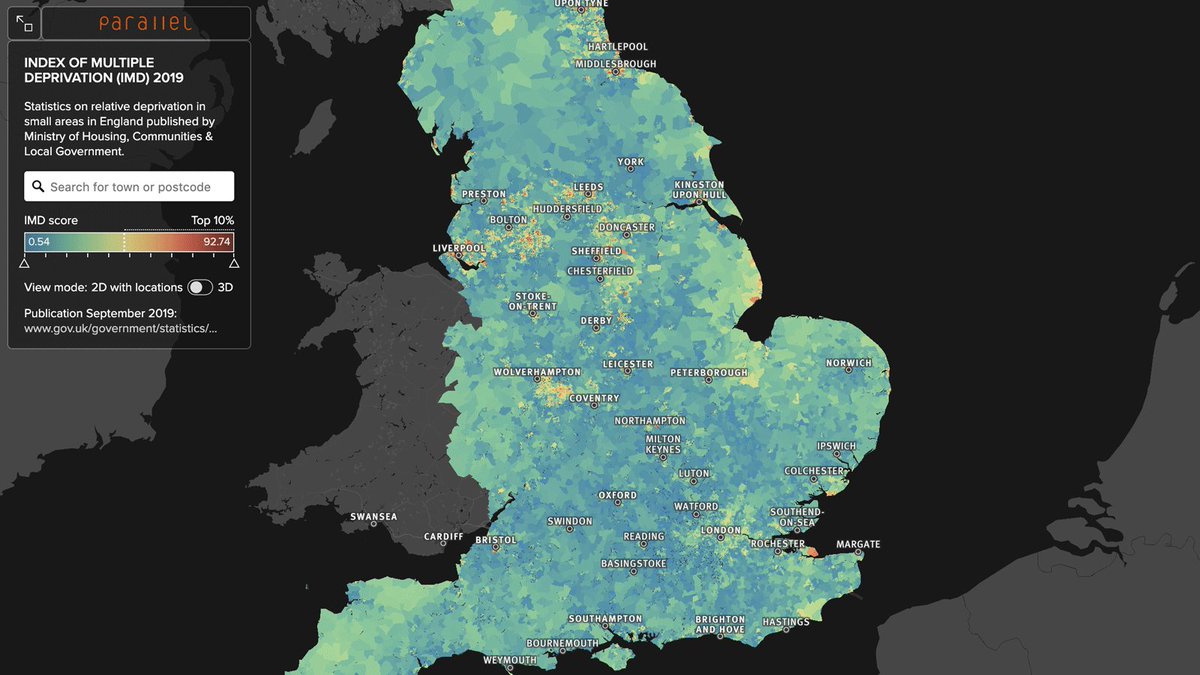
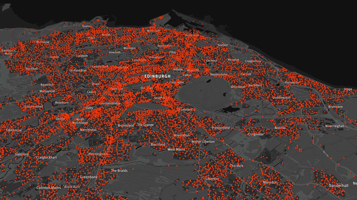
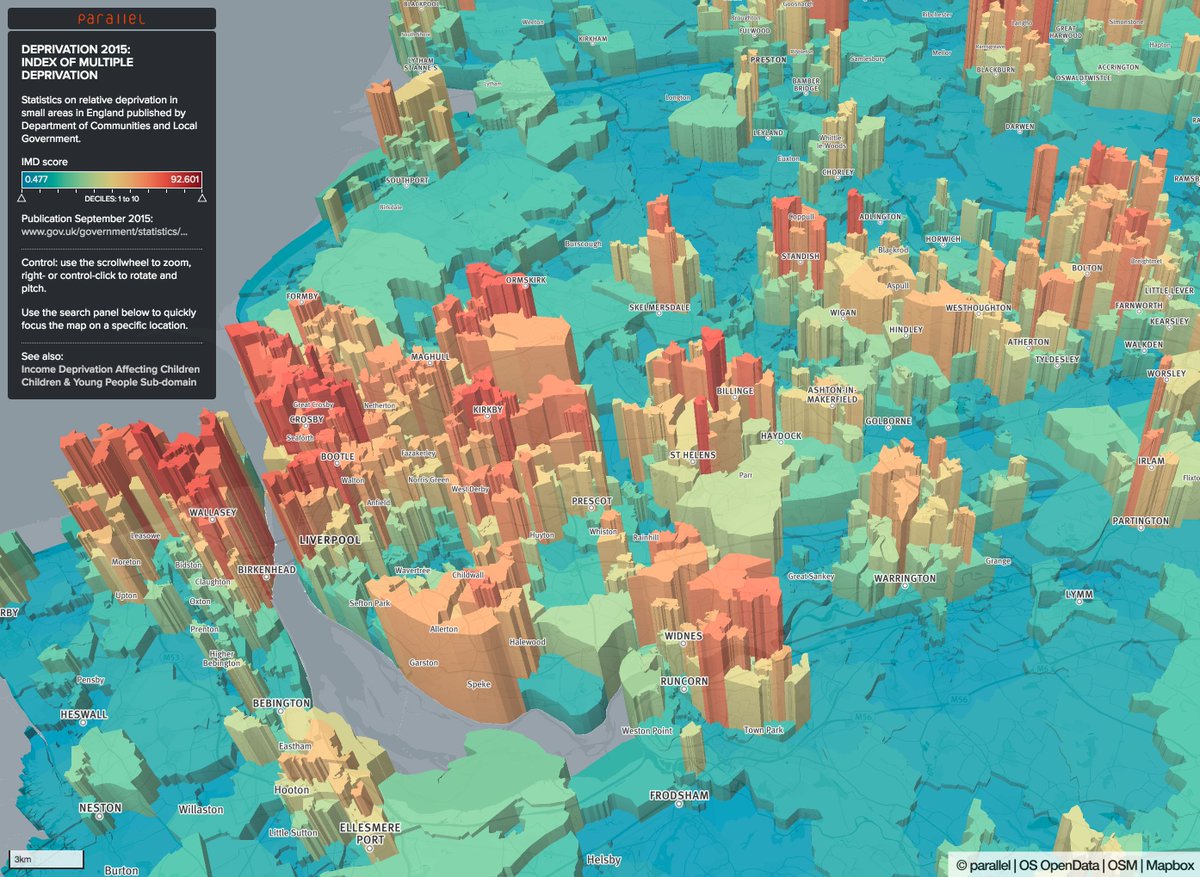
Index of Multiple Deprivation 2019 in England - interactive 2D and 3D map: parallel.co.uk/imd/ #builtwithmapbox #imd2019
1
17
19
21 Aug 2019
20 Aug 2019

Oh the Netherlands building age map of @parallelmaps reached its limits! Check out apps.webmapper.nl/bag_3D/ for the alternative version :) Not with building ages but with heights based on the BAG 3D by @tudelft3d @BalazsDukai & tiles @cartiqomaps

1
2
19

parallel.co.uk retweeted

7 Nov 2018
Sutton Coldfield Town Council's new report on community development approaches to health & wellbeing bit.ly/2SStdO7 applied open data local listening @RoyalSutColTC #SHAPEPlace @ONS @OrdnanceSurvey @NHSDigital @NALC Thx to those who gave of their time & knowledge
1
1
3
12 Jun 2018
25 years since the last UK Ordnance Survey benchmark was carved - see all 500,000 and find your closest example: bit.ly/osbma @OrdnanceSurvey #BuiltWithMapbox #geocaching
1
1
5

5 crazy data healthcare data visualizations from @parallelmaps buff.ly/2D6Knyb #builtwithmapbox #ddj #mapboxforbi

1
23
66
18 Jan 2018
All schools in England & Wales mapped with walk, cycle and drive time catchments: bit.ly/EWschools @route360_ @OrdnanceSurvey #OpenData #BuiltWithMapbox
1
34
56
1 Nov 2017
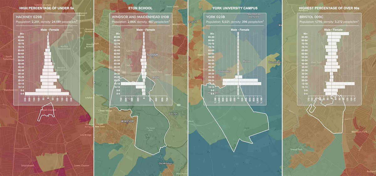
Latest @ONS England & Wales population estimates: age profile and population density mapped: bit.ly/ONSpop #BuiltWithMapbox
2
15
33
16 Aug 2017
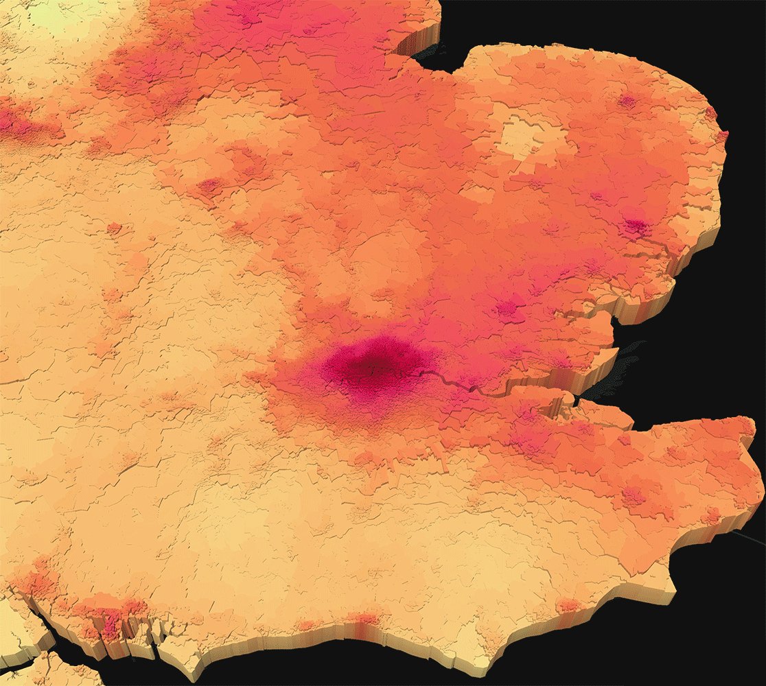
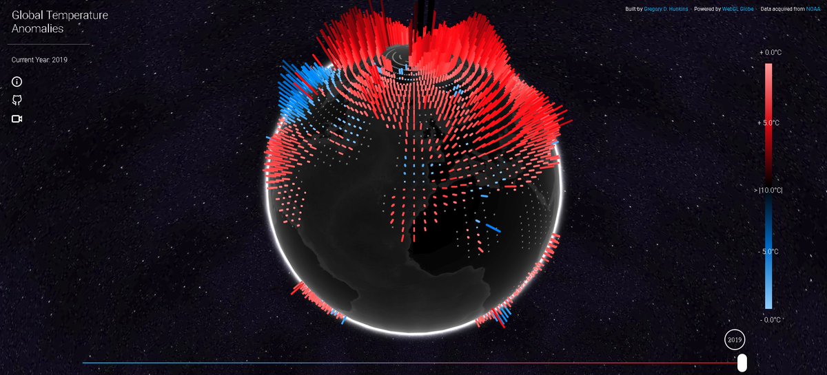
UK Access to Health Assets and Hazards air quality PM10, NO2 & SO2 3D maps: bit.ly/AHAHNO2 @geodatascience @Mapbox #OpenData
5
7
16 Jun 2017
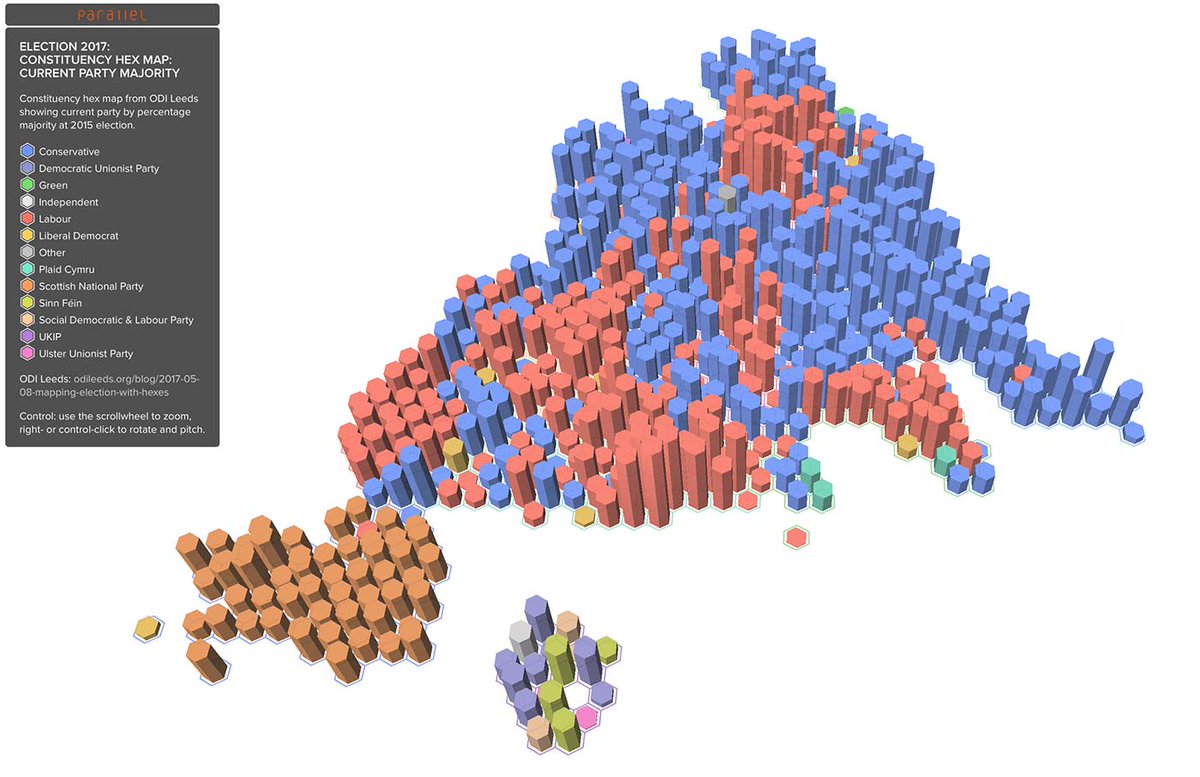
UK election results constituency hexmap showing winning party majorities 2017 & 2015 #GE2017 @ODILeeds @mapbox: bit.ly/GE2017hex
7
10
23 May 2017
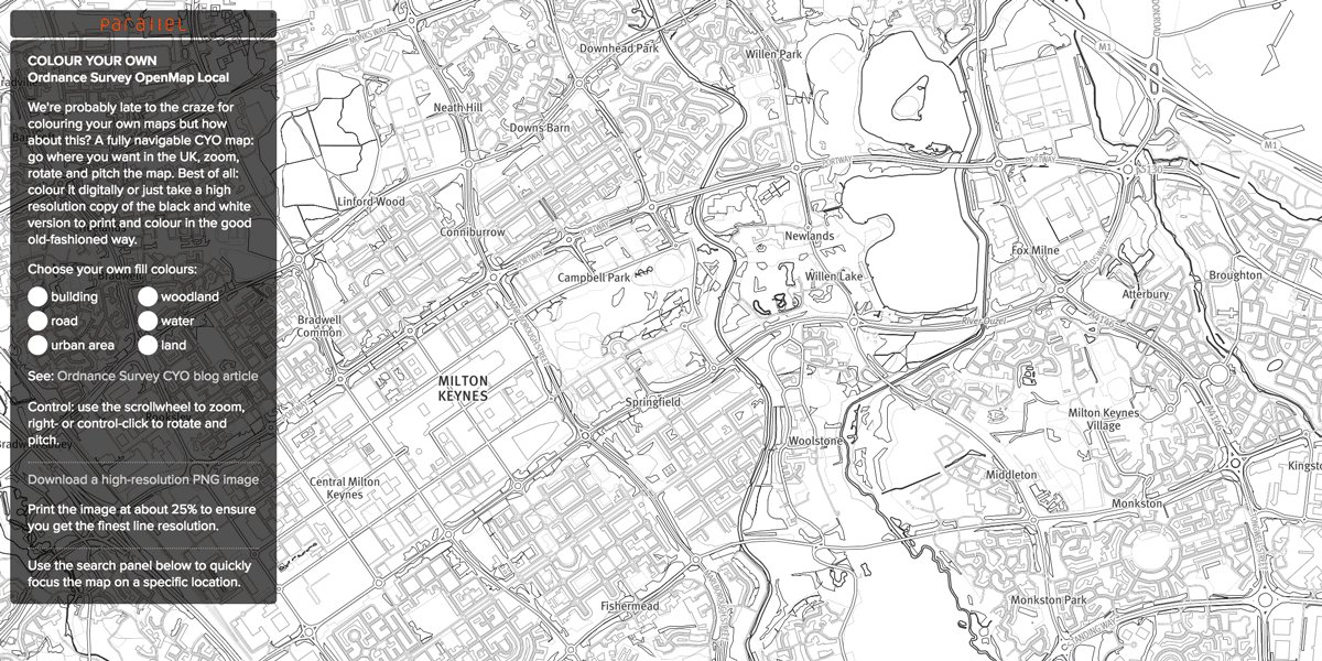
Colour your own @OrdnanceSurvey #OpenData map using @Mapbox GL: print in B&W and hand colour or colour directly: bit.ly/OS-cyo
3
6
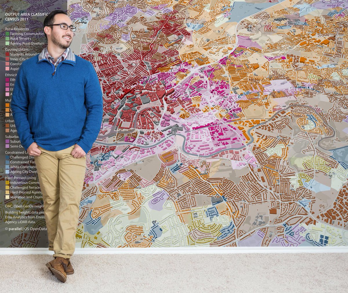
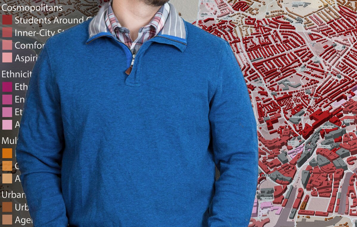
@parallelmaps @OrdnanceSurvey Easy-to-apply and removable wall coverings for 3d information #Wallmurals. #BristolCity
1
6
12
13 Apr 2017
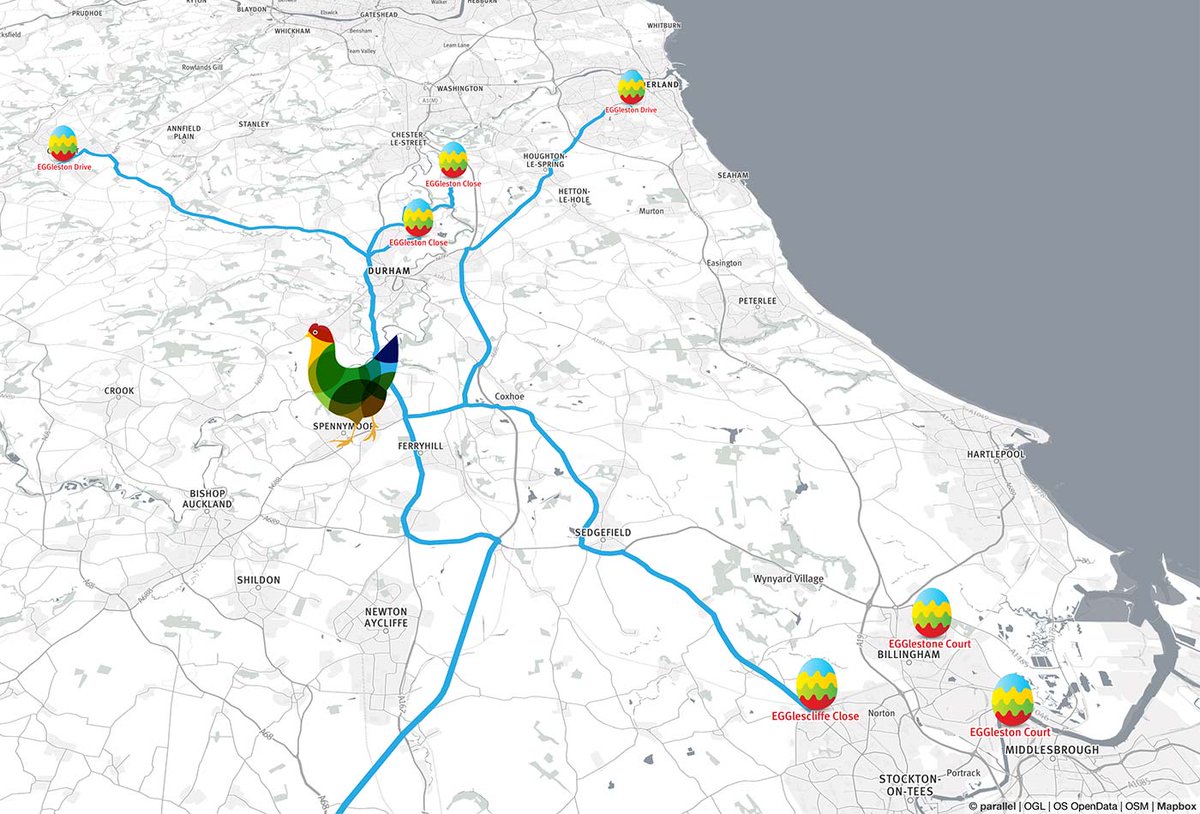
Map of all the ‘Egg’s in @OrdnanceSurvey #OpenData to say thanks and to celebrate their 7th anniversary: Explore: bit.ly/OS-egg
1
6
6
parallel.co.uk retweeted

10 Apr 2017
We’re celebrating 7 years of OS #OpenData. Could it help you as much as it has helped @ParallelMaps? Find out: social.os.uk/zLHdc
13
15
23 Feb 2017
All 1.7 million GB postcode locations in this month’s @OrdnanceSurvey Code-Point Open data in a @Mapbox GL 3D map: bit.ly/codepoint
2
13
14
7 Feb 2017
London ward-level population projection to 2041 as animated 3D map @LDN_data @mapbox @OrdnanceSurvey : bit.ly/GLApopproj
11
15