
Researcher of post-fire debris flows and landslides. Trying to make pyrogeomorphology “a thing”.
Joined February 2008
- Tweets 1,553
- Following 856
- Followers 691
- Likes 3,408
109 Photos and videos


Francis Rengers retweeted

7 Aug 2024
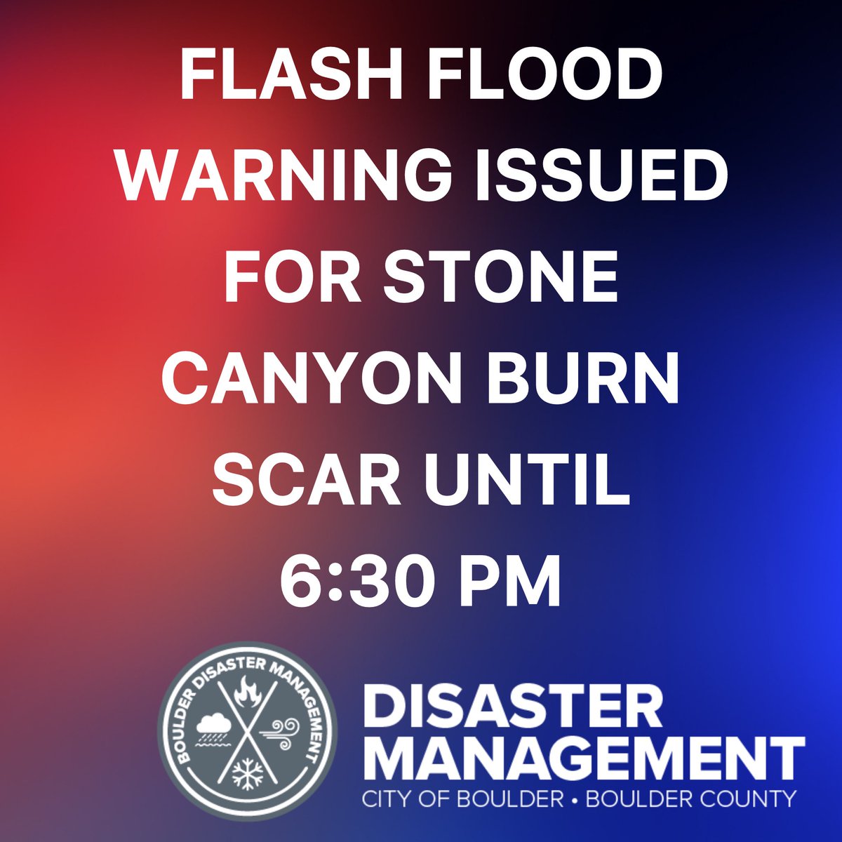
The National Weather Service has issued a Flash Flood Warning on 8/7/24 until 6:30 p.m. for the Stone Canyon Fire burn scar area. Law enforcement in the area is not seeing significant impacts at this time. We have not issued a Climb to Higher Ground order, however, please pay attention to your surroundings and take action if necessary.
Radar indicated thunderstorms producing heavy rain over the Stone Canyon Burn Scar. The expected rainfall rate is .25 inches in 15 minutes. Flash flooding is ongoing or expected to begin shortly. Excessive rainfall over the warning area will cause debris flows near steep terrain. The debris flow can consist of rock, mud, vegetation, and other loose materials.
Impact includes life threatening flash flooding of areas in around the Stone Canyon Burn Scar. Locations that may experience flash flooding include Stone Canyon Road and Stone Canyon HOA. Heavy rainfall will cause flash flooding of creeks, streams, and ditches in the Stone Canyon Burn Scar. Debris flows can also be anticipated across roads. If you encounter flood waters climb to safety.
10
11
7,479
Francis Rengers retweeted

7 Aug 2024
A strong thunderstorm just developed right over the Stone Canyon burn area! The heavy rain will lead to flash flooding. Move to higher ground or get out of the area immediately! #COwx
7 Aug 2024

Flash Flood Warning including Boulder County, CO until 6:30 PM MDT

10
13
10,650
Francis Rengers retweeted

20 Jul 2024
Here's a look at the hydrograph for the Rio Ruidoso. The water will continue to race downstream toward Glencoe this afternoon. Stay safe! #nmwx
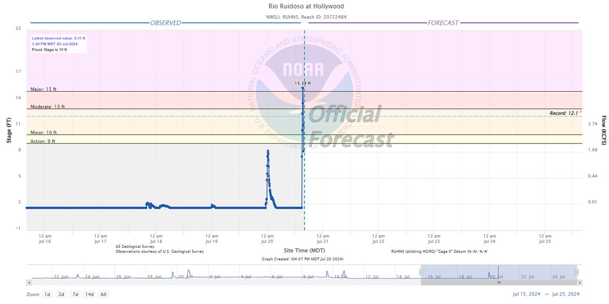
8
17
1,953
Francis Rengers retweeted
20 Jul 2024
The Rio Ruidoso at Hollywood jumped into MAJOR flood stage - over 15 feet! Look at the last few frames of this video. Stay away from the river banks! It could be deadly! #nmwx
4
33
124
11,078
Francis Rengers retweeted

20 Jun 2024
Hail flow happening west of Scottsbluff, NE #newx
164
592
3,271
693,852
Francis Rengers retweeted

3 Jun 2024
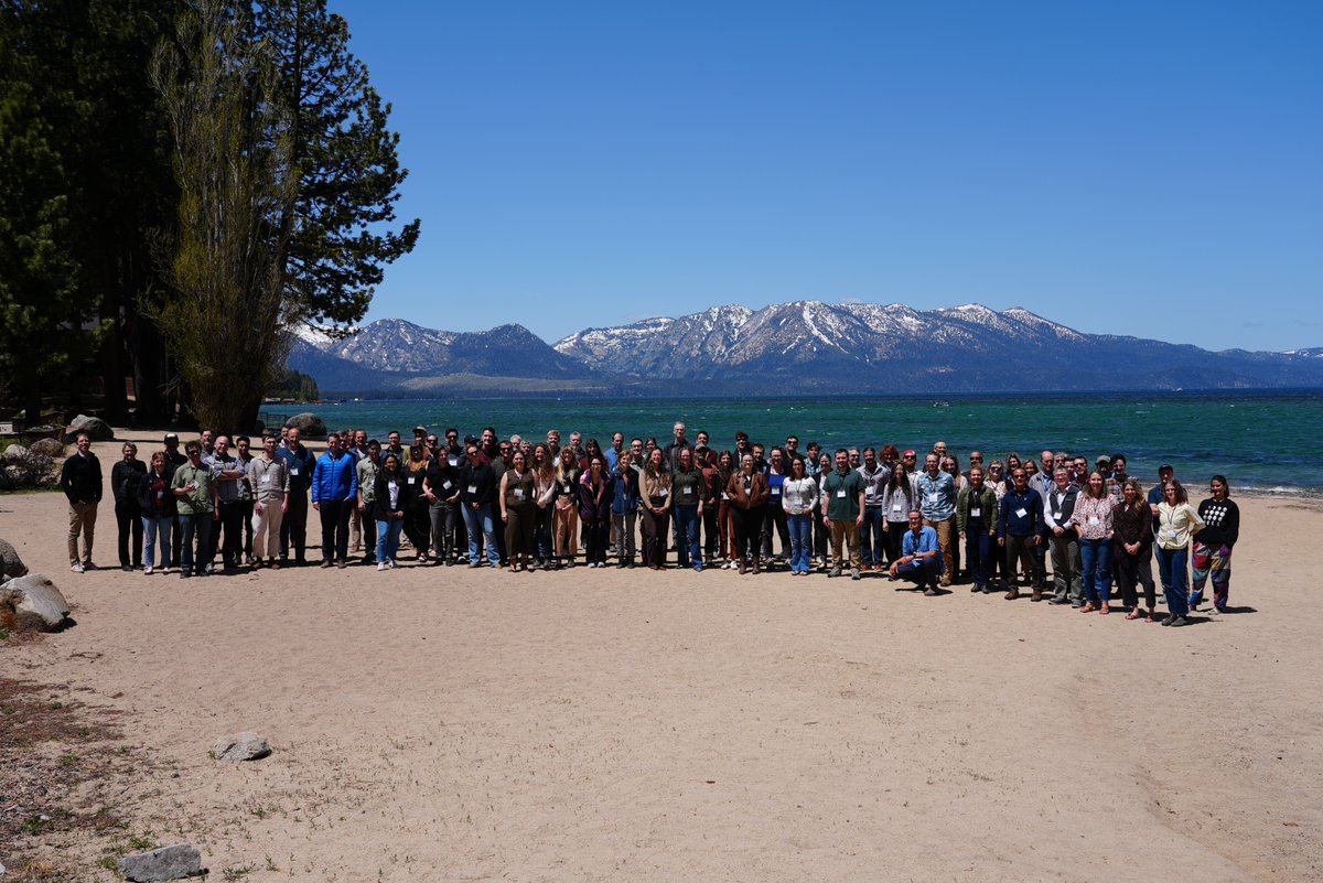
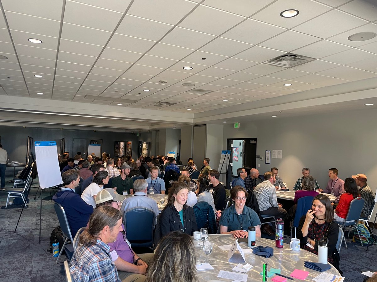
Recently, @USGS @UArizona @AZGeology @CAGeoSurvey & @CAFireScience organized the Establishing Directions in Postfire Debris-Flow Conference on future science directions including #hydrology, geomorphology, engineering, remote sensing, atmospheric science, ecology, & data science.
1
3
15
766
Francis Rengers retweeted

31 May 2024
🚨New Review!
Fire effects on geomorphic processes🔥🏞️
Learn how landscape attributes, rainfall & burn severity influence post-fire geomorphic responses over a range of temporal & spatial scales
nature.com/articles/s43017-0… @Dicasivi @EU_ScienceHub
Free: rdcu.be/dJzf8
6
10
1,219
Francis Rengers retweeted
13 May 2024
May is Wildfire Awareness Month! 🔥🔥 A recent publication with @BGCEngineering, @USGS, @UNRScience, @CalConservation, and @UniMelb focuses on post-wildfire debris flows which pose severe hazards to communities & infrastructure near and within recently burned mountainous terrain


1
4
8
563
Francis Rengers retweeted

8 Nov 2023
A timelapse of the wildfire in @NewRiverNPS from the iconic Grandview Overlook tonight.
📍Grandview, WV
11
103
308
84,071
Francis Rengers retweeted

3 Nov 2023
The scale of the fires currently burning across northern Australia is pretty unfathomable.
This animation visualises just the last two months of fire captured by #DEAHotspots - for context, the map covers an area larger than France, Spain and Germany combined...
179
2,569
5,687
908,937
Francis Rengers retweeted

18 Sep 2023
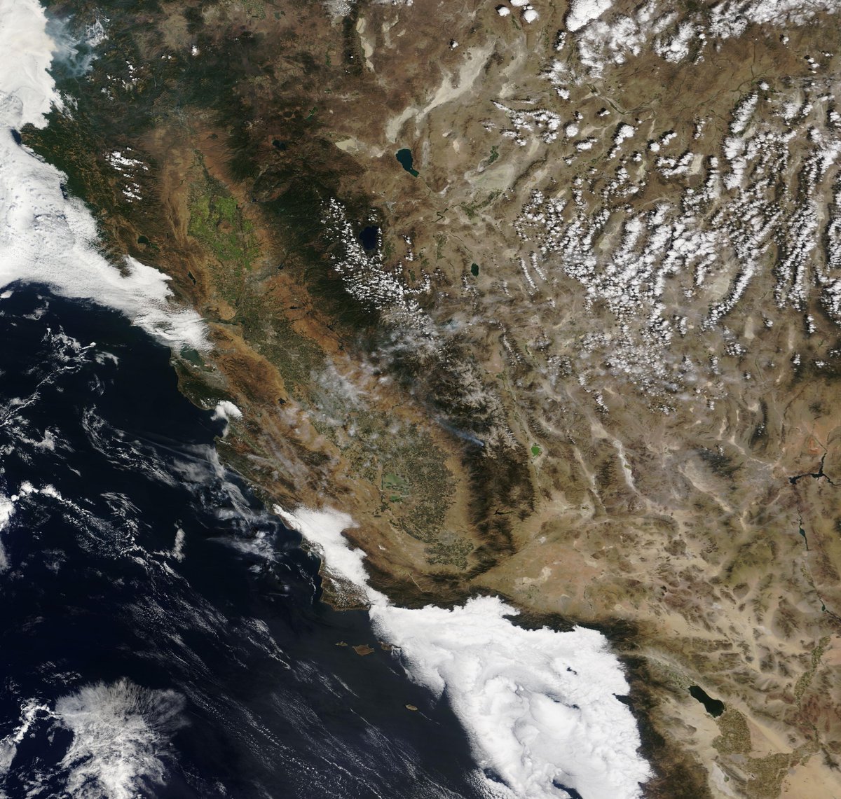
Satellite image of California shows virtually no smoke across the state in typical peak fire season, with fire activity confined to the extreme northwest part of the state.
Only 257,000 acres have burned across the state this year, which is 4.5x fewer acres than the 5-year average of 1.15 million.
California has experienced yet another quiet fire season so far, compared to recent years (2020 and 2021).
This past year's very wet winter, combined with very few significant heatwaves and fire weather events, has resulted in minimal fire activity outside far Northern California and the Mojave Desert.
Soil moisture across much of the state remains well above normal due to several significant moisture intrusions (e.g. Hilary) and a robust marine layer.
137
418
3,462
605,651
Francis Rengers retweeted

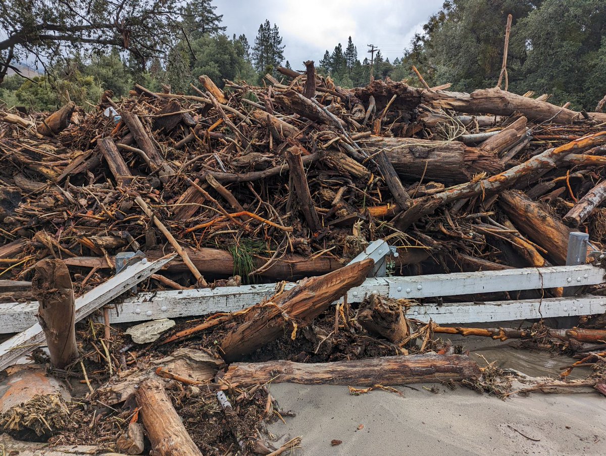
25 Aug 2023
Personnel of the San Bernardino National Forest are conducting surveys and assessments of damage to sites and areas on the forest due to Tropical Storm Hilary’s landfall, Aug. 20-21. Read our safety messages and information about the impact of the storm at fs.usda.gov/detail/sbnf/?cid…

1
13
23
5,286

Francis Rengers retweeted

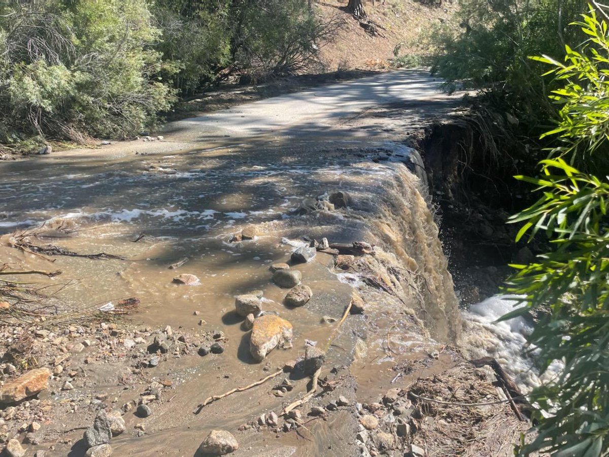
21 Aug 2023
7
24
2,291
Francis Rengers retweeted

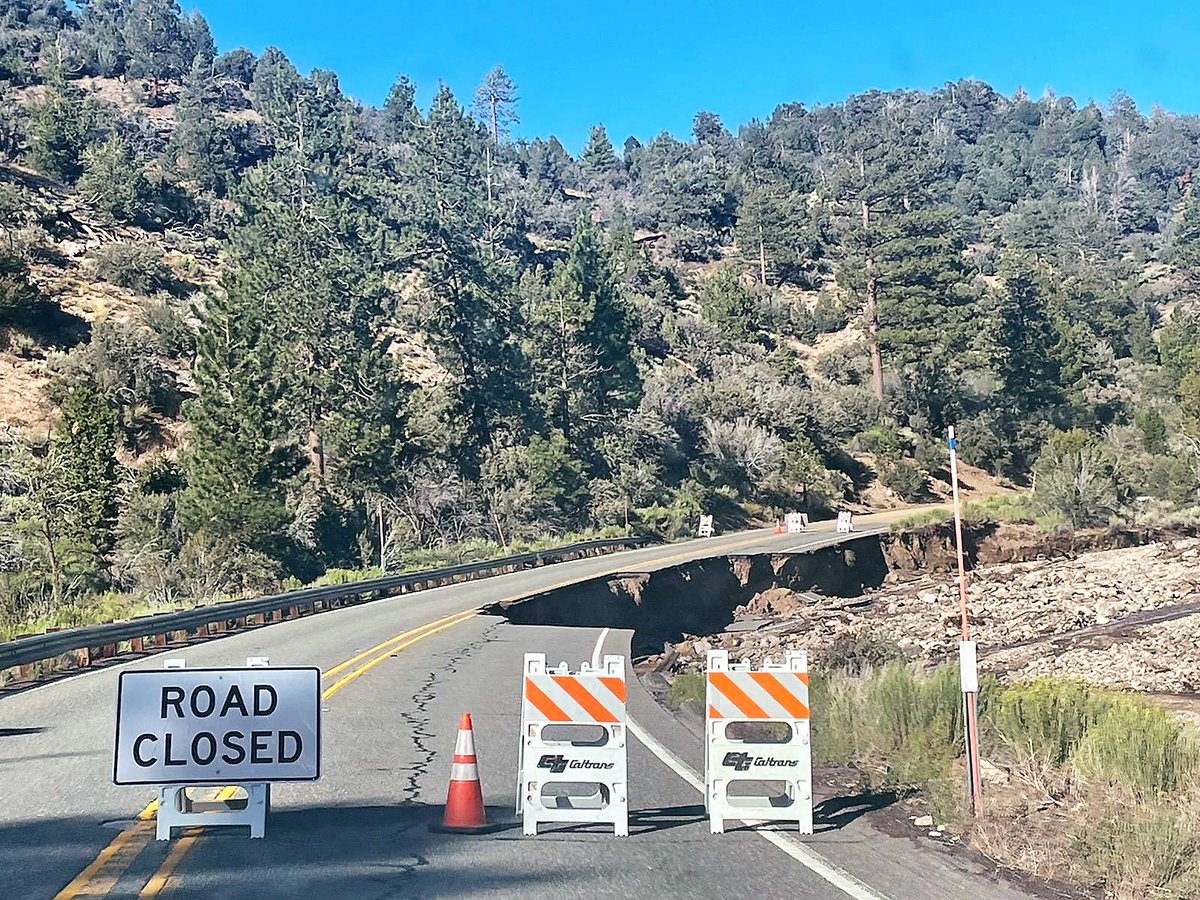
17 Aug 2023
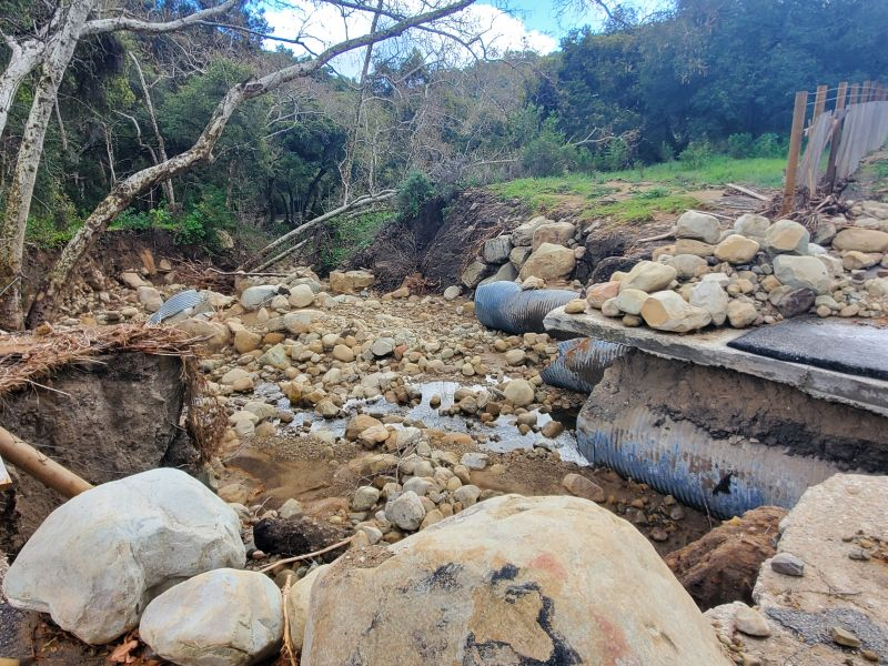
I-70 through Glenwood Canyon back open after mudslide denver7.com/news/local-news/…
1
180

17 Aug 2023
Interstate 70 closed through Glenwood Canyon due to mudslide | PostIndependent.com postindependent.com/news/int…
2
351
14 Aug 2023
Hi everyone! There is a new opportunity to study postfire debris flows as part of the USGS Landslide Hazards Program in Golden, Colorado! Application deadline is November 1st. usgs.gov/centers/mendenhall-…
1
21
60
7,283
Francis Rengers retweeted

29 Jul 2023
#Fluchthorn rock avalanche (2023-06-11) volume estimate yielded 1 Mio m³ - that makes it one of the biggest high-alpine rockfalls, and one of the few known to have decapitated a summit! 🏔️
Fascinating video about laserscan survey of the site!
Source @jan_beutel @uniinnsbruck
1/
3
43
137
13,885
Francis Rengers retweeted

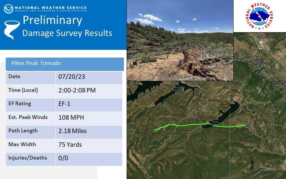
22 Jul 2023
The damage survey along Pikes Peak is complete and the survey team found damage consistent with an EF-1 tornado with estimated winds up to 108 mph.
Check out the graphic for more info and an estimation of the tornadoes path. #cowx
3
89
305
51,968
Francis Rengers retweeted

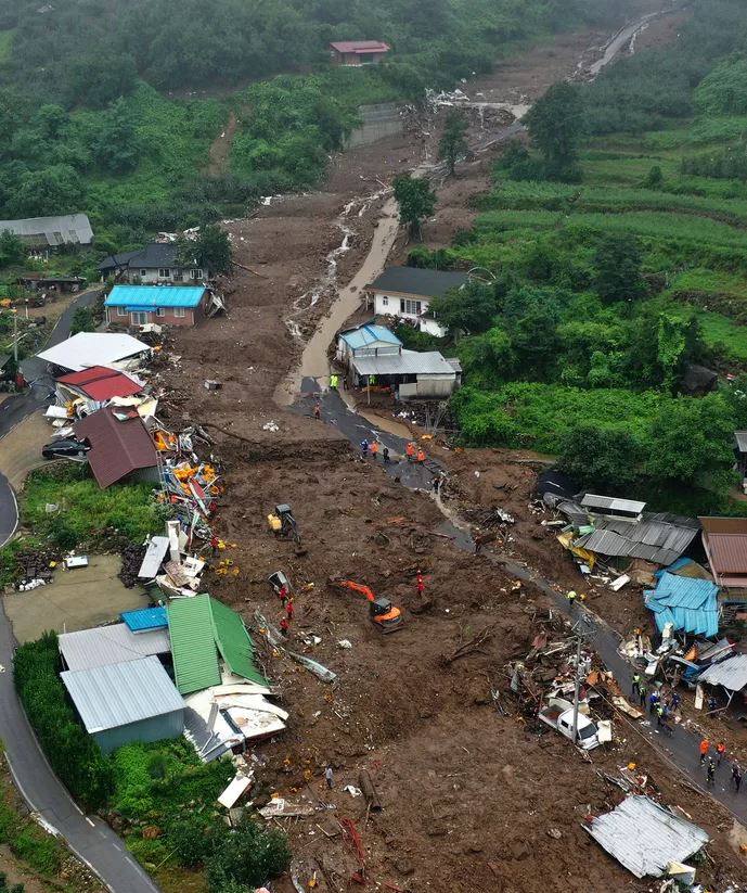
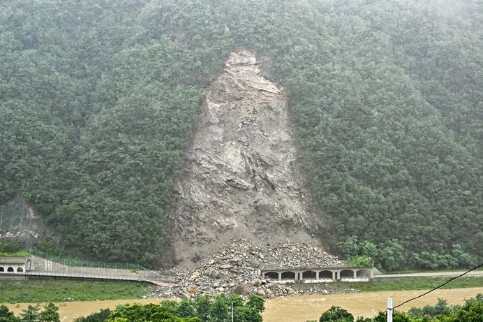
17 Jul 2023
In recent days, multiple landslides have been triggered by intense rainfall in South Korea, killing several people:- blogs.agu.org/landslideblog/…
1
16
44
4,420