
Storm Team Meteorologist for @WGAL • @millersvilleu Alum • Storm Chasing • 🌪️2
Joined July 2020
- Tweets 2,773
- Following 372
- Followers 742
- Likes 6,120
1,051 Photos and videos


Pinned Tweet

6 Sep 2024
(1/4)
📢 CAREER ANNOUNCEMENT 📢
I’m very excited and honored to announce that I have officially joined the @WGAL News 8 Storm Team as their newest meteorologist! It’s been a very surreal experience for me and I’m very honored and grateful for the opportunity. Many thanks to
13
5
61
8,392
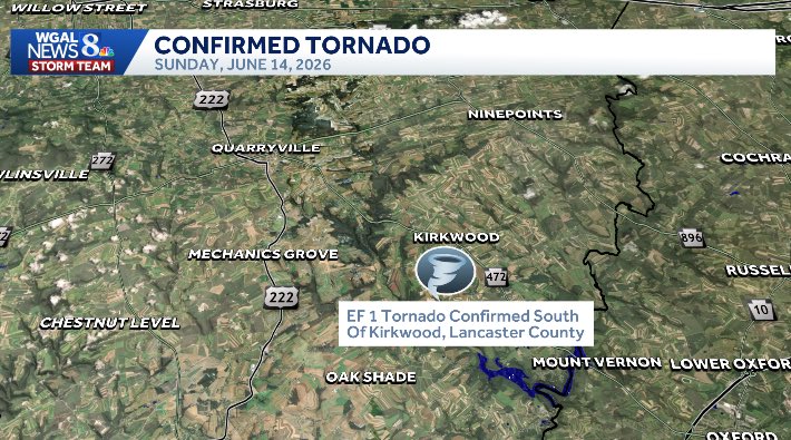
Completed a damage assessment of Sunday night’s storm in southern Lancaster County near Kirkwood, PA. @JaidenChasesWX and I saw some damage that looked pretty close to what is now confirmed as an EF1 tornado by @NWSStateCollege after they sent out an official crew to investigate
1
1
5
185
An official public information statement (PNS) from State College with a thorough discussion and review will be released later

TORNADO OFFICIAL: The NWS State College has officially confirmed an EF1 touched down in kirkwood #PAwx
Huge thanks and shoutout to @ryanargenti who was a huge help in touring the damage and talking to locals!💪
BIG DAWGS GOTTA EAT ON HOMETURF SOMETIMES TOO #wxtwitter #tornado
1
109
Ryan Argenti retweeted

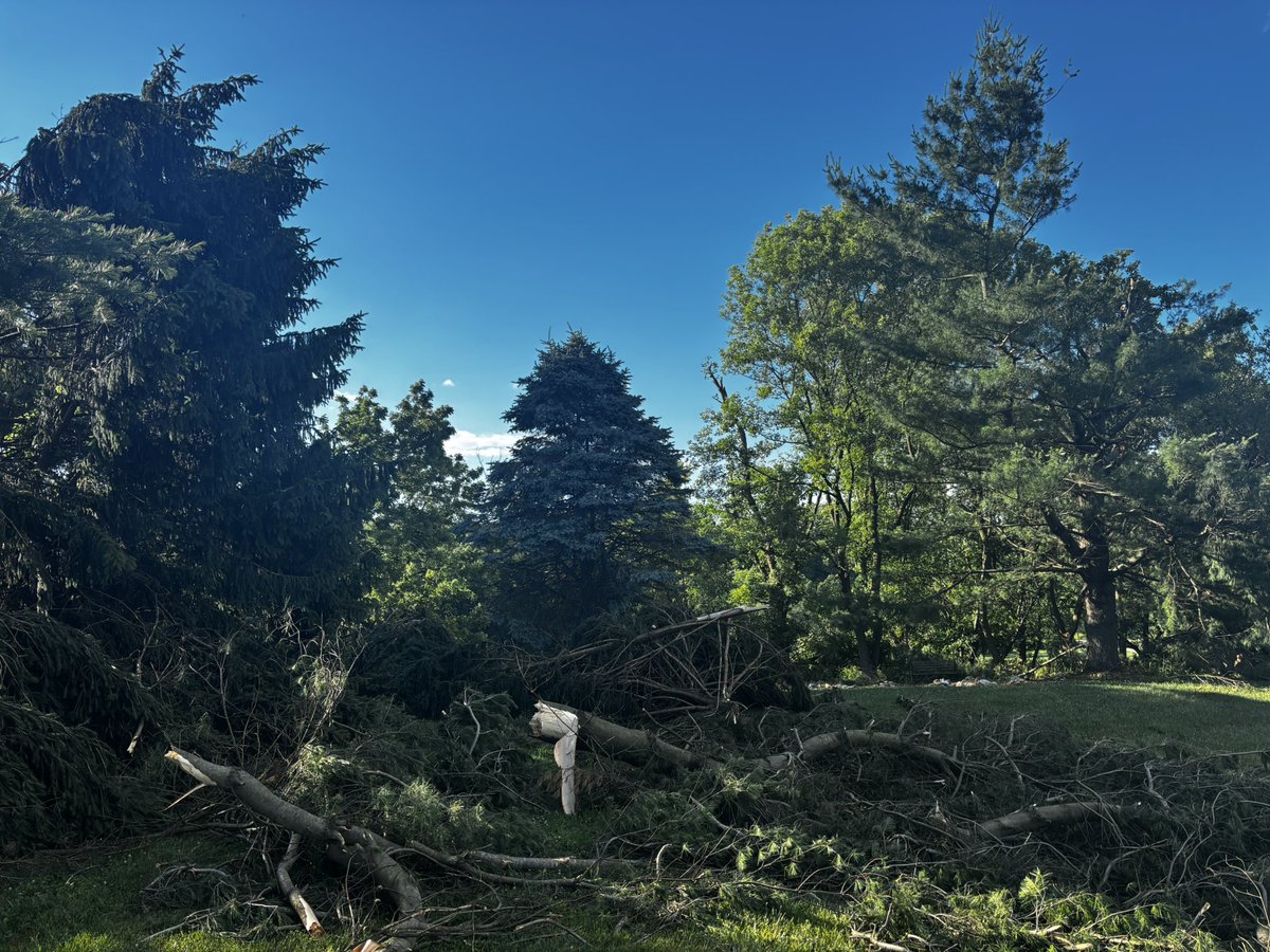
Pretty intense tree damage along Wesley road behind a property. Multiple trees falling in opposite winds, multiple uprooted trees, likely tornadic winds. #pawx #wxtwitter @ryanargenti @NWSStateCollege

3
2
19
716
Ryan Argenti retweeted
More isolated and somewhat intense damage along Wesley road. Lines are down along with sporadic tree damage @ryanargenti @NWSStateCollege #pawx #wxtwitter #tornado


1
6
351
Ryan Argenti retweeted
Out doing damage reports from the likely tornado in kirkwood PA from last nights supercell
One tree uprooted, with many other big limbs and branches down behind the property
📍Picture cords 39.83882° N, 76.09526° W
#pawx #wxtwitter #tornado #severeweather @NWSStateCollege

1
3
16
829
Ryan Argenti retweeted

Jun 15
These images are very convincing for a tornado in Lancaster County last night with reports of damage in the area.
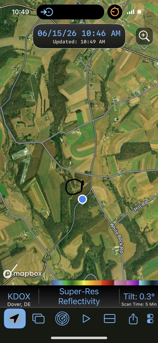
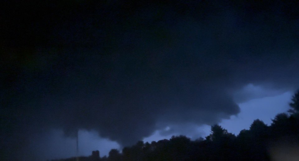
POSSIBLE TORNADO: from 9:30 to 9:34pm, I took these shots of a potential tornado 5 miles north of little Britain. due to poor terrain and heavy rain, I couldn’t tell the motion on this thing. Radar imagery below of the storm at the time. @NWSStateCollege @MaxVelocityWX #pawx


1
3
12
768
Ryan Argenti retweeted
POSSIBLE TORNADO: from 9:30 to 9:34pm, I took these shots of a potential tornado 5 miles north of little Britain. due to poor terrain and heavy rain, I couldn’t tell the motion on this thing. Radar imagery below of the storm at the time. @NWSStateCollege @MaxVelocityWX #pawx
8
29
164
9,181
Jun 15
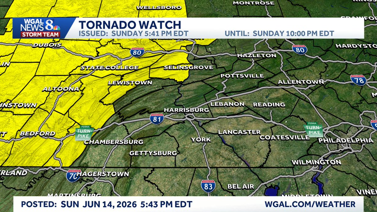
A SEVERE THUNDERSTORM WARNING has been issued for highlighted area until Jun 14 9:30PM. Seek shelter indoors now! Track on radar: wgal.com/weather/radar. @WGAL #PAwx
1
1
107
Jun 15
A SEVERE THUNDERSTORM WARNING has been issued for highlighted area until Jun 14 8:45PM. Seek shelter indoors now! Track on radar: wgal.com/weather/radar. @WGAL #PAwx
1
115
Jun 14
A SEVERE THUNDERSTORM WARNING has been issued for highlighted area until Jun 14 8:45PM. Seek shelter indoors now! Track on radar: wgal.com/weather/radar. @WGAL #PAwx
1
99
Jun 14
Storm reports are coming in of trees and wires down in a few communities in Franklin county. Be on alert for more severe weather through the rest of the evening! Stay tuned to our forecasts and posts online!
2
1
113
Jun 14
A SEVERE THUNDERSTORM WARNING has been issued for highlighted area until Jun 14 8:15PM. Seek shelter indoors now! Track on radar: wgal.com/weather/radar. @WGAL #PAwx
1
108
Jun 14
A SEVERE THUNDERSTORM WARNING has been issued for highlighted area until Jun 14 7:30PM. Seek shelter indoors now! Track on radar: wgal.com/weather/radar. @WGAL #PAwx
1
104
Ryan Argenti retweeted

Jun 14
Confirmed tornado on the ground moments ago in Punxsutawney, PA! 🌪️
📹 Video Credit: Myranda Phillips
#pawx #Pennsylvania #tornado
facebook.com/share/r/1HBs3Xi…
43
233
1,407
151,980
Jun 14
A SEVERE THUNDERSTORM WARNING has been issued for highlighted area until Jun 14 6:45PM. Seek shelter indoors now! Track on radar: wgal.com/weather/radar. @WGAL #PAwx
1
80
Jun 14
The Storm Prediction Center has issued an 80% chance of a Severe Thunderstorm Watch being released in the coming hours as storms begin to erupt across portions of Pennsylvania. We'll let you know once the watch is released.
2
4
2
261
Ryan Argenti retweeted

The sunset tonight was absolutely gorgeous!
What did it look like where you live?
#PAwx

ALT Harrisburg, PA

ALT Ephrata

ALT Elizabethtown
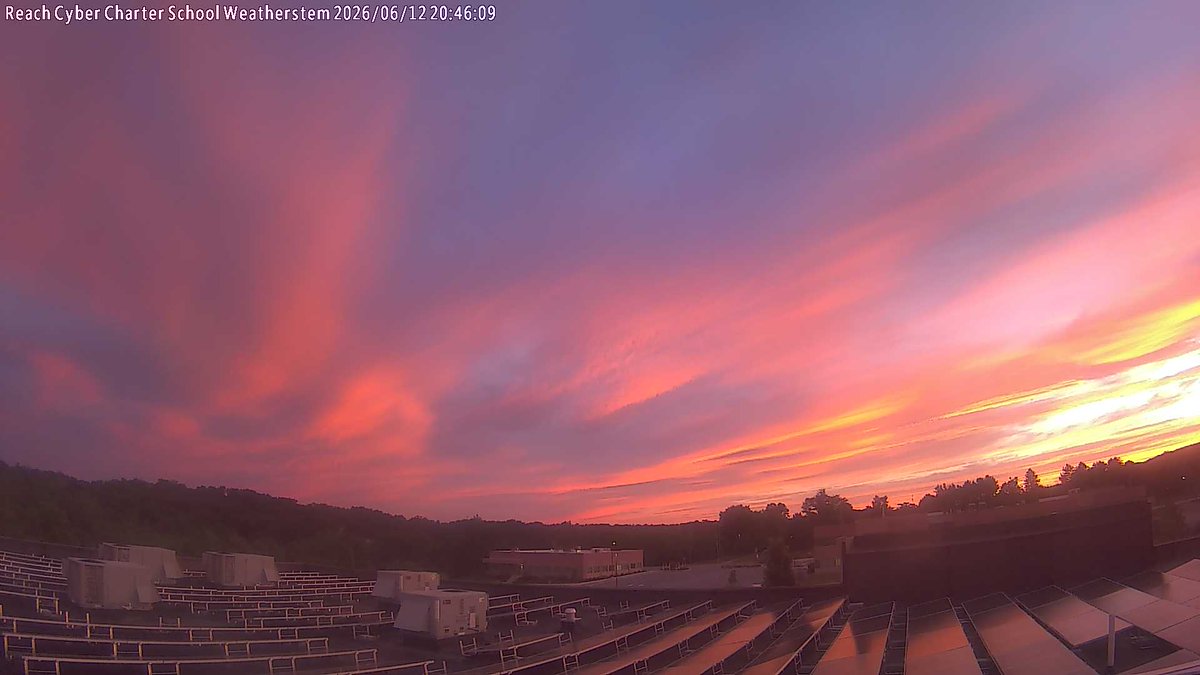
ALT Reach Cyber Charter School, Harrisburg
4
7
37
1,847