
Flâneur.
Joined July 2022
- Tweets 581
- Following 277
- Followers 147
- Likes 2,182
104 Photos and videos


May 18
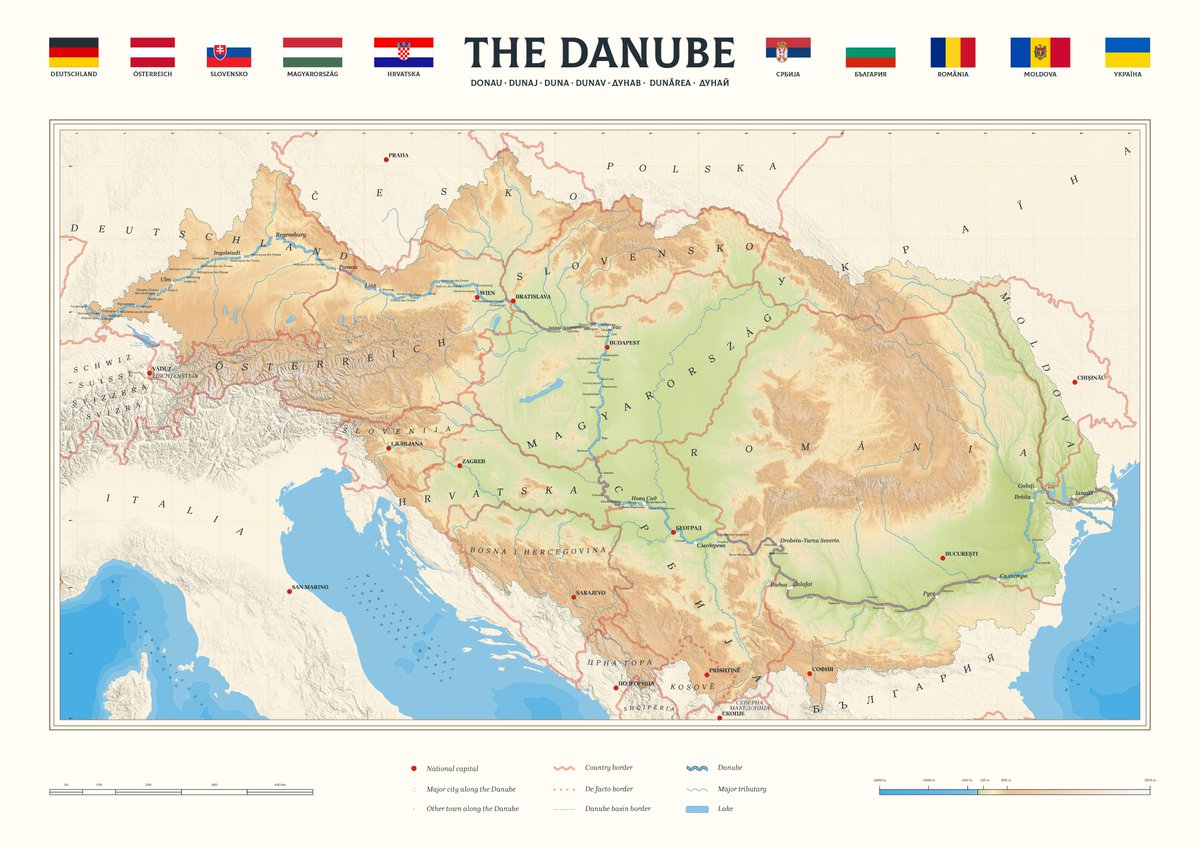
Tras leer Danubio, de Claudio Magris, me decidí a hacer este mapa.
9
512
Mar 21
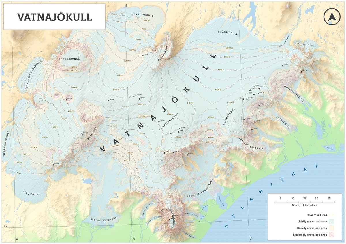
El glaciar Vatnajökull cubre aproximadamente el 8% de Islandia, creando un sobrecogedor paisaje de hielo que entierra volcanes activos bajo su superficie. El mapa muestra la elevación del glaciar y la concentración de grietas por zonas.
2
62
Jan 30
Un placer el ratito que pasamos en el sureste, Jon. Por más y mejores días de fuego y hielo.
2
128
4 Nov 2025
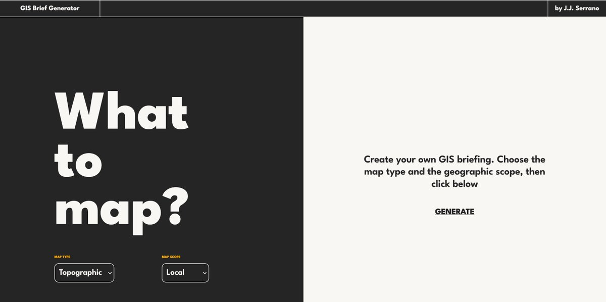
November means #30DayMapChallenge.
Stuck on a theme or just want new ideas?
This small tool I built generates map briefs to help you overcome the feared creativity drought and get started:
gis-brief-generator.vercel.a…
Happy mapping! 🗺️
1
1
144
4 Nov 2025
More details here! 👇🏻
x.com/serranowski/status/189…
27 Feb 2025

Stuck on your next GIS project? I have been working for the last few weeks on a little side project: a creative GIS generator based on React that will help you break through any creative block and explore new ideas.
This is GIS Brief Generator! 📄
57
J.J. Serrano retweeted

30 Aug 2025
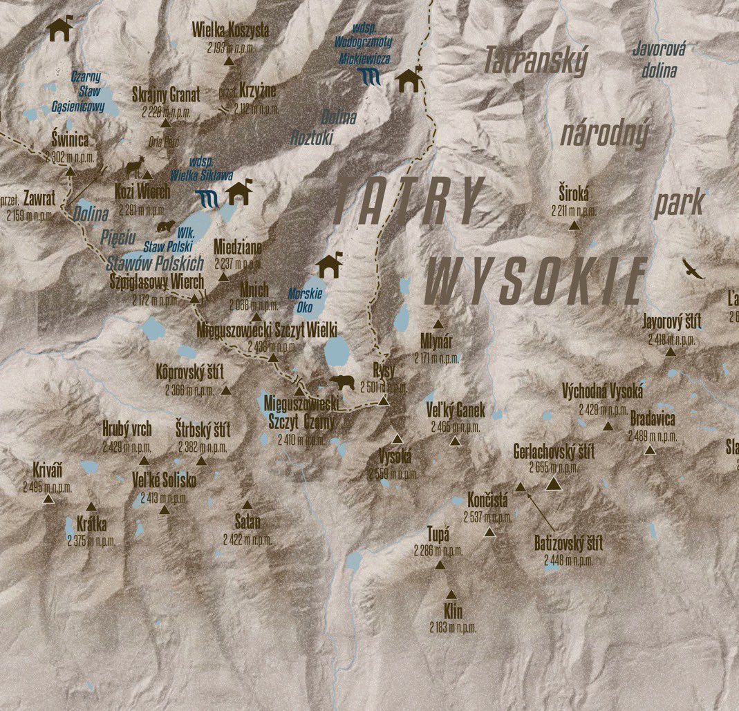
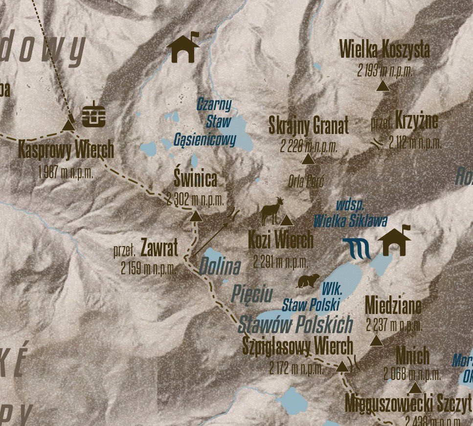
Tatra Mountains, highest range of the Central Carpathians, located on the border of Slovakia and Poland. #tatramountains #qgis #tatry

4
4
20
1,684
25 Jun 2025
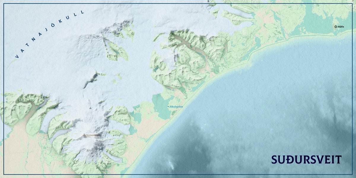
I made this map of Suðursveit (although I want to think of it as a postcard) based -roughly- on a tutorial by @pinakographos.
1
1
105
27 Feb 2025
Stuck on your next GIS project? I have been working for the last few weeks on a little side project: a creative GIS generator based on React that will help you break through any creative block and explore new ideas.
This is GIS Brief Generator! 📄
1
3
204
27 Feb 2025
Select your map type (you can choose between Topographic, Political, Choropleths, Dots, Physical or Transit), your map scope and click Generate.
That's it. That easy.
The tool will give you a brief and its deadline.
1
66
27 Feb 2025
On the following link you have the full code available in Github:
github.com/Serranowski/gis-b…
I hope it helps all GIS professionals going through a creative drought to find interesting ideas for their next projects.
Do not hesitate sharing your feedback and outcome!
71
30 Dec 2024
A map I made of the Pieniński Park Narodowy, which I wanted to publish before New Year's Eve, is now ready; so there you go.
1
5
251
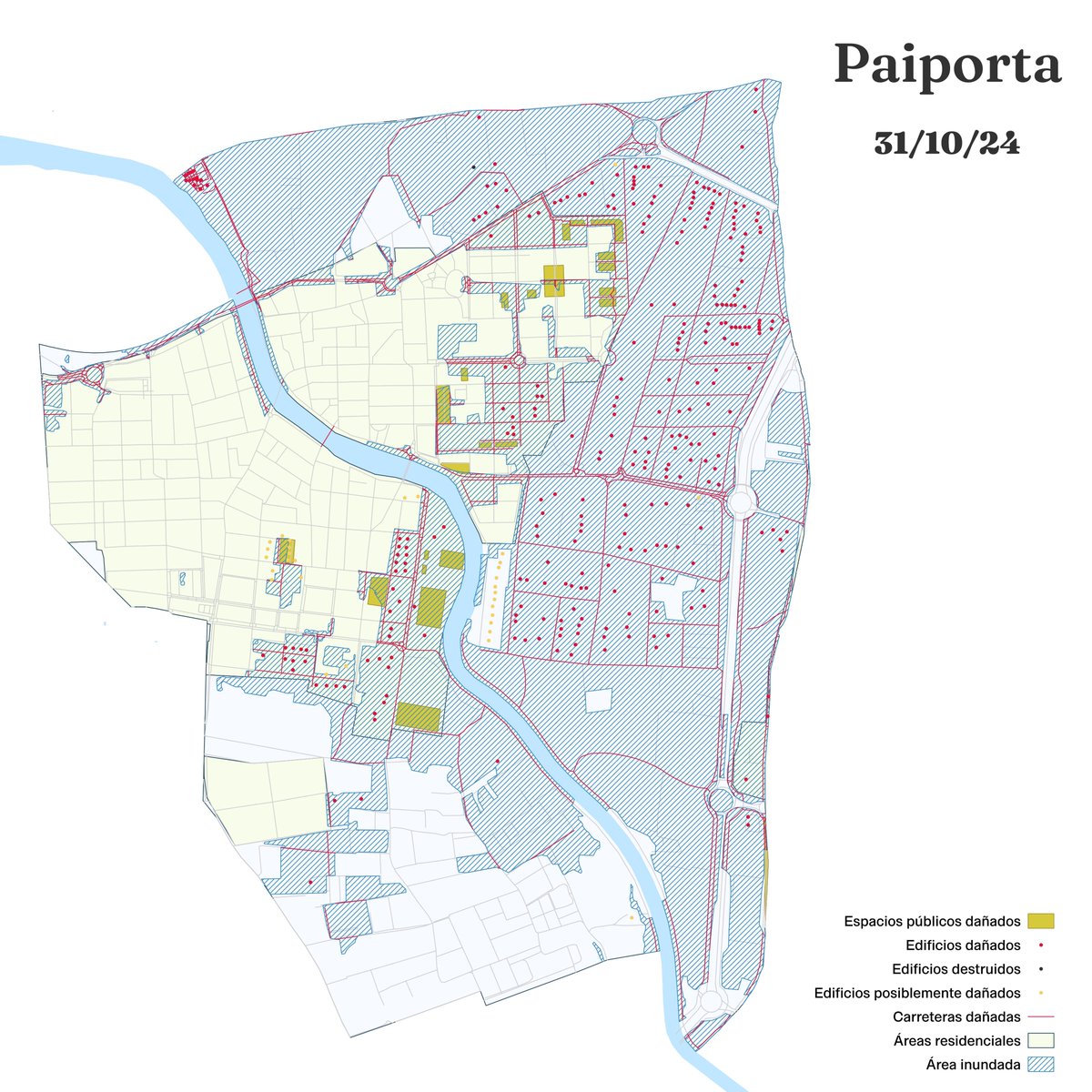
4 Nov 2024
Más de un 55% de la superficie de Paiporta se ha inundado.
Este es un mapa simplificado a partir de los datos de @CopernicusEMS que muestra edificios, carreteras y espacios públicos dañados por las inundaciones a 31 de octubre de 2024.
1
176
17 Oct 2024
La intro del disco de @salvardonana es un viaje maravilloso a un sitio donde uno es tela de feliz.
open.spotify.com/track/61VfO…
4
3
361
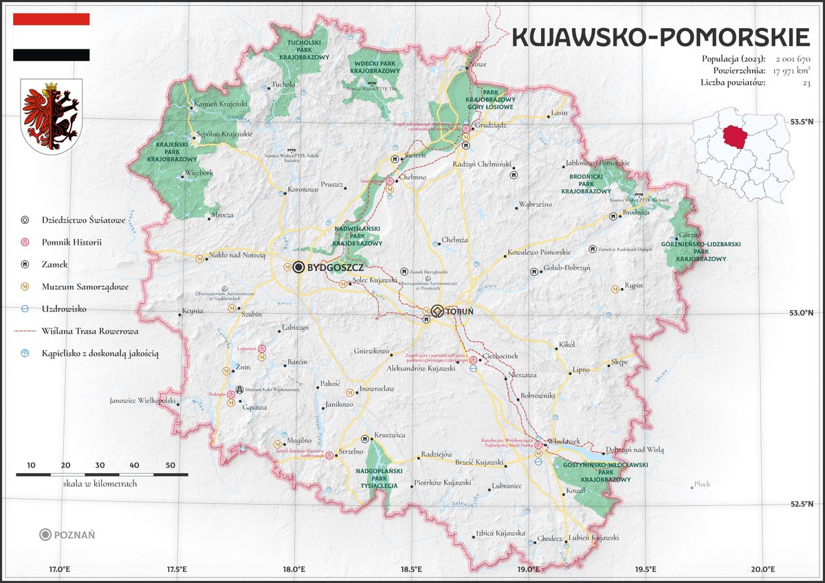
17 Oct 2024
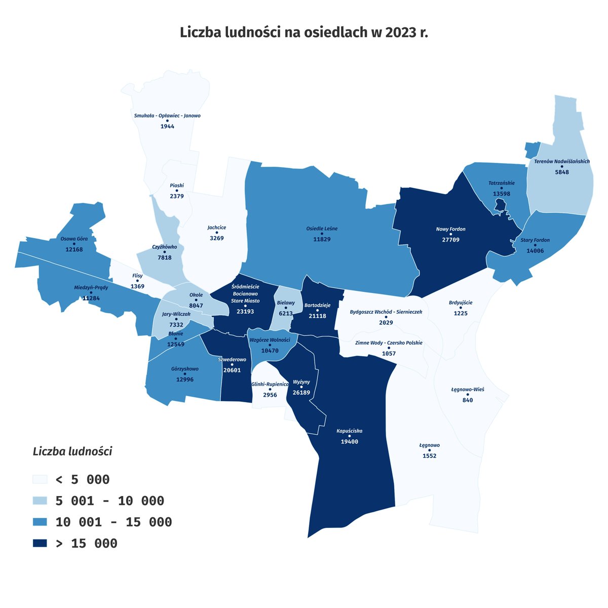
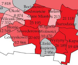
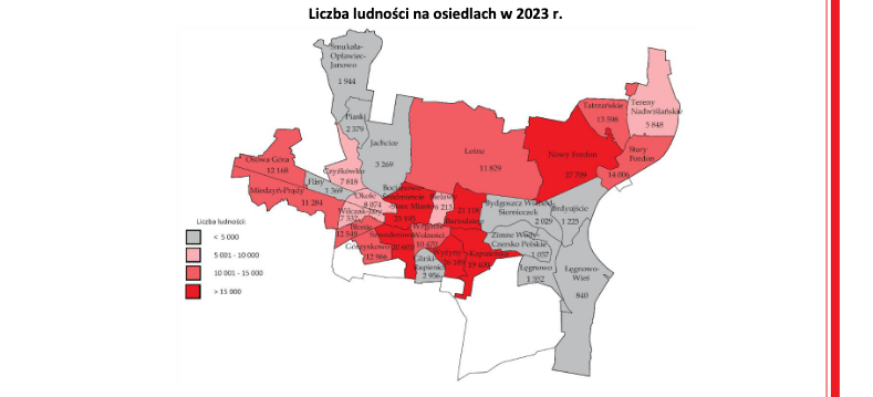
Happy to share my latest project: a map of Kujawsko-Pomorskie with a classic feel.
1
1
10
274
17 Oct 2024
It features, among others, the History Monuments listed by @NarIDpl; the best bathing areas, shared at Serwis Kąpieliskowy by @GIS_gov; and the most interesting castles, according to an article by @NatGeoMag Polska.
@LubieTuByc, I hope you like it! 🌞
1
92
11 Oct 2024
The entire morning cleaning and formatting the data from Serwis Kąpieliskowy (sk.gis.gov.pl) by @GIS_gov and creating a light, usable .geoJson for all the folk out there 😅
69