
Weaponizing Open Source in my spare time.
Joined December 2008
- Tweets 1,463
- Following 694
- Followers 1,865
- Likes 5,373
395 Photos and videos


Pinned Tweet

12 Dec 2025
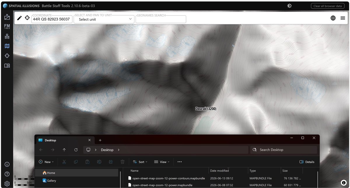
With Battle Staff Tools you can now produce proper maps with the correct scale and MGRS grids. Online now, and always available for offline use with a license if you want to handle classified information. #BattleStaffTools
1
2
18
3,445
With 20m equidistant contours at zoom 11, my global world map grew from 61 to 76Gb, we can manage that.
Sure, I can do 10m at zoom 12, but then we are talking 100Gb just for the contour lines.
Jun 12

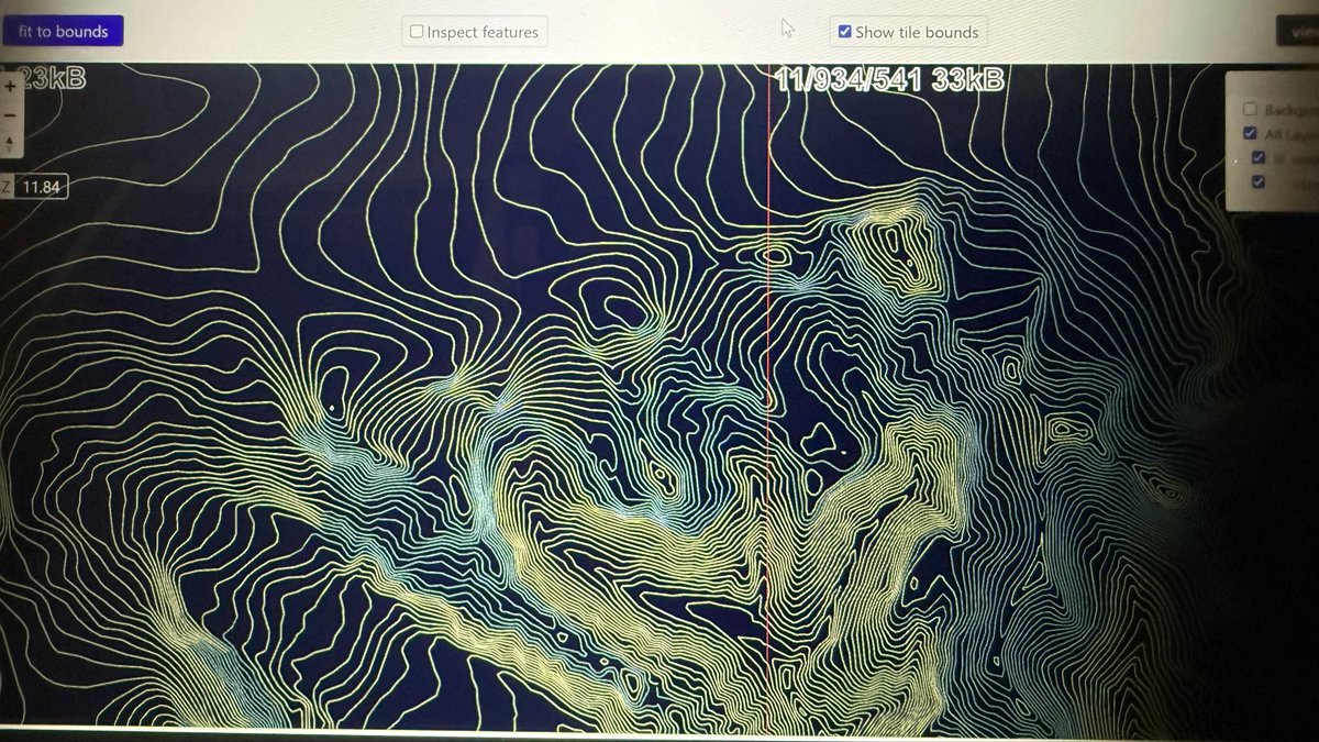
Unfortunately the file will be larger than I thought, but it sure looks good. 😊
1
10
970
So glad I put in the extra work to get blue lines over glaciers and otherwise brown lines.
2
258
Jun 12
Unfortunately the file will be larger than I thought, but it sure looks good. 😊
Jun 10
Working on contours using a modified version of the vectorvector application by @dgreen
Hacked to code to use @Mapterhorn as input and being able to separate ordinary contours from glacier, so that the output matches what @ArmyGeospatial uses in RBT.
1
20
10,979
Jun 10
Working on contours using a modified version of the vectorvector application by @dgreen
Hacked to code to use @Mapterhorn as input and being able to separate ordinary contours from glacier, so that the output matches what @ArmyGeospatial uses in RBT.
1
7
10,870
Jun 7
Universal Reference now have both dark and light mode. Really like the UI and might have to port over the colors and some elements to Battle Staff Tools.
1
222
Jun 6
There is a connection!
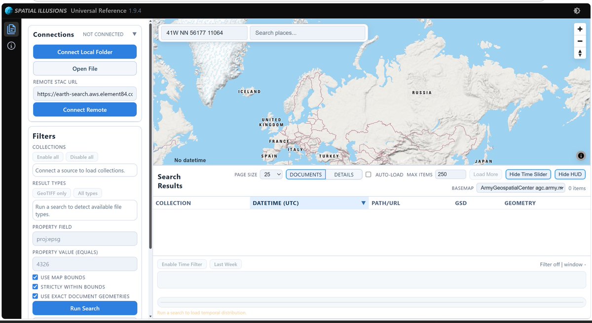
Universal Reference is a tool for discovering geodata and to process large amounts of documents, and then you can send the file to the map in Battle Staff Tools for further analysis and presentation.
Jun 6
Been working on a new thingie the last weeks. People might have encountered my “Universal Reference” before, and this is sort of the same but so much better, and it only requires a web browser.
(No internet connection required.)
1
9
1,416
Jun 6
And when I say large amounts of data, I’m talking 100 000 files. All done in browser without the need of any backend or installations. Indexing of documents is what I would call super fast 15 000 documents in about 5mins.
1
3
491
Jun 6
Once you have indexed a folder it will launch instantly the next time and do a simple diff of what documents that has been added, removed, or changed since the last time and update your index.
2
423
Jun 6
Been working on a new thingie the last weeks. People might have encountered my “Universal Reference” before, and this is sort of the same but so much better, and it only requires a web browser.
(No internet connection required.)
1
2
13
8,960
May 30
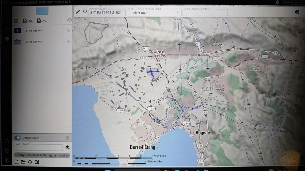
My conversion of the RBT style from @ArmyGeospatial to @protomaps was missing power infrastructure, but I managed to create my own planetiler profile that extracts the missing data and creates a more complete look.
Then we can create a single mapbundle file with all resources.
6
395
May 29
Does anyone know about a good resource about working with holding types in ORBATs? Trying to improve some visualizations.
#orbatboys
1
4
496
May 24
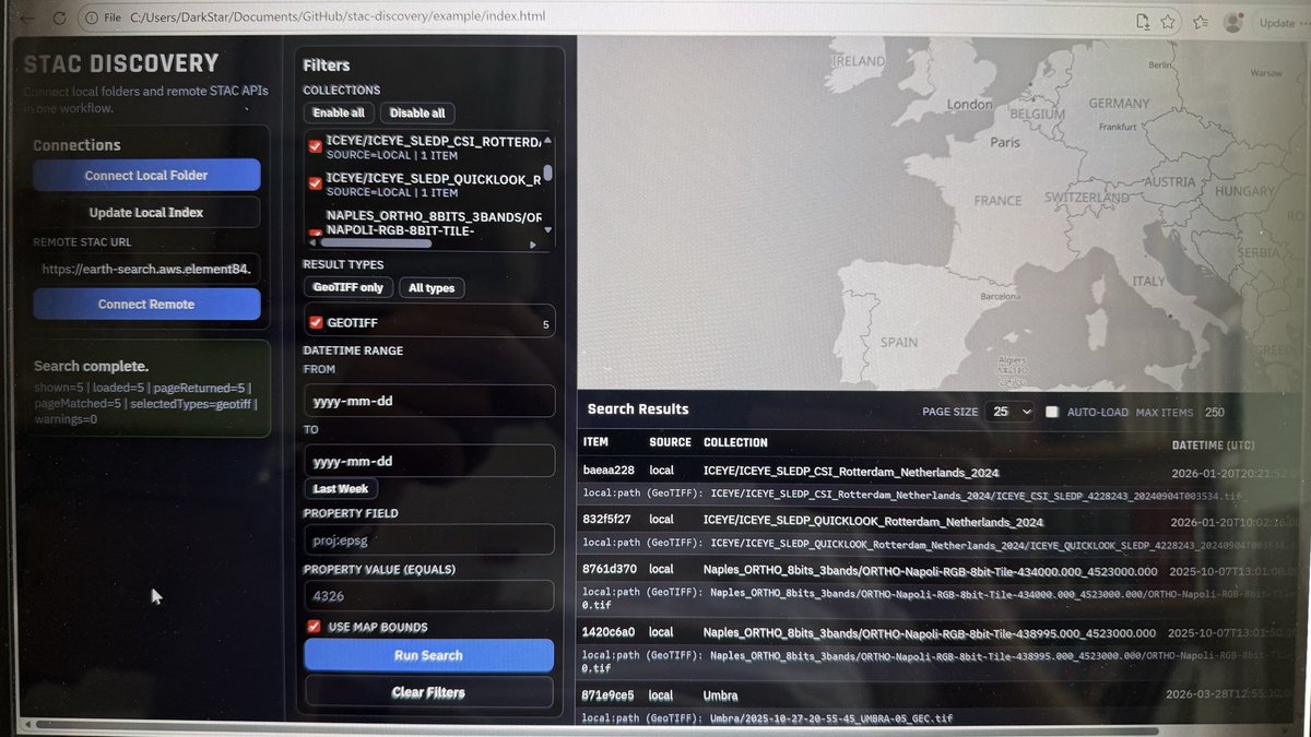
Next small thinge, lets you connect to a STAC @STACspec service to browse data, or directly create STAC compatible metadata for a local folder with data.
Still experimental, but the goal is to integrate into Battle Staff Tools.
1
4
754
May 21
Keeping an eye on space.
(Built a small thingie to try things out.)
1
2
11
1,306
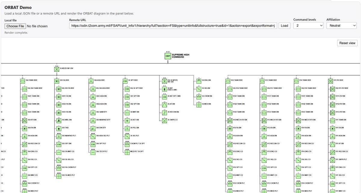
May 17
If you create a very, very, very large ORBAT in Battle Staff Tools you might run into that you can’t save it as PNG since it exceeds the maximum canvas size. I have now made a fix that scales it down to fit into 32767x32767 pixels.
2
16
827
May 17
In the future I might add PDF support so that you can download them for print in their full high resolution glory.
1
2
205
May 17
Spent the morning doing a change to my download script that packages the worldwide equipment guide. The very large json files are now also stored gzipped and that should make the loading slightly faster over slow network connections.
1
3
321
May 17
Out of tokens for the week so felt like a troglodyte sitting there typing it all out.
3
163
May 15
Well that was a very interesting meeting. To be continued.
May 14
Built a demo-thingie for a demo-thingie.
(Might add some functionality to Battle Staff Tools.)
6
485
May 15
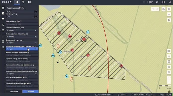
Does anyone know if Delta is using milsymbol?
I have heard rumors but nothing confirmed.
May 14

Delta is deeply interconnected now with the country's civilian digital infrastructure. It's all but an intrinsic part of it now.
It's something closer to a national battlefield mesh network than a traditional Western C2 system. This doesn't make it any less an achievement.

1
1
2
748
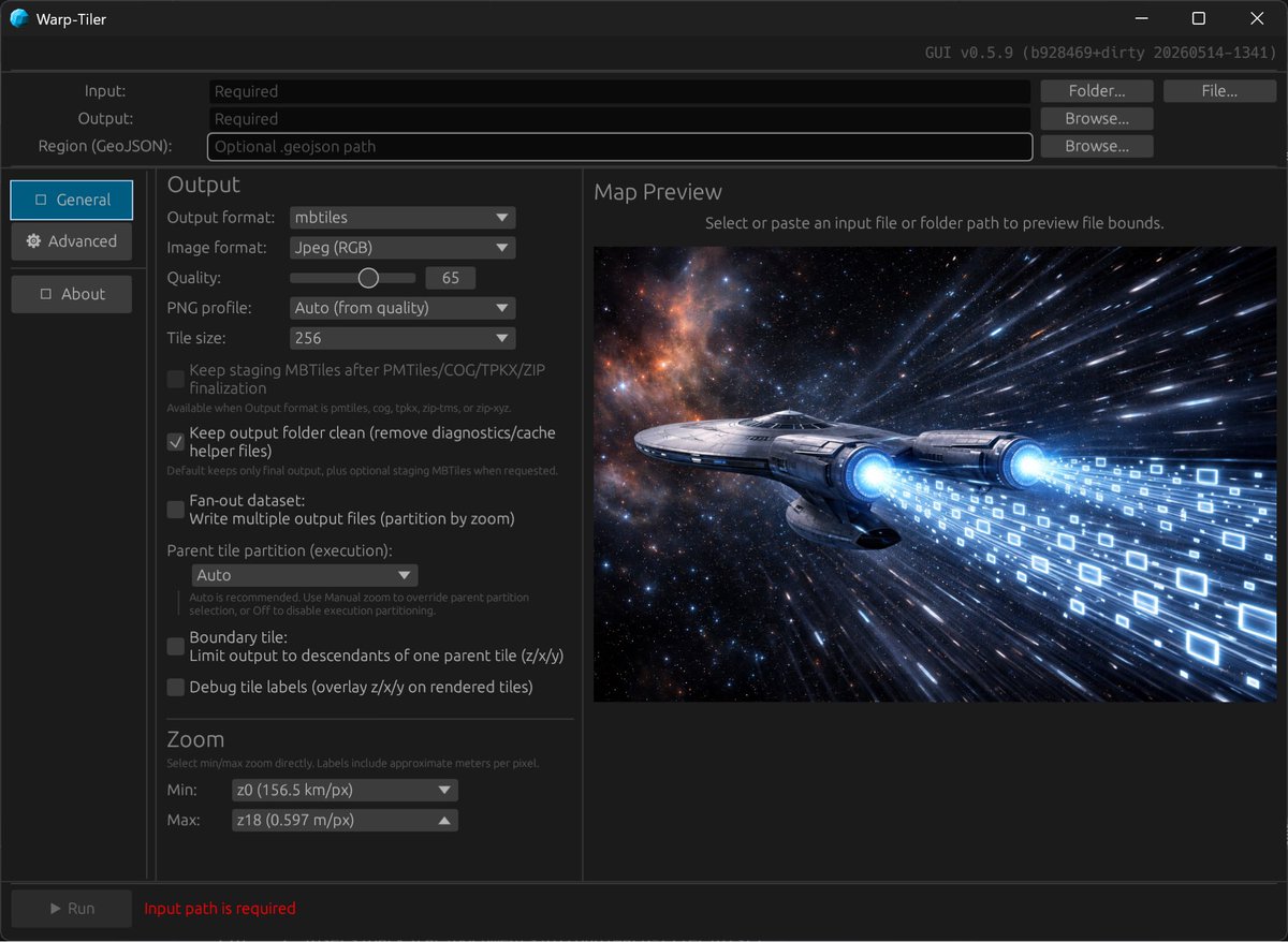
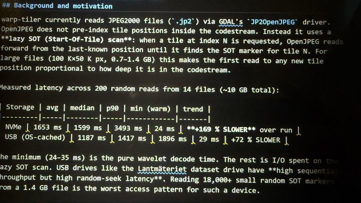
May 14
Built a new version of warp-tiler, the fastest way to convert your raster data into tiled formats. Polished the UI and included the latest JPEG2000 improvements that makes conversion at least five times faster.
6
511