
Official site of the Army Geospatial Center. Providing #USArmy timely, accurate, and relevant geospatial information and capabilities. (F/RT/L ≠ endorsement)
- Tweets 3,196
- Following 239
- Followers 1,635
- Likes 2,904


ALT An Amtrak schedule for northbound trains from Los Angeles. (Photo Credit: Amtrak)
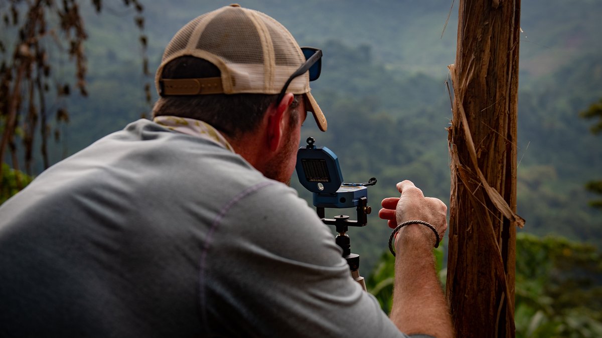
ALT A man takes a sighting with a compass in a hilly jungle area. (Photo Credit: Staff Sgt. Cole Yardley, Defense POW/MIA Accounting Agency; modified by the Army Geospatial Center)
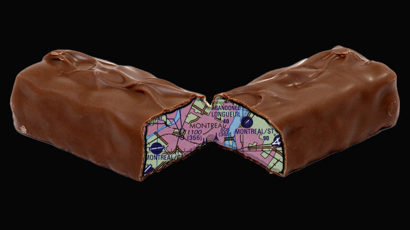
ALT A chocolate candy bar split in the middle, with a map as the filling. (Photo Credit: PIXY#ORG; U.S. Defense Mapping Agency Aerospace Center Tactical Pilotage Chart from the Perry-Castañeda Library (PCL) Map Collection; and composite by the Army Geospatial Center)
ALT A view from the rear of woman with a white knit knit cap holding a compass with mountains before her. (Photo Credit: Ali Kazal on Unsplash)
ALT Photograph of a Marine lying on a map on the ground, while pointing to another map. Another Marine kneels and looks on. (Photo Credit: Cpl. Grant Schirmer, 1st Marine Division; modified by the Army Geospatial Center)
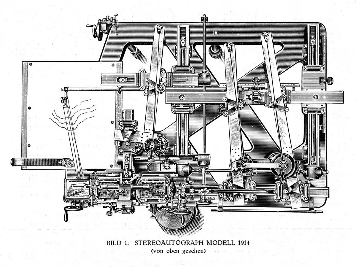
ALT A complex drawing of a Stereoautograph machine for generating contours in the early 1900s. It is roughly square with many mechanical parts. (Photo credit: Zeiss Archives)
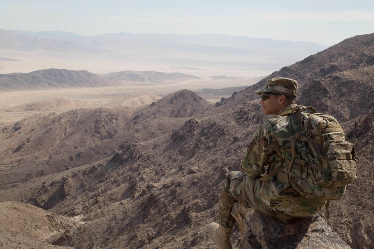
ALT A Soldier in camouflage wearing a backpack and sunglasses sites on a rock in the mountains overlooking the desert floor. (Photo Credit: Staff Sgt. Douglas Lovely, 356th Broadcast Operations Detachment, U.S. Army)
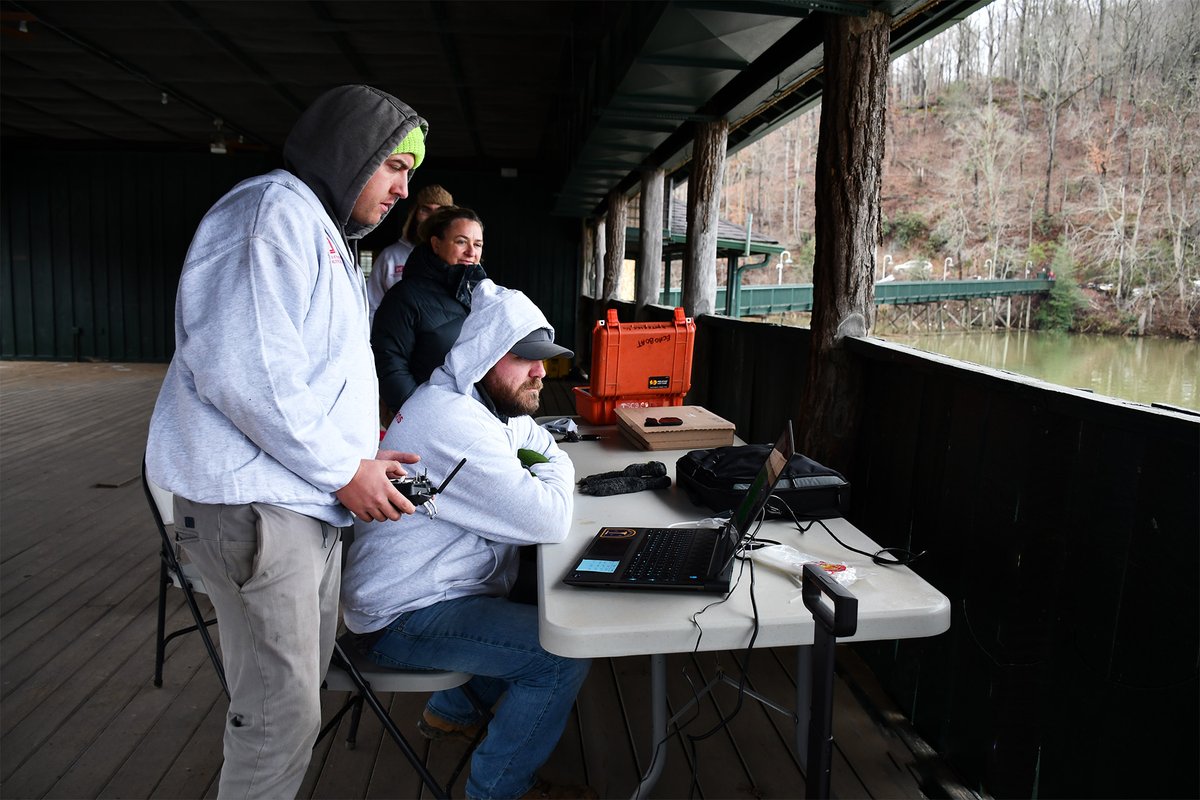
ALT Two men in sweatshirts and a woman work at a table with a computer and other technical equipment, while looking out onto a lake. (Photo Credit: Nayelli Guerrero, U.S. Army Corps of Engineers, Wilmington District; modified by the Army Geospatial Center)
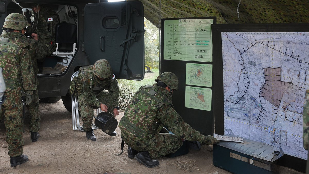
ALT U.S. Soldiers and Japan Ground Self-Defense Force soldiers construct a joint tactical operations center and put up maps and charts. (Photo Credit:Sgt. Austan Owen 5th Mobile Public Affairs Detachment; modified by the Army Geospatial Center)
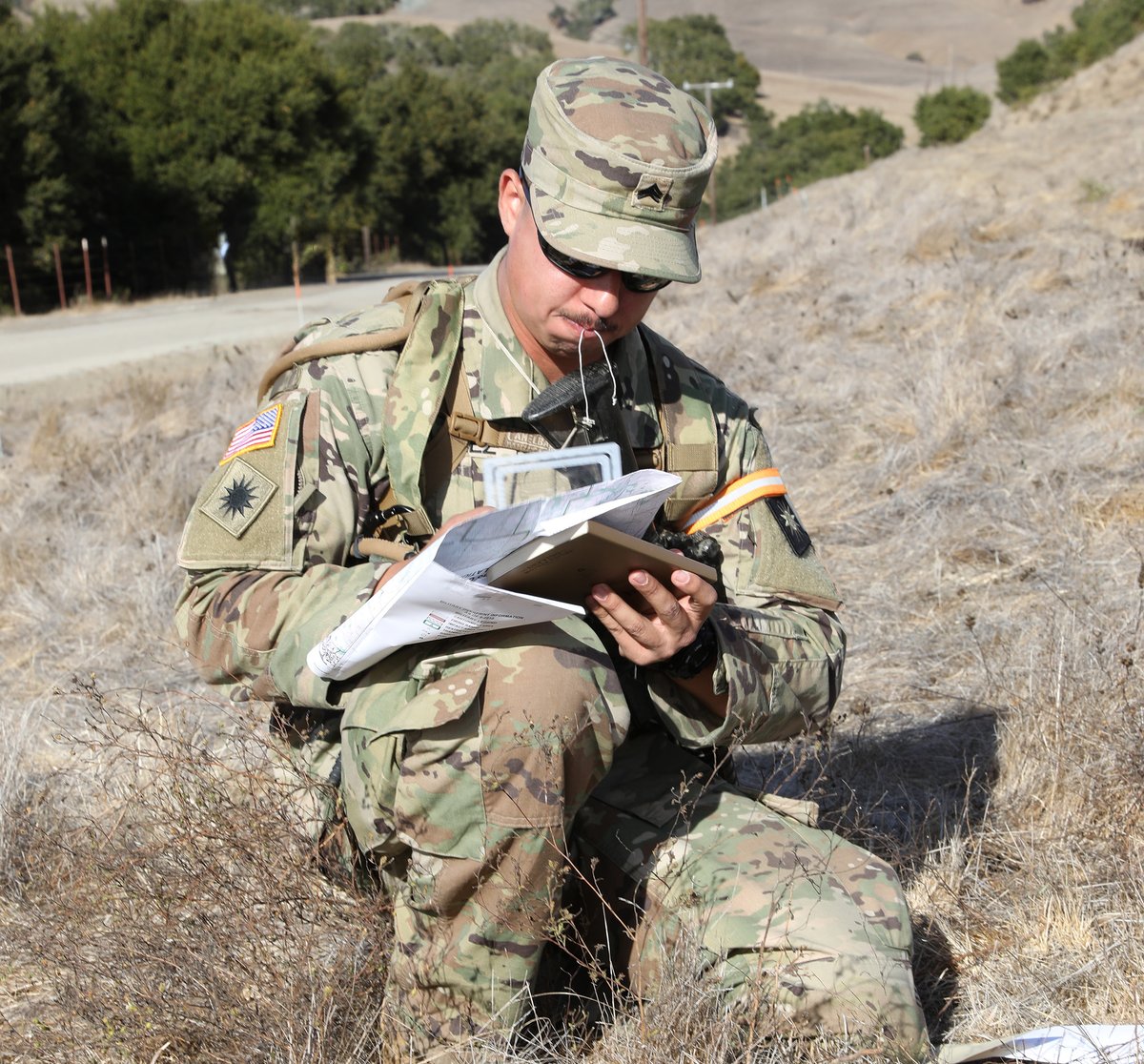
ALT A photo of a kneeling Soldier holding a map and a protractor. (Photo Credit: Spc. Elizabeth Buck, 69th Public Affairs Detachment, U.S. Army National Guard; modified by the Army Geospatial Center)
ALT In the top frame, there are two red buttons. One says "Create metadata" and the other says "Let user guess what's in dataset." In the bottom frame is the head of a man sweating profusely about making the choice.
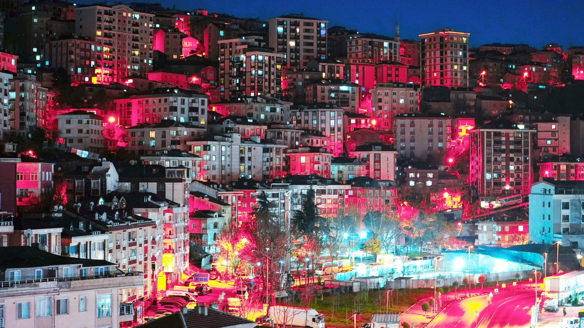
ALT A night image of an urban area showing tightly clustered buildings on a hill. (Photo Credit: selcuk s on Unsplash; modified by the Army Geospatial Center.)
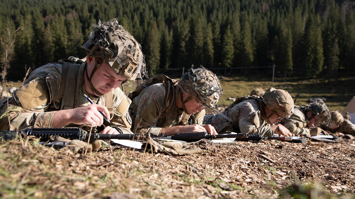
ALT A photograph of four Soldiers lying on the ground and plotting coordinates on a map. (Photo Credit: Pfc. Daely Goodwin, U.S. Army Southern European Task Force, Africa)
ALT A green landscape representing climate covered with symbols, graphs, and a clock. (Photo Credit: Adobe Firefly, modified by the Army Geospatial Center)
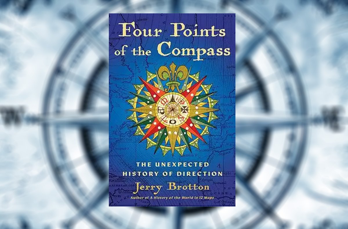
ALT The cover of the book "Four Points of the Compass: The Unexpected History of Direction" which shows a colorful compass rose over a blue map. (Photo Credit: Amazon and Wallpaper Delight)

ALT Soldiers recover a vehicle trapped in the muddy water. (Photo Credit: U.S. Army)

ALT A Marine writes in a notebook on top of a chart that is on a desk. (Photo Credit: Lance Cpl. Christian Salazar, U.S. Marine Corps Forces, Europe and Africa)

ALT The logos of the Department of Homeland Security, the U.S. Customs and Border Protection, and the Army Geospatial Center displayed over an aerial image. (Photo Credit: Wikipedia, Department of Homeland Security, and the Army Geospatial Center)
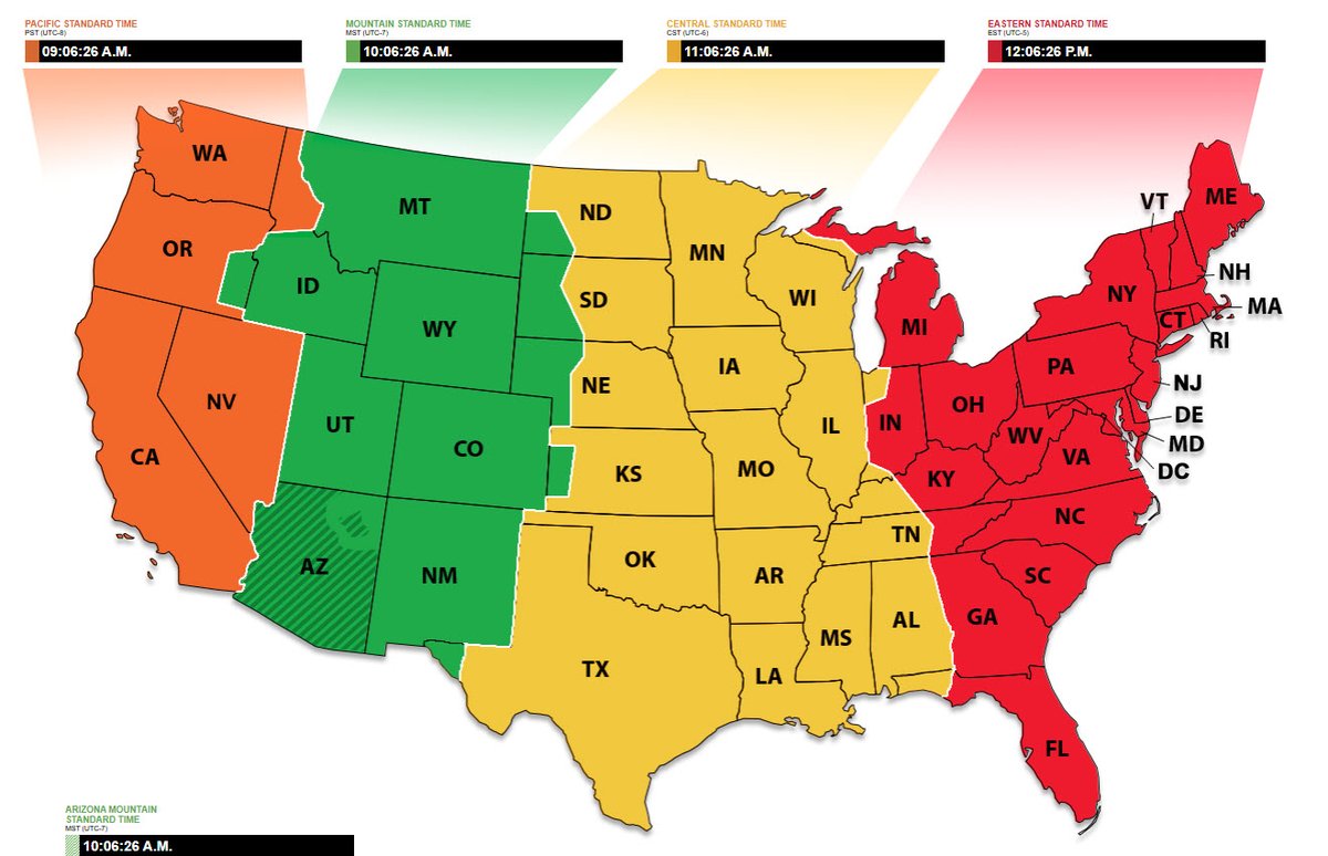
ALT A National Institute of Standards and Technology map of the current time in time zones across the United States. (Photo Credit: National Institute of Standards and Technology)