
Joined June 2020
- Tweets 79
- Following 110
- Followers 668
- Likes 407
39 Photos and videos


12 Mar 2023
Blender geometry nodes - 25.000 flight routes from a single csv-file into airport positions and simulated aircrafts along the routes.
Source data: openflights.org
#blender3d #blendergis #cartoblend #b3d #openflights
7
67
491
51,939
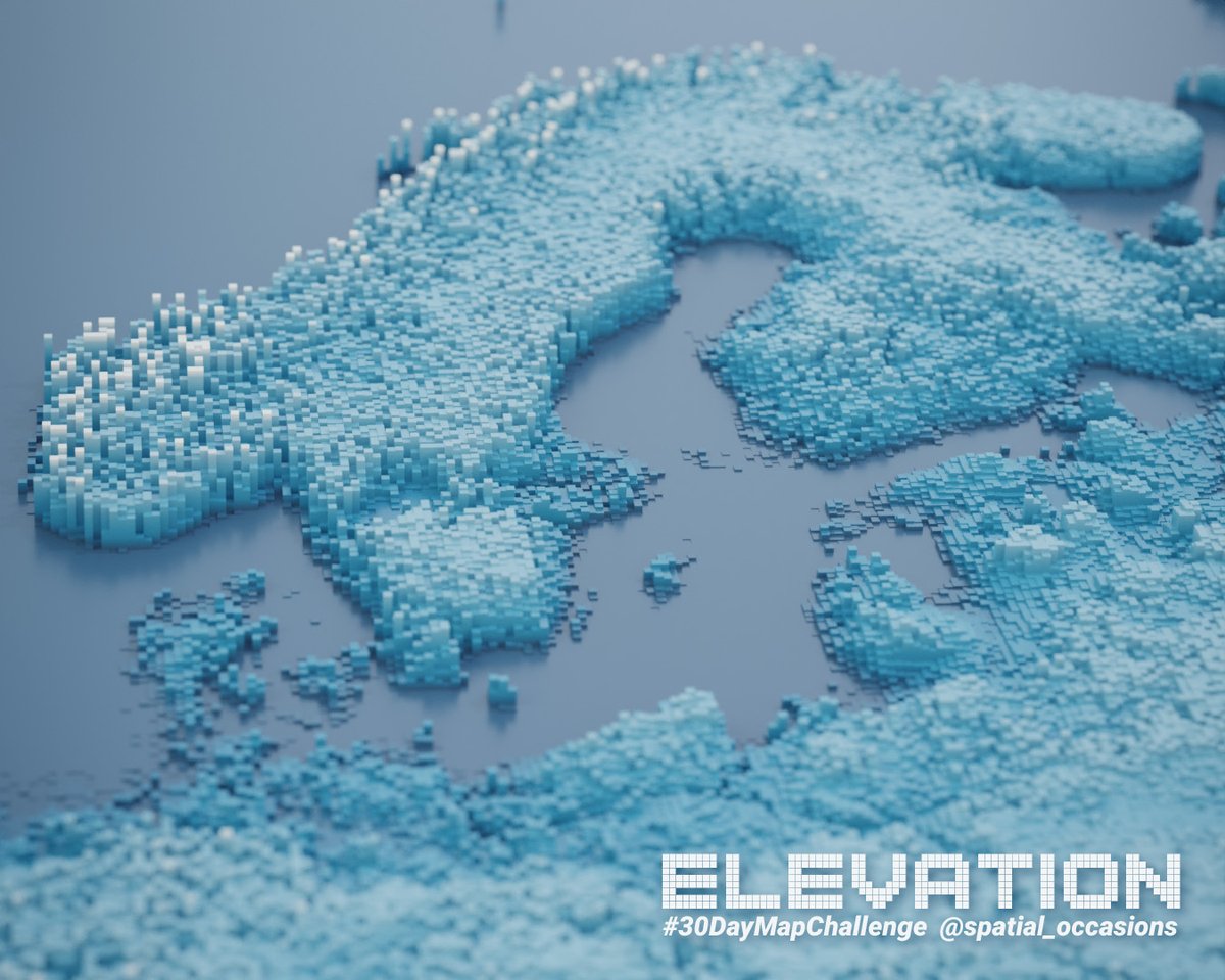
30 Jan 2022
Playing with elevation and geometry nodes inspired by a @Ducky3d tutorial.
#b3d #cartoblend #blendergis
2
40
22 Dec 2021
A wonderful list of geospatial 3D-artists that have inspired me a lot. But mind-blowing that my occasional free time fiddling is mentioned amongst these giants. Let's continue to create, inspire and develop!
22 Dec 2021

3D maps can look complex & difficult to make…
Here are 12 humans who proved to me that 3D is not out of reach:
Different tools, many styles... all fantastic: 1/14🧵 #dataviz #3dmaps #gis
1
5
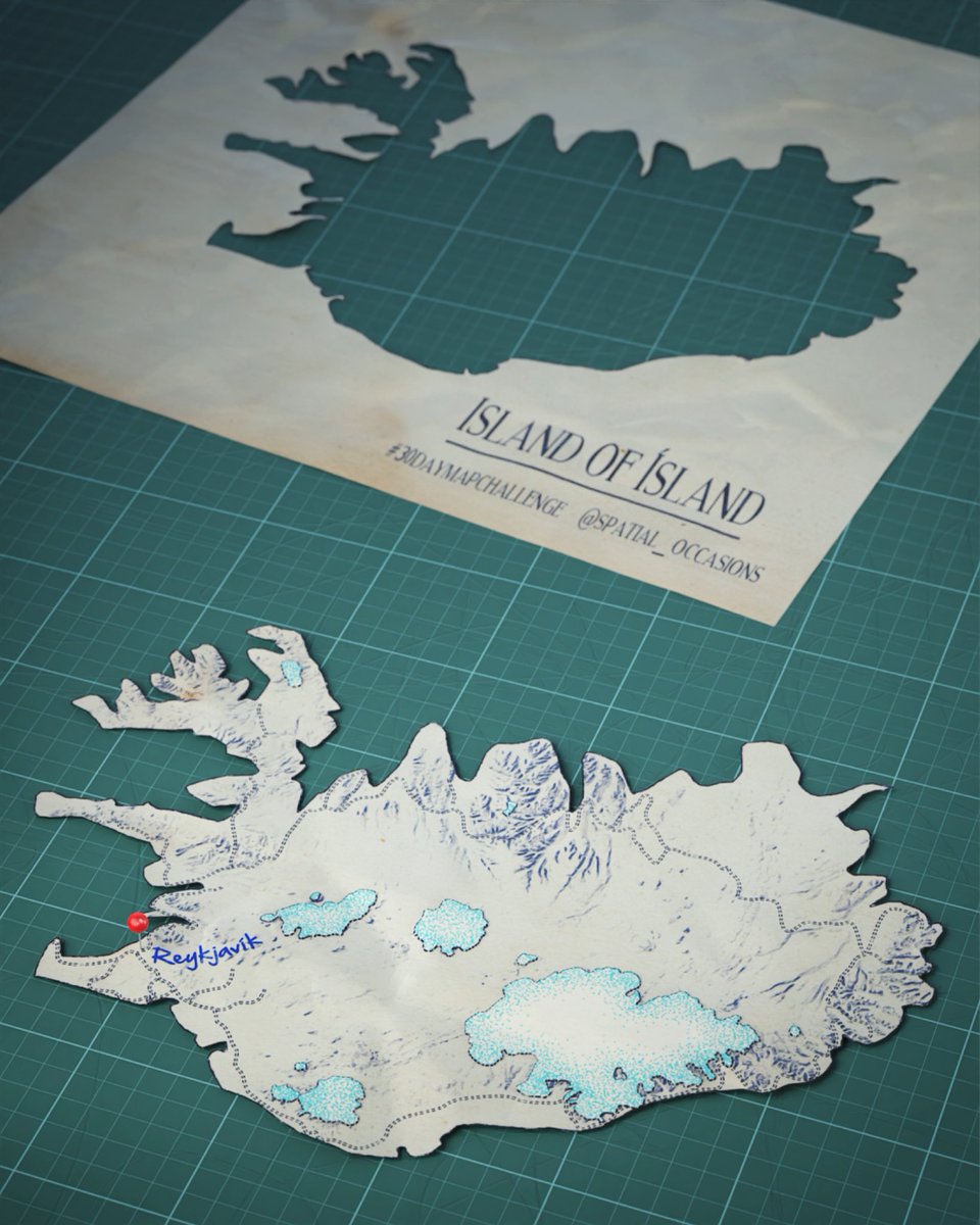
19 Nov 2021
#30DayMapChallenge Day 19: Island of ísland.
Blender render based on NaturalEarth data. #Blender3D #b3d
3
36
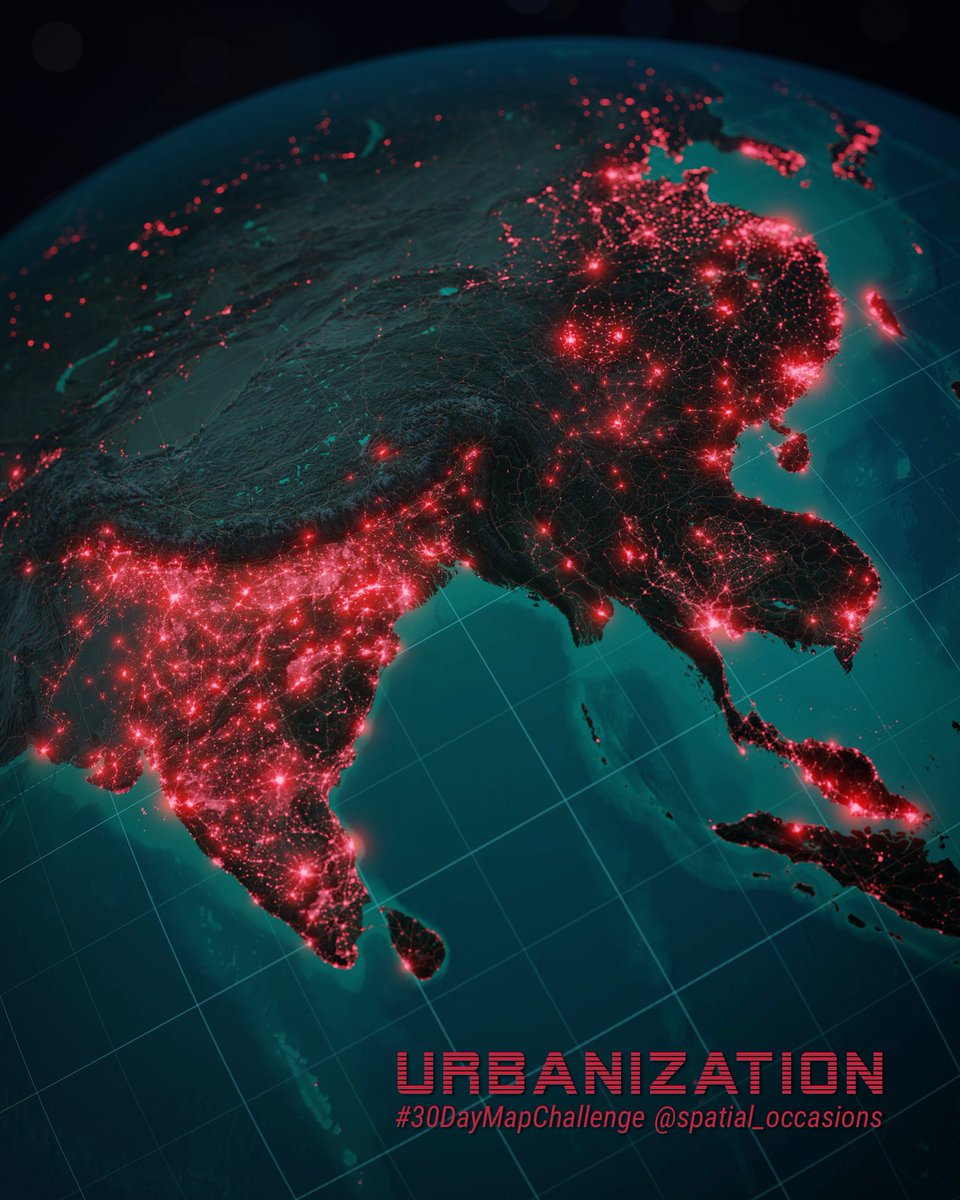
16 Nov 2021
#30DayMapChallenge Day 12: Urban/Rural.
Blender render with nightlight data from NASA Black Marble. #Blender3D #b3d
1
11
109
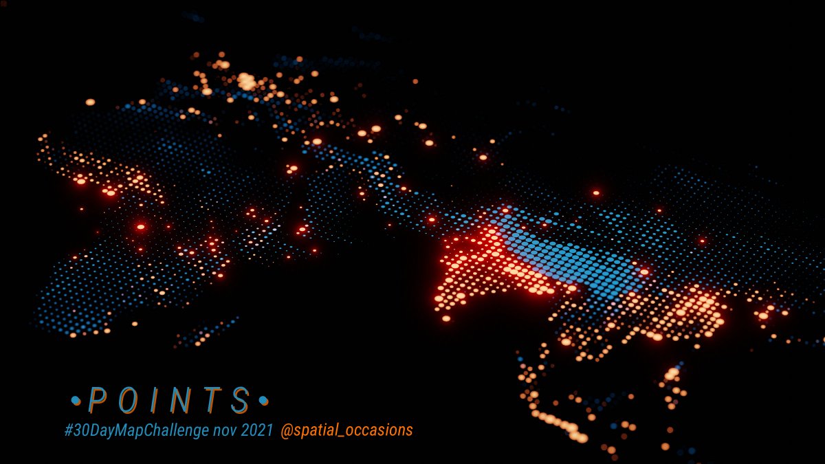
1 Nov 2021
#30DayMapChallenge Day 01 Points.
Playing with geometry nodes in Blender - elevation in blue, population in red. #b3d #blender3D
2
17
189
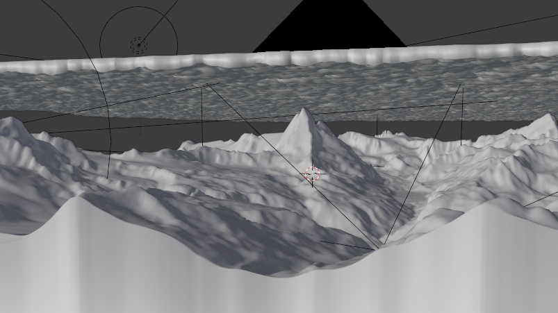
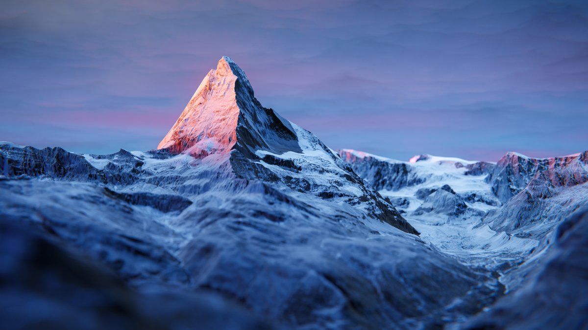
13 Mar 2021
Finally got the time to play with the new free high-res elevation and imagery data from @swisstopo. Wonderful resource to recreate some iconic views in Blender. #blender3d #b3d #matterhorn #swisstopo #cartoblend
5
18
163
spatial_occasions retweeted

19 Jan 2021
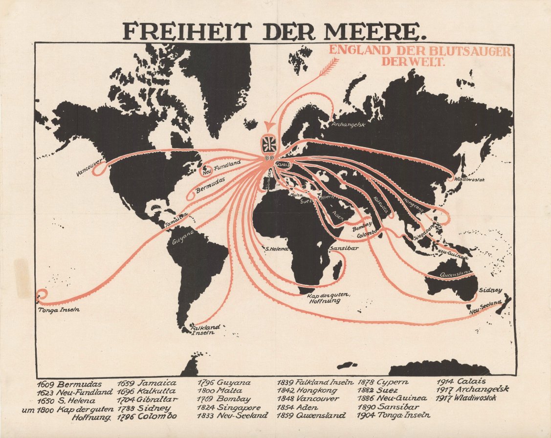
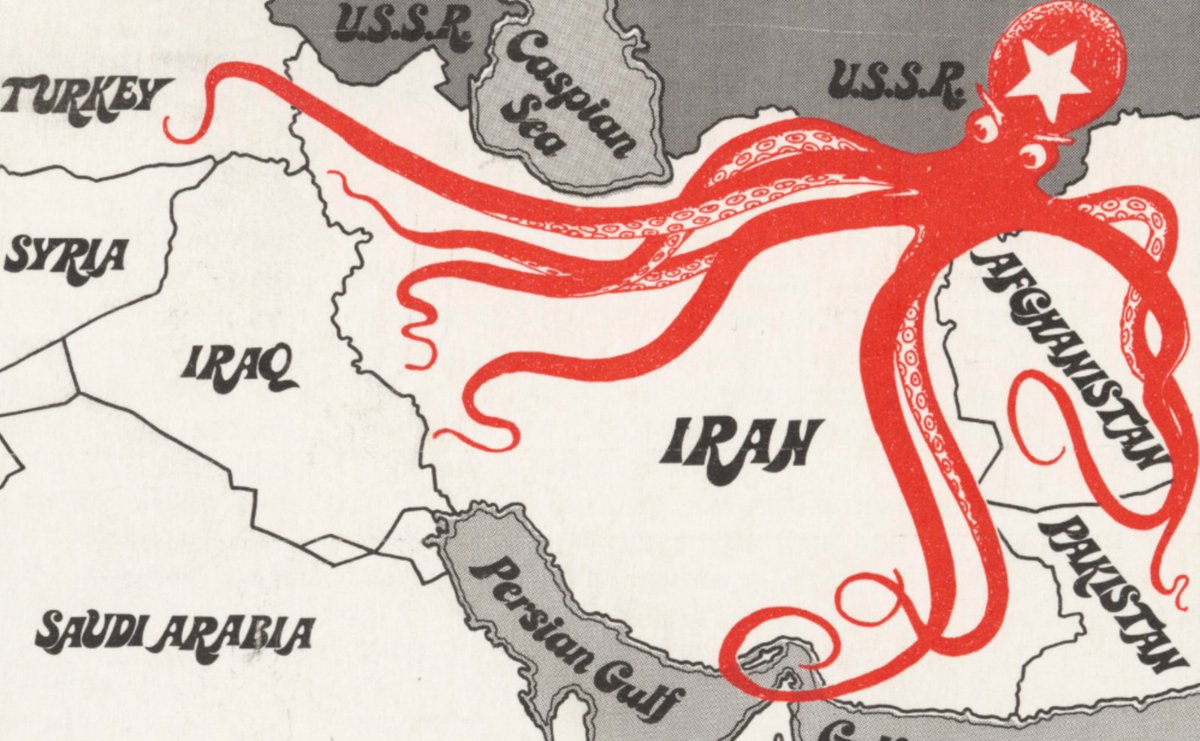
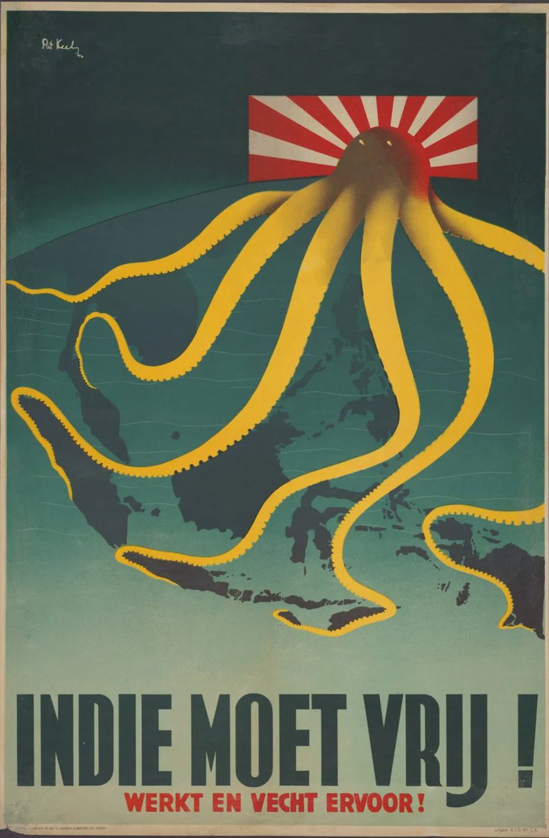
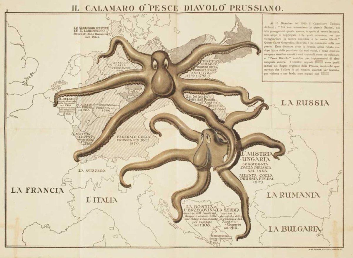
There was a time when Western cartographers loved portraying their enemy States as octopus. #maps #cartography #propaganda
6
40
254
spatial_occasions retweeted

19 Jan 2021
Marie Tharp was the right *woman* in the right place at the right time to make the most beautiful, detailed maps of the world's ocean floors. Her story on @ScienceNews by @betsymason bit.ly/2XUurMv #science #Geology #maps #cartography #WomeninScience #platetectonics
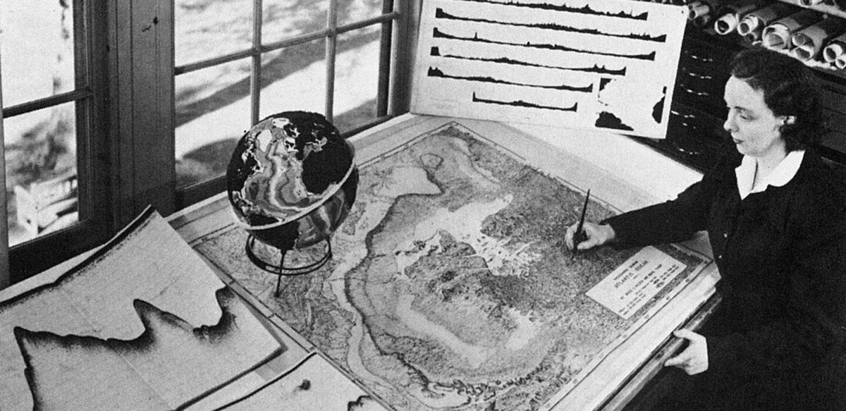
14
38
spatial_occasions retweeted

3 Jan 2021
Great news! The French national mapping agency @IGNFrance made its core geographic datasets free on January 1st 2021!! (topographic data, orthophotos, DEM). #opendata - numerama.com/tech/679565-ca-…
3
45
105
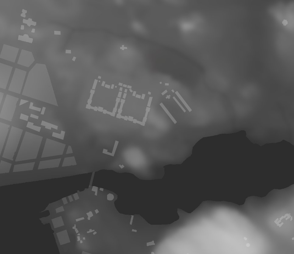
2 Jan 2021
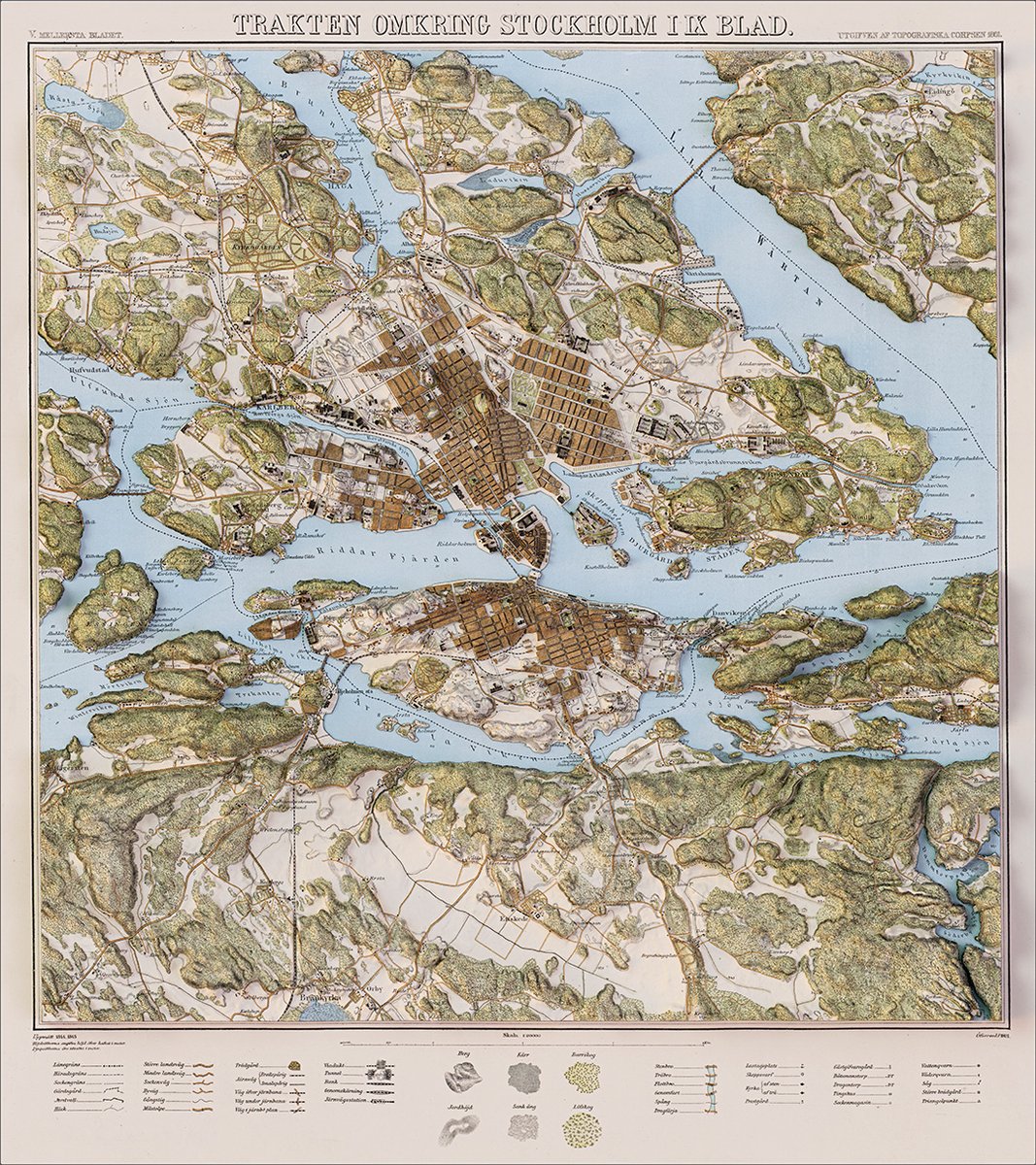
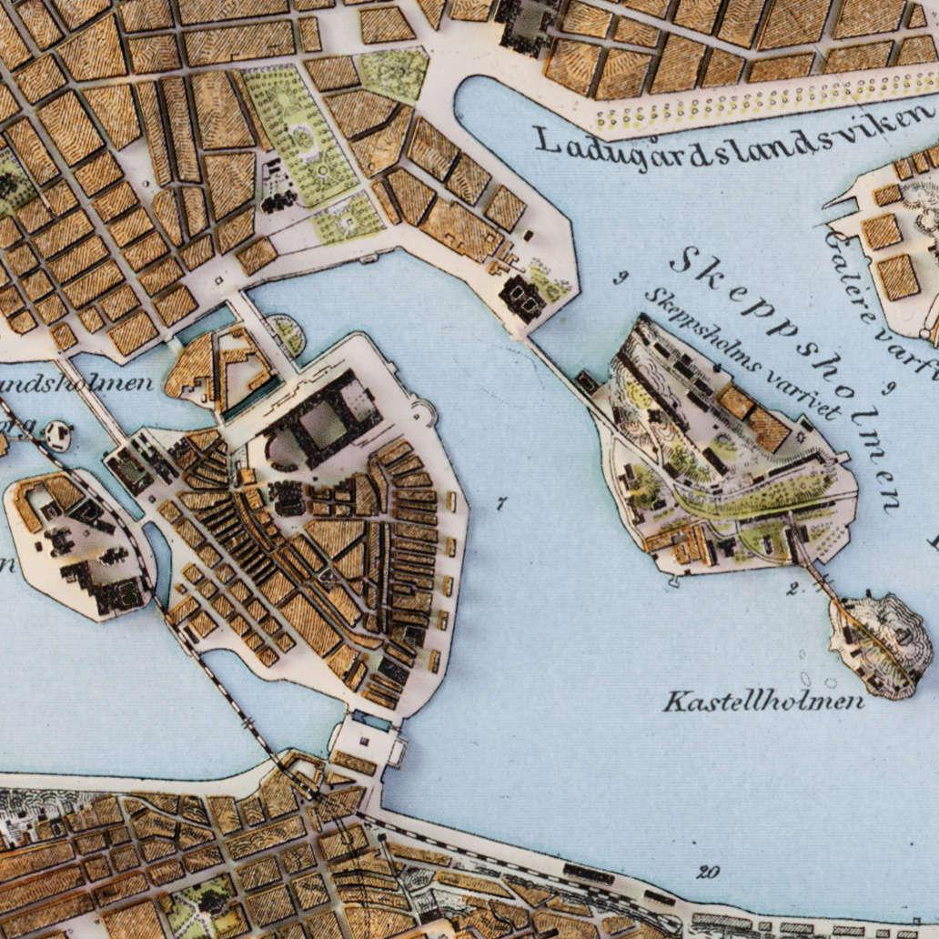
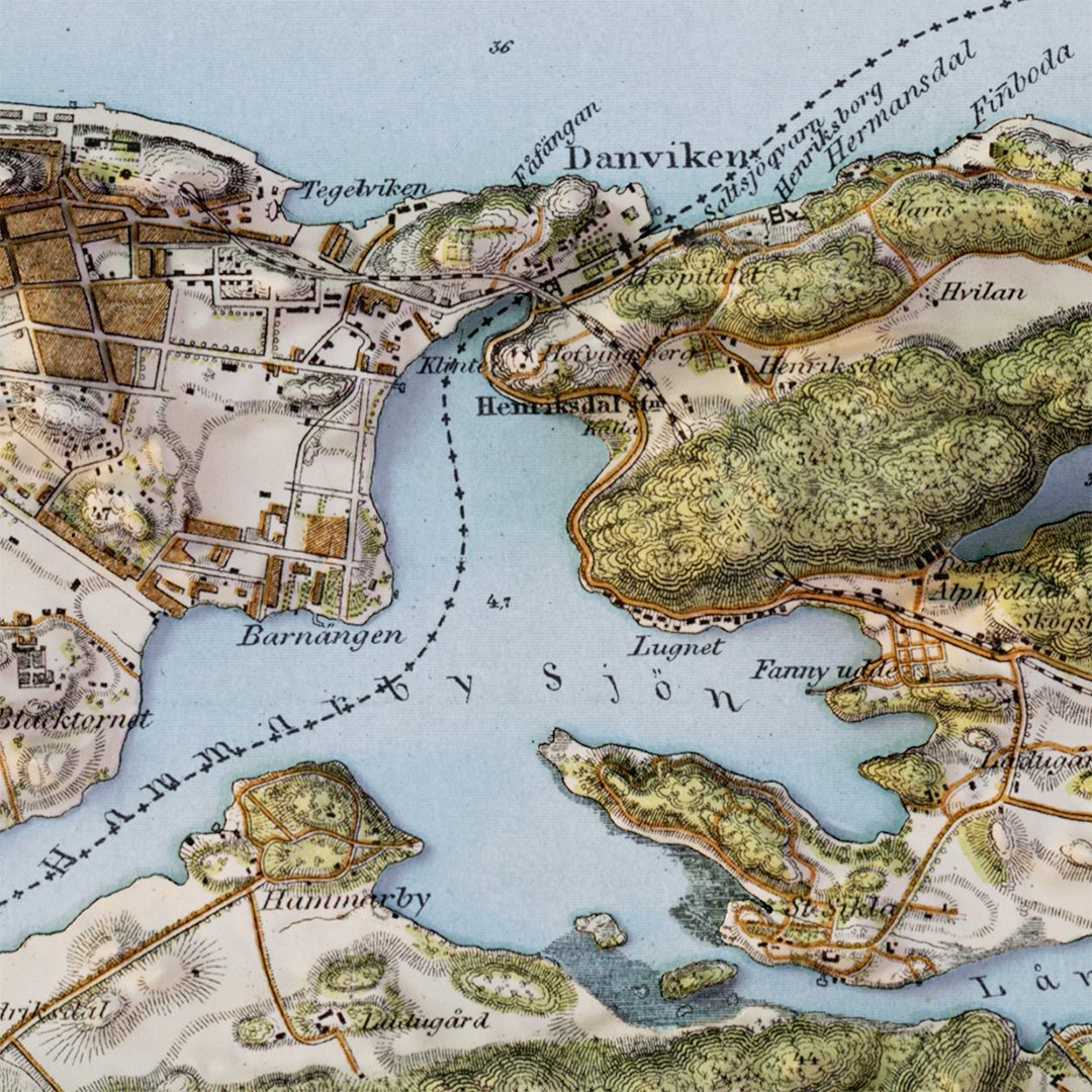
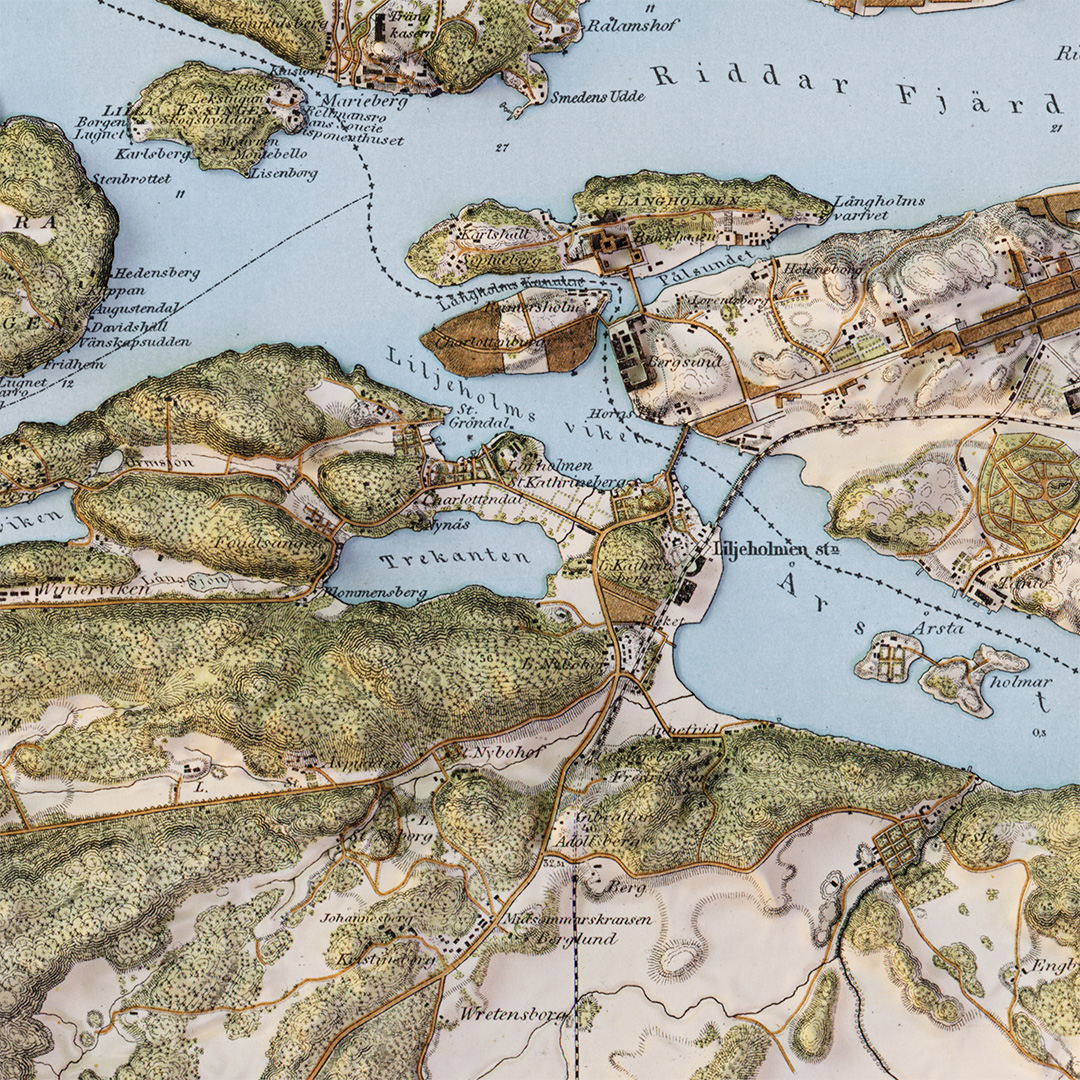
A bit late to the "elevated vintage map"-party, but here is my finished version of this lovely 1845 (rev. 1891) 20k map of Stockholm.
(Map sheet available as public domain: sv.wikipedia.org/wiki/Trakte…)
#blendergis #stockholm #b3d
3
25
2 Jan 2021
I had a low-res DEM as base but the geometric accuracy of the map, especially across water, was pretty low so there is a *lot* of manual adjustments of elevation (dodge/burn/smudge) as well as water masks, old bridges, building cut-outs etc...

spatial_occasions retweeted

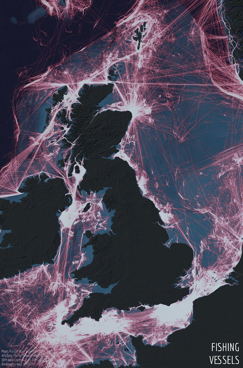
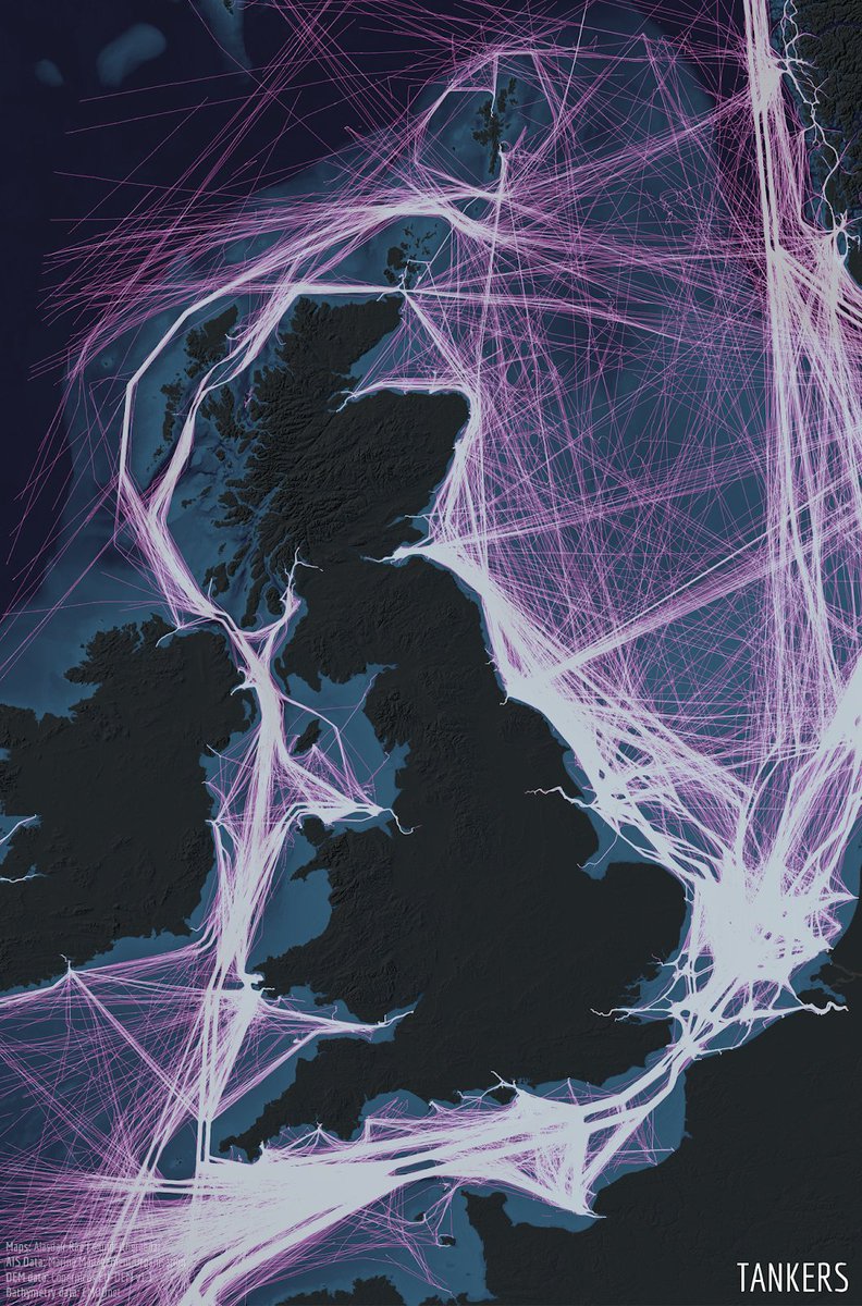
21 Dec 2020
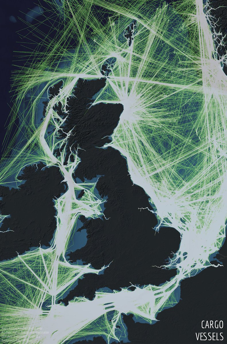
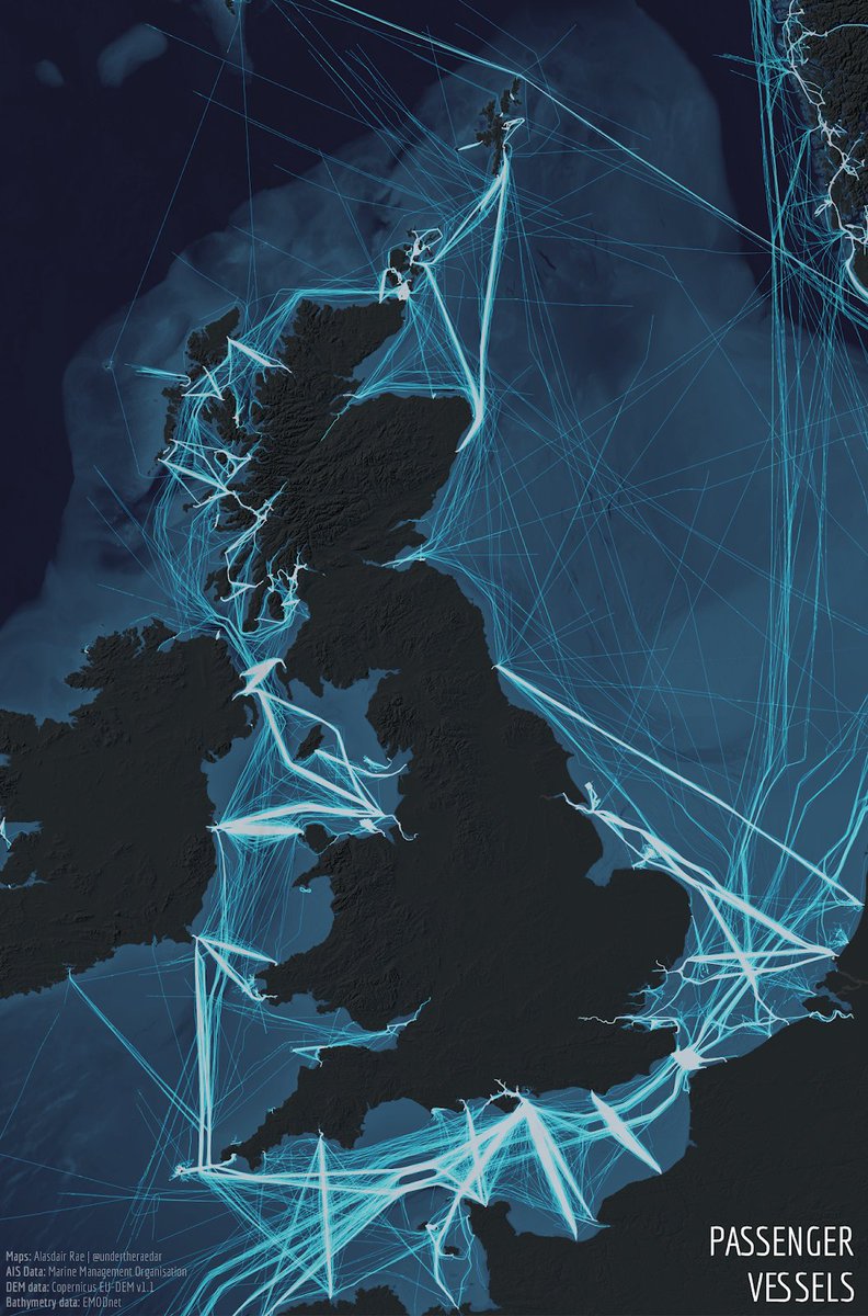
Dredging up old content, fishing for likes, or merely a vessel of communication for where the cargo goes? Some maps of UK marine traffic from 2015 AIS data. Seems as relevant as ever.
statsmapsnpix.com/2018/08/wa…
9
18
109
spatial_occasions retweeted

22 Dec 2020
The process and command-line programmes are described on textureshading.com by Leland Brown


2
11
21 Dec 2020
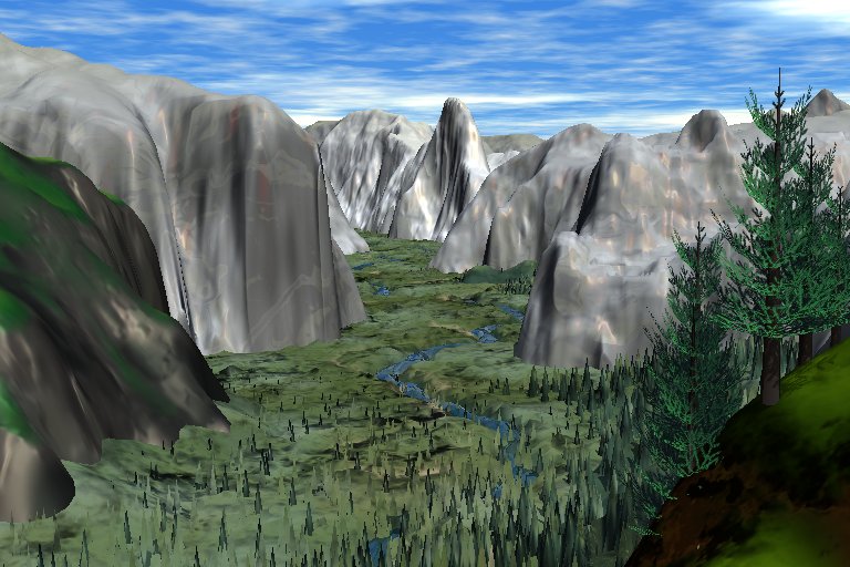
Speaking of Bryce – anyone else played with Bryce3D back in the days? I found some old renders with Bryce v5 from 2001 after my visit to Yosemite! I remember being amazed that I could re-create real world terrains from DEMs. Almost 20 years ago... #timeflies
4
21 Dec 2020
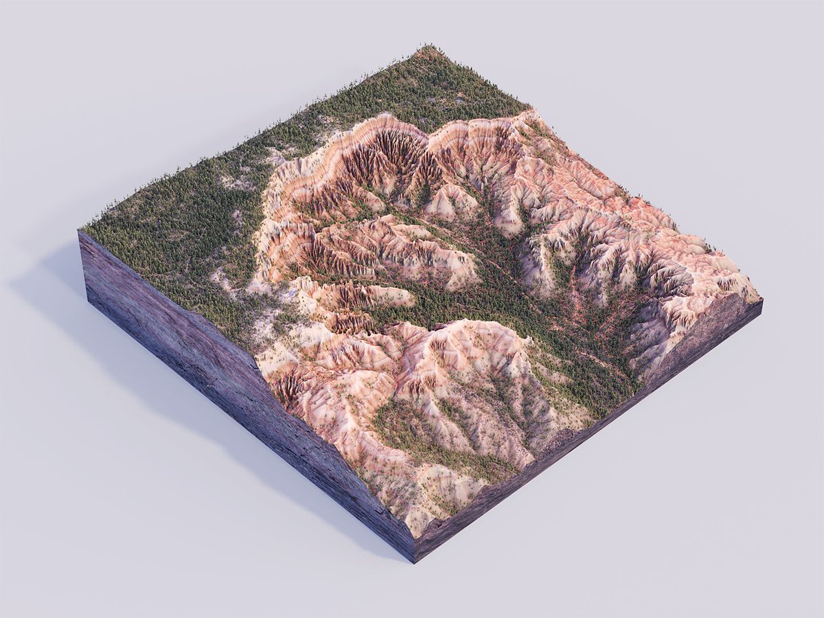
One last render from Bryce Canyon before moving on to something else. Great fun to develop one simple DEM with some tools and techniques from both GIS and the more creative softwares. #b3d #blendergis
2
1
46
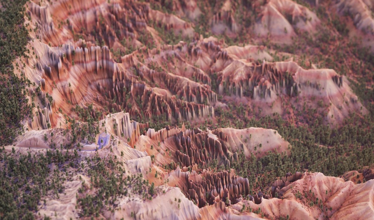
20 Dec 2020
Just couldn’t let go of the @mtnmapper Bryce Canyon DEM - such a fantastic landscape! So I had to throw in some tree modelling, volumetric lighting, particle systems and whatnot, to try to do it justice. #b3d
1
1
43
30 Nov 2020
OK, last day of #30DayMapChallenge - a map. A quick and dirty concept that will be developed further in another project.
Thank you all contributors to this years challenge, it will take a while to sort out all the new ideas and tools that have been used. Stay mappy, friends!
8