
PhD candidate in Meteorology | Scientist | Meteorologist | Lover of supercells and tornadoes | Lake Zurich, IL ➡️ Norman, OK | Opinions are my own
Joined July 2012
- Tweets 2,176
- Following 595
- Followers 1,460
- Likes 14,539
723 Photos and videos


Jun 12
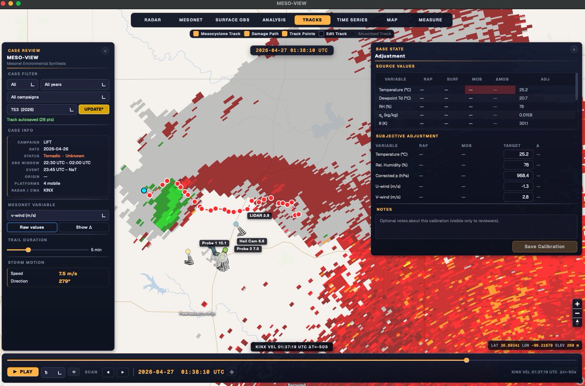
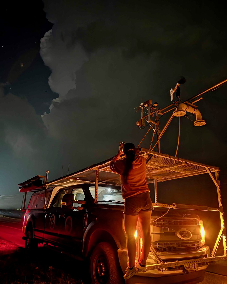
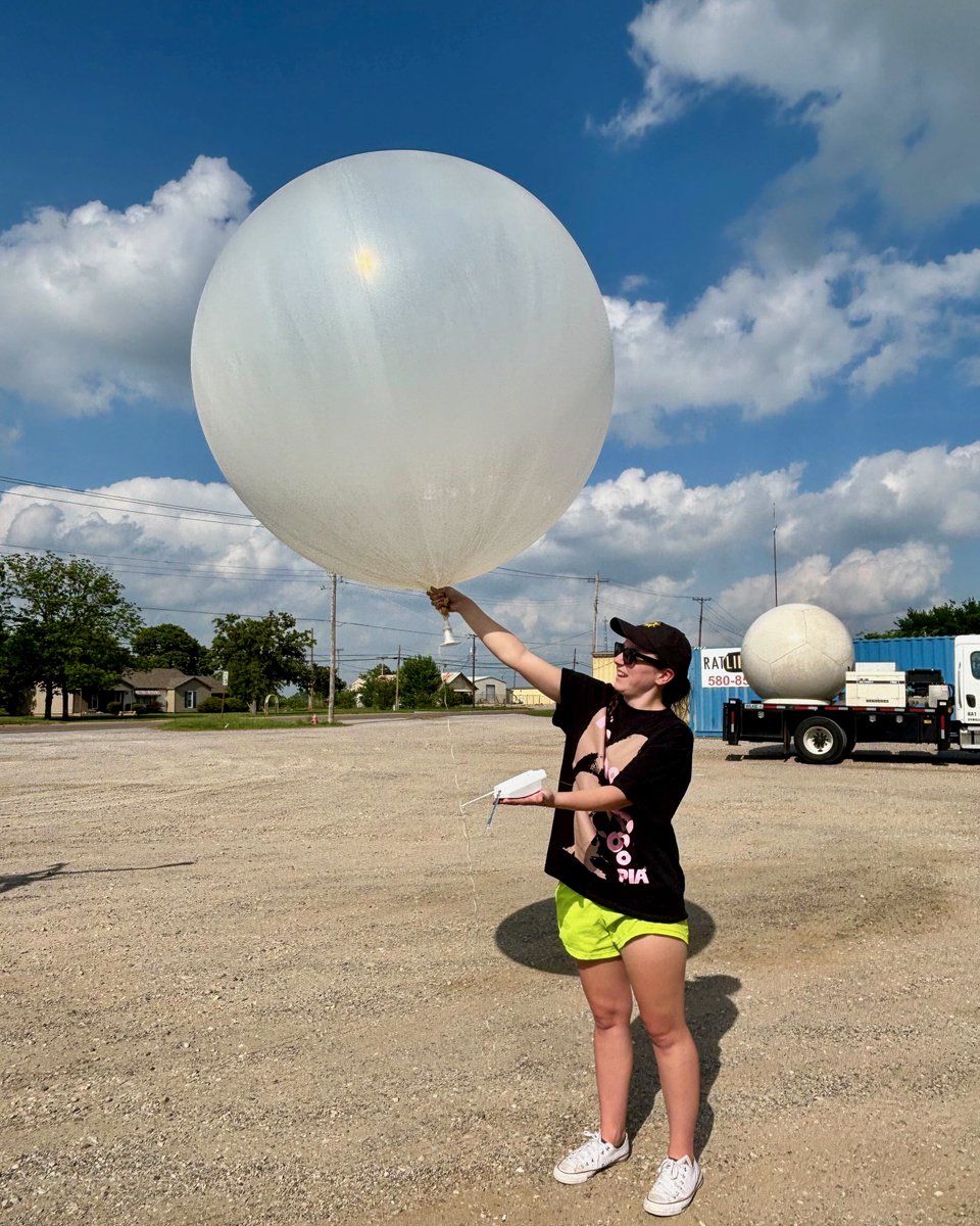
NSSL mobile mesonets waiting for Tgen in classic style from the 26 April Pawhuska, OK tornado
5
186
Tyler Pardun retweeted

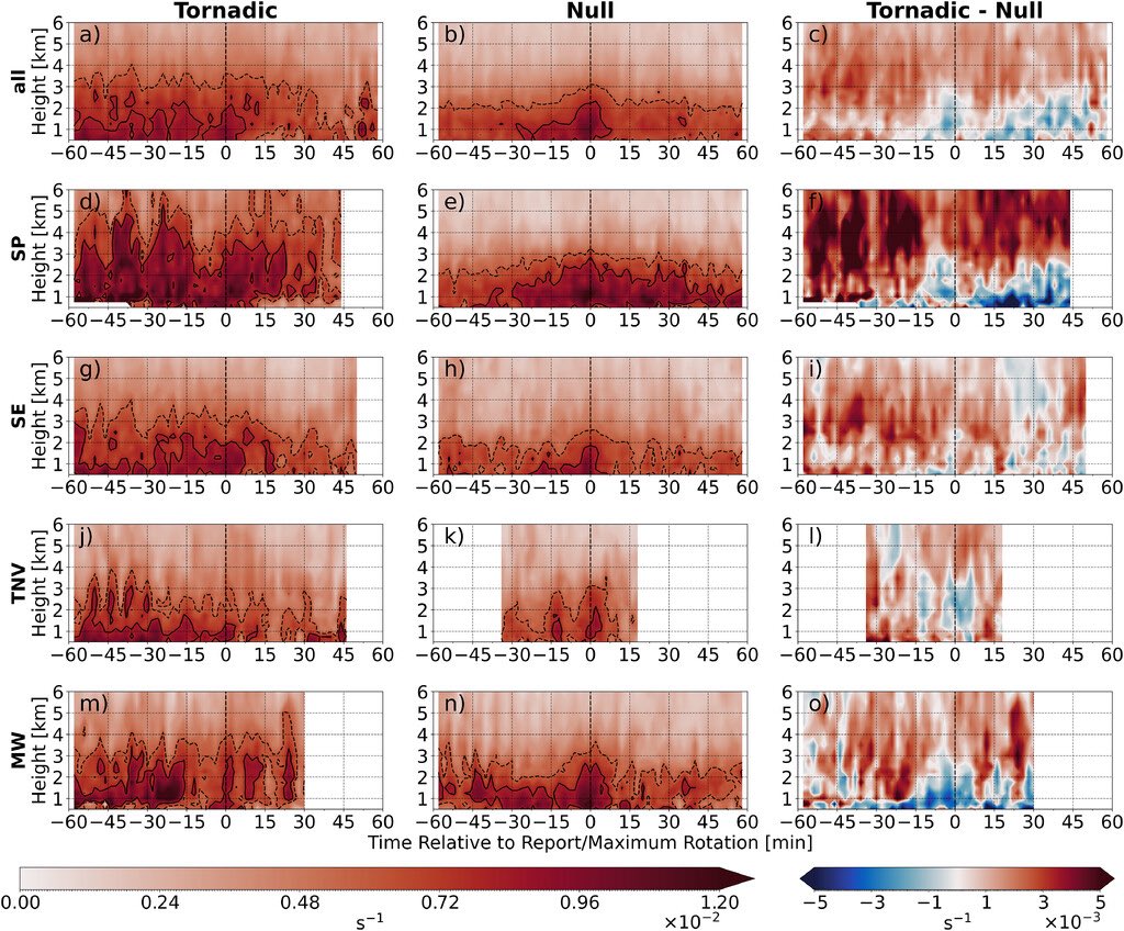
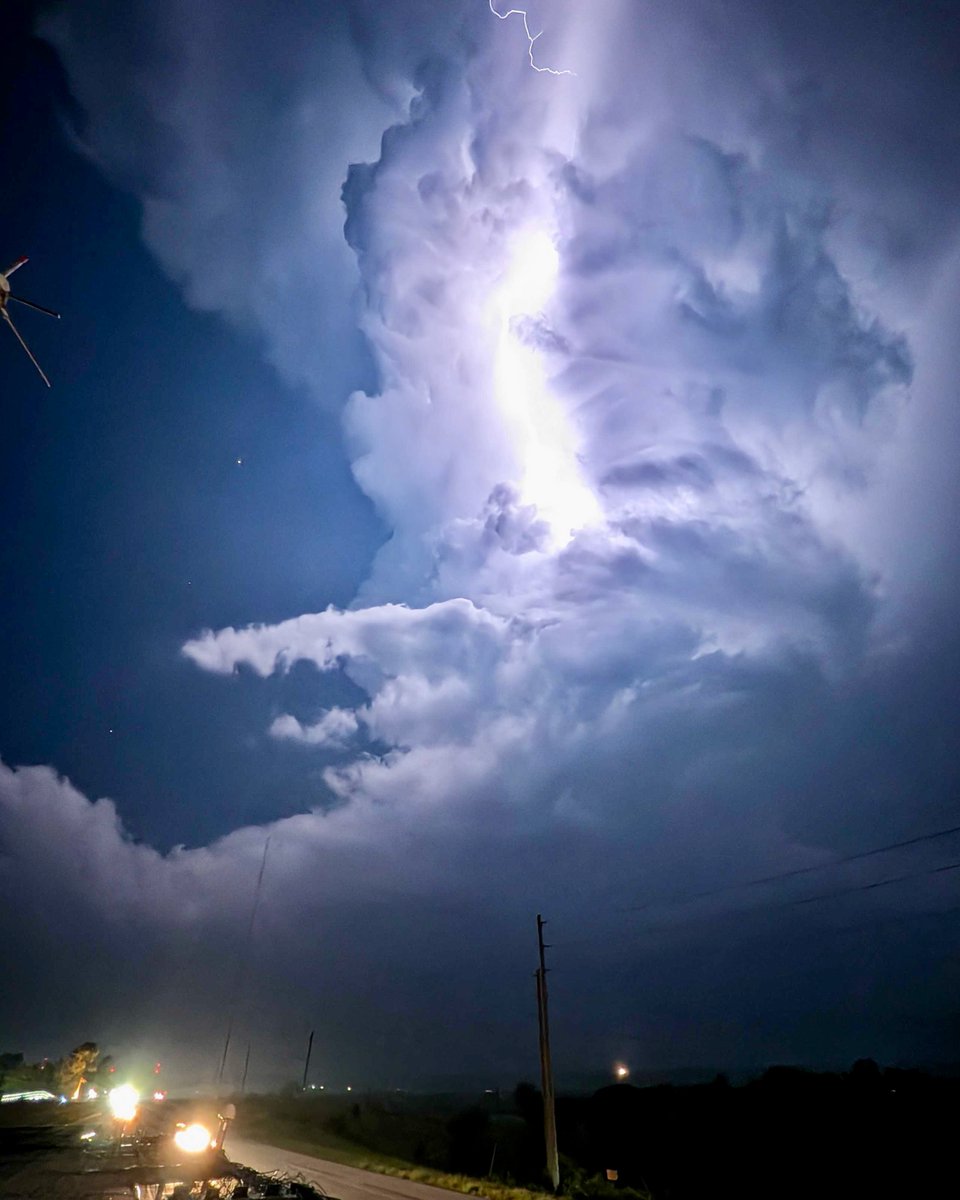
🌪️05/17: The LIFT project used LiDAR & mobile mesonets to sample ground-level wind flow on a strong tornado in Nebraska.
This type of data of both the tornado itself AND its formation at such close range and proximity to ground is rare and valuable.
🔗: inside.nssl.noaa.gov/nsslnew…
1
25
81
7,005
May 21
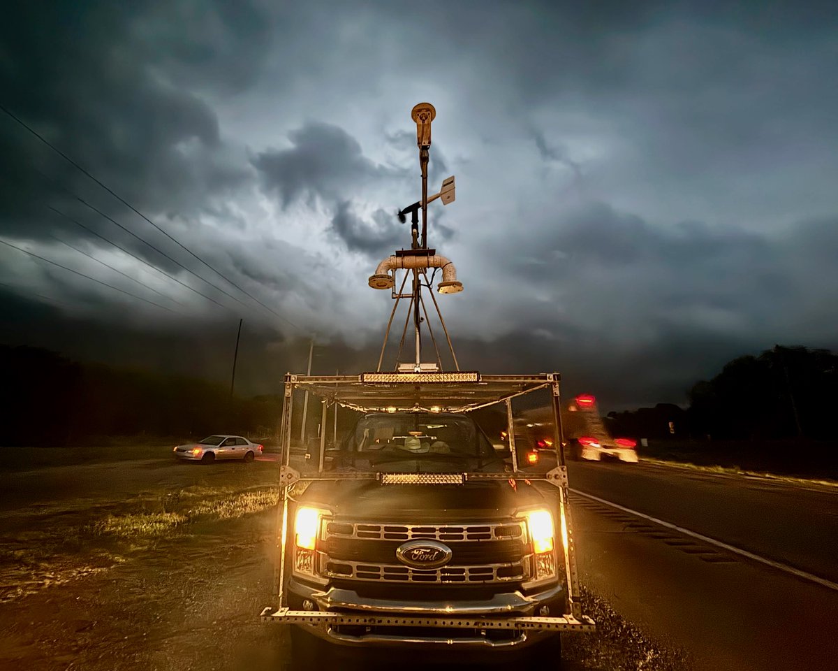
Fantastic deployment by @NOAANSSL mobile mesonets doing a “circuit maneuver” around the St. Libory, NE tornado capturing surface data from all four quadrants of the vortex. Initial analysis yields promising insights that describe the surface flow of this tornado
6
65
2,896
May 18
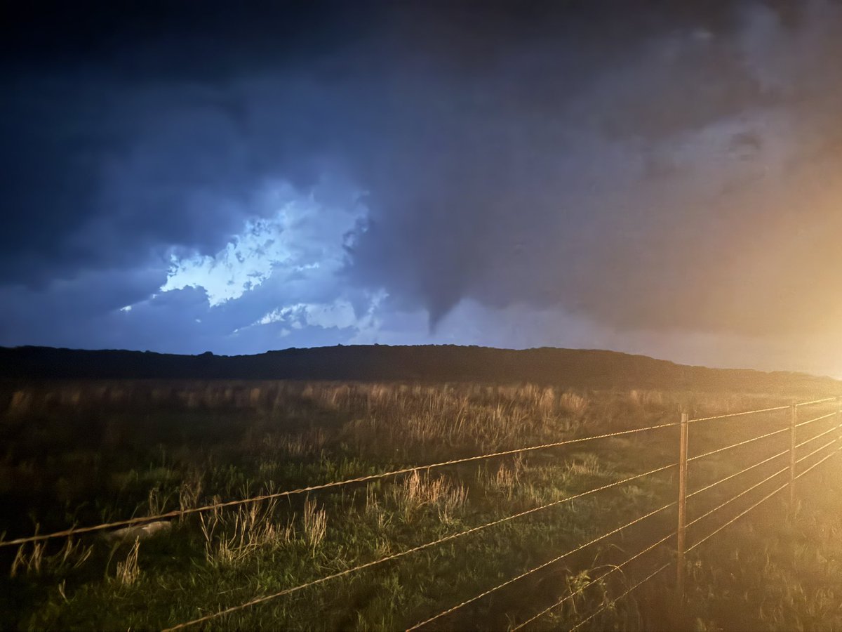
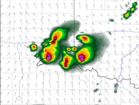
Incredible data collection on this violent tornado from NSSL’s LiDAR, scanning genesis and occlusion near St Libory, NE earlier today #newx
6
5
43
2,306
Tyler Pardun retweeted
🌪️🌩️ "LIFT" campaign is in full swing.
👀 At a glance:
🚛📡 LiDAR: ground-level winds inside the tornado.🌬️
💎🎥 HailCam: Data on hailstones in free-fall
🚁 Drones reporting before & after the storm
👩🔬💬 Social scientists perfecting safety info
🔗: inside.nssl.noaa.gov/nsslnew…
4
50
174
18,505
Apr 29
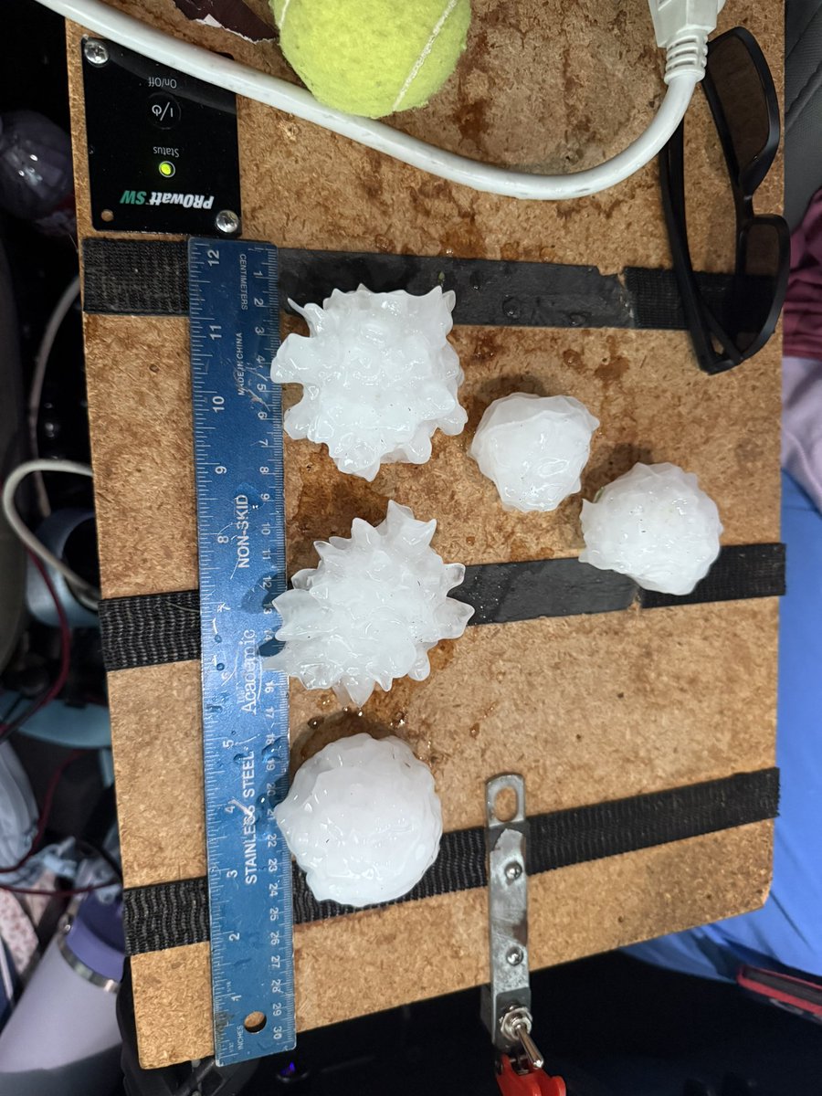
Some spiky baseballs and softballs earlier near Godley #txwx southwest of Ft. Worth. Estimating sizes between 2-3 inches on impact
1
3
291
Tyler Pardun retweeted

Apr 22
Happy Earth Day, everyone.

10
585
11,417
289,109

🎉The weather community gathered to celebrate the unveiling of 3 new cutting-edge @NOAANSSL mobile weather radars. We can't wait to see the data these RAPTORs collect in the field! @TomColeOK04 @OU_President @NOAA @NWCNorman @OUResearch
7
63
304
15,941
Mar 10
For all the HRRR deniers I’ve seen today, the mixing bias historically has been able to handle lake breezes quite well into the mid-summer across Chicagoland. My hunch tells me these solutions are worth using as guidance. Happy to chat
2
1
33
1,590
Mar 6
Call it the Nothing allowing model (NAM)

I'm as CAM-skeptic as the next person, and didn't even chase this one, but it will never cease to amaze me how confidently, consistently, and unanimously CAMs are wrong
1
6
1,294
Mar 5

2
409
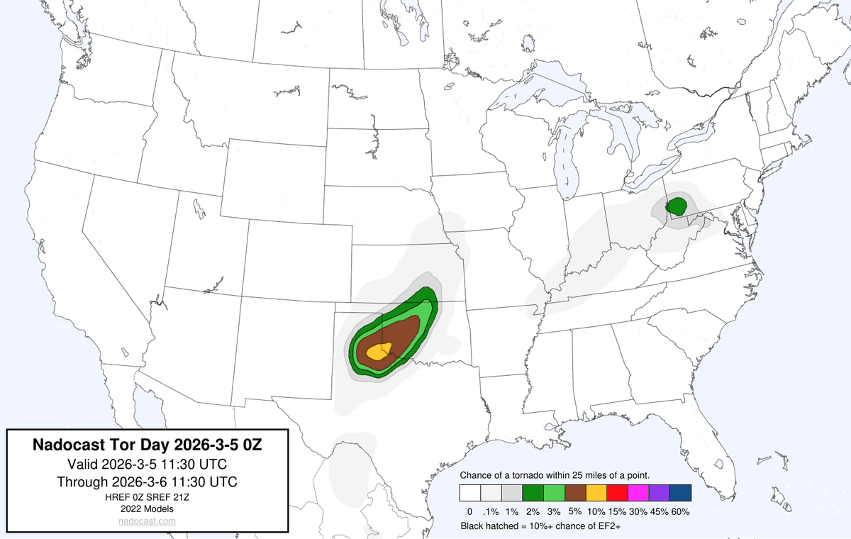
Mar 5
Avocado has returned
1
266
Tyler Pardun retweeted

Mar 2
casimir pulaski day was the best day to have off school because you knew no other state was getting the day off. illinois exceptionalism.
42
358
4,536
115,358
Feb 27
Passive fluid tracers and vorticity budget calculations from Minecraft can solve tornadoes I fear
Feb 25

this minecraft mod adds tornados, seasonal weather, radars, cyclones and more and it's kinda terrifying
(ProtoManly's Weather Mod)
1
1
8
679