
Joined June 2009
- Tweets 49,241
- Following 1,646
- Followers 5,554
- Likes 26,833
2,667 Photos and videos


Victoria Freile retweeted

Apr 21
All I'm saying is today should be a state holiday.
1
5
83
1,720
Victoria Freile retweeted
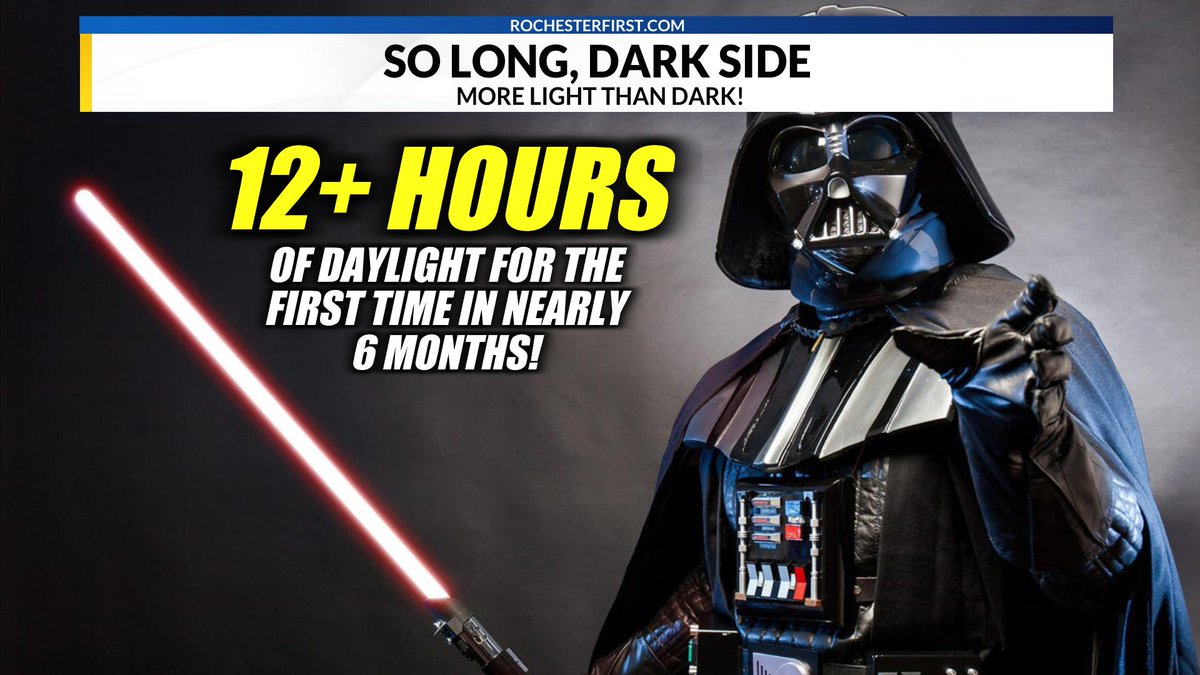
Mar 17
WE DID IT! For the first time in almost 6 months, we received more daylight than darkness today (12 hours & 23 seconds of daylight). So long, dark side!
4
12
89
2,419
Victoria Freile retweeted
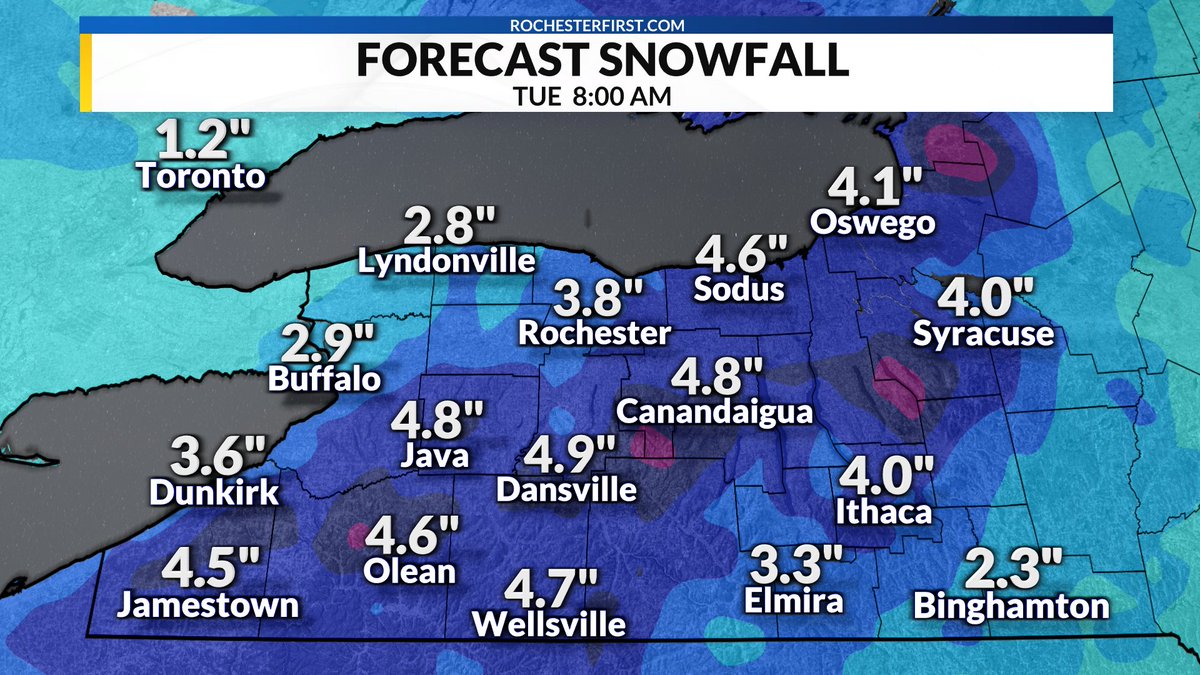
Mar 16
SNOW UPDATE: Temperatures are tumbling rapidly behind the cold front this afternoon. Rochester dropped 20° in an hour and will continue dropping into the evening hours. A reinforcing wave of energy will support a surge of widespread precipitation returning around nightfall. Any rain will quickly transition to a period of sleet and then snow, which could be heavy at times.
Right now, it appears the window of snow will favor 8pm-1am (give or take), so it's quite limited. That said, it'll be wet & heavy during that time, so several inches of dense snow accumulation will be possible. Also worth noting, our temperature drop will present additional travel issues as a layer of black ice could be masked by this snow accumulation.
This will be far from a snowstorm. While the snow totals won't be particularly impressive, the prospect of icy travel & continued strong wind gusts will make for a very wintry night across WNY. The landscape will look VERY different around here by tomorrow morning.
1
6
52
4,684
Victoria Freile retweeted

Feb 24
Widespread light to moderate snow is expected across the region tonight through Wednesday. Snow will taper off across western NY on Wednesday, though snow will continue across the Tug Hill region into Wednesday evening. Winter weather advisories are in effect as shown.
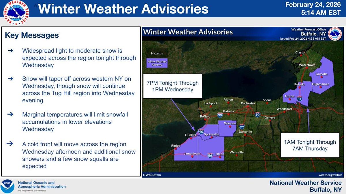
ALT Map of winter weather headlines
1
6
24
4,180
Victoria Freile retweeted
Feb 22
A Winter Storm Warning and Winter Weather Advisories are in effect for portions of Western New York. Steady snow will continue for WNY, with some heavier snow starting this evening for areas south of Buffalo, Batavia and Rochester.
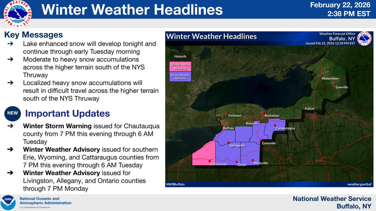
ALT Map of Winter Weather Headlines
2
6
35
8,753
Victoria Freile retweeted
Feb 11
Lake enhanced snow will continue through Thursday. The most widespread snow will be tonight before giving way to more localized lake effect snow showers Thursday. Travel conditions will deteriorate this evening with snow covered roads and reduced visibility. #nywx
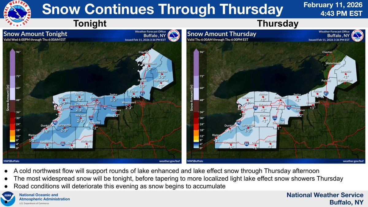
ALT Forecast snowfall maps for tonight and Thursday
4
32
5,162
Victoria Freile retweeted

Feb 10
Up to 11 inches of snow and ice forecast for parts of New York democratandchronicle.com/sto…
2
3
2,185

Feb 10
RT @monroesheriffny: MCSO's Snowmobile Unit: Before you head out on the trails, be a responsible rider. Sleds must be registered and ins…
7

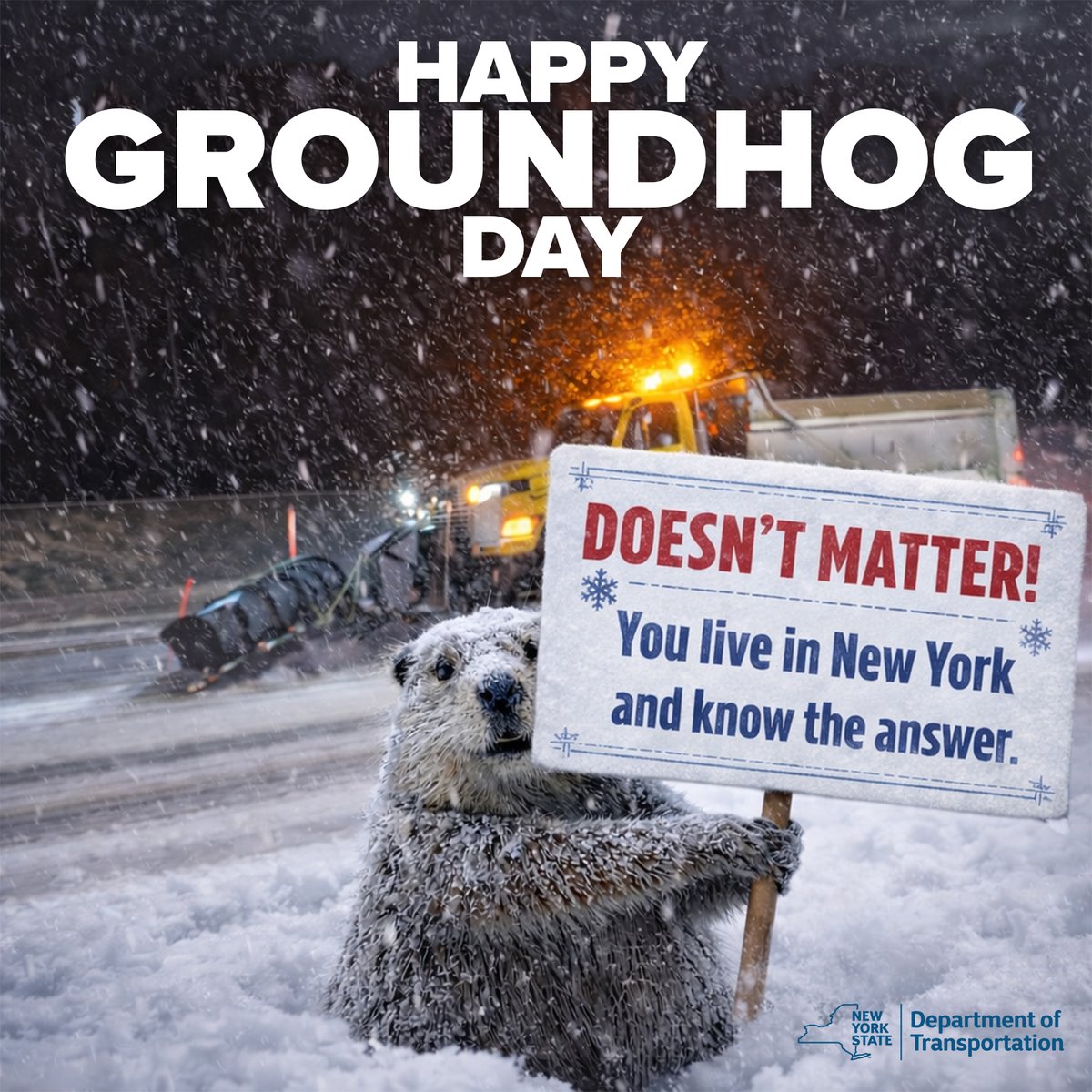
Whether Punxsutawney Phil saw his shadow or not this morning… DOESN’T MATTER!
You live in NY. You already knew the answer... ❄️Winter isn’t over yet and more snow will be here soon.
Slow down and #DontCrowdThePlow
It’s winter in NY. Drive like it.
2
14
30
1,840
Victoria Freile retweeted

Feb 1
Penguins at the Pittsburgh Zoo & Aquarium play in the snow thanks to the recent snow storm.
“Many of the animals like our big cats and elephants enjoy a snow day when they get the opportunity to play in frigid white powder,” the zoo said.
“Animal keepers will bring snow inside for some of our residents like gorillas and siamangs to experience.”
“Penguins love to venture outdoors for a taste of their native waddling grounds, while otters think ice is nice and frolic in their pools with frosty treats.”
“Most of our animals are innately curious and enjoy investigating the foreign weather phenomena.”
369
3,904
35,788
1,222,911
Victoria Freile retweeted
Feb 2
After a nine day period of temperatures in the teens and colder, our region will return to afternoon temperatures reaching the 20s. Even still these values will be nearly 10 degrees below early February normal.
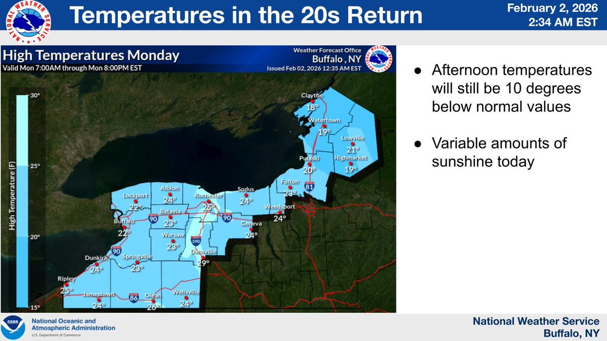
ALT image of today's highs
4
48
9,177
Victoria Freile retweeted
Feb 1
Northwest flow of cold air over Lake Ontario today will yield a few fluffy inches of snow along the shoreline, with an inch or less farther inland. Activity diminishes through the afternoon hours.
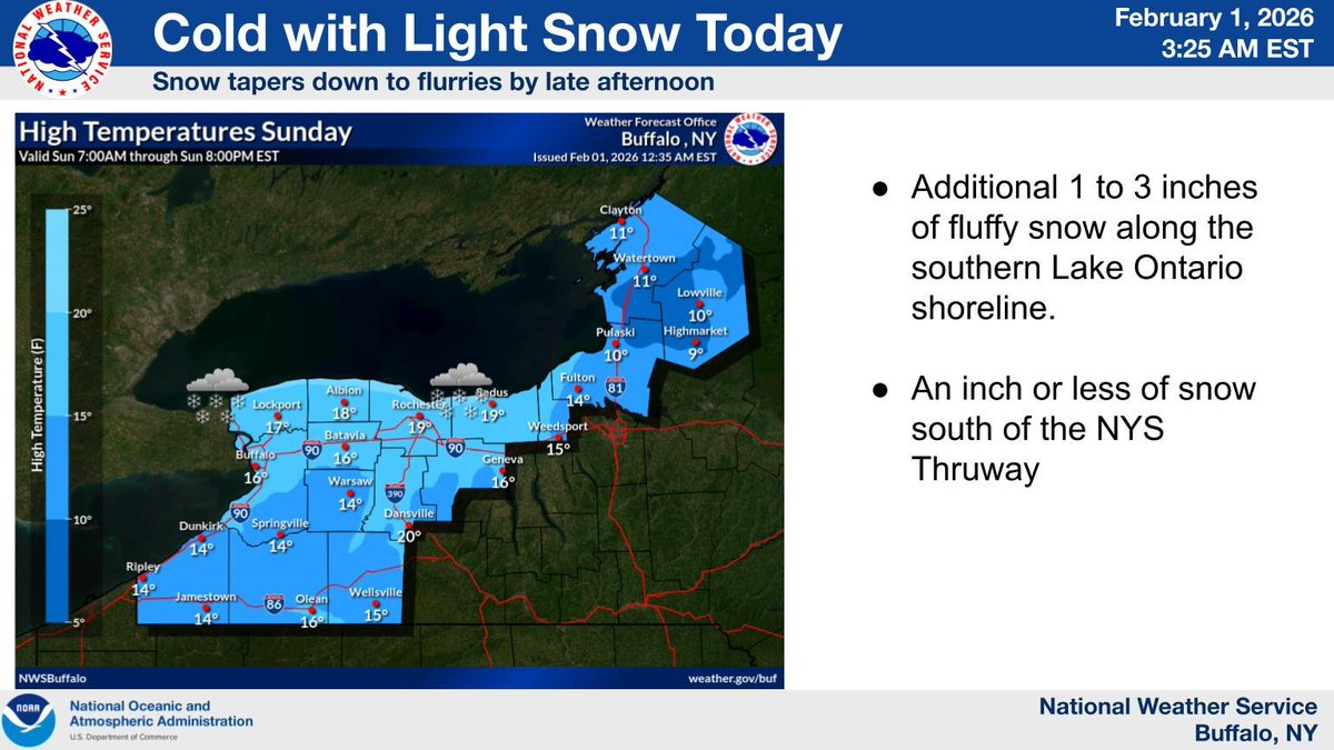
ALT image of temperatures today
5
28
7,775
Victoria Freile retweeted

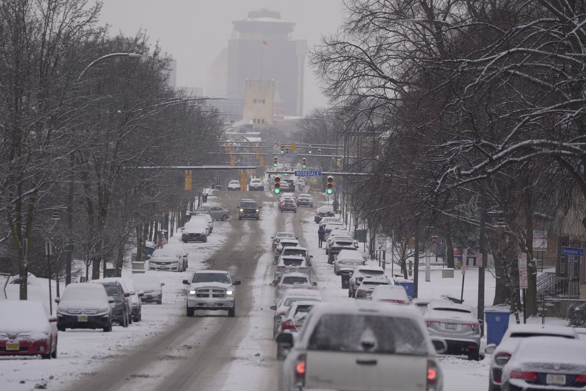
Jan 22
A messy morning commute. A look at downtown from Monroe Ave.
2
2
291
Victoria Freile retweeted

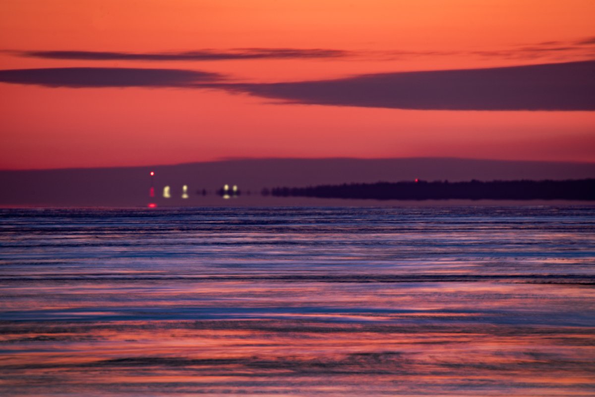
Jan 21
Some intense color this morning looking toward Ontario N.Y. as viewed from Greece zoomed way in with a 600 mm telephoto lens.
2
11
110
1,740
Victoria Freile retweeted
Jan 8
Today will be milder, with morning low clouds and fog dissipating from west to east. Tonight and Friday will then be unseasonably mild and increasingly windy, with occasional showers later tonight and Friday.
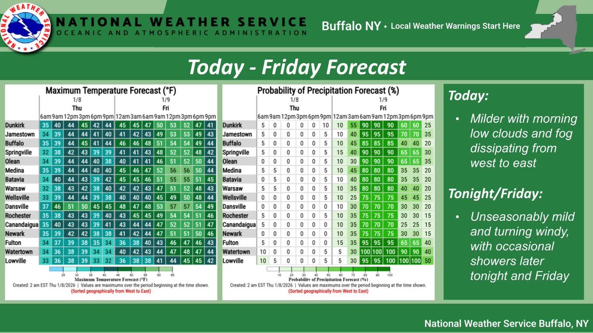
ALT Graphics of temperature and precipitation for Today through Friday.
4
18
3,616
Victoria Freile retweeted

21 Dec 2025
I love this rendition of “The Christmas Song” by Frank Sinatra and Bing Crosby.
182
3,096
12,731
578,725
Victoria Freile retweeted
8 Dec 2025
Today will feature some of the coldest temperatures thus far for the season for many areas. Temperatures for most areas will be at least 10 degrees and even close to 20 degrees below normal.

ALT Map of high temperatures today
2
9
41
8,656
Victoria Freile retweeted
2 Dec 2025
Light to moderate snowfall is expected to continue through the 1st half of today. While accumulations overall will be more on the minor side, snow will peak in coverage and intensity during the morning commute today. If traveling allow extra time to reach your destination.
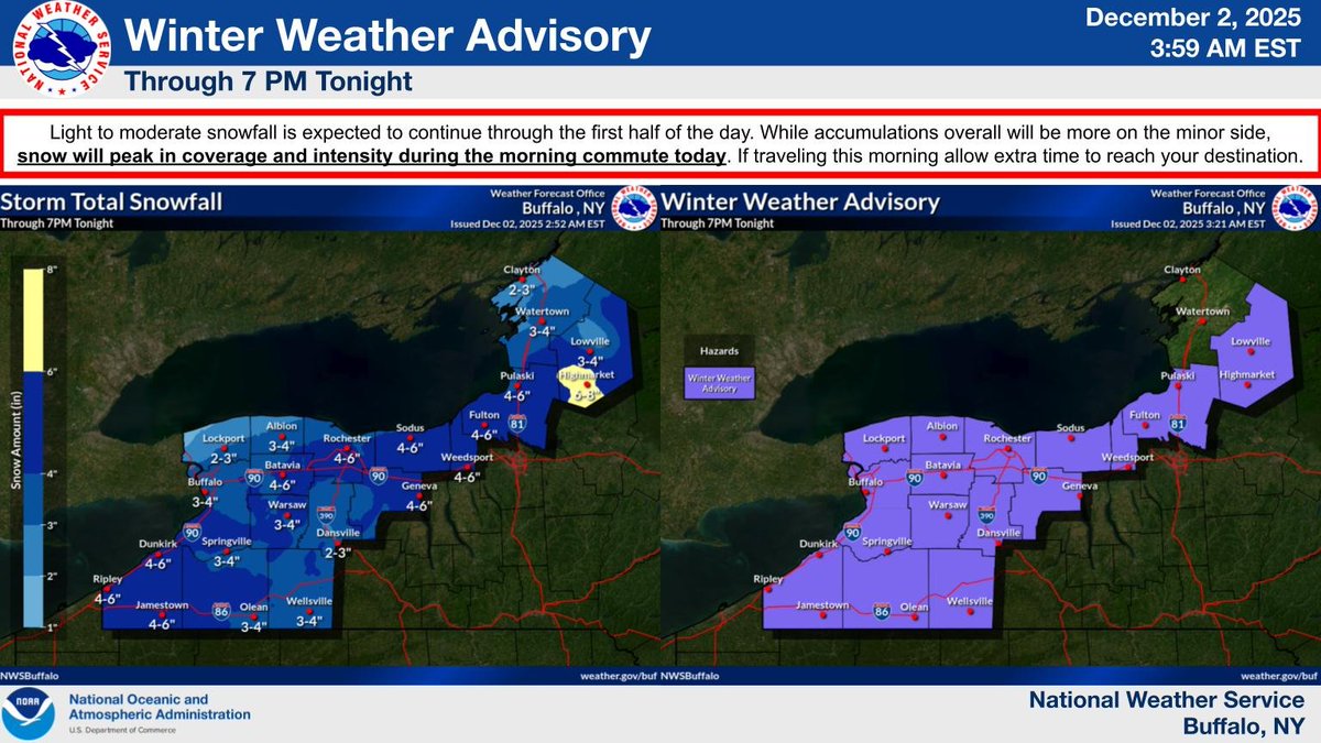
ALT A map of current Winter Weather Advisories and snowfall expected today.
11
38
7,695
Victoria Freile retweeted
24 Nov 2025
A Winter Storm Watch has been issued for counties east of the lakes beginning Wednesday evening. Heavy lake effect snow and gusty winds are possible through Thanksgiving and Friday.
Additional details can be found below and at weather.gov/buf/weatherstory

ALT Infographic with the details of a Winter Storm Watch for areas east of Lake Erie and Lake Ontario, beginning Wednesday evening.
2
17
66
13,768
Victoria Freile retweeted
19 Nov 2025
Dry weather will prevail today through Thursday with a modest day to day warming trend and light winds.
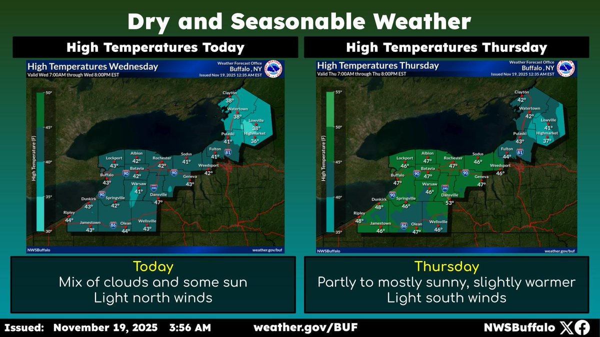
ALT graphic of forecast high temperatures today and Thursday
8
21
4,593