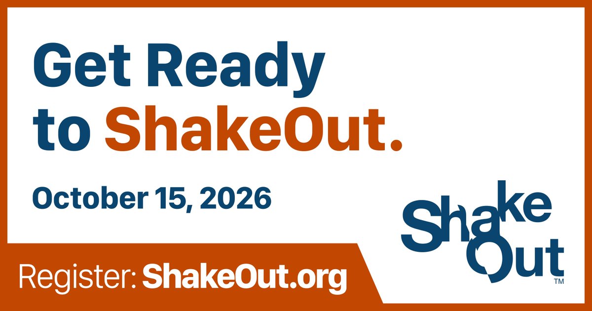
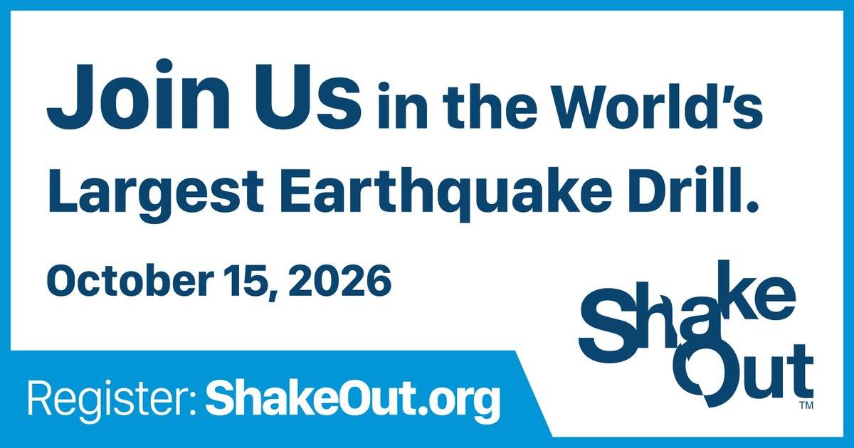
Profile run by @WAemd Hazards & Outreach team. 🌋🌊🌎 Register for the Great WA ShakeOut at 10:15 am on Oct. 15, 2026! Content Rules: go.usa.gov/xycSu
For any recent followers:
Hi, we're @WaShakeOut - an account run by @WaEMD's geologic hazards and preparedness team to share information about Washington's geologic hazards (especially earthquakes, tsunamis, and volcanoes), and what YOU can do to be safe when they occur!
ALT Gif of a large grizzly bear sitting upright on it's hind legs behind a fence in a grassy field. It lifts up it's left arm and waves.
Impacted by the December 2025 storms and flooding? The deadline for applying for FEMA assistance is VERY near. You have until June 10. Call 1-800-621-3362 or visit disasterassistance.gov to register or ask questions.
@FEMARegion10
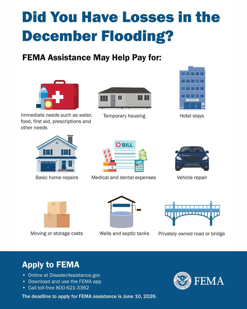
ALT Graphic shows icons representing different ways you can get help. Text says, 'Did You Have Losses in the December Flooding? FEMA Assistance May Help Pay for: Immediate needs such as water, food, first aid, prescriptions and other needs. Temporary housing. Hotel stays. Basic home repairs.Medical and dental expenses. Vehicle repair. Moving or storage costs. Wells and septic tank.s Privately owned road or bridge. Apply to FEMA Online DisasterAssistance.com Download and use the FEMA app. Call toll-free 1-800-621-3362. The deadline to apply for FEMA assistance iĹź June 10, 2026. FEMA'
A big volcano doesn't always mean risk of a bigger eruption. In this video, we want to help you understand how volcanoes are monitored and how you can get alerted. Visit mil.wa.gov/alerts to sign up for Volcano alerts.
What determines the size of a volcano's eruption? Our expert explains how size doesn’t always matter.
Watch our full video: youtube.com/shorts/ppxXmuNjJ…
Visit mil.wa.gov/volcano to learn more.
It’s Volcano Awareness Month! We’re teaming with Washington Emergency Management Division for a Reddit Ask Us Anything. Our scientists are ready to answer your questions starting at 11 a.m. Pacific Time today. The link is ready now for you to post questions! reddit.com/r/AMA/comments/1t…
We’re doing a live Ask Me Anything on Reddit with the @USGSVolcanoes. 🌋
It starts at 11am Today (Tuesday) but the link is up now for you to start answering questions. Lots of amazing scientists are joining us.
reddit.com/r/AMA/s/i8JFfkZlm…
Did you know our state has five active volcanoes? Congrats. You are now part of volcano awareness month.
There’s lots of events this month, both in-person and online hosted by @USGSVolcanoes, us, @WAStatePks & others. Find details in the link:
mil.wa.gov/news/volcano-awar…
We are proud of the new partnership between @UNDRR and @ShakeOut to observe this new #EarthquakeDay and to encourage everyone, everywhere to learn and practice earthquake safety actions such as #DropCoverHoldOn during annual earthquake drills. Learn more: ow.ly/8L5150YQsu2
Washington is Earthquake Country! Today is the anniversary of the Puget Sound earthquake back in 1965. Have you heard of this quake?
Learn more: historylink.org/File/1986
Learn how you can get prepared for the next earthquake at mil.wa.gov/earthquake
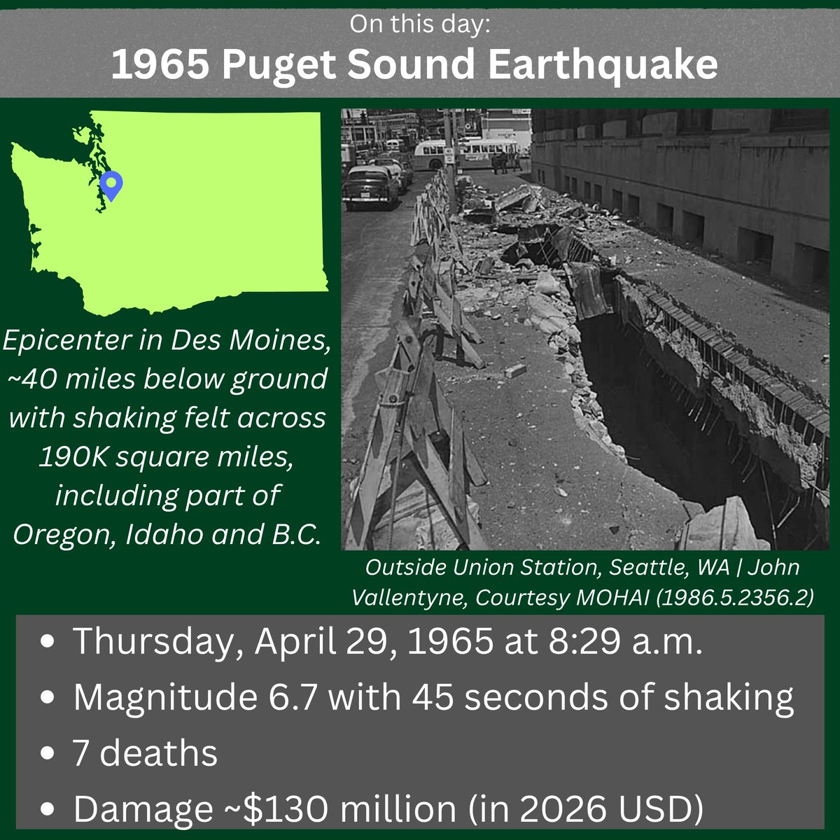
ALT Infographic about the 1965 Puget Sound Earthquake. On April 29th, the 1965 Puget Sound Earthquake struck. Image below shows the ground outside Union Station in Seattle, WA with a large crack in the sidewalk. A map of Washington shows the epicenter in Des Moines and notes that the shaking extended over 190k square miles, impacting Washington, NW Oregon, North Idaho, and SW British Columbia. Facts are listed below the images, including: the earthquake took place on Thursday, April 29, 1965 at 8:29 a.m. with a magnitude of 6.7 and 45 seconds of shaking. The earthquake caused 7 deaths and damages cost about $130 million in 2026 USD.
Today is also the United Nations' inaugural "International Day in Memory of the Victims of Earthquakes." We encourage you to think about earthquake safety.
Drop, Cover and Hold On is the gold standard when you're in an earthquake. #EarthquakeDayundrr.org/m/earthquake-day/
It's the 61st anniversary of another significant earthquake in our region—one that led to the establishment of the PNSN a few years later! Here’s some footage from the KING 5 archives showing how the M6.7 Puget Sound quake on April 29, 1965 affected WA: youtube.com/watch?v=zV-P3N1G…
There's a lahar drill this morning in East Pierce County. Some communities may see drones overhead tracking student movement. Please don't call 911. Learn more at laharexercise.com/
Happy National Anime Day! Here’s a shout out to #KaijuNo8 which had an episode that actually showed the right way to drop, cover and hold on when the ground was shaking — even if it was a giant Kaiju going by.
Why drop, cover & hold on works: shakeout.org/dropcoverholdon…
ALT Children and a woman go under a table as the ground shakes and hold on to each other.
Happy #Fieldwork Friday! Over UW's spring break, the Cascadia Culture and geoScience Exchange team visited Neah Bay High School to teach a week-long course on geohazards & preparedness. Read below to see how this program highlights the cross section between STEM & Makah culture!
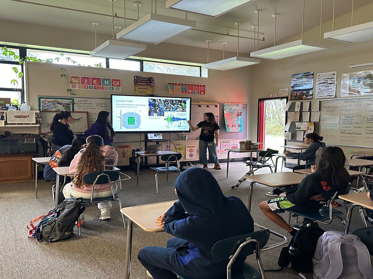
ALT A high school science classroom, with a few rows of students sitting in desks facing the front. At the front, a member of the CCASE team points towards a TV showing seismic activity at Lumen Field during a Seahawks game. Two other team members stand nearby watching.
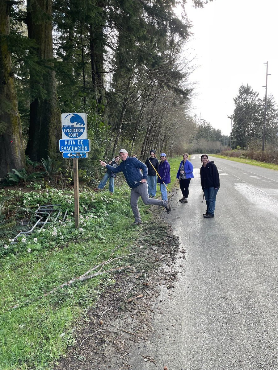
ALT Six people stand at the side of a forested road smiling and holding garden tools, next to a tsunami evacuation route sign that points towards a trail going into the forest. One man in the foreground stands in a running pose, pretending to run up the trail.
ALT A close up shot of a few students' hands while they work on building structures out of plastic toy building materials. The structures sit on top of a wooden board that is designed to imitate an earthquake when manually shook.
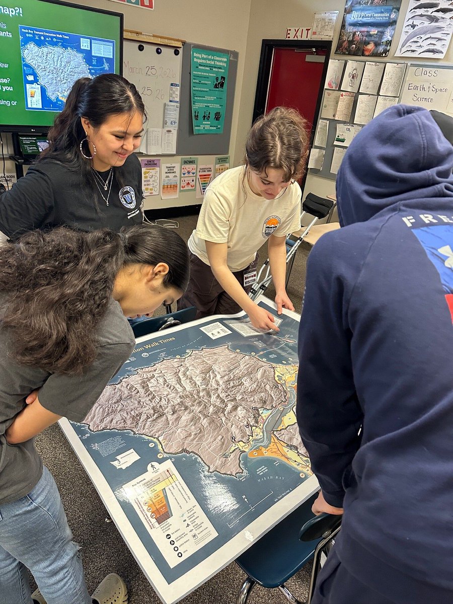
ALT Four people stand around a large map laid out on a school desk in a high school classroom. It is a topographical map of Neah Bay, with tsunami evacuation routes, evacuation time estimates, and tsunami inundation zones outlined.
For #SafePlaceSelfie Day, we remind you that the best action you can take during an earthquake is to drop, cover and hold on. This action helps prevent debris from falling and ensures you don't fall down during the ground shaking.
Follow @washakeout for more earthquake tips.
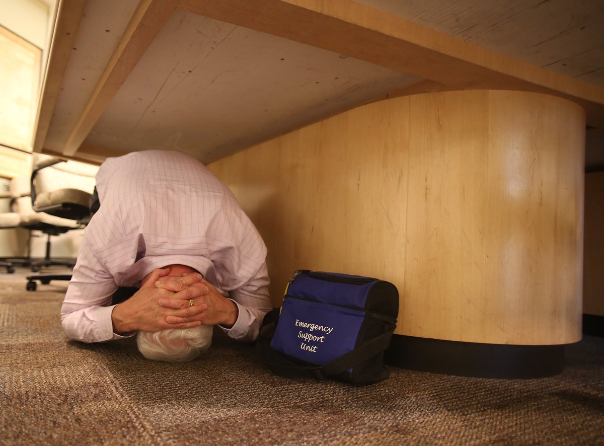
ALT A person under a table holding on to his head with an emergency kit next to him. Drop, cover and hold on is a safety action you can take during earthquakes.
October may feel far off, but getting prepared starts now. Register for the 2026 October #ShakeOut and start planning your participation today. Register and learn more at: ShakeOut.org#preparedness
Our Tsunami Boater’s Guide outlines protective actions for boaters. Whether you’re out on the Pacific Ocean, in the Puget Sound or Salish Sea, or tied up at the marina, find out how best to protect yourself in the next tsunami. mil.wa.gov/tsunami#education
ALT A dark blue background of rolling waves moves in the background overlaid by white text on a black transparent background at the top of the screen. The text reads, “what would you do if you were on the water during the next tsunami?” Below, more white text that says “Check out the Boater’s Guide linked below to learn more”. In the bottom left corner rests the logo for the Washington Emergency Management Division.
Registration is now open for the 2026 October #ShakeOut! Join the millions of people each year who practice earthquake safety. When you feel shaking or get an alert, remember to Drop, Cover, and Hold On. Sign up and learn how to get prepared at ShakeOut.org!
Now is an especially good time to start thinking about the Great #ShakeOut if you're interested in holding a larger drill, practicing what your organization would do during a quake.
Learn more about earthquake drills in our webinar from last Summer:
youtube.com/watch?v=9Z_LzOq_…