
Hey, it's Brian Shrader from WRAL! For traffic updates, follow @wraltraffic!
Joined March 2009
- Tweets 949
- Following 815
- Followers 1,729
- Likes 166
107 Photos and videos


Brian Shrader retweeted

Mar 27
Ready for a downright beautiful display of fluid dynamics?
The Fujiwhara effect between two mid-latitude cyclones in the North Pacific.
16
215
1,250
58,526
Brian Shrader retweeted

Mar 17
DETAILED post-storm analysis. What went wrong with the forecast?
• stronger pre-frontal trough than modeled
• more Carolina “crapvection” than expected
• southerly, rather than SSE, surface winds
• slightly more capping
• extra surface moisture
8
25
183
20,987
Brian Shrader retweeted

Feb 12
I joined @wralbrian on WRAL's YouTube page for a live Q&A about measles in North Carolina. Stay safe! youtube.com/live/FALvzxG4P5A…
#measles | #NorthCarolina | #Raleigh
1
195

Feb 3
1
1
146
Jan 31
2
1
512
Jan 29
1
304
Jan 28
1
2
564
Jan 28
122
Jan 27
1
376
Brian Shrader retweeted

well said
Jan 26

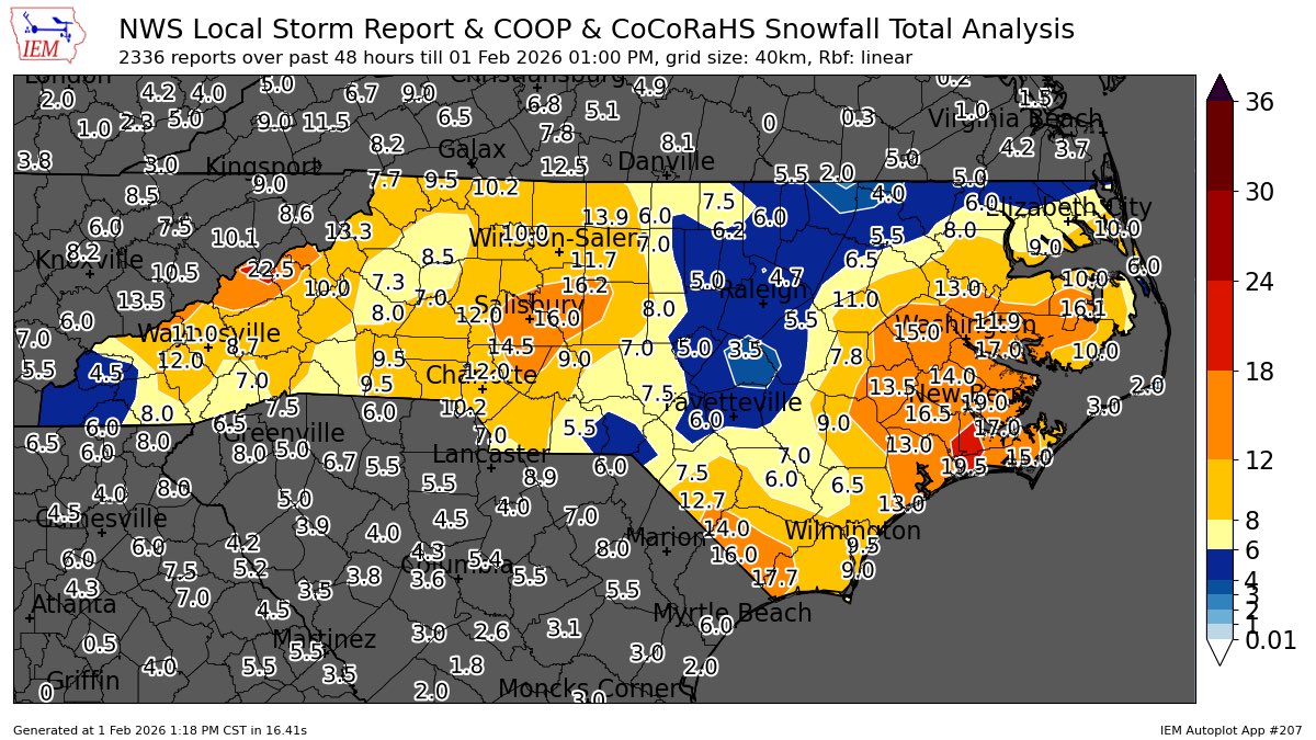
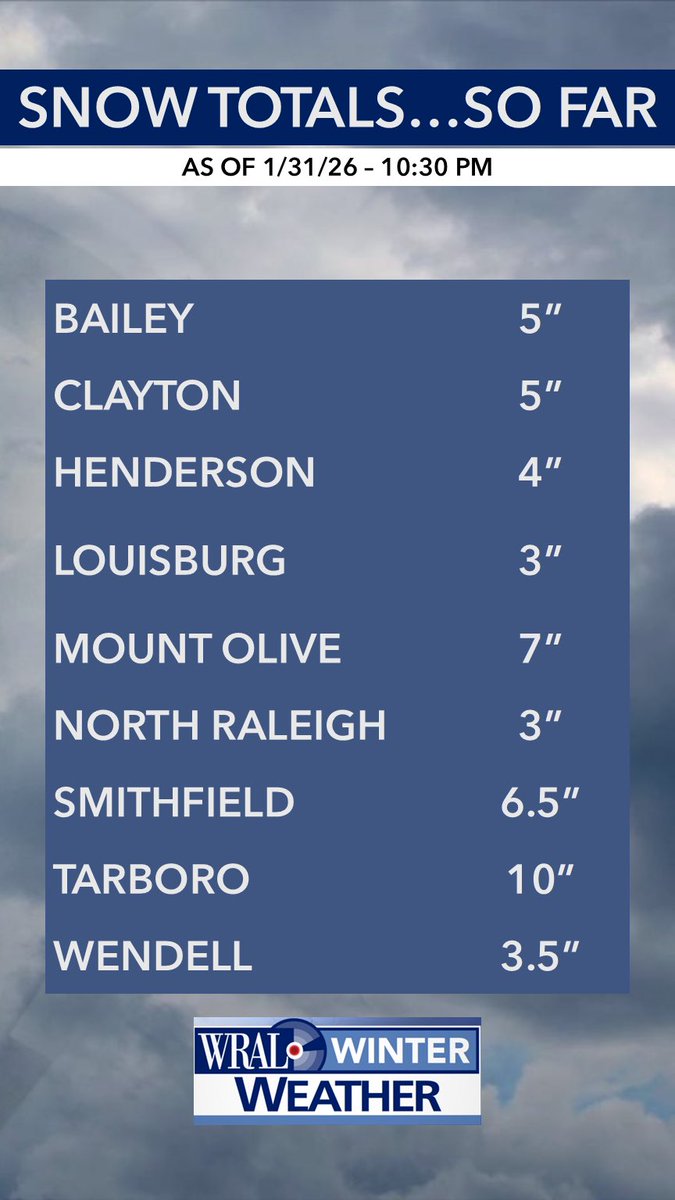
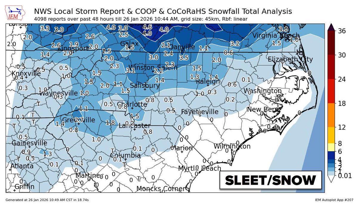
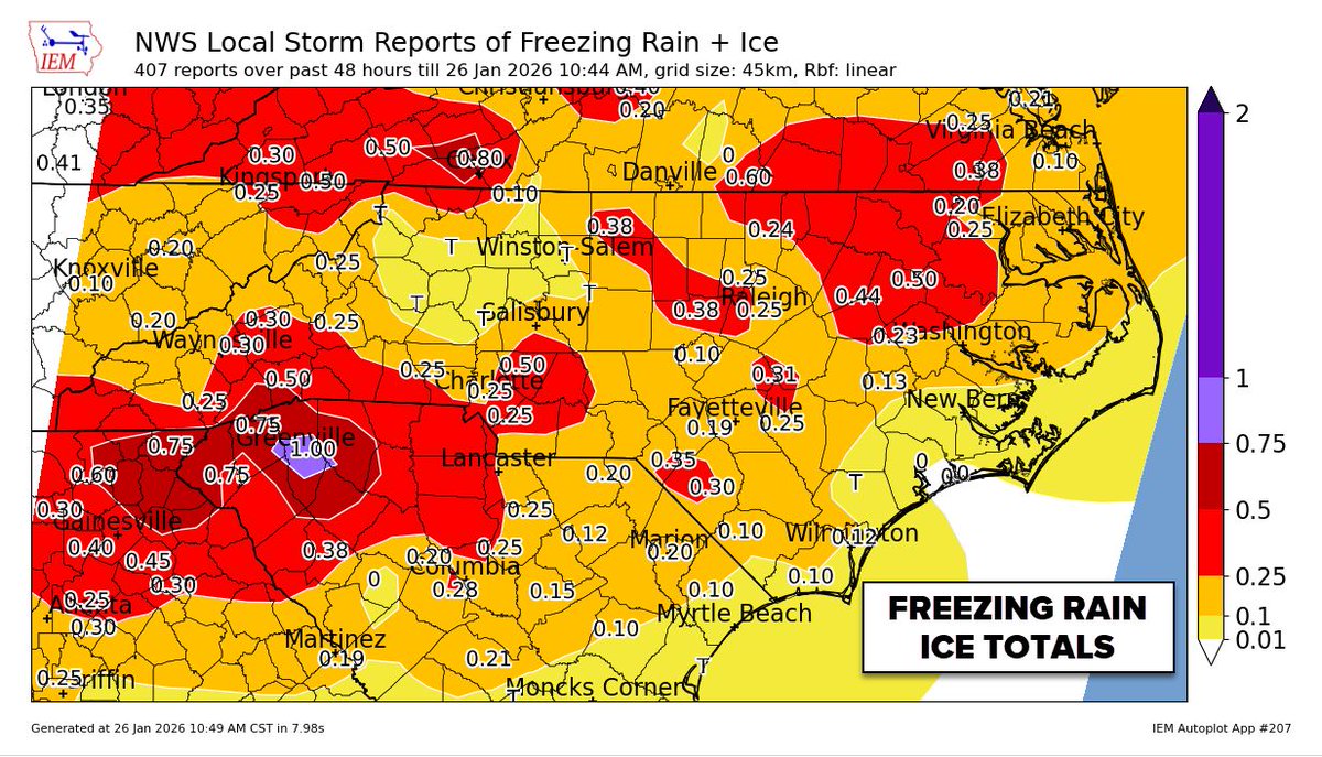
So, what actually fell? Here are the final accumulation totals, broken down by precipitation type. Note that sleet and snow totals are combined for this analysis, while ice (freezing rain) is tracked separately. The region's saving grace was a shift in the precipitation mix: we saw slightly more sleet than freezing rain. This was the preferred scenario, as it significantly reduced ice load on trees and power lines compared to a pure freezing rain event. This was a very odd storm, with super-cold surface air and very warm air above. The cold air near the surface was so cold and shallow that it was still able to refreeze raindrops before landing; in some odd cases, snow was created in the lowest 2,000', not in the cloud. Very rare and the opposite of normal
Forecast Criteria Status Verdict
Major Winter Storm✅Verified
The system produced significant wintry precipitation across the area.
Timing⚠️Mostly Verified
Arrival and departure times were generally accurate, with minor deviations.
Hazardous Travel✅Verified
Road conditions deteriorated as predicted, leading to dangerous driving conditions.
Ice Storm✅Verified
Freezing rain accumulation met the technical criteria for an ice storm in many areas.
Crippling Ice Storm❌Did Not Verify
Thanks to the higher volume of sleet, we avoided catastrophic ice accumulation levels.
Widespread Power Outages❌Did Not Verify
#cltwx #ncwx #scwx #wcnc
3
2
32
7,576