
Joined July 2019
- Tweets 15,111
- Following 1,992
- Followers 1,136
- Likes 25,719
2,364 Photos and videos


Day 134 of asking @bruntworkwear to sponsor my three-person service team. Nothing lasts long with my guys in the field doing millwright work.
I'll provide daily updates for 365 days on the wear and tear. Let's see if they're as good as they claim. Time to test.
What do you say?
Be kind 💫


Day 133 of asking @bruntworkwear to sponsor my three-person service team. Nothing lasts long with my guys in the field doing millwright work.
I'll provide daily updates for 365 days on the wear and tear. Let's see if they're as good as they claim. Time to test.
What do you say?
Be kind 💫

5
1
10
150


Jun 13
@DontTrustVerfy ...
Hi, maybe it's just operator error, but the website will not allow me to pre-order.
The Venmo hyper link routes me back to the website, the debit/credit option does nothing.
I tried on both the X link, and also copying the website link to chrome.
TIA.
🍻
1
17
Redball_11 retweeted

Jun 13
Details matter


7
10
23
904
Redball_11 retweeted

Jun 13
Tree Love


10
22
152
4,876


Redball_11 retweeted

Trumpet section is always jokers.
23
261
2,198
61,745


Redball_11 retweeted

May 13
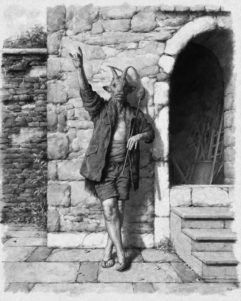
The purpose of art is to make the invisible visible.

58
46
168
4,308
Redball_11 retweeted

Mar 21
Need a fantasy map for your story, but can’t draw? I’ve got you covered. 👇
9
61
506
27,411
Redball_11 retweeted

Jun 12
One arm, one rifle - the math works.
13
7
66
1,263
Redball_11 retweeted

Jun 4
I’ll support anyone giving it an honest try. I’ll never apologize for that.
1
10
26
580
Redball_11 retweeted

Jun 12
Mrs Parlor repping the Gobsmack Crop Top!

1
4
32
233
Redball_11 retweeted

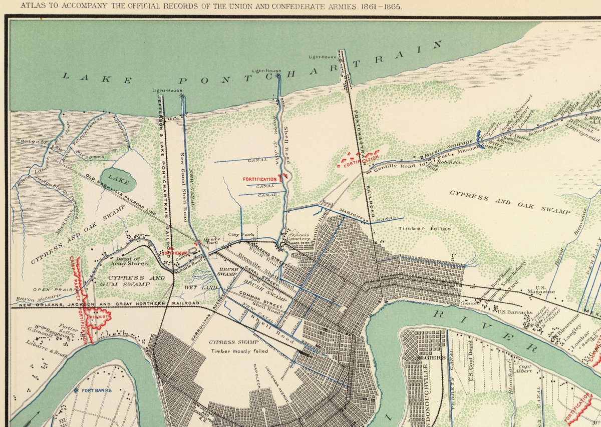
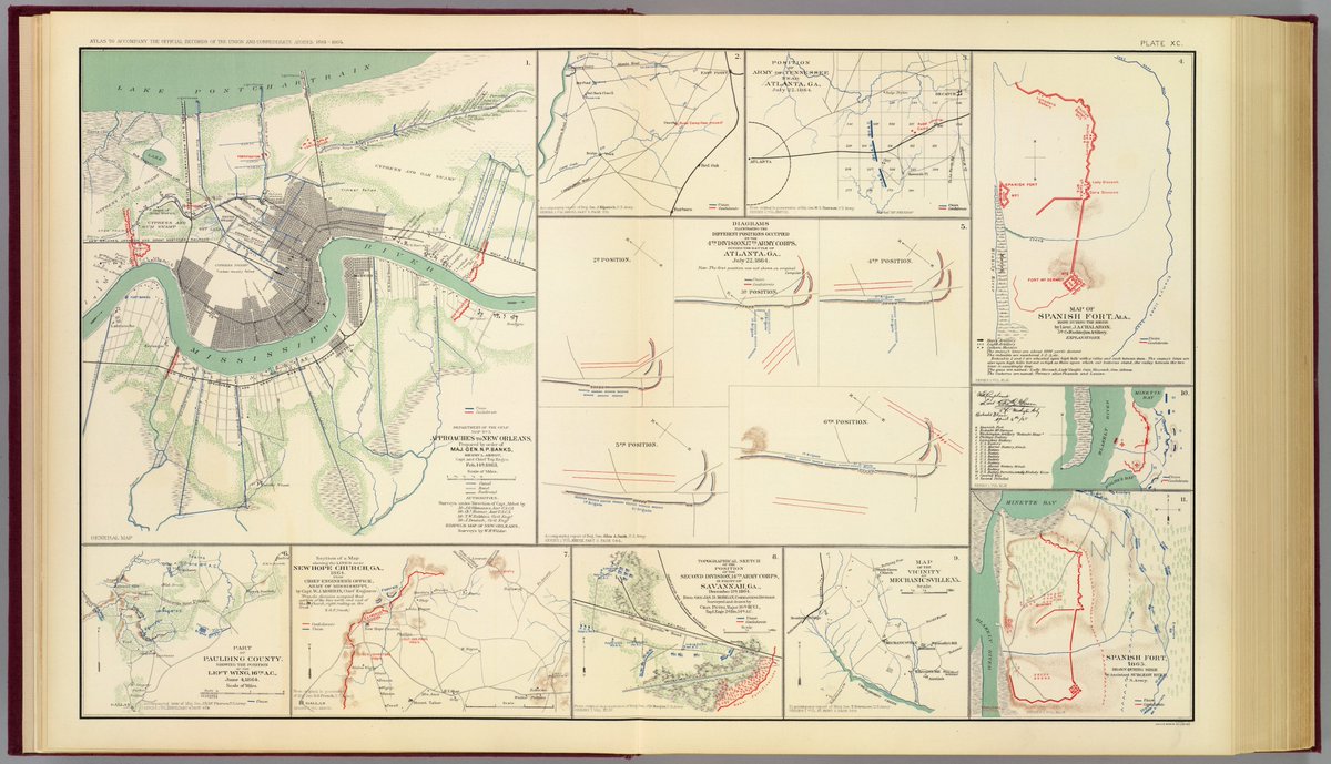
Jun 10
I have always been intrigued by maps, especially those drawn before my time. They sometimes tell and paint a story better than history books. Like this, the "Gen. Banks map" which was drawn during the occupation of New Orleans at the time of the Civil War. It depicts the "New Canal" or New Basin Canal. Note how far into the city it reached from Lake Pontchartrain. To the right, Bayou St. John which reached well into the city. Both were major avenues of transportation. Many are surprised to learn that much of the city commerce began from the Lake and not the Mississippi River. Turning to the west, note the curving Bayou Metairie which is also Metairie Road. And finally, looking at this map, it is no wonder we have pumping stations and drainage canals everywhere. New Orleans and Metairie really were built in a swamp! As for General Banks or "Spoons", that's another story. (map is from Library of Congress)
4
18
162
4,331