
Joined January 2013
- Tweets 30
- Following 48
- Followers 6
- Likes 73
11 Photos and videos
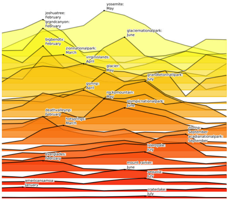

A joyplot that shows how individual parks’ monthly patterns diverge from the norm (the average monthly patterns for all parks), based on unique user counts from subreddits.
31
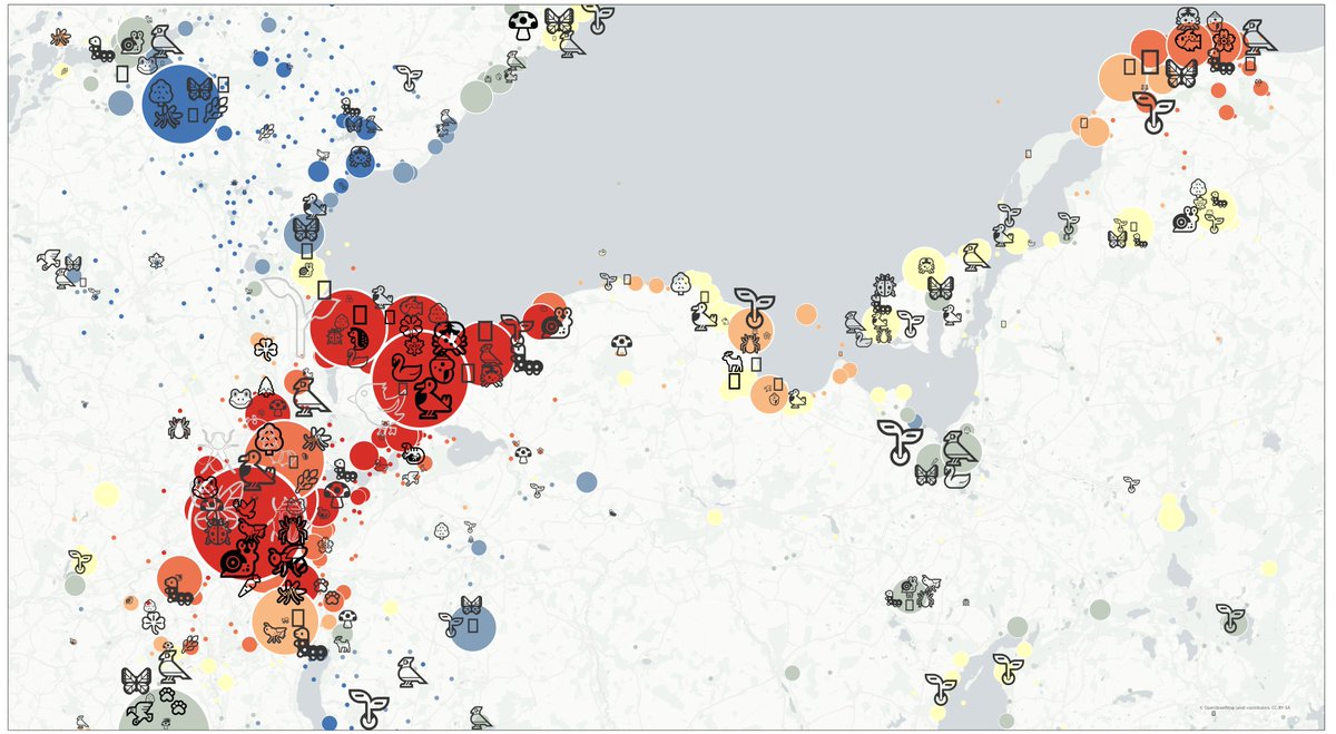
An Emoji Map based on #iNaturalist data.
Currently, there are about 160 Million species observations available worldwide. I wrote a mapping, where #species taxonomy is assigned to available, known nature & animal #emoji. The map was made with [1].
[1]: github.com/Sieboldianus/TagM…
26
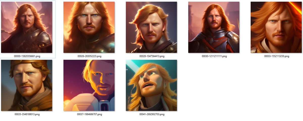
A neural network model trained on 16 images of myself - sample prompt for the images below:
"Alex as a knight, medieval times" 😁
Some more info on the process here: ad.vgiscience.org/links/post…
14
Tag Map #Oderbruch - Based on georeferenced public photos and tweets from Flickr (8550), Instagram (10228), and Twitter (6388).
flickr.com/photos/64974314@N…
93
My first package that completely migrated to a pyproject.toml build: github.com/Sieboldianus/lbsn… ! This was possible after #setuptools added --editable install support (PEP 660) in v64.0.0 (Aug 11, 2022). Finally a unified packaging system for Python.
6
A little Gist that describes how I log in to my Electricity Provider's Website and downloading PDFs automatically each month with #Python, #Selenium and #Docker.
gist.github.com/Sieboldianus…
13
Heute Abend 18:00 wollen wir im #CartoHack #16
open source #cartography mit JupyterLab besprechen:
visualisierung.dgfk.net/de/e…
Ich werde Details meiner Arbeitsumgebung zeigen und wie man mit #JupyterLab (#geoviews, #geopandas) reproduzierbare Karten und transparente Forschung macht
1
29
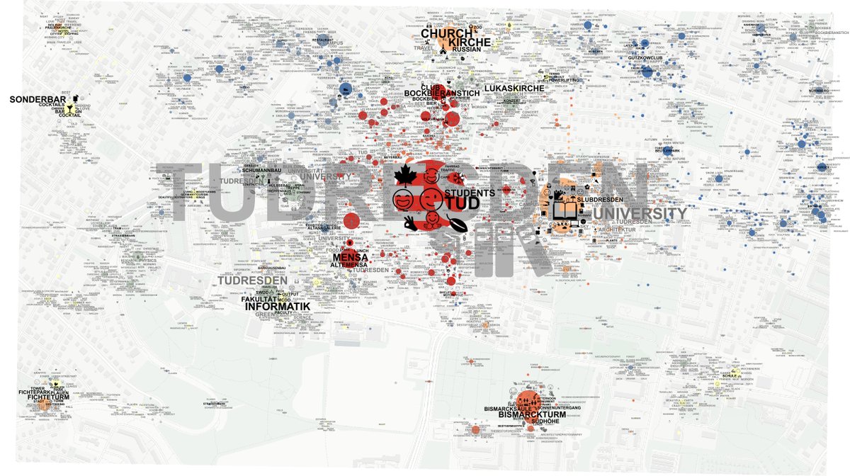
Some selected student results from the "Mobile #Cartography Workshops 2023". I think the students did a wonderful job to produce a lot of variety and creativity in the short time frame from these 2x 1DS workshops. kartographie.geo.tu-dresden.…
13
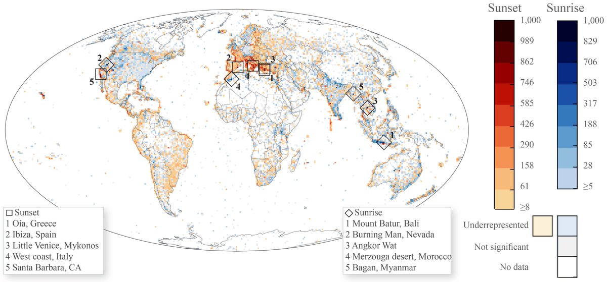
#BurningMan in #Nevada ranking second worldwide to view the #sunrise on #Instagram! A new article looking at the big picture of #landscape preferences. doi.org/10.1371/journal.pone…
1
175
2022/23 lecture (web) #slides "#Python data science 101 for Social Media #Cartography (and beyond)" with #revealjs! kartographie.geo.tu-dresden.…
1
45
This #film was just released, where my colleagues Eva and Marc, and I, explain the background and motivation behind our #DFG funded project #EvaVGI vgiscience.org/2022/12/21/vi…
10
Last task of the year: Test #ChatGPT API in #JupyterLab and #Python to summarize research papers #thelazyresearcher #gpt3 kartographie.geo.tu-dresden.…
39
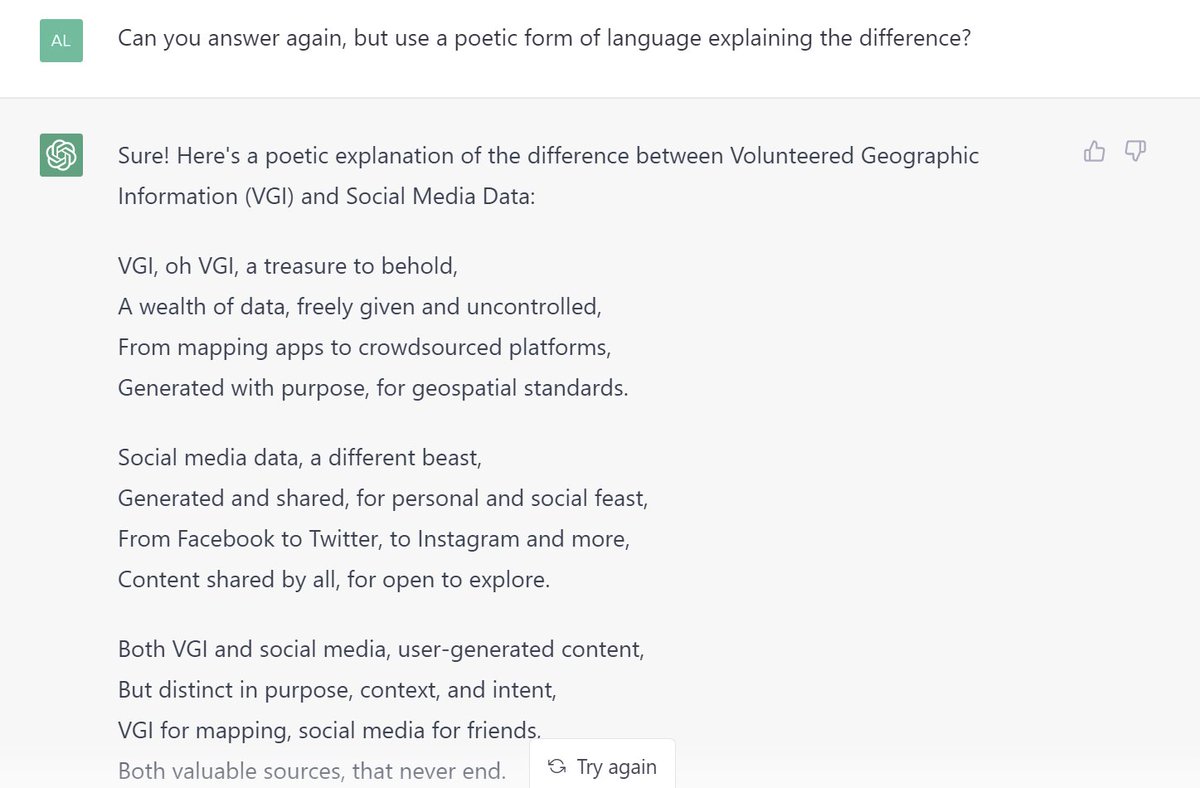
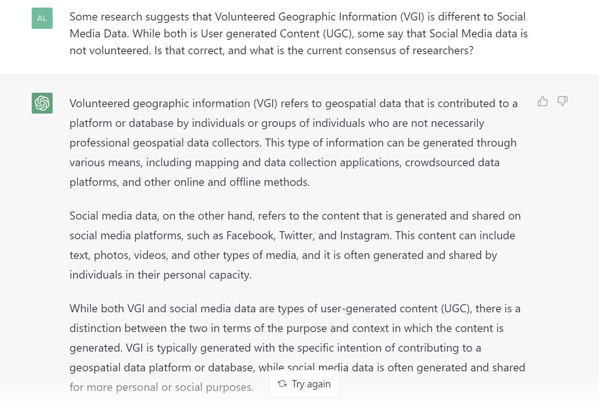
I asked chatbot to explain the difference between Volunteered Geographic Information (VGI) and Social Media Data.
1
15
.. and then, to repeat the answer in poetic form 😆
11
Started working on this over a year ago, but only now got to polishing it up: #IPSEC between #OPNsense and #pfSense with one side behind Carrier-grade NAT (#CGNAT) or internal subnet
du.nkel.dev/blog/2021-11-19_…
Tag Maps emoji tag clustering, rendered with Python and #Mapnik in #JupyterLab, with the help of #mapclassify #pysal #esda #contextily and #fiona.
ad.vgiscience.org/tagmaps-ma…
Compare to the former rendering with proprietary ESRI ArcGIS flic.kr/p/KiPfGz
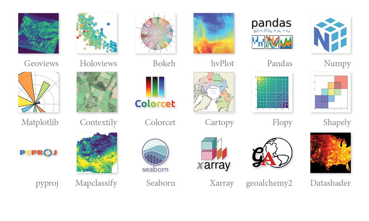
A #JupyterLab #Docker container for #Python #mapping, data science and interactive #cartography.
This includes many packages, e.g. #geoviews, #holoviews, #Datashader, #Contextily, #Geopandas, #Mapclassify
gitlab.vgiscience.de/lbsn/to…
2
4
A #shell #script that helps distribute/update local #SSL certs from a centrally managed remote location via SCP or FTP. This allows reducing exposure to external services by retrieving SSL (wildcard) #certificates from a central location.
github.com/Sieboldianus/ssl_…
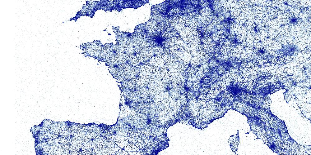
#Python #visualization of 350 Million geo-coordinates with #parquet (streamed processing) and #datashader.
#jupyterlab #pyviz ad.vgiscience.org/twitter-gl…
7
24