
Mar 6
Built a Python humanitarian GIS analytics pipeline to turn fragmented conflict and displacement datasets into operational maps and timelines.
Stack: pandas, geopandas, shapely, fiona, pyproj, mapclassify, matplotlib, plotly, folium.
Architecture uses DuckDB for analytics GeoPackage for spatial layers, orchestrated via a Typer CLI and YAML run contexts across 15 country configs.
Curious how others structure Python GIS pipelines — DuckDB/GeoPackage locally, or straight to PostGIS?

5
110

5 Jan 2024
Mapclassify. Geralmente, utilizamos a mapclassify sem saber quando classificamos um dado com geopandas. No card, mostramos exemplos de classificação por quantis, quebras naturais e intervalos iguais de dados do IVS para o Mato Grosso.
2
78

6 Jul 2023
おー、mapclassify便利そう
6 Jul 2023

記事を投稿しました! Google ColabでPythonの位置情報を扱えるライブラリGeoPandasが最初から入るようになった話 on #Qiita qiita.com/OgawaHideyuki/item…
1
2
476

27 May 2022
pip install shapely
pip install fiona
pip install pyproj
pip install rtree
pip install psycopg2-binary ← 気になる
pip install GeoAlchemy2
pip install geopy
pip install mapclassify
をした上で
pip install geopandas
無事、インストールできました。
#python
#独学プログラミング
25 May 2022

cartopyが~ とか言いながらやってたら、グチャグチャになった上にSSDの残容量が一桁GBに😱
SSD の 換装 も視野に入れながら、ubuntu を 22.04 に更新して 20.04 を削除したら、20GB近く空いた。
他にもgeopandas とかいろいろあるみたいなので、もう少し調べよ。
#ubuntu
#python
#独学プログラミング
3

28 Apr 2022
Creating interactive choropleth maps with 15 classification schemes using #geemap. It supports vector data categorical and numeric columns. Built upon
@geopandas and @pysal_devs mapclassify.
Notebook: geemap.org/notebooks/110_cho…
#gischat #geospatial #dataviz #EarthEngine
35
68

27 Apr 2022
Top story: @giswqs: '#Leafmap new feature: Creating interactive choropleth maps with only one line of code. There are 15 classification schemes to choose from. Built upon @geopandas @pysal_devs mapclassify.
Notebook: h… x.com/giswqs/status/15193104…, see more tweetedtimes.com/v/1527?s=tn…
 Qiusheng Wu
4
27 Apr 2022
#Leafmap new feature: Creating interactive choropleth maps with only one line of code. There are 15 classification schemes to choose from. Built upon @geopandas @pysal_devs mapclassify.
Notebook: leafmap.org/notebooks/53_cho…
#gischat #geospatial #dataviz #cartography
4
37
197

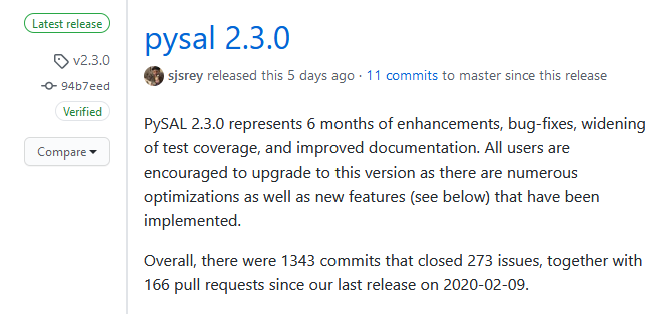
And just like that, a new version of @pysal_devs (2.3.0!) is in the wild! A brand new package -access- w/ classical&novel spatial accessibility; blazing fast local statistics (esda), topological coloring (mapclassify) many more improvements! Read on at: github.com/pysal/pysal/relea…
1
18
51

7 Apr 2020
The result of my first coding project in #Python - A #MotionMap of #Covid19 cases worldwide, up until today.
Steep learning curve but great fun because everything worked out.
#pythonlibraries #geopandas #pandas #geoplot #matplotlib #mapclassify #imageio #glob #datetime #os
1
3

12 Jul 2019
Bug-fix release 0.5.1 is out: only change compared to 0.5.0 is compatibility with the latest mapclassify release, for all your choropleths!
github.com/geopandas/geopand…
1
10
Super cool! If you want more choice for the color classifications, you could also use `mapclassify` (github.com/pysal/mapclassify), part of the PySAL federation. It's what geopandas uses under the hood and gives you quite a few options based on research. Happy to collaborate!
1
6