🚀Watch LIVE now as #ArtemisII gets ready for launch in little more than 2 hours!
📺NASA's Artemis II Live Mission Coverage (Official Broadcast): youtube.com/live/m3kR2KK8TEs
Many hands make flight work…
EarthCARE teams up with @DLR_en research aircraft HALO to validate the satellite’s measurements 🛩️🛰️
🔗egusphere.copernicus.org/pre…
ALT The photograph shows the HALO and ATR42 aircraft at Cabo Verde.
CREDIT
ESA–J. von Bismarck
🚀✨ GHGSat is here!
Part of @ESA’s Third-Party Missions programme, this Canadian satellite constellation monitors greenhouse gas emissions 🌱💨 from space.
📊 Check out our infographic to see how satellite technology is helping tackle climate change!
📷 @ESA_EO
How can we make #VHRODA better?🤔
🙏Please help us and take a few minutes to complete our survey at: docs.google.com/forms/d/e/1F…
Your feedback will be most welcome! 🙂
Missing #VHRODA25?
Presentations and posters are now available through the Agenda page at: earth.esa.int/eogateway/even…, with associated Zenodo DOIs.
Summary Minutes and Recommendations Report will be released in the following weeks. Keep an eye on: earth.esa.int/eogateway/even…
Having both CryoSat's radar and ICESat-2's lidar monitoring the same ice is an excellent opportunity.
Check out the latest comparison, "New insights into uncertainties in Antarctic elevation change estimates by comparing radar and laser altimetry"
👉egusphere.copernicus.org/pre…
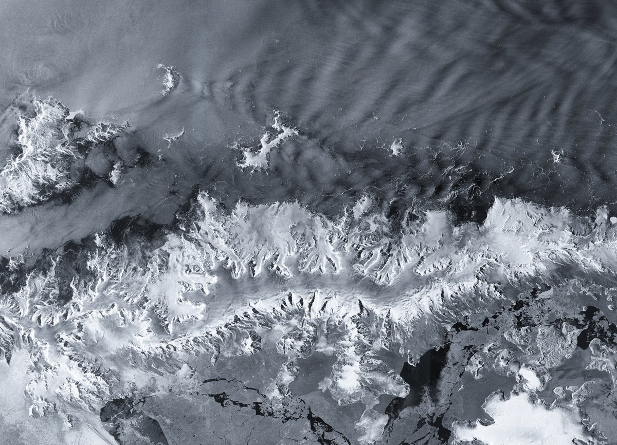
ALT This image is one of the first to be captured by the Copernicus Sentinel-1D satellite, which carries a 12 m-long synthetic aperture radar (SAR) instrument.
https://www.esa.int/Applications/Observing_the_Earth/Copernicus/Sentinel-1/Sentinel-1D_delivers_first_images_from_Antarctica_to_Bremen
Registration is open for the JACIE 2026 Workshop! Make plans now to attend April 13-17, 2026. The remote sensing workshop brings together federal agencies, industry partners and researchers to talk about what’s new in Earth observation. Register here: ow.ly/m8A150XRZlt
ALT Group of people attending a JACIE seminar with a presenter pointing toward a projector screen.
👏Thanks for all your support this year👏What a year!!! #CEOS_WGCV was impressed by the talent, experience, latest tech and fresh ideas you presented in 2025. We look forward to more!👀
Here's to calibrations which are harmonious and validations of pure joy!😎🛰️Happy 2026! 🙌🎉🪇
Big news: You can now access the full ASTER archive already processed in the cloud! The LP DAAC—a USGS-NASA partnership—finished the project early, so 25 years of data are ready for you. Here are just a couple views from ASTER. Learn more: ow.ly/5Ahb50XNhqc@NASAEarth
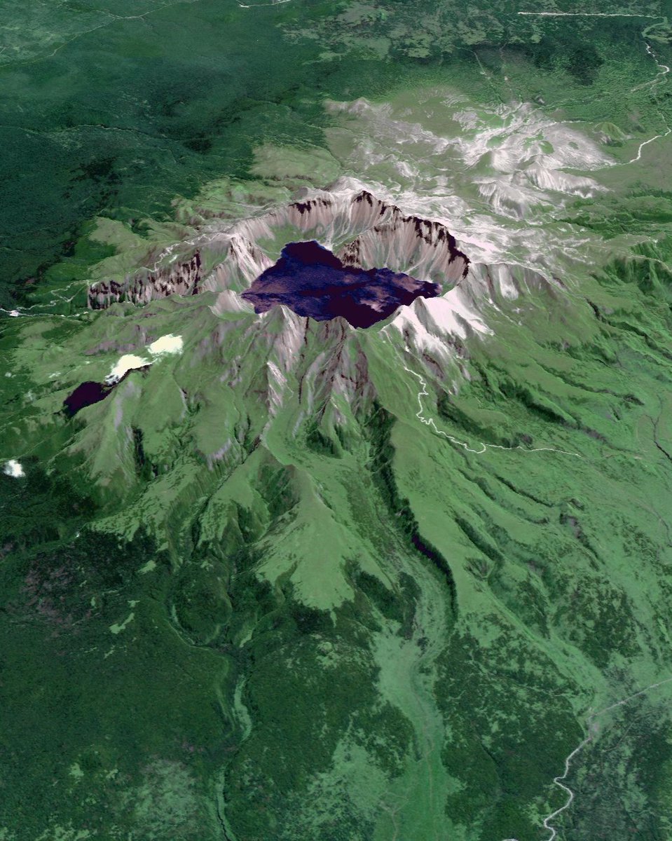
ALT Satellite image showing a large volcanic caldera with a deep lake at its center amid lush vegetation.
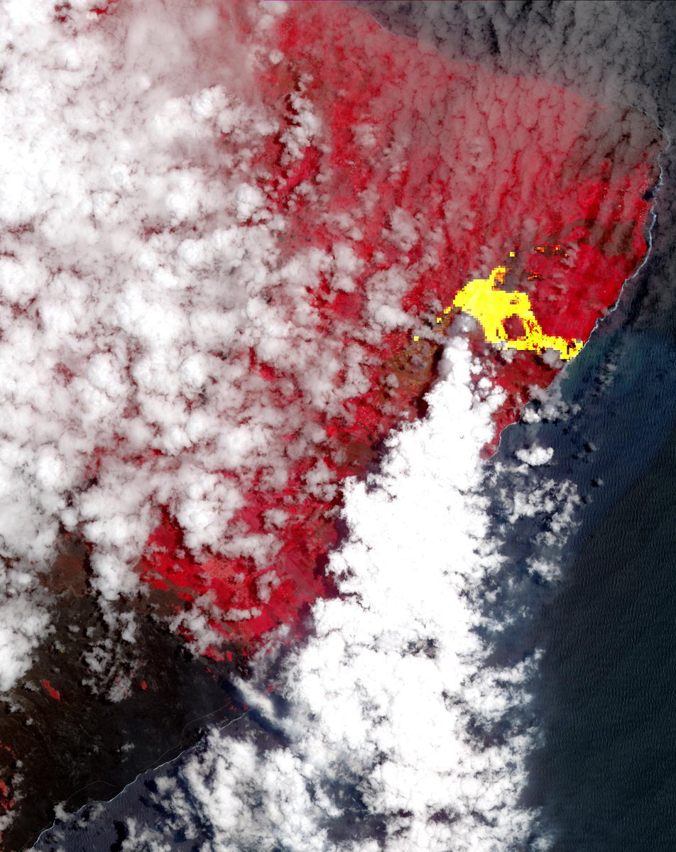
ALT Satellite view showing a volcanic eruption with bright yellow lava flow and surrounding areas of vegetation depicted in red under scattered clouds by the coastline.
📢 VH-RODA 2025 Presentations now available
Missed the VH-RODA 2025 meeting? The presentations are now available on Earth Online.
👉 View them here: earth.esa.int/eogateway/even…
🛰️ Two scientific papers on atmospheric correction recently published!
Conducted within @CEOS_WGCV, the Atmospheric Correction Inter-Comparison eXercise (ACIX) addresses atmospheric correction challenges with a comprehensive assessment of algorithms
🔗 ceos.org/news/acix-iii/
🙋♀️🙋🙋♂️Due to popular demand, the deadline for abstracts for #JACIE26 has been extended for the final time to 19 December 2025 👏👏👏
🛼🛼Get your skates on so you don’t miss out!
For more details 👀calval.cr.usgs.gov/apps/jaci…