
Hyperlocal journalism for Carmel Valley Village in Monterey County. #cvrg16
Joined August 2016
- Tweets 134
- Following 15
- Followers 54
- Likes 73
23 Photos and videos


6 Aug 2019

#MillFire #CA #CALPF bit.ly/2YHgQdC Mill Fire: The Mill Fire was reported at 5:36 a.m. on July 30\, 2019 on Mill Creek\, off of the
1
3 Aug 2019
#MillFire #CA #CALPF bit.ly/2YHgQdC Mill Fire: The Mill Fire was reported at 5:36 a.m. on July 30\, 2019 on Mill Creek\, off of the
1
Carmel Valley River retweeted

3 Aug 2019
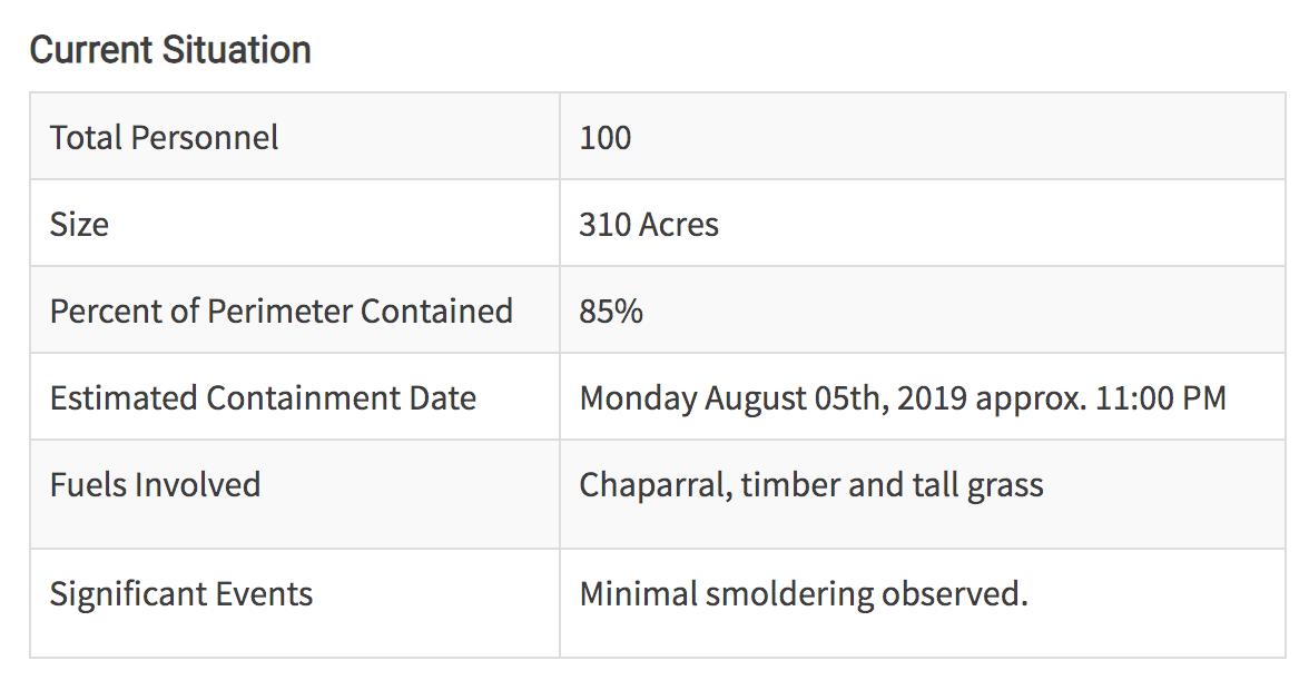
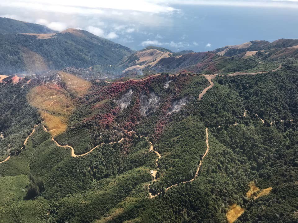
#MillFire holding at 310 acres & 50% containment. Crews will continue reinforcing line & snuffing out hotspots within the perimeter. Air resources based at the Fort Hunter Liggett helibase are available to support crews on the ground until the fire is declared OUT.

4
10
38
3 Aug 2019
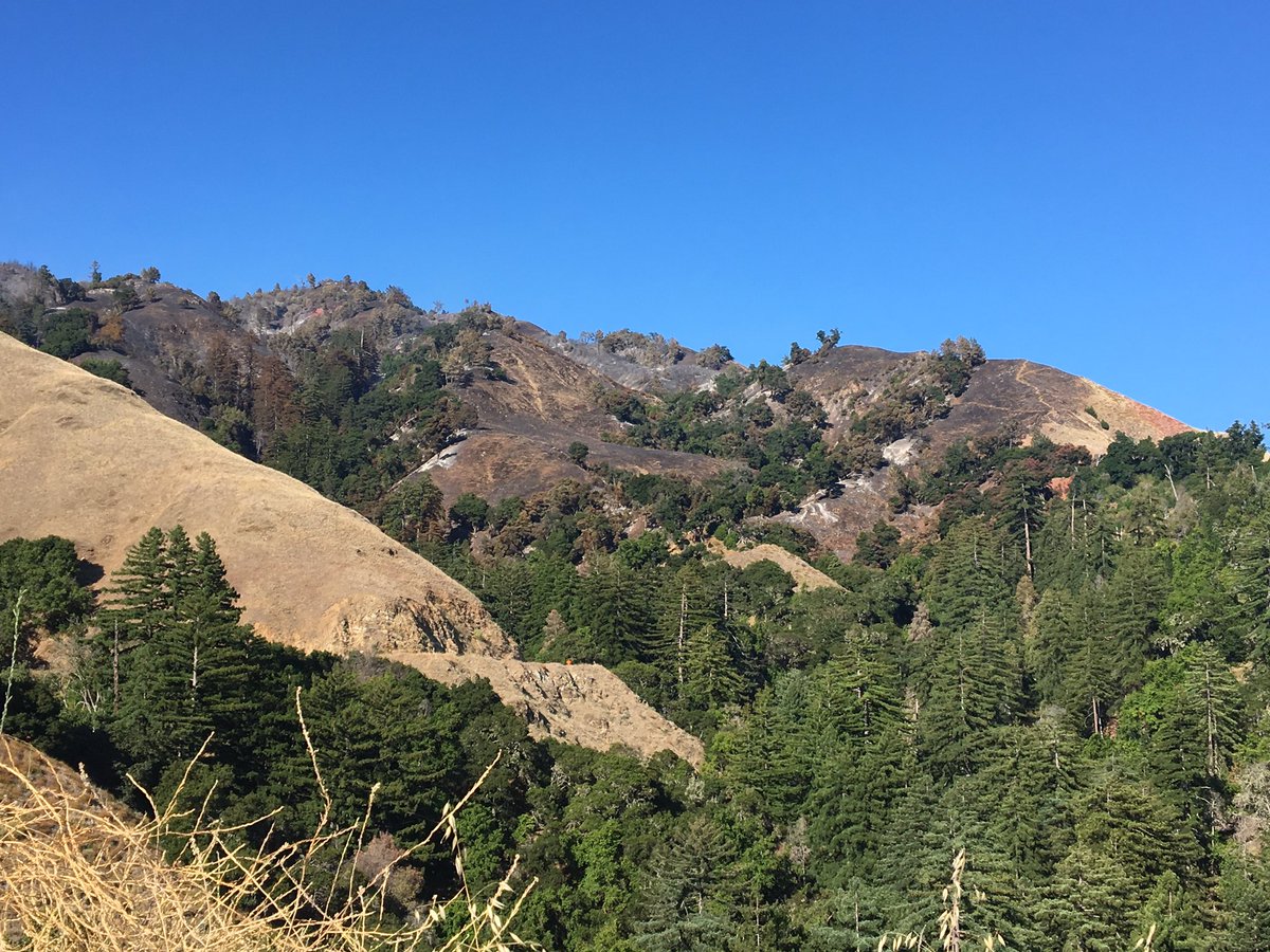
Big Sur Kate writes the community is giving the #MillFire response an A , and she's thanking the incident commanders. #cvrg16
3 Aug 2019

Mill Fire, Day 5, 8/3/19 bigsurkate.blog/2019/08/03/m…
1
3 Aug 2019
The Herald's clickbait teaser sounds like the #MillFire threat is building when the official report from @inciweb is the opposite, including the phrase "Good recovery," which never makes it into their article. #cvrg16
2 Aug 2019

Mill Fire in Monterey County burns almost 300 acres, sees little containment trib.al/Do9jGpx
1
3 Aug 2019
Contrast 300 acres to 2016 when the #SoberanesFire on Day 18 was 60,400 acres but still only 45% contained.
It would eventually last 82 days and burn 132,127 acres, the third largest fire in Monterey County.
1
3 Aug 2019
Historically, the 2008 Basin Complex fire was 162,818 acres, and the 1977 Marble Cone fire was 178,000 acres.
2 Aug 2019
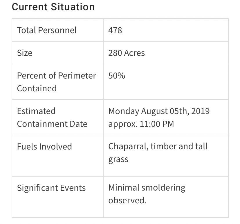
8/2 11 a.m. #MillFire significant events: "Fire behavior declined after midnight. Activity on the line decreased. Good recovery." Estimated containment date still Monday. #cvrg16
#MillFire #CA #CALPF bit.ly/2YHgQdC Mill Fire: The Mill Fire was reported at 5:36 a.m. on July 30\, 2019 on Mill Creek\, north west
Carmel Valley River retweeted

2 Aug 2019
#millfire in Monterey County. Just above California’s famous highway 1. No smoke showing
1
2
6

1 Aug 2019
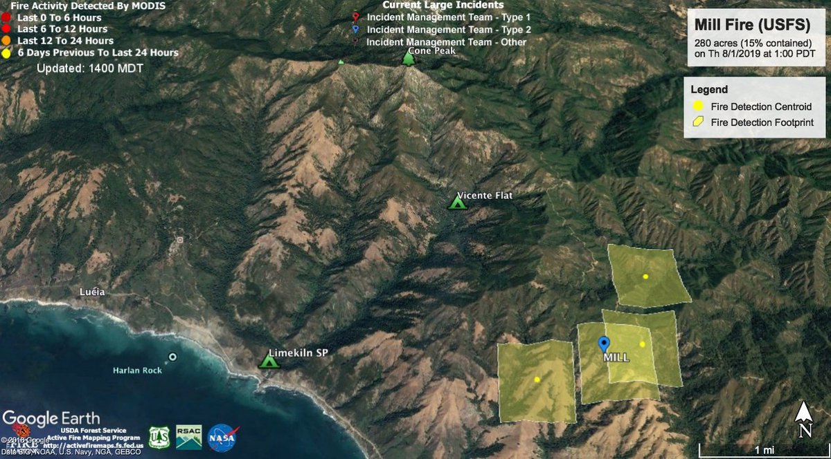
The #MillFire map using Google Earth and MODIS data at 1 p.m. on 8/1/2019. Limekiln State Park remains open but Vicente Flat remains closed. Follow @LosPadresNF for latest fire updates and @ventanawild for trail closures. #cvrg16
ALT Map showing four squares of previous fire activity south of Limekiln State Park.
1
1
1 Aug 2019
#MillFire #CA #CALPF bit.ly/2YHgQdC Mill Fire: The Mill Fire was reported at 5:36 a.m. on July 30\, 2019 on Mill Creek\, north west
1
3
1 Aug 2019
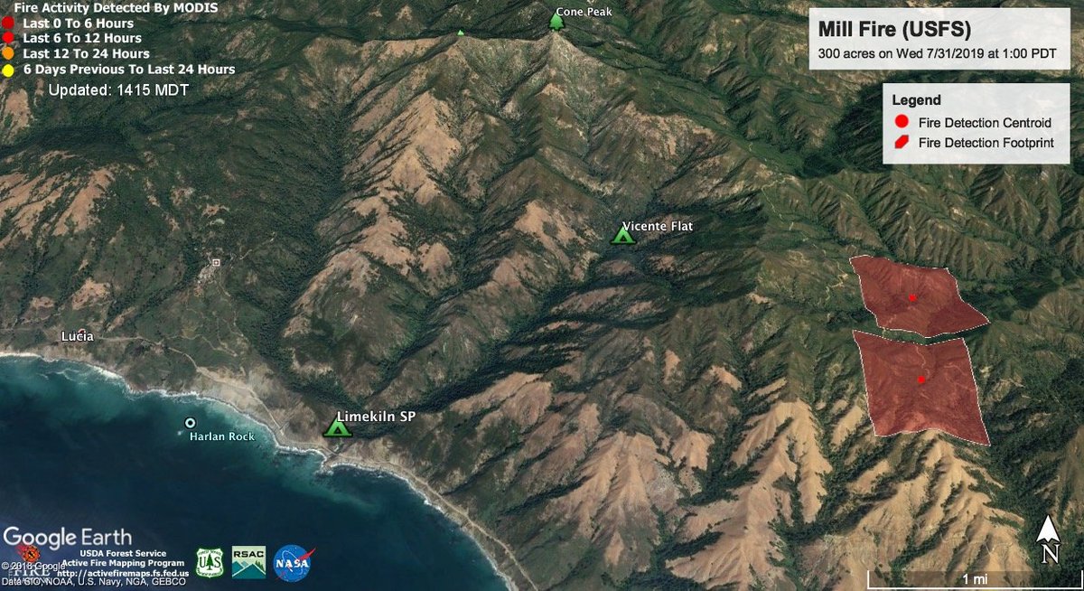
The #MillFire map using Google Earth and MODIS data at 1 p.m. on 7/31/2019. Limekiln State Park remains open but Vicente Flat is closed. Follow @LosPadresNF for latest fire updates and @ventanawild for trail closures. #cvrg16
4
5
16 Oct 2016
Rain has finally come to the Village & we are that much closer to containing the #SoberanesFire. medium.com/carmel-valley-riv…
16 Oct 2016
Seeing 0.11' at Los Padres Dam but 1.10' on Ponciano Ridge & 2.80' up at White Rock, on the eastern edge of the #SoberanesFire x.com/NWSBayArea/status/7876…
16 Oct 2016

Unofficial Storm Rainfall Reports through 6AM from around the San Francisco Bay and Monterey Bay areas: wrh.noaa.gov/total_forecast/…
#cawx
23 Aug 2016
Shirt for sale at the Village Market. Not so sure about the claim of "largest." Thoughts @KeithVandevere? #cvrg16
19 Aug 2016
1 PM: Traffic slows to a crawl at Via Mallorca but opens up past Rancho San Carlos Road. #cvrg16
ALT traffic jam on CV Road
18 Aug 2016
Poke Lab food truck may be coming to Carmel Valley on the weekends. #cvrg16 x.com/MontereyMCA/status/766…


17 Aug 2016