
MultiOne j.d.o.o.
Joined October 2019
- Tweets 20
- Following 25
- Followers 29
- Likes 41
Photos and videos
MultiOne j.d.o.o. retweeted

25 Aug 2025
🚀 Today, we officially launch the Open Geospatial Carbon Registry (OGCR) in Doorwerth! 🌍
Our mission: build an open, transparent, and farmer-friendly carbon registry for Europe.
#OGCR #CarbonFarming #EUGreenDeal #CarbonRegistry

2
9
51
2,426
MultiOne j.d.o.o. retweeted

1 May 2024
A Map🗺️ Showing Soil Texture Types 🏜️ of Kingdom of Saudi Arabia🇸🇦 ,Dataset is from (Hengl,T.,MacMillan,R.A,.2019)
#SaudiArabia #Soil #geology #map #dataviz #gischat #geospatial #dataviz #qgis #b3d #Blender
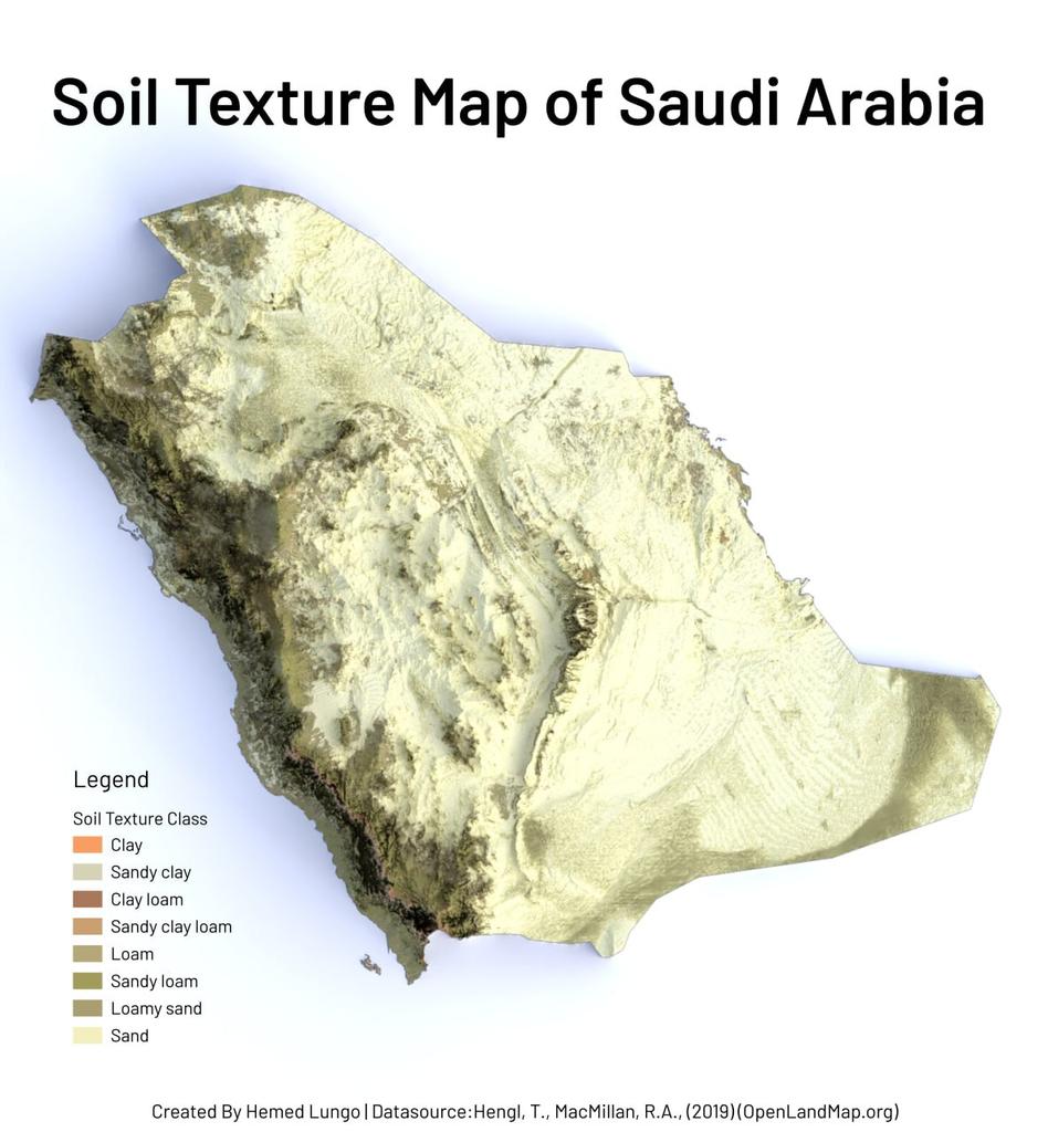
ALT Soil Texture Map of Kingdom of Saudi Arabia
1
4
50
2,522
MultiOne j.d.o.o. retweeted
1 May 2024
A Map🗺️ Showing Soil Texture Types of Africa Continent, Dataset is from (Hengl,T.,MacMillan,R.A,.2019) #Africa #EastAfrica #WestAfrica #SouthAfrica #NorthAfrica #Soil #geology #map #dataviz #gischat #geospatial #dataviz #qgis #b3d #Blender

ALT A Map🗺️ Showing Soil Texture Types of Africa Continent
3
28
134
7,641
MultiOne j.d.o.o. retweeted

14 Feb 2023
We are building ensemble DTM of the world at 30m for #geomorphometry research communities; next we will build series of DTM parameters (slope, northness, eastness, catchment area, openess, erosion risk, TWI etc) and then make them available as COGs: opengeohub.medium.com/an-ens…
5
16
990
MultiOne j.d.o.o. retweeted
27 Oct 2022
📣 Help us improve #data access & #findability by filling out the survey of the @EarthMonitorOrg by @GFZ_Potsdam
What are your biggest challenges w #geospatial data? What would you change?
Share the link: ec.europa.eu/eusurvey/runner…
#FAIRdata
2
6
MultiOne j.d.o.o. retweeted

25 Jul 2022
📢 Paper out! Mapping all the things all the time: We mapped 43 #LULC classes at once with #MachineLearning, using @corine, #LUCAS and @UMD_GLAD #landsat data.
Check it at peerj.com/articles/13573
and the maps on ecodatacube.eu
#opendata #openscience #remotesensing
2
13
35
MultiOne j.d.o.o. retweeted
20 Jul 2022
We have added the 10m spatial resolution seamless mosaics for EU for period 2017--2021 to enhance @HarmonizerGeo use cases and support environmental monitoring projects; powered by @DMultione. Visit stac.ecodatacube.eu to import data into your projects #OpenData @EU_HaDEA

2
6
19
MultiOne j.d.o.o. retweeted
12 Jul 2022
[- 7 days to the #OpenEarthMonitor Project Launch💫]
🗓Come and join us in our very first #interactive workshop: meet experts, provide feedback and #TellUsYourStory from the ground!
🔎Info: bit.ly/3nOglZP
Register: bit.ly/3ArlA9y
@HorizonEU #EO4Europe
3
2
MultiOne j.d.o.o. retweeted
28 Jun 2022
Meet our #keynotes🎙️
Join, connect and contribute to the discussion together with world-leading experts 🌐
Programme & speakers: earthmonitor.org/
Registrations: bit.ly/3Lq7qbx
#openscience #opendata #EO #cyberinfrastructure #GreenDeal #Europe #HorizonEurope
3
6
MultiOne j.d.o.o. retweeted
15 Jun 2022
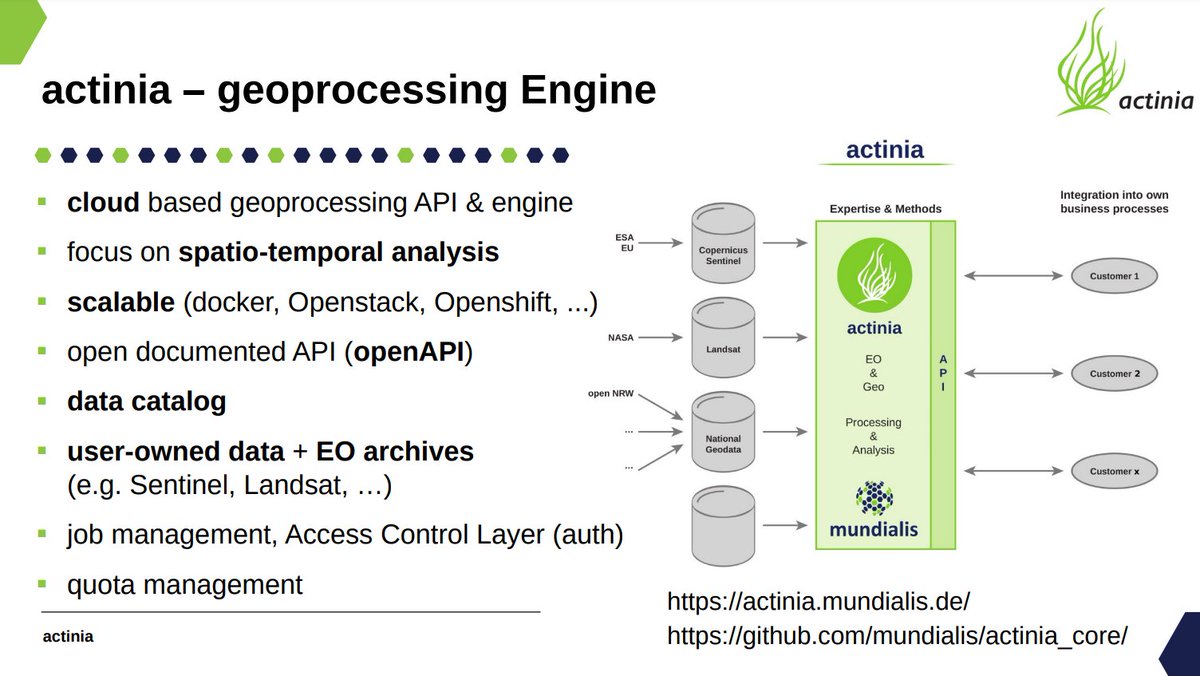
Just watching @MarkusNeteler presenting Actinia cloud services for processing 🌍 data (using GRASS, GDAL and similar in backend) at the #OpenDataScience workshop Prague @CVUTPraha @HarmonizerGeo Examples with jupyter python notebooks are available at: github.com/mundialis/actinia…
7
20
MultiOne j.d.o.o. retweeted
10 Jun 2022
📣 Open event: DEADLINE EXTENDED to July 1st!
Open-Earth-Monitor is a @HorizonEU-funded project building an #opensource #cyberinfrastructure to accelerate the uptake of #environmental information: join the Open-Earth-Monitor #user #community!
bit.ly/3Lq7qbx #free
3
2
MultiOne j.d.o.o. retweeted
23 May 2022
Big #EarthObservation Data and upcoming #EO missions🛰️:
Learn how to contribute to the upcoming @HorizonEU Open-Earth-Monitor through interactive debates, demo sessions & social activities at the public workshop in #Wageningen @WUR
👉Register by 1 June: bit.ly/3Lq7qbx
7
13

MultiOne j.d.o.o. retweeted
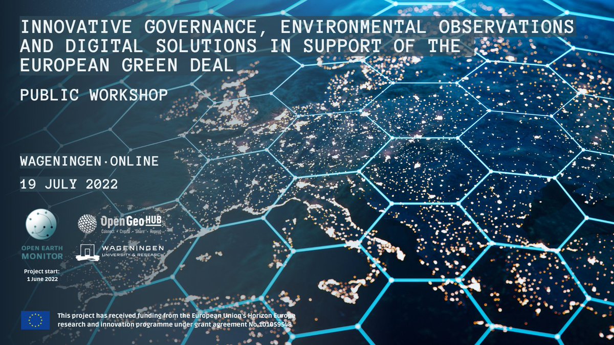
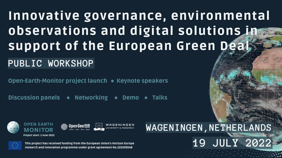
3 May 2022
Innovative #governance, environmental observations and digital solutions in support of the European Green Deal —the public workshop of the upcoming @HorizonEU Open-Earth-Monitor project.
👉Info: earthmonitor.org/
👉Register: bit.ly/3Lq7qbx
#opendata #EUGreenDeal
10
16
MultiOne j.d.o.o. retweeted

6 Apr 2022
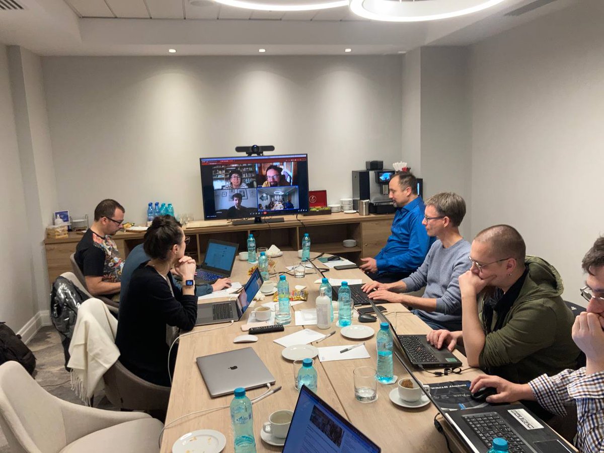
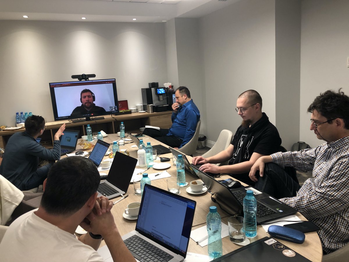
The team @MundialisInfo @opengeohub @DMultione @TERRASIGNA @CVUTPraha is
busy polishing #opendata #foss4g #geo-harmonizer results during the co-dev meeting in #Bucharest. Come to the @cinea_eu #CEFTelecom #ODSE workshop in Prague, 13-16.06, to check them out!
3
9
MultiOne j.d.o.o. retweeted
24 Feb 2022
Looking for the analysis-ready EO #OpenData for Europe 🇪🇺? The @HarmonizerGeo project has produced 210GB of cloud/artifact-free #sentinel2 images at 30m covering 2018 and 2019 and available as Cloud-optimized GeoTIFFs: opengeohub.org/datasets/seam… 👏 @DMultione @EU_HaDEA
1
16
77
MultiOne j.d.o.o. retweeted

3 Apr 2022
I did it.
I hope this might make me feel a bit more comfortable on solo road rides.
34
1
113
MultiOne j.d.o.o. retweeted

3 Feb 2022
For the love of trees 🌳
2 Feb 2022

The presence-absence database with 4.4 million training points for #tree #speciesdistributionmodelling for Europe is now available 🌳 Check out here: bit.ly/34ecO0w
#LUCAS @HarmonizerGeo @EU_HaDEA @GBIF @EU_ScienceHub @jo_heisig @CBonannella

1
2
MultiOne j.d.o.o. retweeted
2 Mar 2021
We have mapped land cover classes for the 2000-2019 period for continental Europe at 30-m resolution using spatiotemporal ML. Explore the dynamic EU landscapes on your palm using the ODS-Europe viewer: maps.opendatascience.eu
Read more in: opengeohub.medium.com/europe… @inea_eu
1
8
14
MultiOne j.d.o.o. retweeted
9 Oct 2019
OpenGeoHub, @CVUT, @MundialisInfo, @TERRASIGNA and @DMultione are starting a 3yrs project “Geo-Harmonizer” (ec.europa.eu/inea/en/connect…) funded by @inea_eu (1.8M EUR). We look forward to developing software and new harmonized GIS layers for EU citizens. #OpenData #GRASSGIS #Rstats
6
8