Tornadoes and stuff 🐻⬇️ Meteorologist from NIU and Storm Chaser #Cubs

Joined April 2020
2,637 Photos and videos
Pinned Tweet
Powerflash illuminates the Enid, #okwx tornado at the end of its life. If you zoom in you can see the ghostly inner vortex
6
76
874
18,871
4 years ago today, a monstrous supercell exploded like a nuke over Chicagoland. This storm exceeded 65K feet in height and caused damage to much of the CHI metro, dropping a few weak tornadoes. If shear was better, a tornado disaster may have transpired #ilwx
12
33
538
75,759
This event highlighted the impact the lake breeze may have in certain setups. A similar setup with better shear would spell an absolute disaster for Chicagoland
1
1
32
2,361
Noctilucent clouds over Northern IL tonight! First time ever seeing them
9
145
4,011
Ethan Mok retweeted
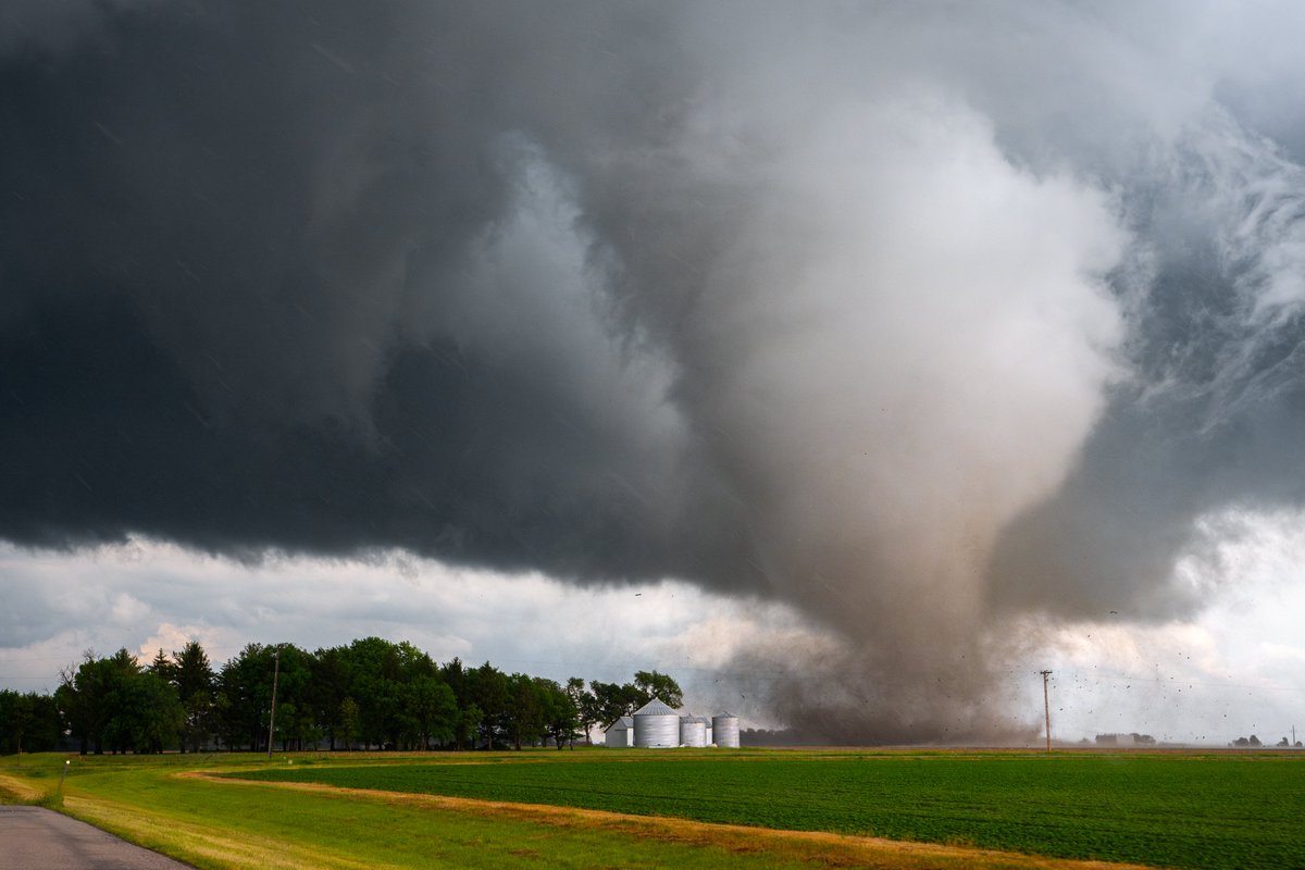
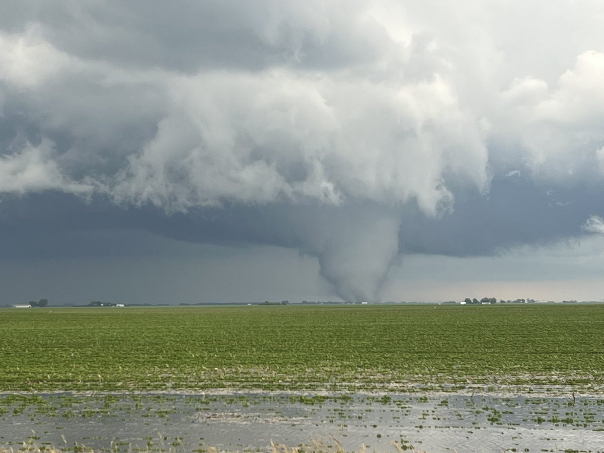
About 90% of the lifecyle of the Dwight, IL tornado. @NWSChicago
4
47
347
12,661
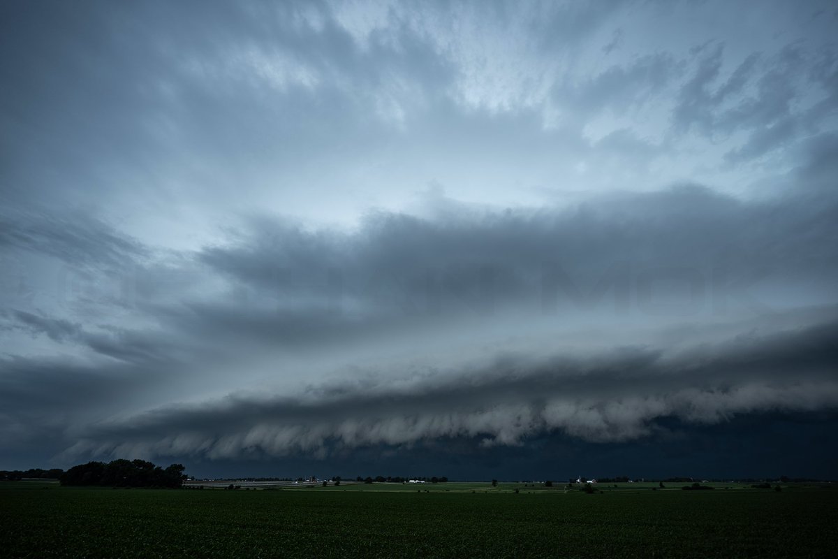
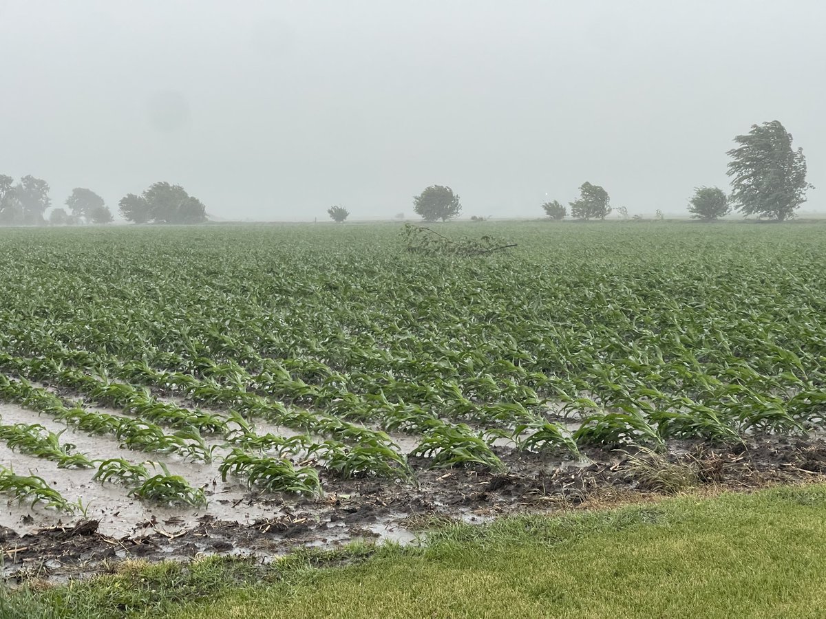
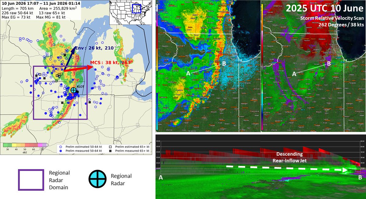
It has been an incredibly active couple days across the Midwest. You can count about 6 separate MCSs in this radar loop, many rolling through south Chicago which has been absolutely hammered. Another chance at storms is coming mid next week, and the pattern looks active after too
1
6
64
2,646
Points at sign
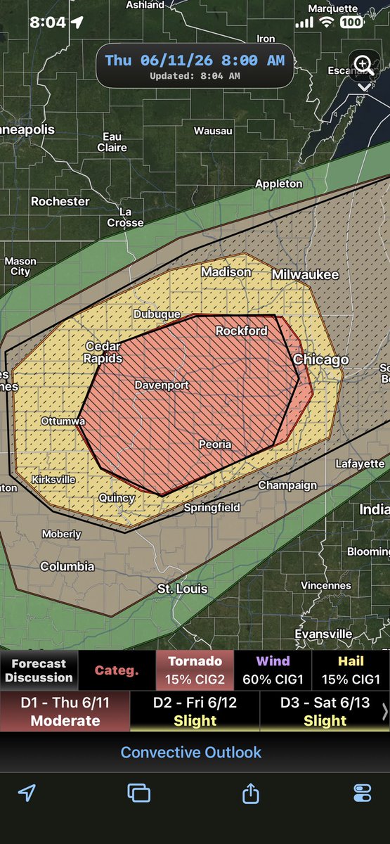
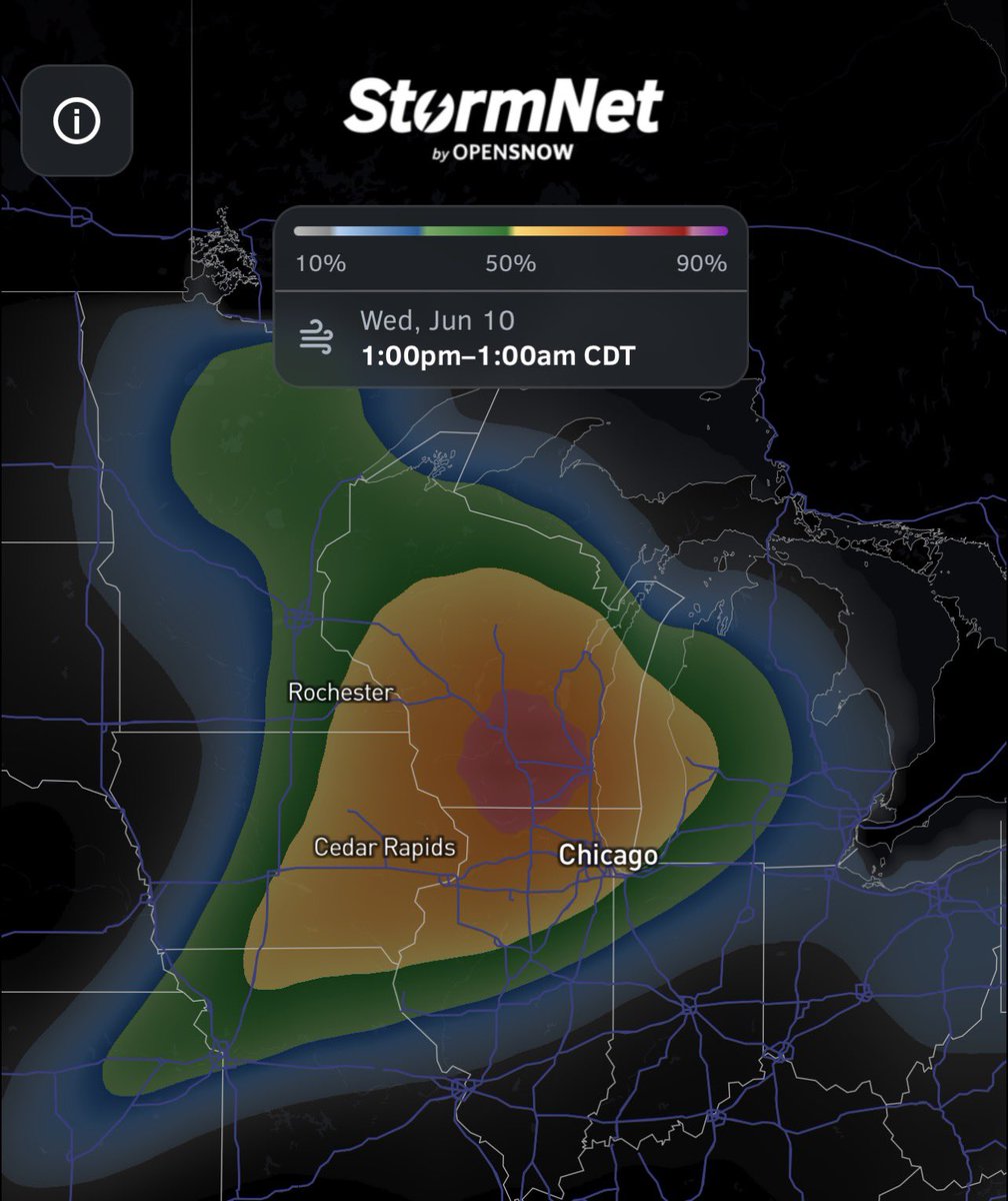
Overall pattern on Thursday looks favorable for derecho potential in Midwest. Will be interesting to see how things pan out with complex morning precip situations, but background elements are certainly present. Stormnet likes Wednesday, could be either days (both?)
1
37
3,743
Ended up being both days x.com/nwsspc/status/20654599…

The damaging wind swath from Wednesday, June 10 has been preliminarily confirmed as a derecho. The wind swath had a track length over 400 miles with a footprint just under 100,000 square miles. The strongest known gust was measured at over 94 mph.
1
6
716
Ethan Mok retweeted
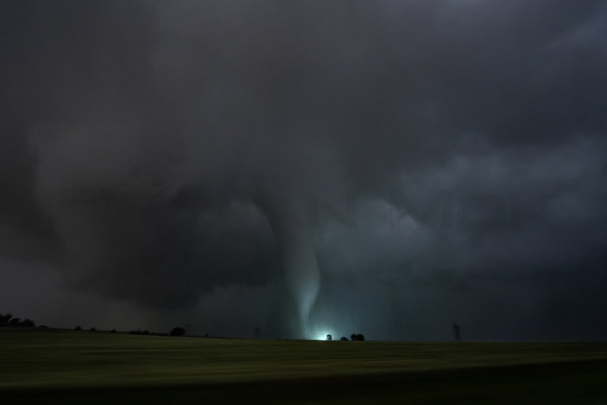
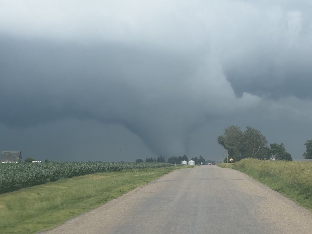
LARGE AND POWERFUL TORNADO WEST OF REDDICK, IL @NWSChicago #ilwx
5
87
299
18,472
The moment a rope tornado fully condensed with the truck from Twister in front of us, Dorthy in the bed and all. Definition of life imitates art
10
102
1,523
70,659
Ethan Mok retweeted
Large tornado N of Long Point Illinois #ilwx
10
136
600
22,850
I just captured the Twister truck with Dorthy in the bed in front of a beautiful rope tornado holy shit
12
81
426
17,580
Beautiful snakey rope near Lewistown, #ilwx. Just lifted @NWSLincolnIL
2
33
258
6,334
Very indifferent to this prospective chase right now. The song about sums it up
14
698
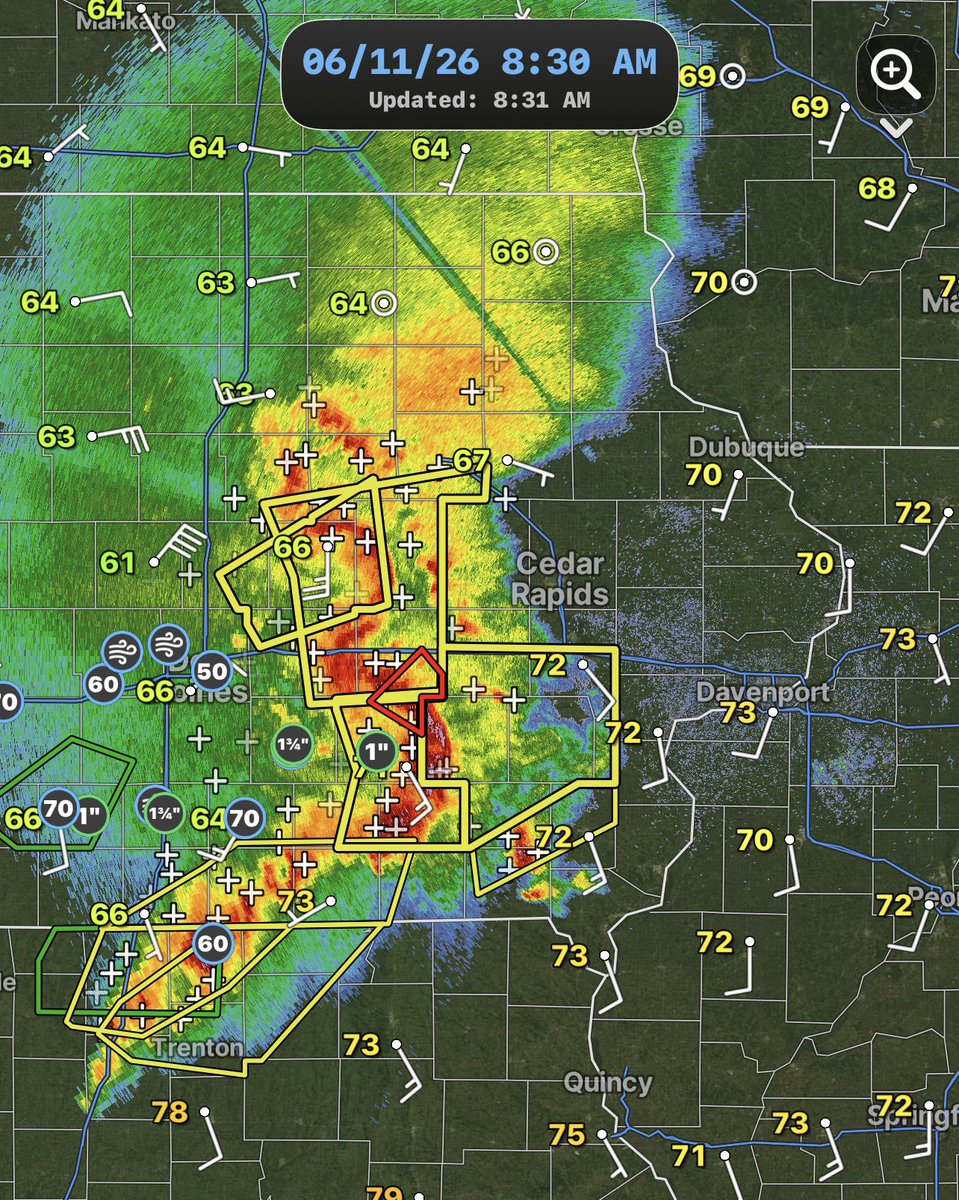
Morning storms are very strong, but the main bowing segments have begun to move northeasterly rather than straight east. The southernmost segment is also elevated. This scenario is accounted for in recent CAM runs, yet a favorable outcome for tornadic supercells still prevails
1
4
29
2,203
In this scenario, the zone for tornadic supercells shifts a bit further south and east. Robust warm air advection and airmass recovery is likely behind this morning complex. Very difficult forecast at hand. MDT upgrade released
2
4
29
1,139
Nice high quality discussion from Thornton/Lyons for this initial day 1. Almost forgot what a good discussion looked like
11
1,084
If I had to bet on the outcome for today’s severe threat, I’d say you get messy, string bean storms that struggle to strengthen but eventually one or two produce rainwrapped tornadoes. This is owed to poor low level thermos keeping storm intensity down. However…
2
2
53
7,639
Weaker morning storms are a real possibility. If a clearing develops and sufficient mixing can occur, this environment is one of the most volatile I have ever seen across northern Illinois. A violent tornado would absolutely be possible.
1
1
19
1,480
I do wonder if mid level lapse rates can carry this event a little bit. Still have 60kts of 0-6km shear paired with mid 7 to low 8 LRs in the mid levels. If storm mode cooperates there is a chance
1
1
9
1,244