
The representation in this feed of any fact, stay or opinion is no evidence of the existence of any right thinking
Joined October 2017
- Tweets 325
- Following 158
- Followers 48
- Likes 188
47 Photos and videos


22 Sep 2022
West Yorkshire Combined Authority are recruiting a GIS Analyst. If you have Esri and FME skills this is a splendid role that will let you demosntrate your data manipulatiuon, analysis and visualisation skills.
westyorks-ca.gov.uk/vacancie…
1

20 Aug 2020
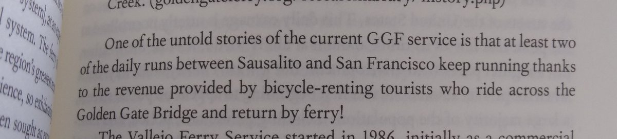
When I was in San Francisco early this year I loved the transport museums and thier left leaning analysis of the cities transport history and current ecosystem. These ideas are excellent captured in Hidden San Francisco from @Nowtopian and letting me relive happy holidays!
Dean Ellison retweeted

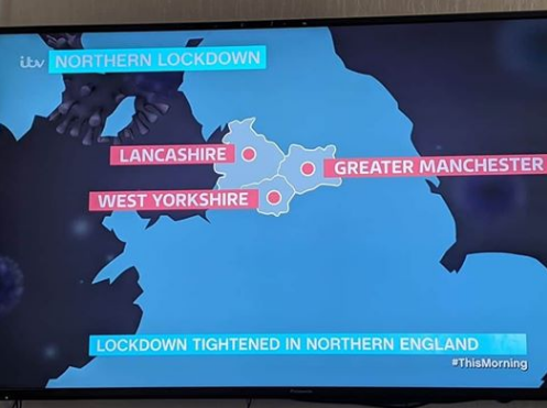
31 Jul 2020
In other news ... @ITV seem to have moved Greater Manchester over the Pennines today ... and shifted a chunk of Yorkshire this way ...
199
489
2,246
Dean Ellison retweeted

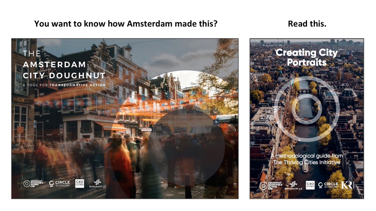
19 Jul 2020
Tomorrow we publish the methodology for how to downscale the Doughnut to the city. If you want to explore how you could downscale the Doughnut where you live, watch this space on Monday morning!...
46
577
1,972
Dean Ellison retweeted

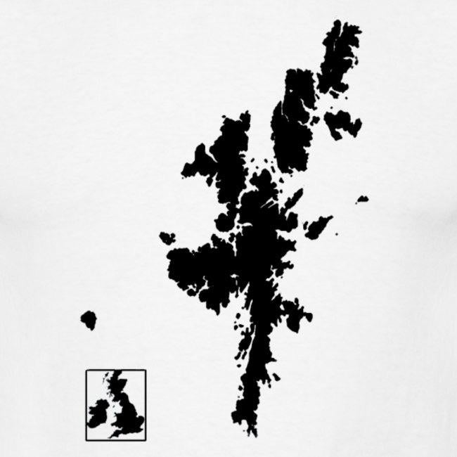
8 Jul 2020
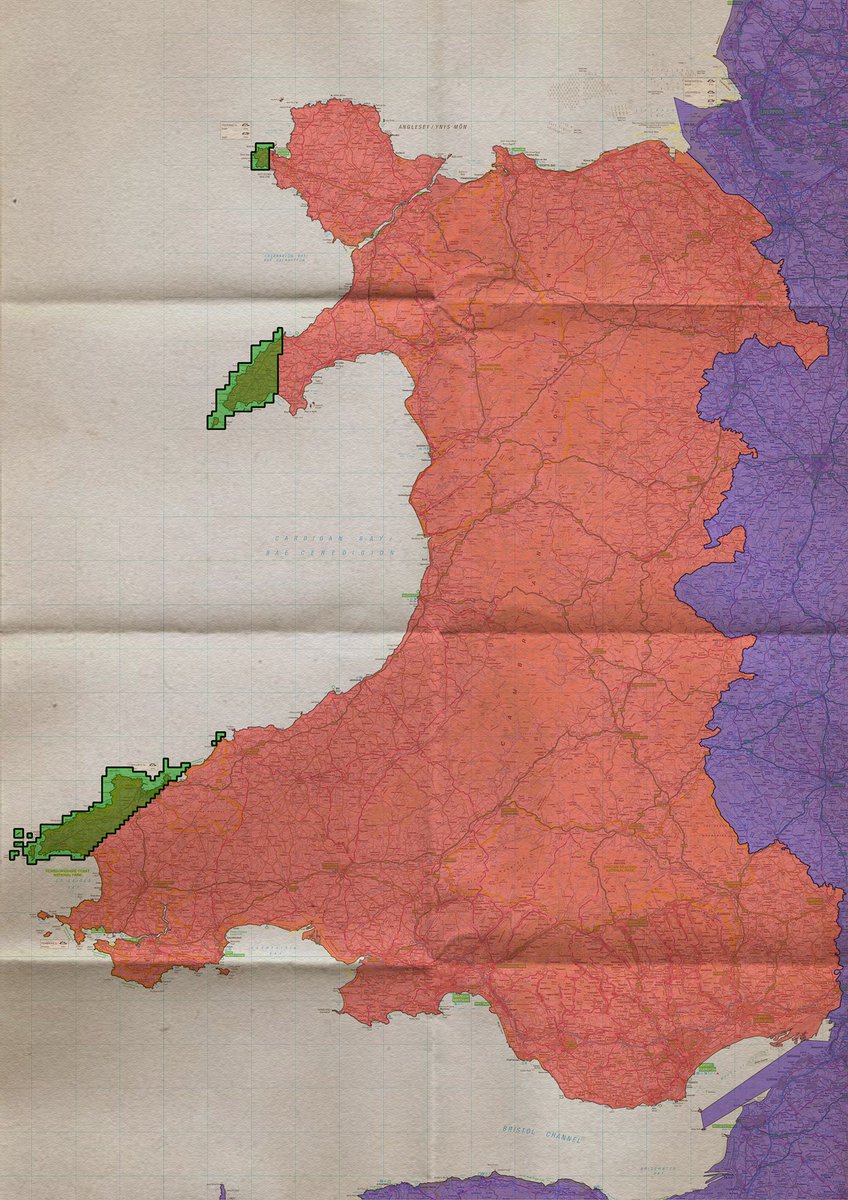
Mae'r ardaloedd gwyrdd ar y map isod yn agosach i Iwerddon na Lloegr.
The green areas on the map below ar closer to Ireland than England.
27
79
523


Dean Ellison retweeted

1 Jul 2020
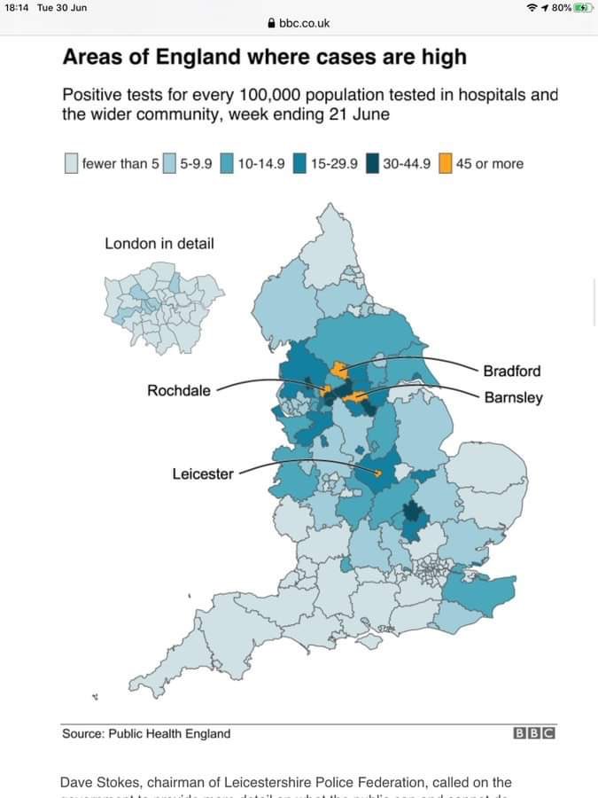
A #COVID19 fever map and a Bradford needs urgent care. Cases high and the @BTHFT still too busy. This is such a critical time to keep social distancing, avoid gatherings, maintain hand washing and keep looking after our vulnerable citizens.
The virus is still circulating
8
281
296
Dean Ellison retweeted

30 Jun 2020
Car usage is now at around 70% of what it was pre-COVID. Bus use is still at 25-30%, because of the message to prevent its use. Cycling, walking & e-scootering can’t do the heavy lifting. Buses are mass transit and can - safely and cleanly.
#ChangetheMessage #CleanSafeReadytoGo

14
68
226
14 Jun 2020
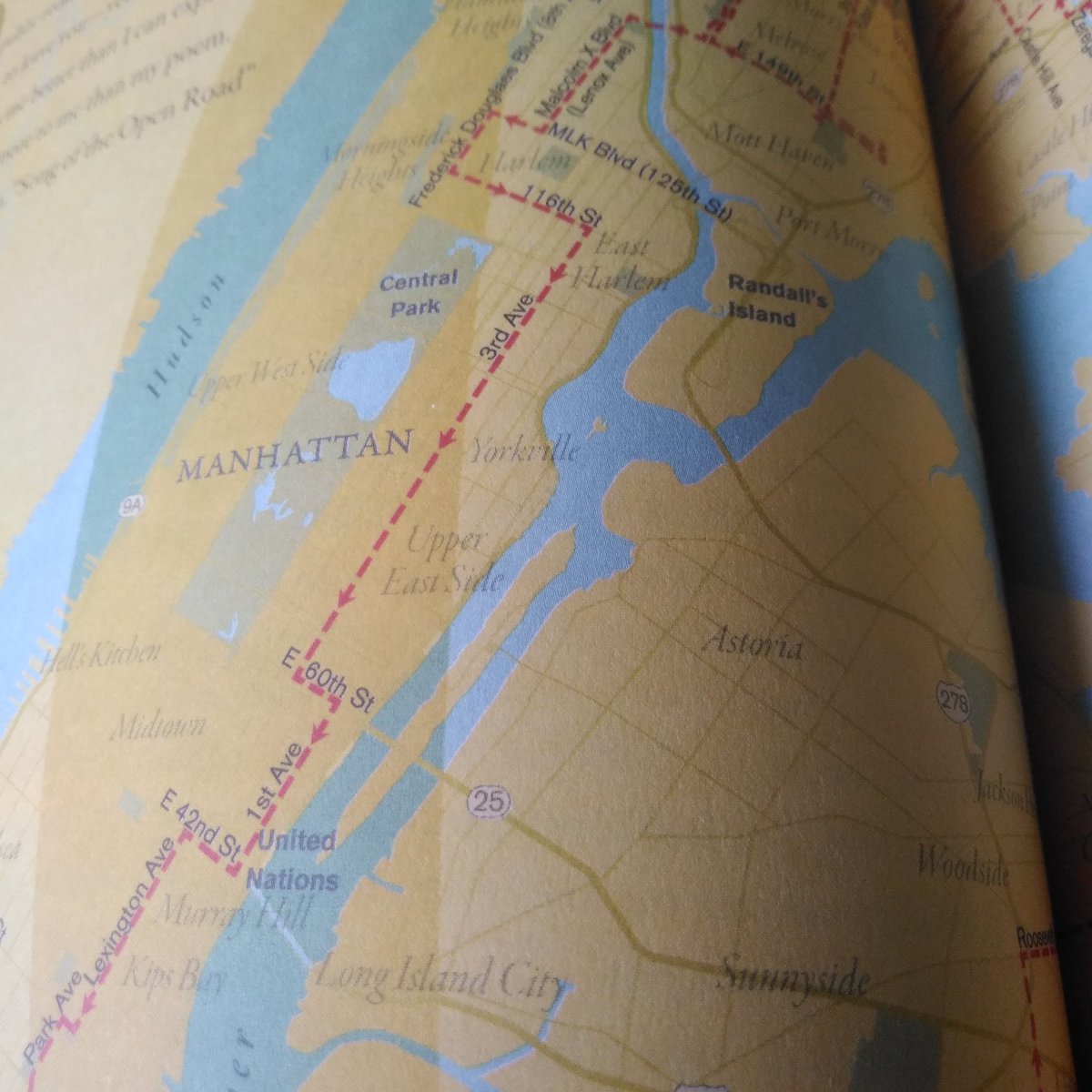
Solnit's third atlas, Nonstop Metropolis, has made me realise that Manhattan runs NE to SW. Because of the subway map I always assumed it was N to S 🤦
Shows the power of a transport map!
1
14 Jun 2020
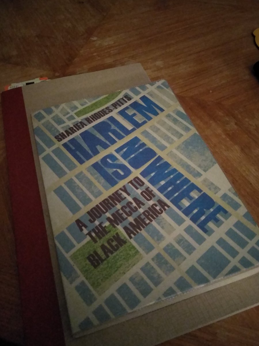
I loved Garnette Cadogan's chapter, the storyof his unexpected turn as a Shabbos Goy and his map of a 24 hour walk in New York. It says so much about how walking connects people to place.
17 Mar 2020
WFH means finally catching up on @Esri online training content.
Long over due, but I've finally watched the introduction to new story maps with @greysonviz and @allencarroll. The frustrations with the new site and now replaced with ideas and opportunities.
1
Dean Ellison retweeted

17 Mar 2020
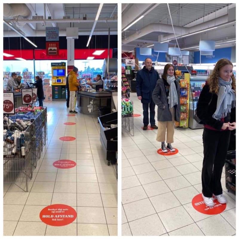
Distancing solution in a Danish supermarket
via Henrik Schou
274
7,032
21,256
Dean Ellison retweeted

11 Feb 2020
Is Your Child Texting About GIS?
LOL: latitude or longitude
SMH: spatial modeling help
OG: opensource GIS
IDC: I desire coordinates
STFU: shit the files are unprojected
FML: friggin maintenance license
#mappymeme #gischat
37
347
1,165
27 Jan 2020
Building on the @OrdnanceSurvey #ColourBlind friendly Zoomstack layers I've been finding out more about accessibility and @ArcGISOnline.
I found this really helpful video from @Esri presenting to the US Department of @Interior last year. Recommended.
doi.gov/ocio/section508/vide…
1
21 Jan 2020
Hurrah, my opinions in the double red lines approaching Speke International airport are reaching a large audience.
I think in both Leeds and Liverpool the only place I see #DoubleRedLines is on the approach to privately owned airports with paying drop off.
Why none in cities?
1
20 Jan 2020
Something about the relief in this map makes me feel very disoriented 😵
1
14 Jan 2020
I've been looking for a new North arrow for my maps and now I think I've found it
14 Jan 2020

The gravity of the wolf moon/lunar eclipse and emotional weight of recent medical traumas/medication adjustment have forced me to navigate some pretty rough roads. It's been intense, but finally feels like I've turned a corner and am headed in the right direction.

1
Dean Ellison retweeted

12 Jan 2020
An interesting report v/ @FT on the BBC’s out-of-London plans & what that could mean for #North
ft.com/content/09cea670-3536…
1
12
30