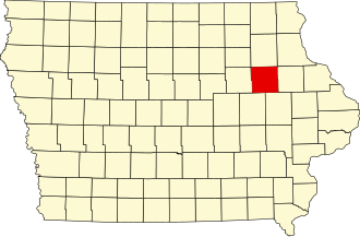
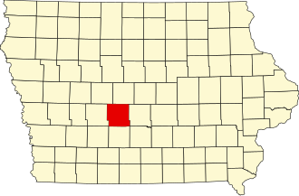
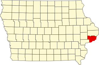
IEMA exists to advance the professional interests of its members and to assist Iowans in preserving life and protecting property in the face of any hazard.
- Tweets 6,865
- Following 94
- Followers 790
- Likes 63


ALT This graphic displays Tornado Watch watch number 210 plotted on a map. The watch is in effect until 11:00 PM CDT. The watch includes parts of Iowa and Missouri. The threats associated with this watch are a few tornadoes likely, scattered hail up to tennis ball size likely and scattered gusts up to 70 mph likely. There are 330,490 people in the watch along with 299 schools and 27 hospitals.

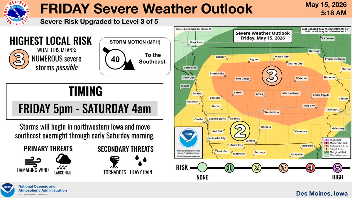
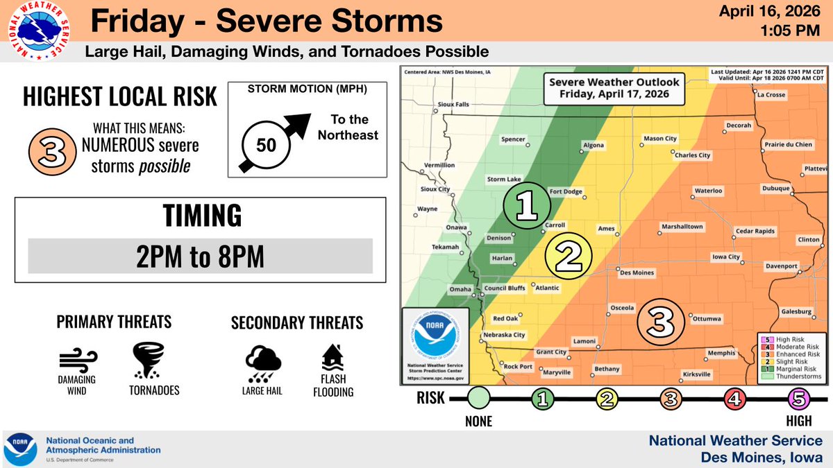
ALT A forecast slide from the National Weather Service in Des Moines, Iowa detailing the severe weather risk for Friday, May 15, 2026. The highest severe weather risk is generally north of Highway 92. The slide details timing for the severe weather as starting around 5 pm in northwestern Iowa and ending Saturday morning around 4am.

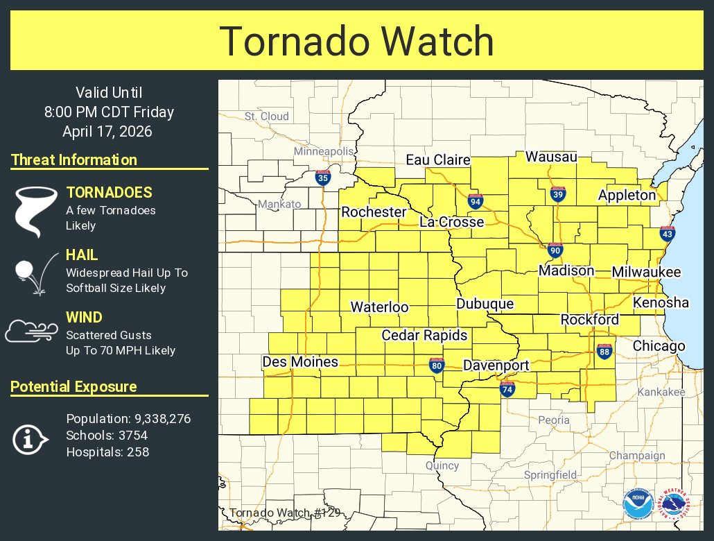
ALT This graphic displays Tornado Watch watch number 129 plotted on a map. The watch is in effect until 8:00 PM CDT. The watch includes parts of Illinois, Iowa, Minnesota, Missouri and Wisconsin. The threats associated with this watch are a few tornadoes likely, widespread hail up to softball size likely and scattered gusts up to 70 mph likely. There are 9,338,276 people in the watch along with 3754 schools and 258 hospitals.
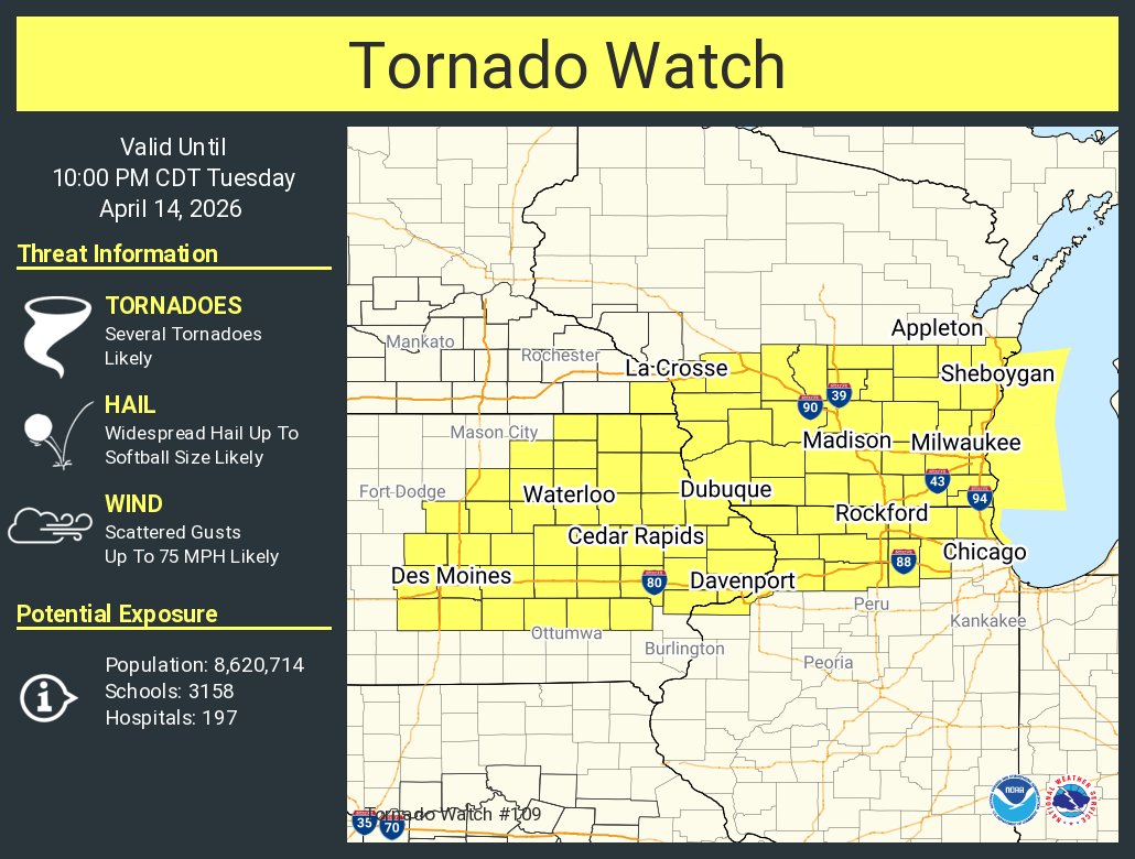
ALT This graphic displays Tornado Watch watch number 109 plotted on a map. The watch is in effect until 10:00 PM CDT. The watch includes parts of Illinois, Iowa, Minnesota and Wisconsin. The threats associated with this watch are several tornadoes likely, widespread hail up to softball size likely and scattered gusts up to 75 mph likely. There are 8,620,714 people in the watch along with 3158 schools and 197 hospitals.
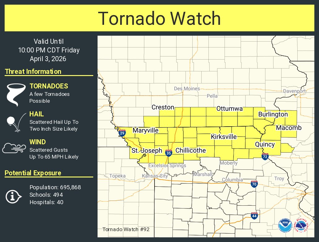
ALT This graphic displays Tornado Watch watch number 92 plotted on a map. The watch is in effect until 10:00 PM CDT. The watch includes parts of Illinois, Iowa, Kansas and Missouri. The threats associated with this watch are a few tornadoes possible, scattered hail up to two inch size likely and scattered gusts up to 65 mph likely. There are 695,868 people in the watch along with 494 schools and 40 hospitals.

ALT Severe Weather Outlook for Friday, April 3, 2026 from the National Weather Service in Des Moines, Iowa. The severe risk timing is from 2 PM to 11 PM. Primary threats are large hail and damaging winds, with secondary threats including Flash Flooding and possibly Tornadoes. Storm motion is 45 MPH to the East-Northeast. Recommended safety actions are to stay weather aware, have multiple ways to receive warnings, and seek nearby sturdy or indoor shelter.

ALT Map of Iowa showing flooding risk mainly for Friday. Most of central and eastern Iowa is highlighted as a limited risk. Flash flooding in urban areas and isolated minor river flooding is possible.
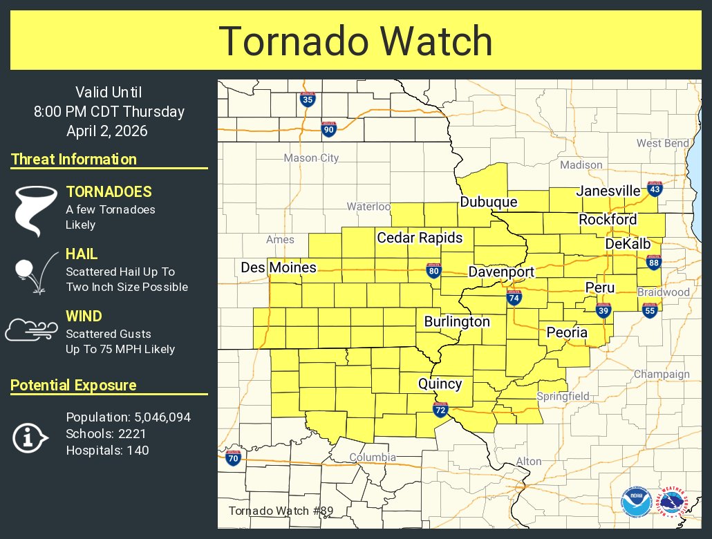
ALT This graphic displays Tornado Watch watch number 89 plotted on a map. The watch is in effect until 8:00 PM CDT. The watch includes parts of Illinois, Iowa, Missouri and Wisconsin. The threats associated with this watch are a few tornadoes likely, scattered hail up to two inch size possible and scattered gusts up to 75 mph likely. There are 5,046,094 people in the watch along with 2221 schools and 140 hospitals.

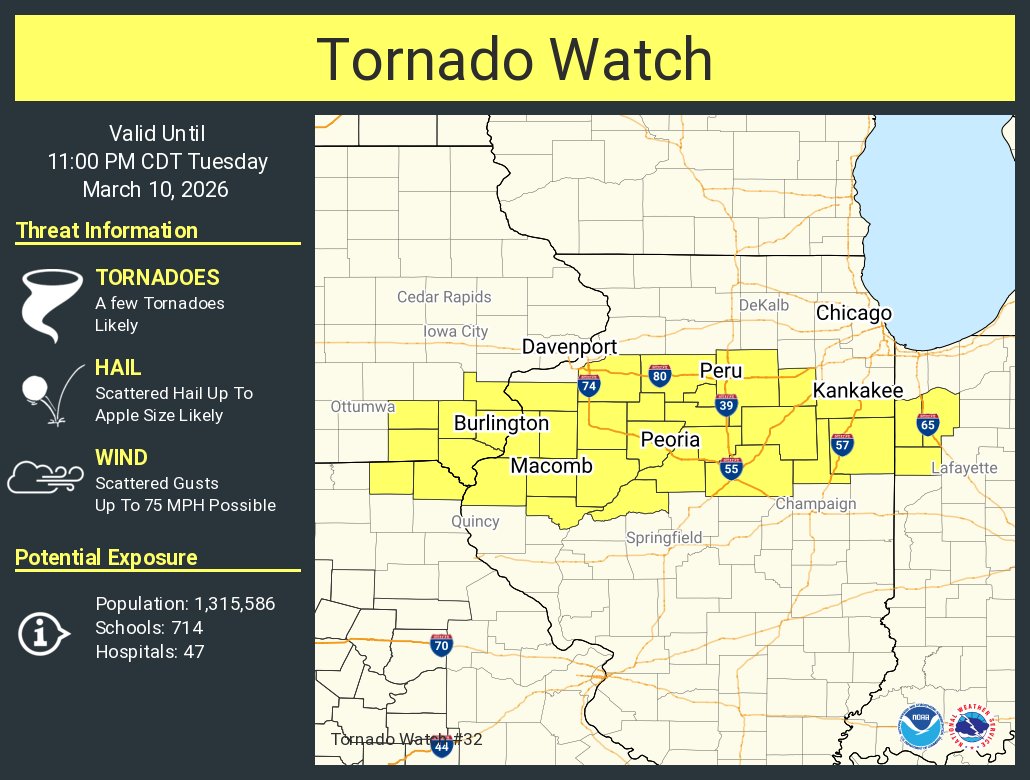
ALT This graphic displays Tornado Watch watch number 32 plotted on a map. The watch is in effect until 11:00 PM CDT. The watch includes parts of Illinois, Indiana, Iowa and Missouri. The threats associated with this watch are a few tornadoes likely, scattered hail up to apple size likely and scattered gusts up to 75 mph possible. There are 1,315,586 people in the watch along with 714 schools and 47 hospitals.
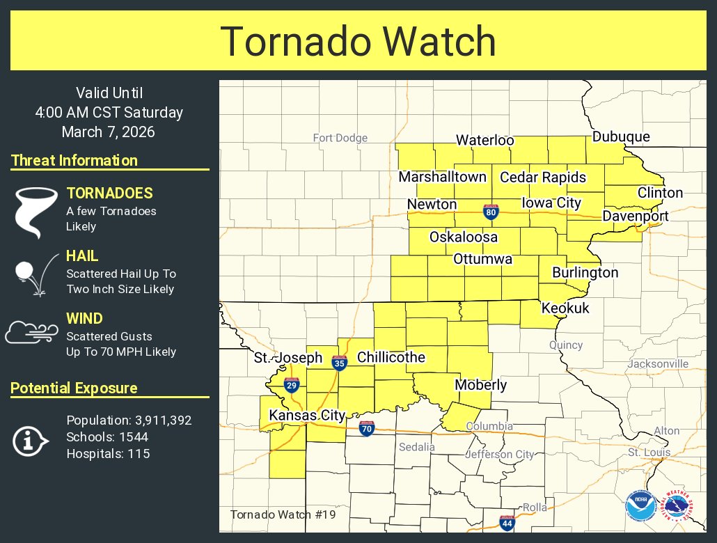
ALT This graphic displays Tornado Watch watch number 19 plotted on a map. The watch is in effect until 4:00 AM CST. The watch includes parts of Illinois, Iowa, Kansas and Missouri. The threats associated with this watch are a few tornadoes likely, scattered hail up to two inch size likely and scattered gusts up to 70 mph likely. There are 3,911,392 people in the watch along with 1544 schools and 115 hospitals.

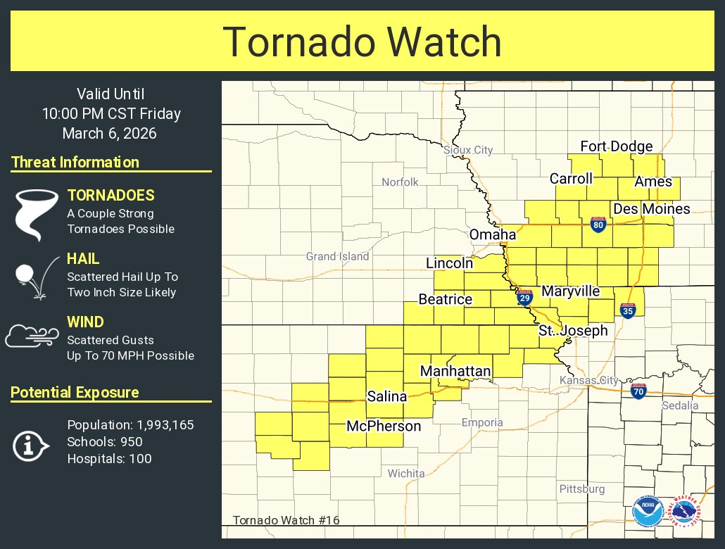
ALT This graphic displays Tornado Watch watch number 16 plotted on a map. The watch is in effect until 10:00 PM CST. The watch includes parts of Iowa, Kansas, Missouri and Nebraska. The threats associated with this watch are a couple strong tornadoes possible, scattered hail up to two inch size likely and scattered gusts up to 70 mph possible. There are 1,993,165 people in the watch along with 950 schools and 100 hospitals.

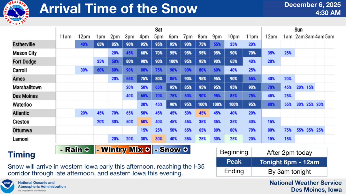
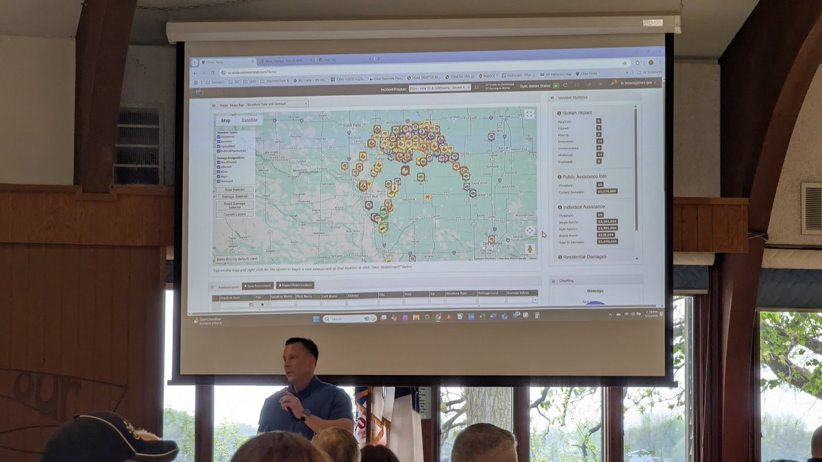
ALT Graphic gives timing information for a number of locations across Iowa.
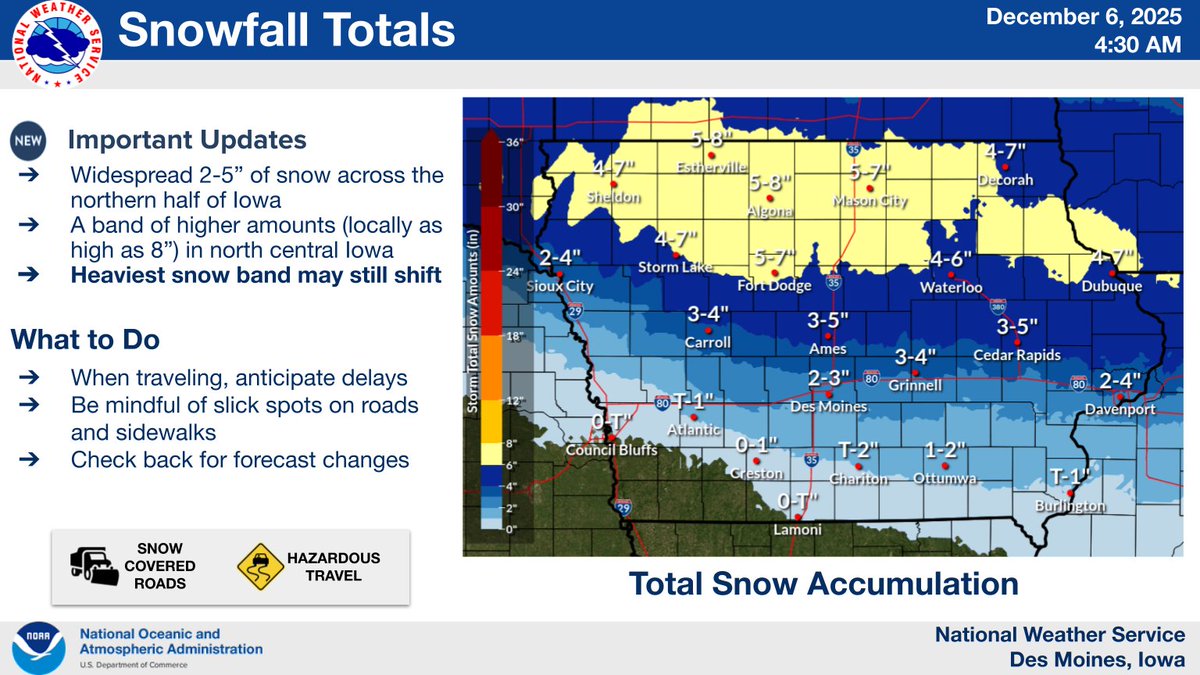
ALT Widespread 2-5 inches of snow in northern Iowa, with a band of 5-7 inches, and isolated 8 inches, possible in north-central Iowa. When traveling, anticipate delays Be mindful of slick spots on roads and sidewalks Check back for forecast changes.