
Meteorologist. Big Sports Fan. Ohio University 2022.
Joined July 2014
- Tweets 15,252
- Following 214
- Followers 662
- Likes 6,774
4,058 Photos and videos


Midnight thoughts on Wednesday. Temper expectations in northern Illinois, especially N of I-80, and far northwestern Indiana. While a few strong tornadoes are probable with initial supercells before things congeal into damaging wind line. Can supercell latch to warm front? TBD.
1
73
Or there can be a scenario where the whole line can spin, especially true in far northeastern IL into northern Indiana on top of individual supercells back in north-central IL & far NE MO. Also going in deep detail now is like explaining Tax code to 8yr old, just not right time.
40
Hopefully this is more cleaner image quality. It didn't look as clean for the earlier post.


Putting together Tuesday-Thursday severe outlooks in one post here. Only additional note is some severe risk extends down into southeastern Kentucky and western VA as well.


1
491
Entire event most definitely won’t get killed. Perhaps your best torando risk shifts to N Missouri to central Illinois.

On a real none meme note, I trust StormNet currently more than any model I use. There will be a chance for long-tracked strong-intense tornadoes as long as morning convection doesn't kill the entire event...
1
239
Putting together Tuesday-Thursday severe outlooks in one post here. Only additional note is some severe risk extends down into southeastern Kentucky and western VA as well.
3
4
36
3,763
While odds of tropical depression or storm has increased, but sensible weather doesn’t change at all from south Texas, Louisiana, Mississippi, Alabama, and western Georgia where several inches of rain is expected with locally 12” from Galveston to Lake Charles area.

BREAKING: The first invest of the Atlantic hurricane season has been issued as a tropical threat takes shape in the Gulf. We have more details on The Weather Channel.

221
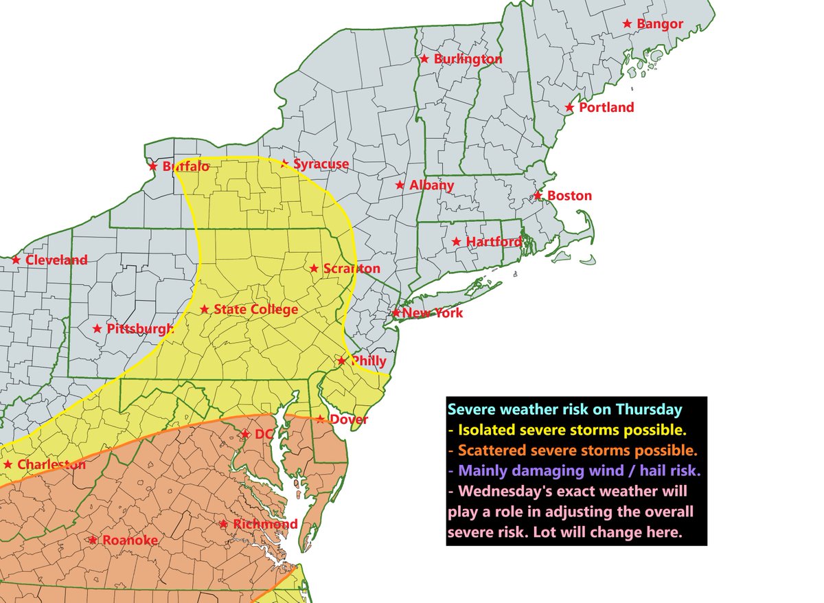
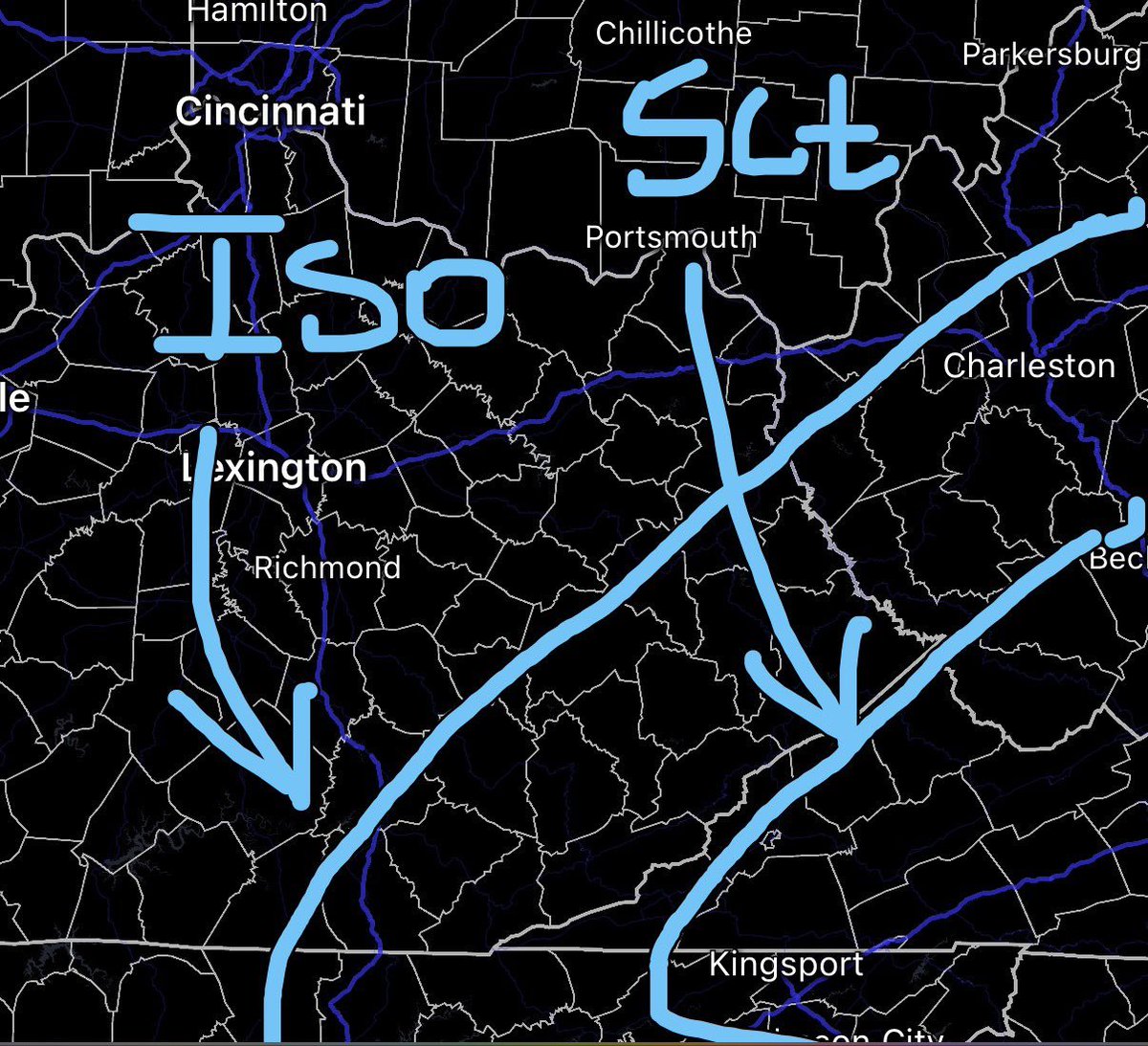
Very early stab at Thursday’s severe risk. At this time it doesn’t appear as intense as Wednesday threat, still a few clusters can develop Thu aft/eve from southern MD / WV into Virginia that produce damaging winds and isolated hail.
1
108
Been a while since I wrote a blog. This post goes in detail about upcoming severe weather events during the Midweek period.
weatherblogdotnet.wordpress.…
1
90
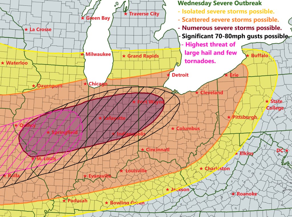
Brief summary for Wednesday is morning storm may play some spoilers, but severe event looks likely in middle Ohio Valley during evening / overnight hours before weakening by Thu AM. Highest large hail / tornado risk in MO / IL while damaging wind threat is more widespread.
106
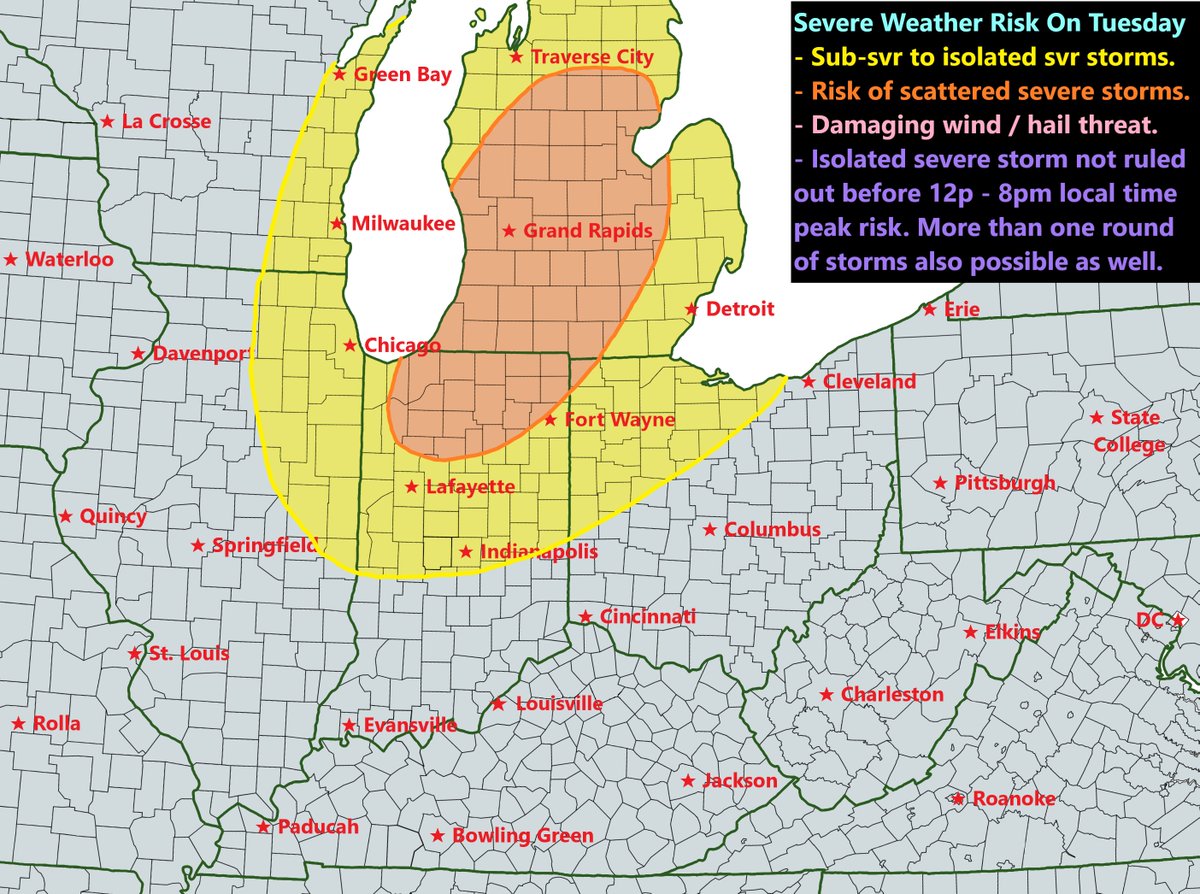
I had drawn this earlier this morning but forgot to post it. A sneaky severe weather event is possible in northern Indiana / central Michigan on Tuesday PM. Some sort of showers and storms are expected pretty much everywhere except far E KY / E OH. Will see if svr risk expand SW.
1
116
That's a good catch right there on the sounding. There is a window between 11am - 4pm on Wed before the shortwave lifts away from the area. This is the same thing which Michigan and northern Indiana will deal with tomorrow afternoon.

Wednesday is starting to have my attention across eastern PA through NJ and up through NYC. Wouldn't be surprised to see a marginal from the SPC when the new Day 3 outlook comes out this afternoon.
179
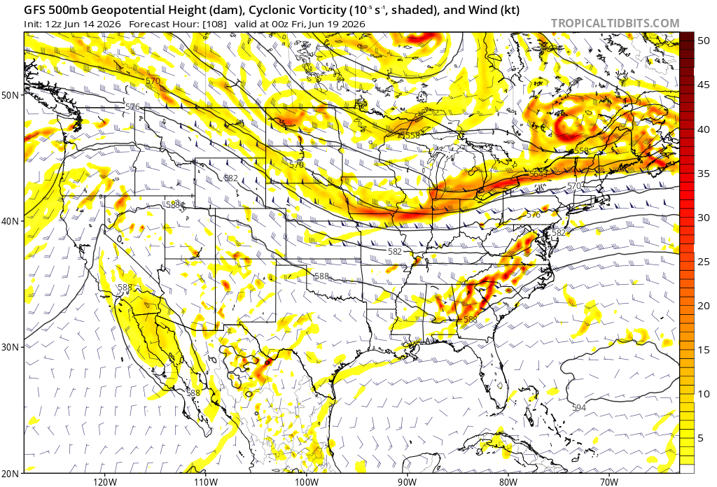
Just a gentle reminder on severe threat, especially those in the Ohio Valley, don't look so far ahead that you lose focus on what's ahead of you. Reference OHV map below with core states being MI, IL, IN, OH, KY, WV, S WI, & W PA.
84
Manan Mathur retweeted

Jun 15
FOR THE FIRST TIME IN 20 YEARS, THE CAROLINA HURRICANES ARE STANLEY CUP CHAMPIONS
288
4,435
22,122
575,578

Jun 15
Its never to early to think about winter, especially if you are from Texas. 11/10 effort.
1
1
126
Jun 15
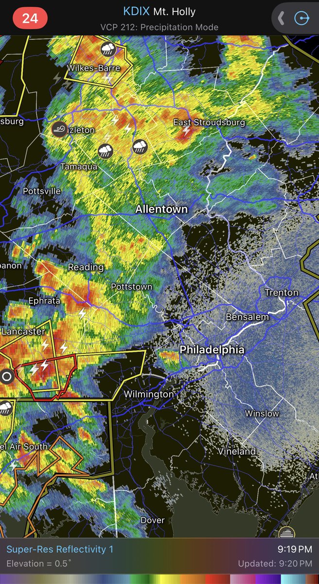
The world cup match in Philly ended just in nick of time because we got batch of thunderstorms heading in its direction. These storms are severe now, but likely weaken in severity when its right overhead.
107
Jun 14
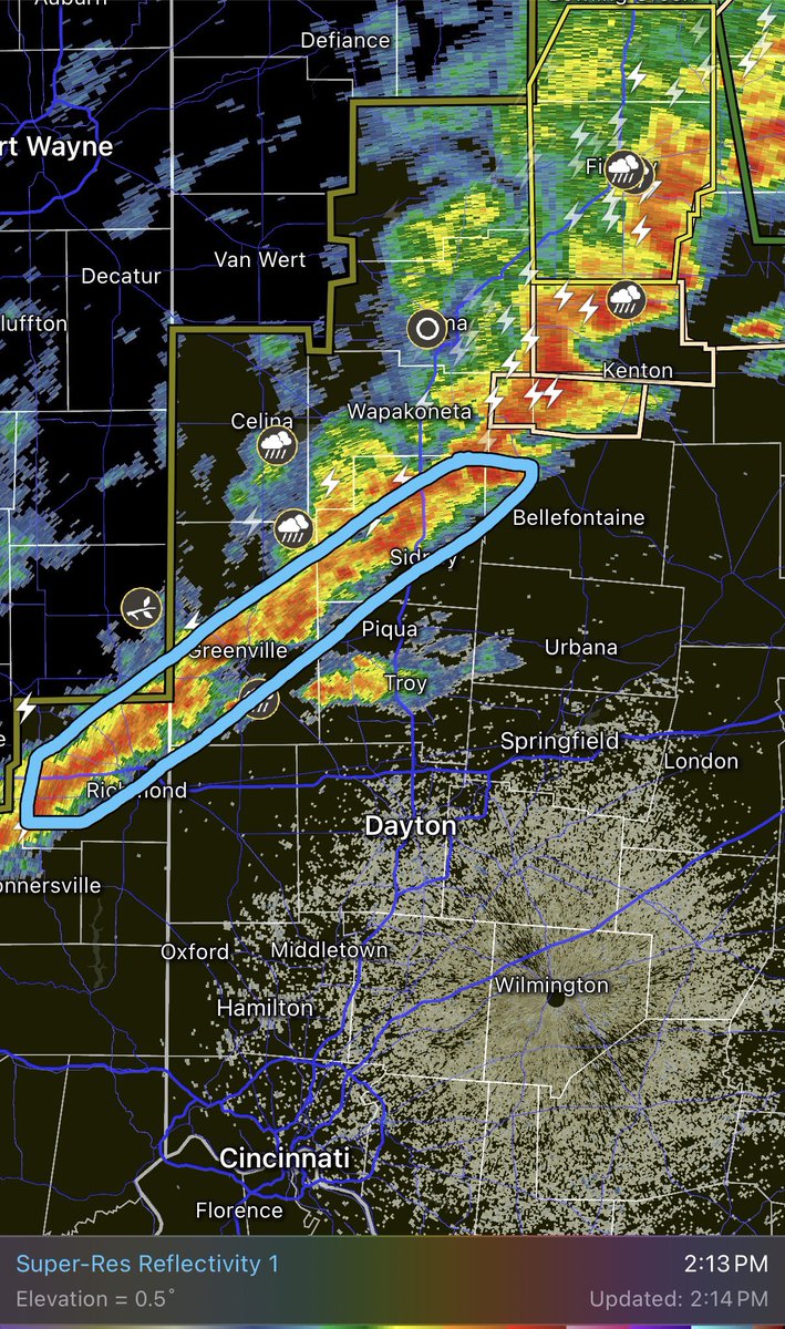
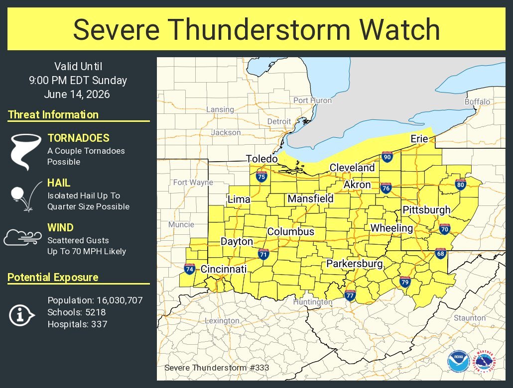
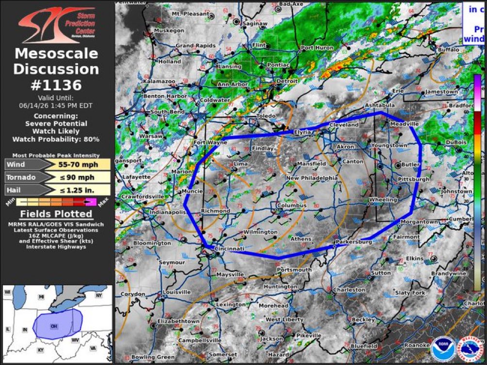
Few supercells have formed in western and central PA hence the issuance of tornado watch


140
Manan Mathur retweeted

Jun 14
We got a report from Ringgold Twp in Jefferson county of a tornado on the ground. Take cover immediately if you are in the path!
1
14
68
13,128
Jun 14
Of course there would be a supercell near groundhog’s home in W PA.
1
57