
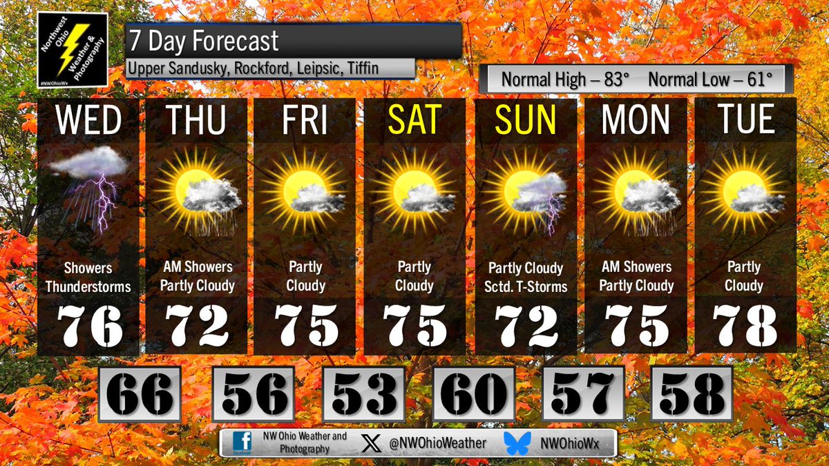
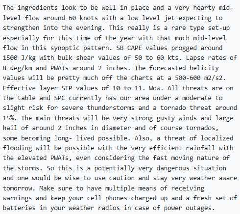
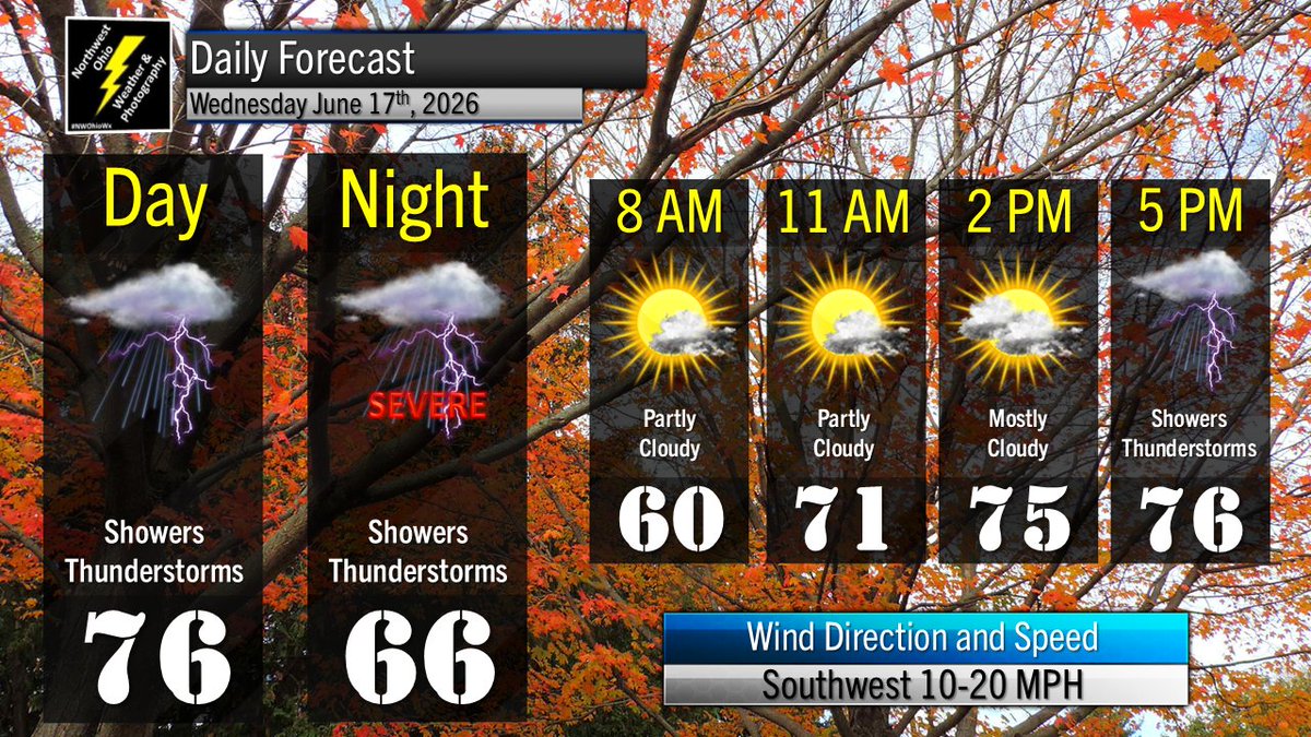
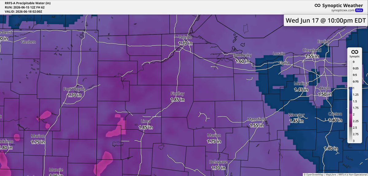
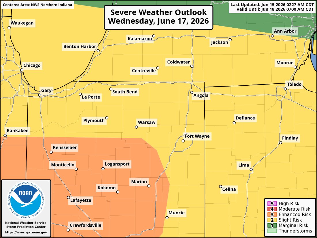
Williams, Fulton, Lucas, Ottawa, Defiance, Henry, Wood, Sandusky, Paulding, Putnam, Hancock, Seneca, Van Wert, Allen, Mercer, Auglaize, Hardin, and Wyandot.
- Tweets 23,351
- Following 19
- Followers 1,447
- Likes 360


ALT This graphic displays a tornado warning plotted on a map. The warning is in effect until 8:45 PM EDT. The warning includes Cridersville OH, Mendon OH and Neptune OH. This warning is for Northwestern Auglaize County in west central Ohio and Northeastern Mercer County in west central Ohio. The threats associated with this warning are a radar indicated tornado and no hail is expected. There are 4,864 people in the warning along with 1 school and 0 hospitals.


ALT This graphic displays Severe Thunderstorm watch number 338 plotted on a map. The watch is in effect until 11:00 PM EDT. The watch includes parts of Illinois, Indiana, Michigan and Ohio. The threats associated with this watch are a couple tornadoes possible, scattered hail up to ping pong size possible and scattered gusts up to 70 mph possible. There are 8,729,982 people in the watch along with 3112 schools and 204 hospitals.


ALT This graphic displays a severe thunderstorm warning plotted on a map. The warning is in effect until 3:15 PM EDT. The warning includes Tiffin OH, Norwalk OH and Fremont OH. This warning is for Western Huron County in north central Ohio, Seneca County in northwestern Ohio, Wyandot County in northwestern Ohio, Southern Sandusky County in northwestern Ohio and Crawford County in north central Ohio. The threats associated with this warning are wind gusts up to 60 MPH and penny sized hail. There are 195,682 people in the warning along with 95 schools and 8 hospitals.
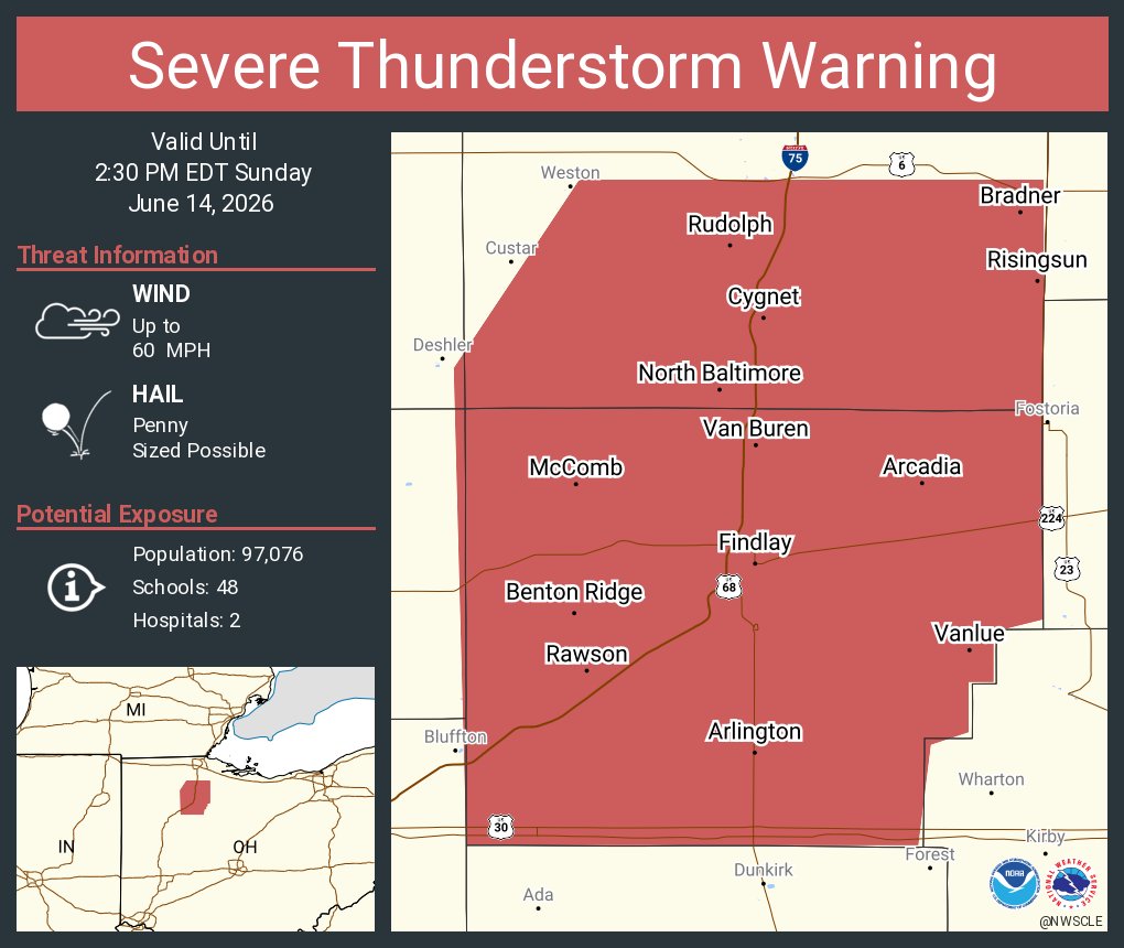
ALT This graphic displays a severe thunderstorm warning plotted on a map. The warning is in effect until 2:30 PM EDT. The warning includes Findlay OH, North Baltimore OH and McComb OH. This warning is for Southern Wood County in northwestern Ohio and Hancock County in northwestern Ohio. The threats associated with this warning are wind gusts up to 60 MPH and penny sized hail. There are 97,076 people in the warning along with 48 schools and 2 hospitals.