Official X account for the National Weather Service Ocean Prediction Center.
- Tweets 6,500
- Following 273
- Followers 26,078
- Likes 249


ALT An image of a large naval ship with a visible hull number 78, in front of a seal of the United States Department of Labor. The text reads: "National Maritime Day, dol.gov"


ALT National Maritime Day | Port of Los Angeles


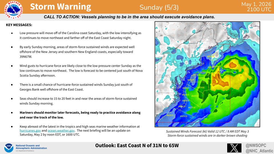
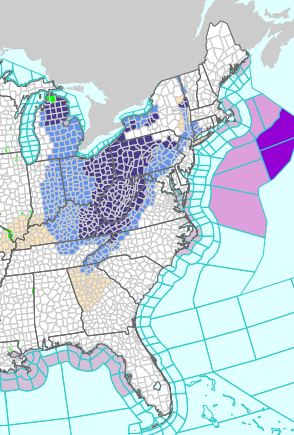
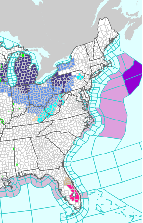
ALT Hurricane Preparedness - Stay Protected During Storms. Stay in your safe places from water and wind. Have a way to get weather alerts and forecast updates. Keep in mind that impacts can be felt far from the coast. Listen to local officials and avoid travel unless ordered to evacuate.


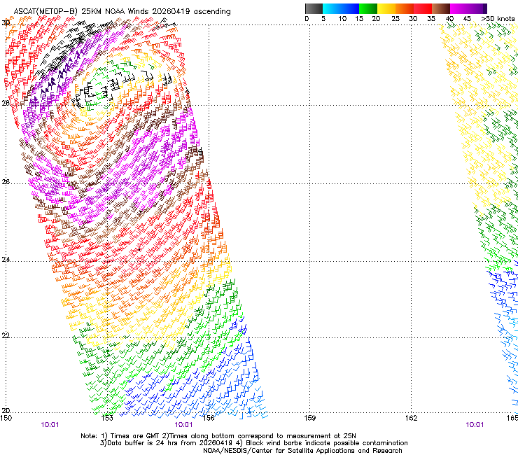
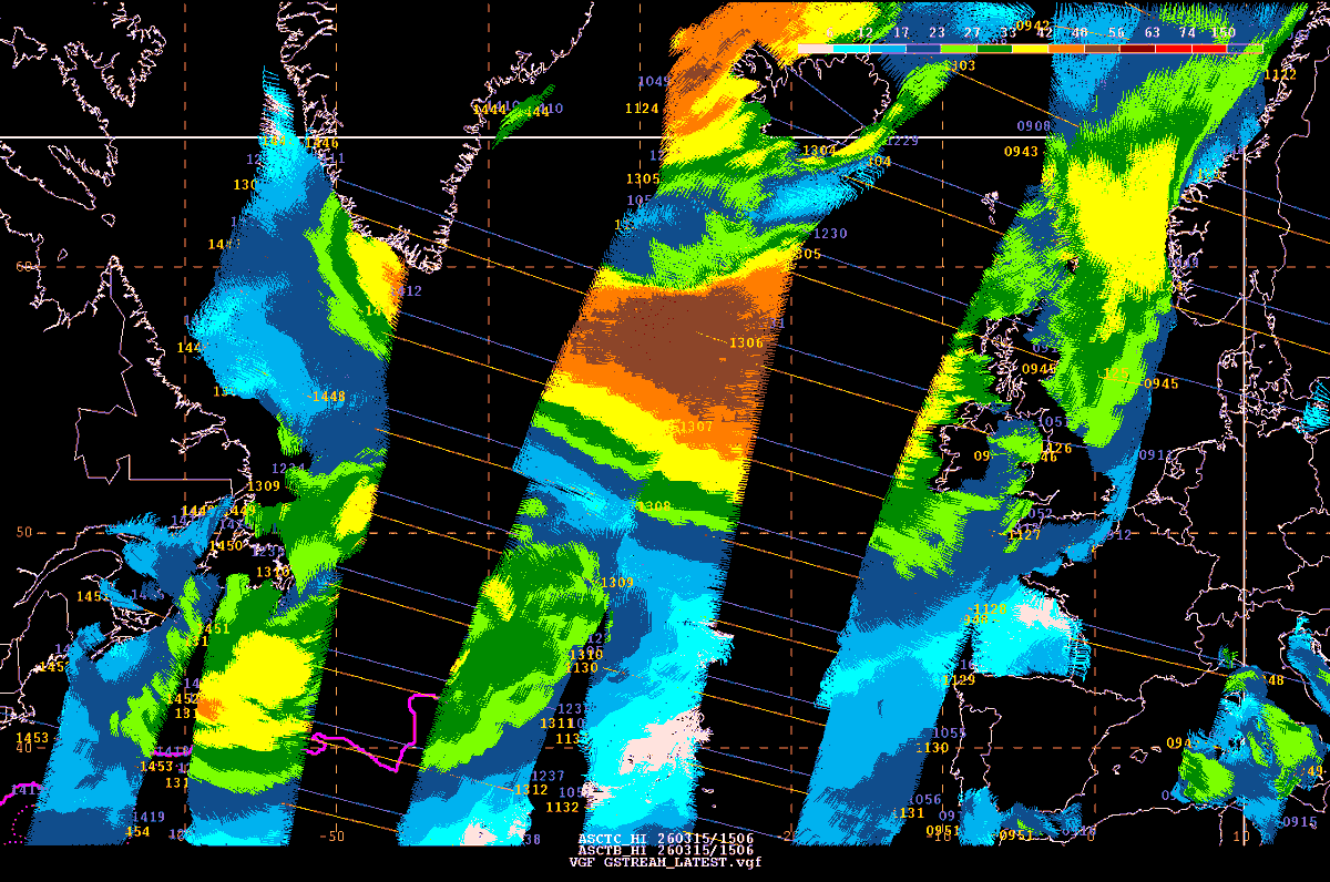

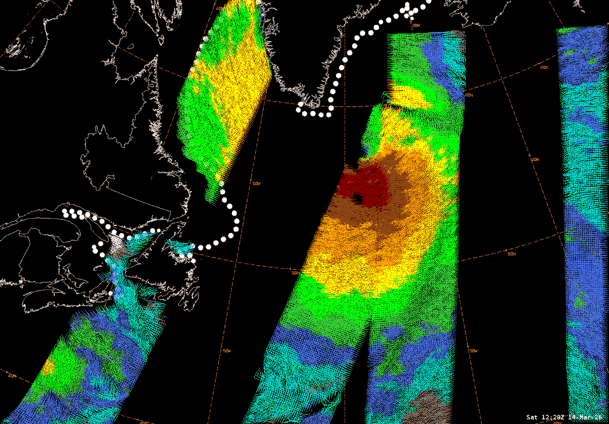
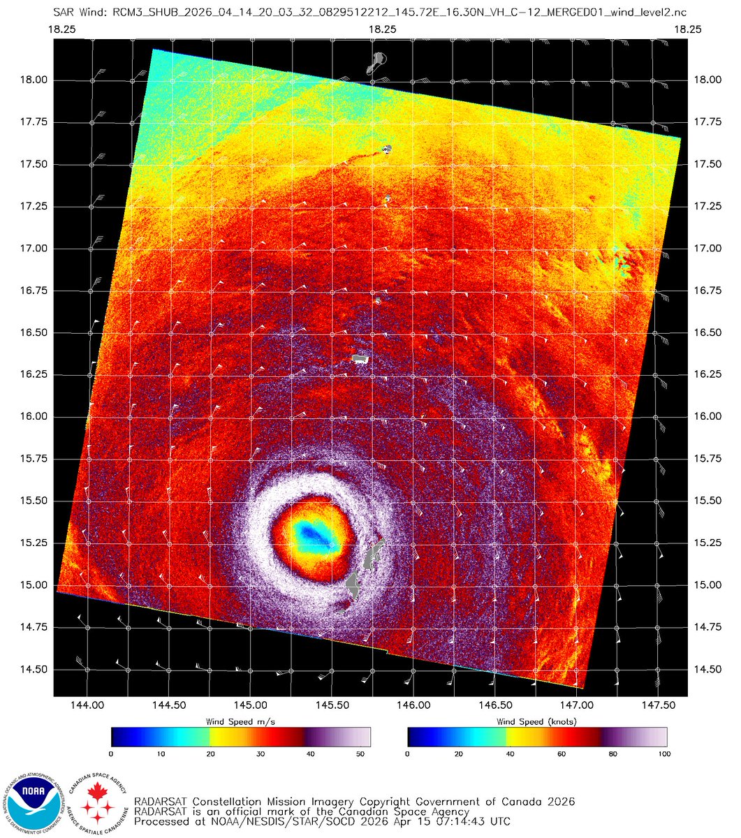
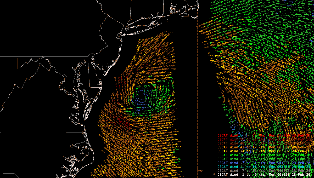
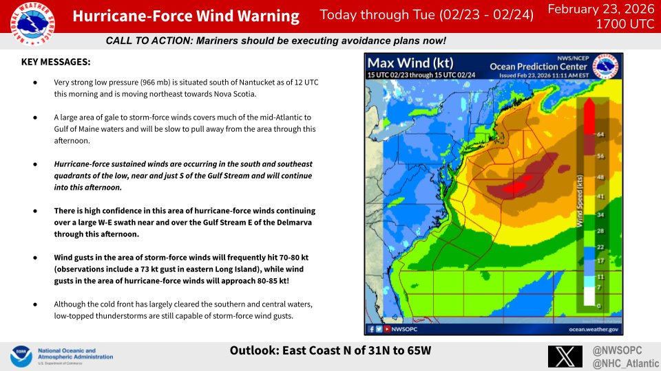
ALT ASCAT winds showing coverage of gales (yellow), storm force (brown), and hurricane force (reds)
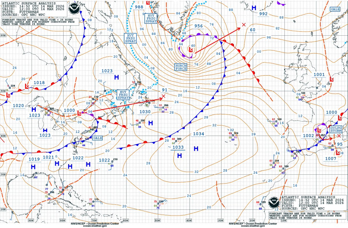
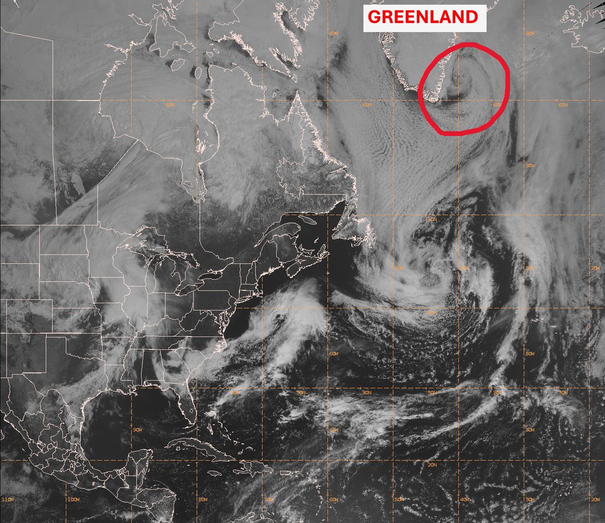
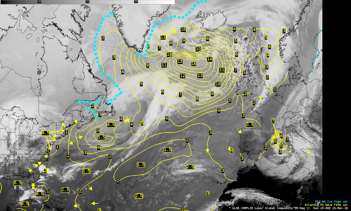
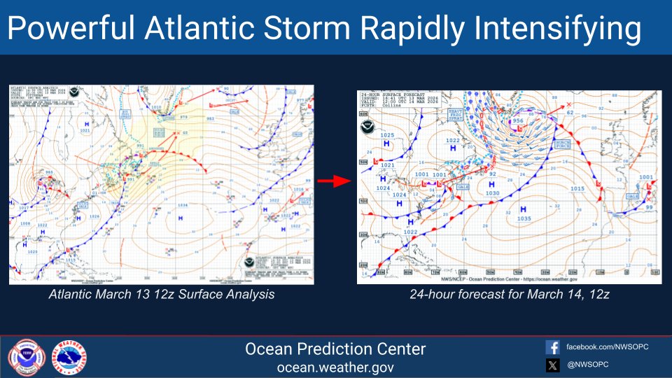
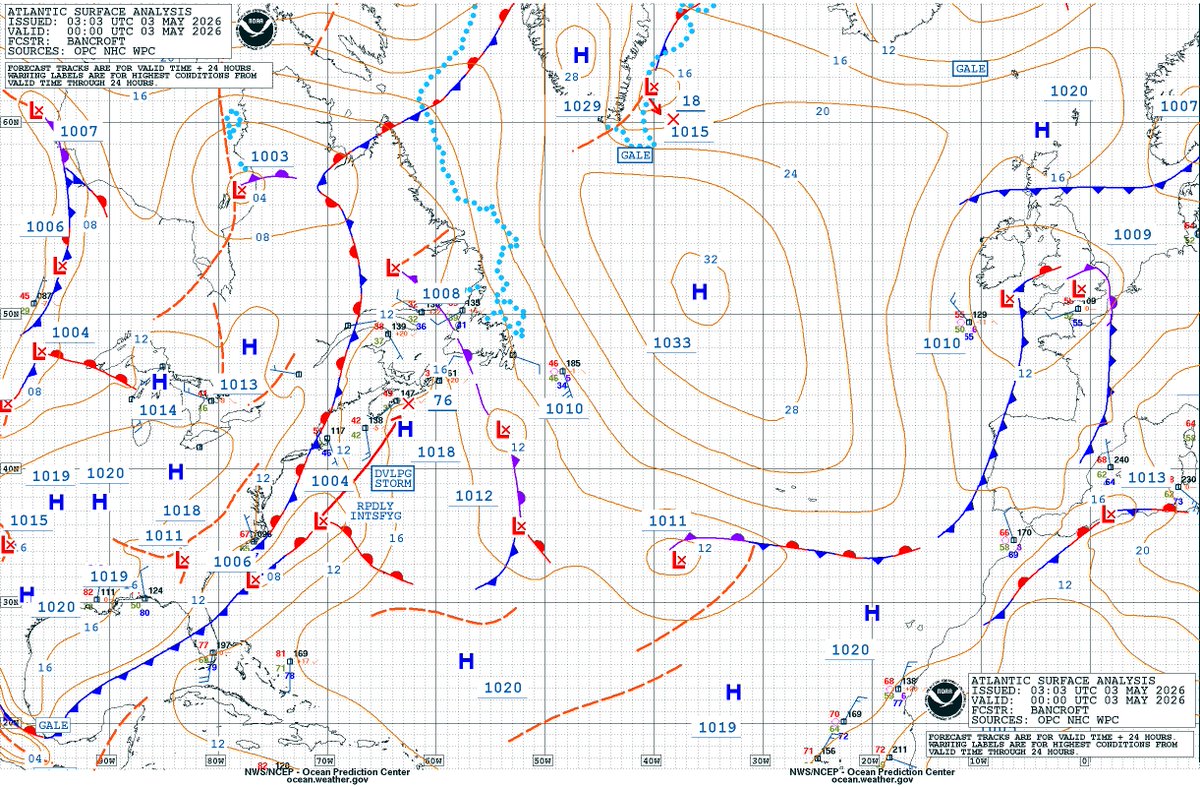
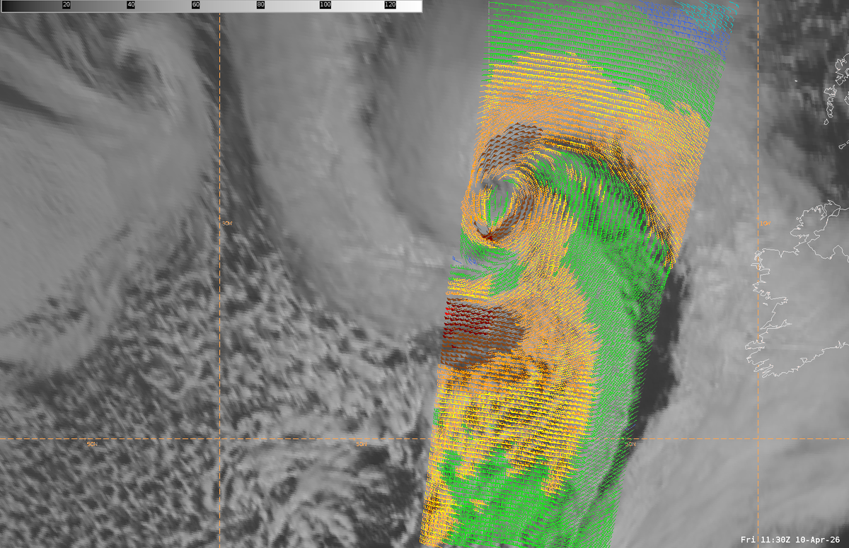
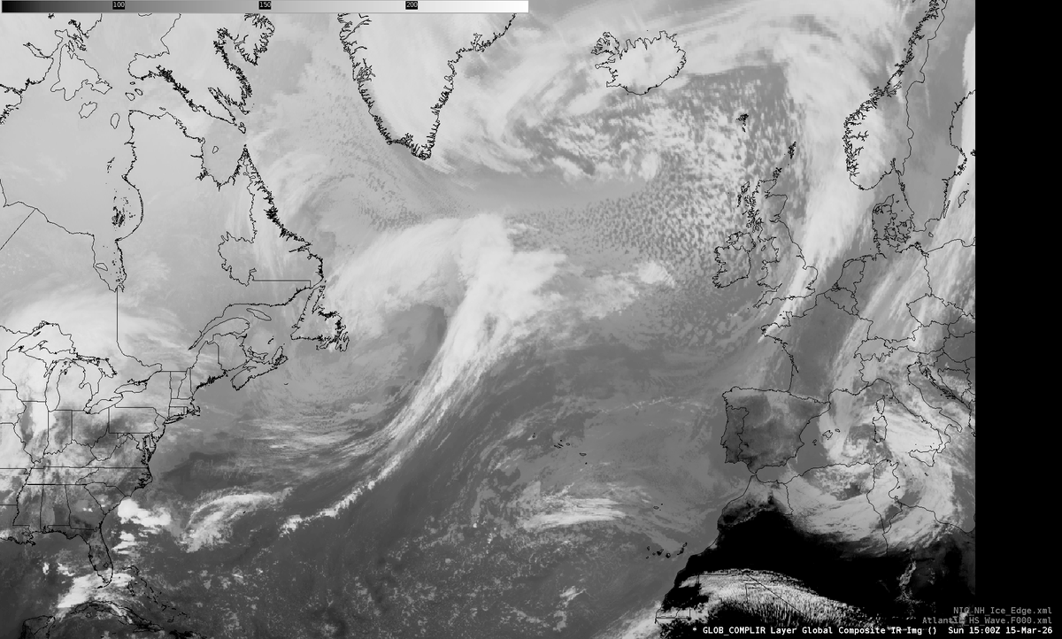
ALT The surface analysis from March 14, 12z, showing a 956 mb southeast of Greenland
ALT ASCAT winds showing coverage of gales (yellow), storm force (brown), and hurricane force (reds)
ALT The surface analysis from March 14, 12z, showing a 956 mb southeast of Greenland