
Joined October 2022
- Tweets 85
- Following 112
- Followers 61
- Likes 103
17 Photos and videos


Pinned Tweet

24 Jan 2023
A story map in the works - creating #CRE web maps with #ESRI - @Mapsynergy
storymaps.arcgis.com/stories…
1
209
2 Oct 2025
4
Matt retweeted

20 Sep 2025
After being here for a few days I think there’s a chance the BYU Utah rivalry is the most heated rivalry we've got in the country
270
215
4,314
526,788

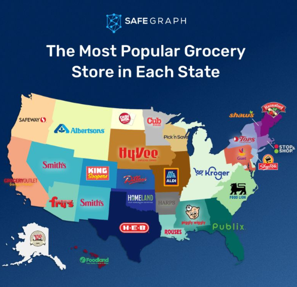
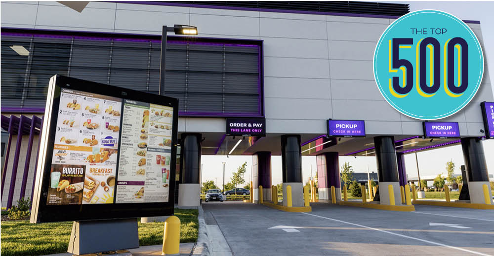
TLDR
1. Crumbl
2. Jersey Mike’s
3. McDonalds
4. Taco Bell
5. Wingstop
6. Popeyes
7. Tropical Smoothie Cafe
8. Scooter’s Coffee
9. Dunkin’
10. Chick-Fil-A
Who surprised you??

21
3
55
36,813
29 Jun 2023
Geocodong with zero errors
29 Jun 2023

#gischat what's something GIS related that when it happens, you just feel great and happy? Like tool working right, clean data, etc.
25
27 Jun 2023
Collecting data and came across this comment
"Growth factored since. 2020 COVID Data not used"
we all know most CRE toss out 2020 numbers, but interesting to see it in official comments.
1
29
5 Jun 2023
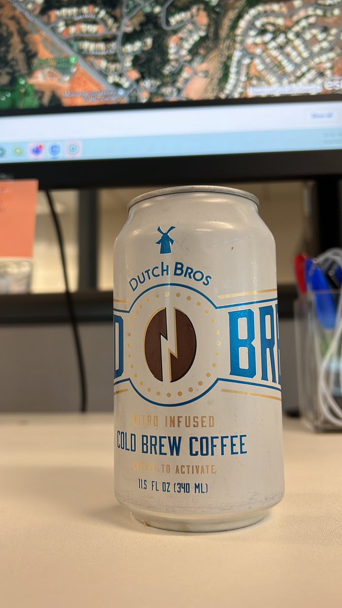
Received!
Start the week right #dutchbros
#getinmybelly
3 Jun 2023

Saved you a couple extra cans
1
2
479
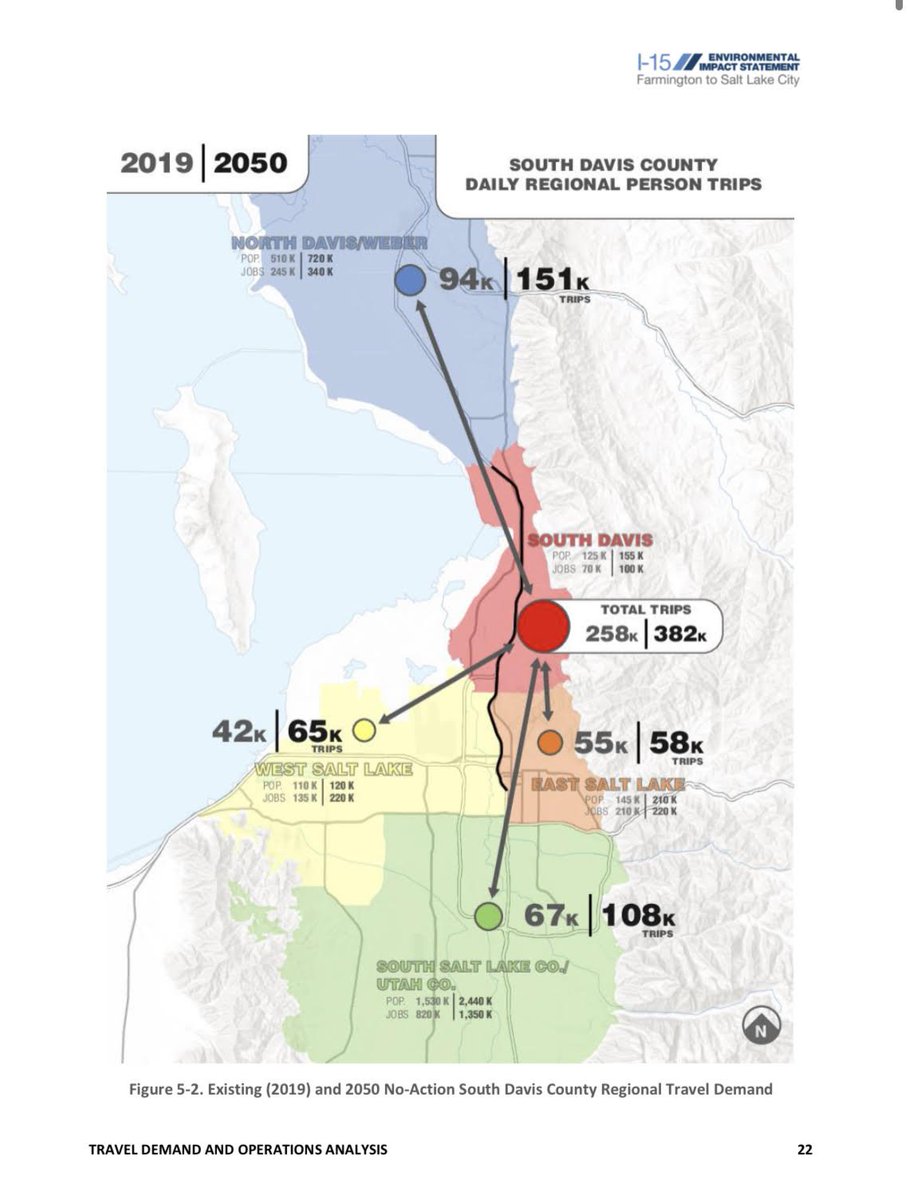
31 May 2023
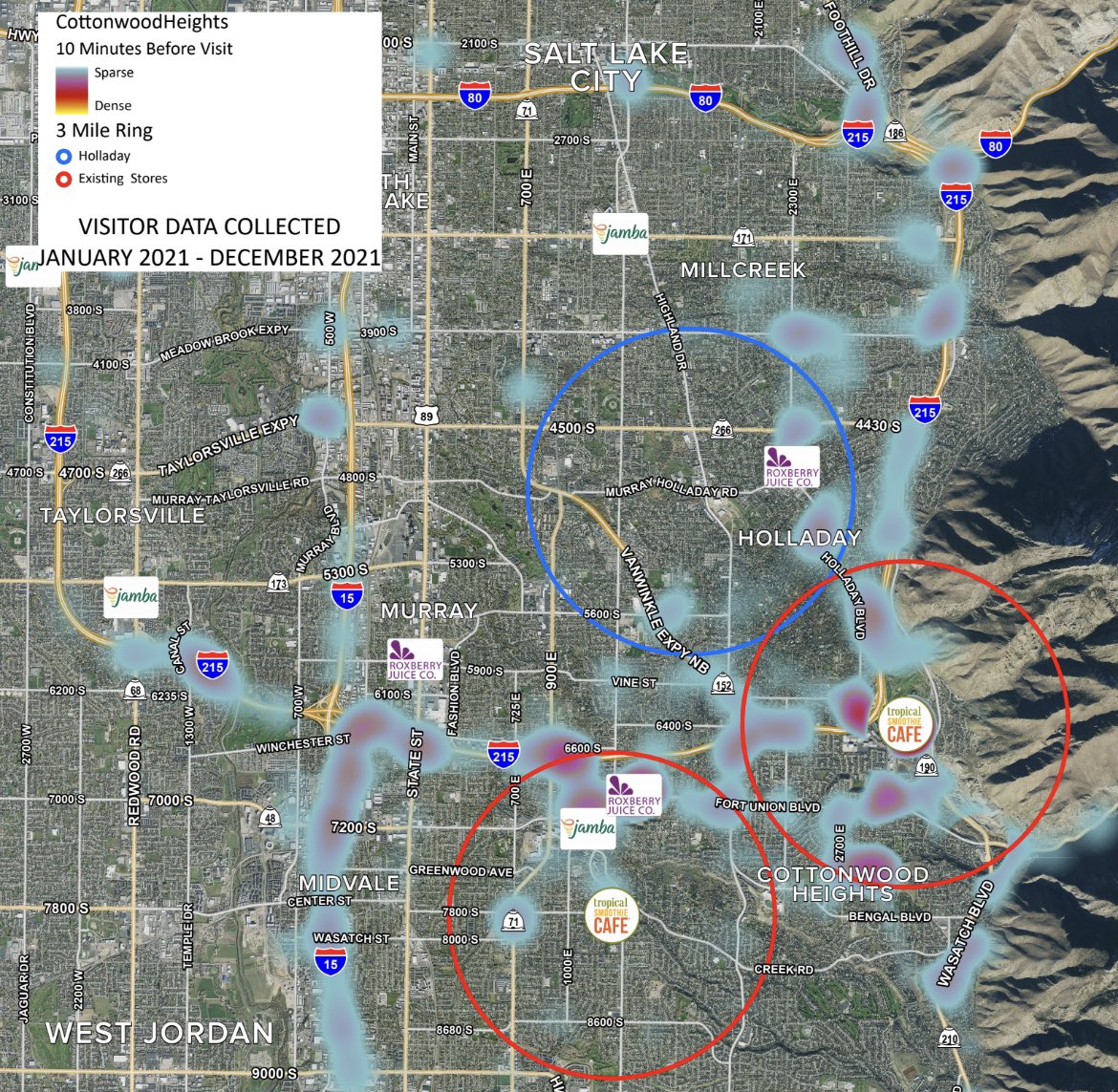
Big jumps in trips. Not a lot of places to develop a hub in South Davis. One of the real estate selling points is the price point and commute distance.
30 May 2023

Still trying to digest this but figure some of you nerds might find it interesting.
Really shows how urbanizing *outside* of SLCo (i.e. more jobs/retail/entertainment closer to where people live) would take a bite out of car traffic way better than a monster freeway
30
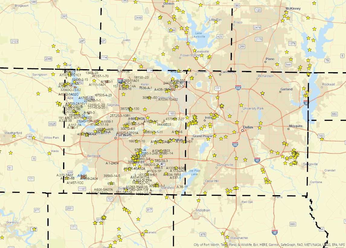
30 May 2023
Guess it’s that time of the year to see which state departments get 2022 traffic counts out on time.
15
21 May 2023
Great read.
#retwit
21 May 2023

Have you ever wondered how GIS is used in retail? Here are a few ways GIS is used in retail:
1⃣Site selection: GIS helps retailers identify suitable locations for new stores or branches. By analyzing demographic data, customer profiles, competition, and traffic patterns, GIS assists in making informed decisions regarding where to establish retail outlets.
2⃣Market analysis: GIS enables retailers to analyze market trends and consumer behavior based on geographic data. This information helps retailers understand customer preferences, target specific market segments, and tailor marketing strategies accordingly.
3⃣Visual merchandising and store layout: GIS can assist retailers in planning store layouts and optimizing product placements. By considering factors such as customer flow, product affinity analysis, and heat mapping, retailers can enhance the overall shopping experience and increase sales.
4⃣Inventory management: GIS aids in optimizing inventory management by integrating spatial data with sales information. Retailers can analyze product demand based on location, adjust stock levels accordingly, and streamline supply chain operations.
5⃣Delivery route optimization: GIS plays a crucial role in optimizing delivery routes for e-commerce and last-mile logistics. By considering factors like traffic conditions, customer locations, and delivery time windows, retailers can improve delivery efficiency, reduce costs, and enhance customer satisfaction.
6⃣Trade area analysis: GIS helps retailers understand the trade areas around their stores, including customer demographics, spending habits, and competition. This analysis assists in refining marketing strategies, identifying potential customer bases, and tailoring product assortments to meet local demands.
7⃣Market expansion and territory management: GIS is used by retailers to plan and manage their market expansion strategies. By visualizing store networks, territories, and market coverage, retailers can optimize their expansion plans, allocate resources effectively, and monitor performance across different regions.
Overall, GIS provides retailers with valuable insights into customer behavior, market dynamics, and operational efficiency. By leveraging spatial data and analysis, retailers can make data-driven decisions, enhance customer experiences, and drive business growth. If you are into business analytics and GIS , these are some of the areas you might want to focus on for your career.
#gischat #gisanalyst #analyst #bussiness #data #gisanalyst

40
Matt retweeted

13 May 2023
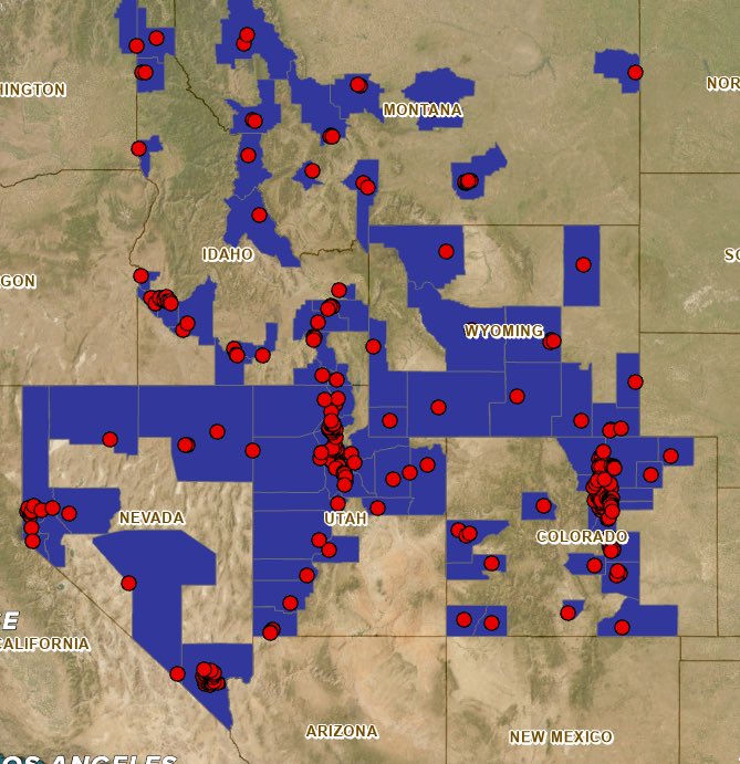
Where the California exodus is settling
3,879
7,971
37,418
8,224,027
12 May 2023
Interesting trade area discussion from data supplied by 3rd party providers such as #DoorDash.
Great event. I think I blended in and didn't stick out too bad as the data guy.
12 May 2023
What an unbelievable evening last night.
Each of these companies has that “special sauce,” that customers can feel when they visit one of their locations. It’s a palpable energy.
For those of us that attended we had the opportunity to hear why from these heads of RE.
I’m here for a world where #retwit provides more and more of these learning and networking opportunities in a small venue format.
Thanks for showing up and sharing your knowledge with us all.
@hotchickendaves
@DutchBros / @dudewithacigar
@jerseymikes
@caferio / @CRE_GnomeMe
#cre
#drivethru
#commercialrealestate


1
1
475
11 May 2023
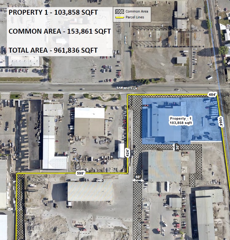
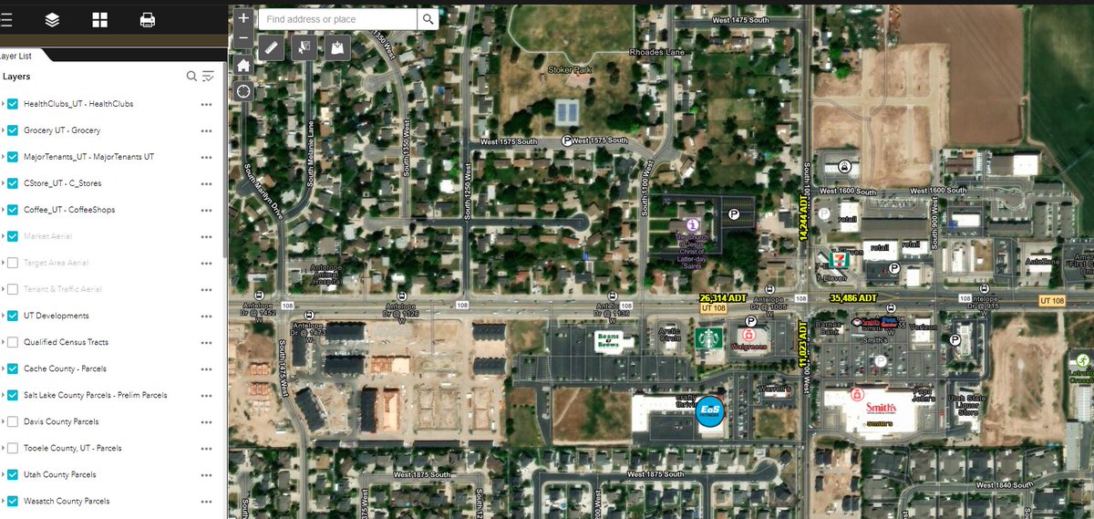
How do you line up site plans on aerials?
I use Photoshop and then georeference in ArcPro.
Bonus points if the parcel lines are shown on the site plan. Makes the fit much better.
2
52
10 May 2023
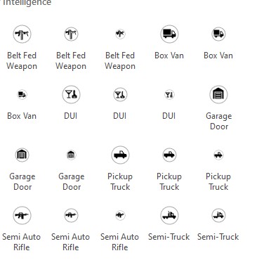
didn't know #ESRI had semi auto rifle symbology.
I just wanted something for generic car wash.
54
9 May 2023
Have you added drone images to a web map so your designer/clients/owners can access the photos whenever? Is it worth it or easier to keep folders in a cloud folder ?
28
5 May 2023
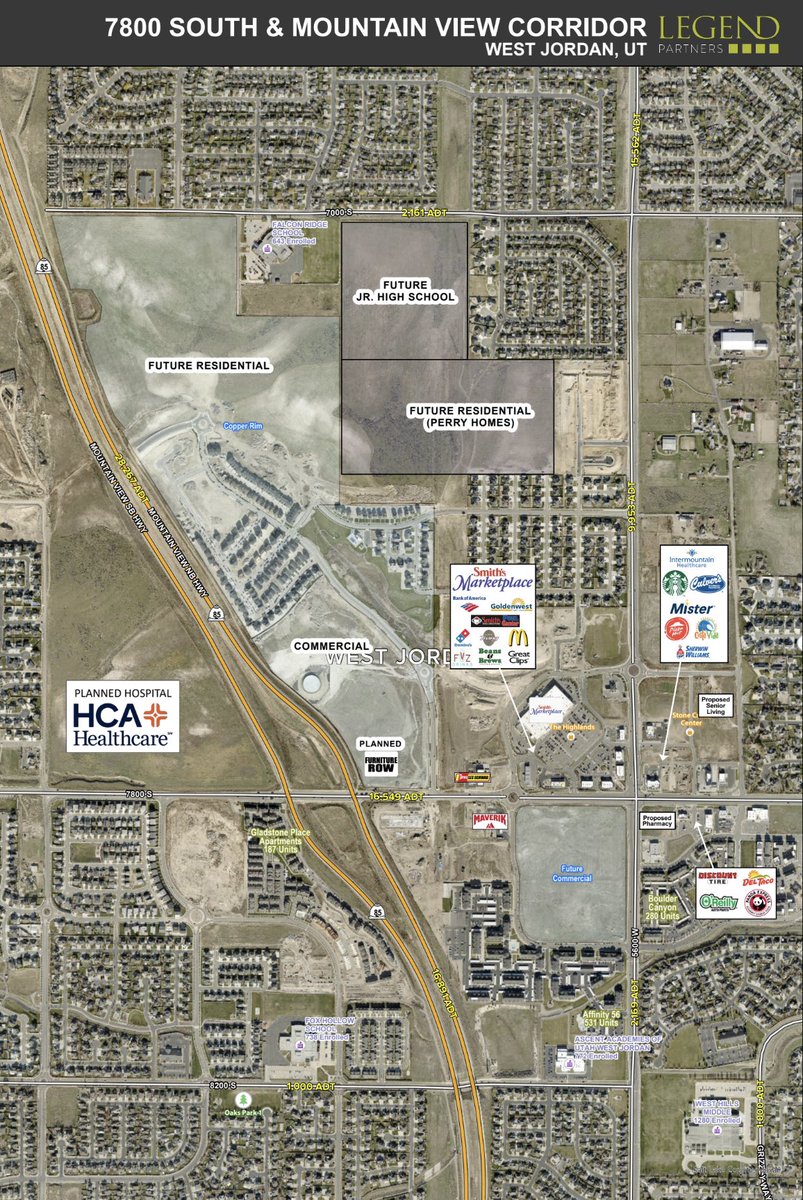
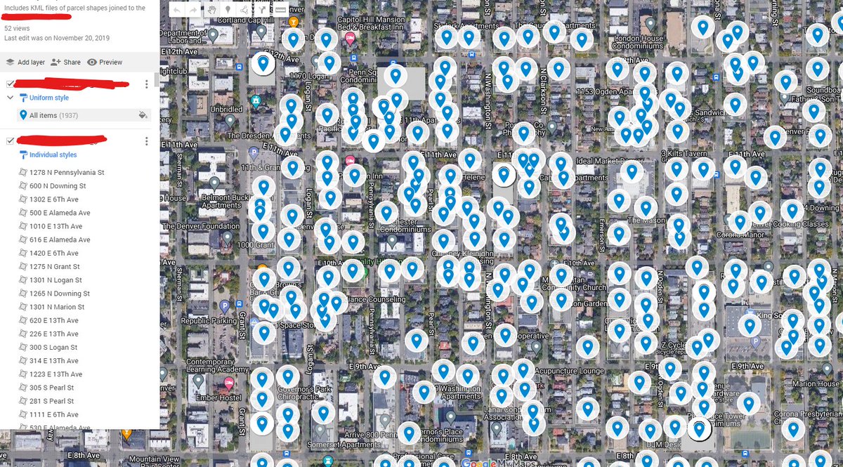
Pretty rad web map you got there !
4 May 2023
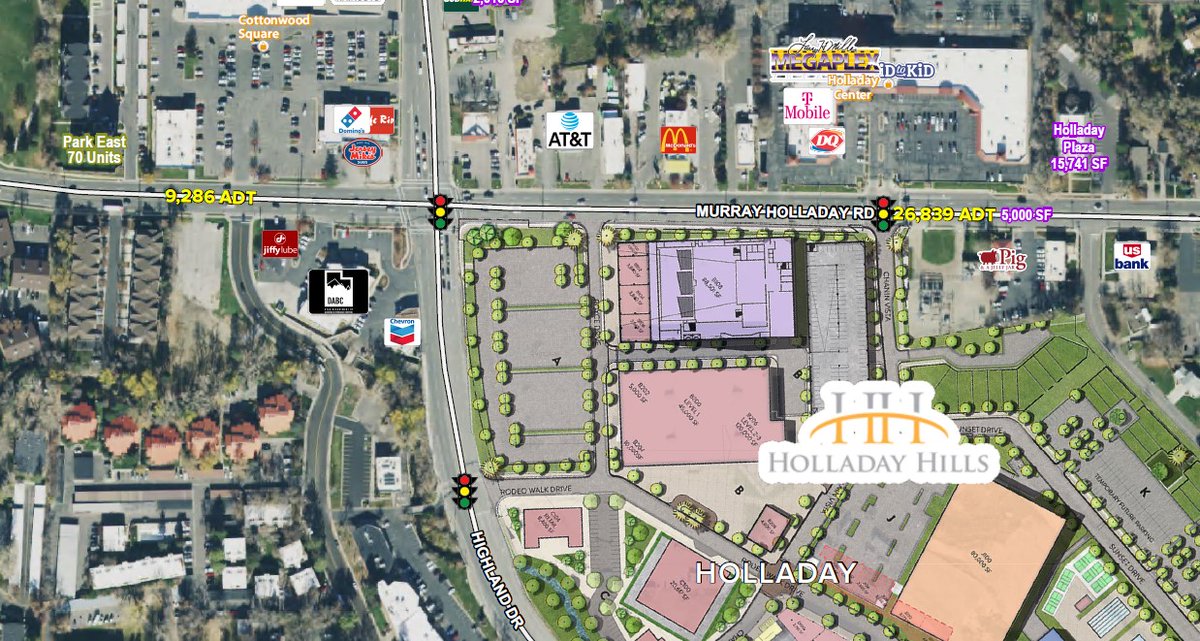
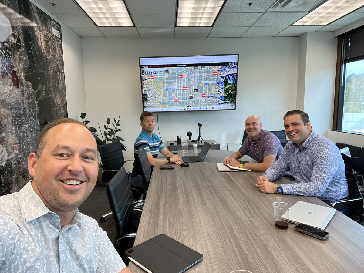
How do 10 new @caferio locations get built?
It all starts with a meeting that looks just like this.
Great to cohost @CRE_GnomeMe with @CRE_Legends
#retwit
#cre
1
1
407
3 May 2023
Spent way too much time converting symbology from a web map to a web app. Experience builder isn’t ready yet #esri rant
46