PennCo Fire provides support to twenty volunteer fire departments for Pennington County citizens not residing in Rapid City.
- Tweets 5,207
- Following 195
- Followers 1,284
- Likes 2,452

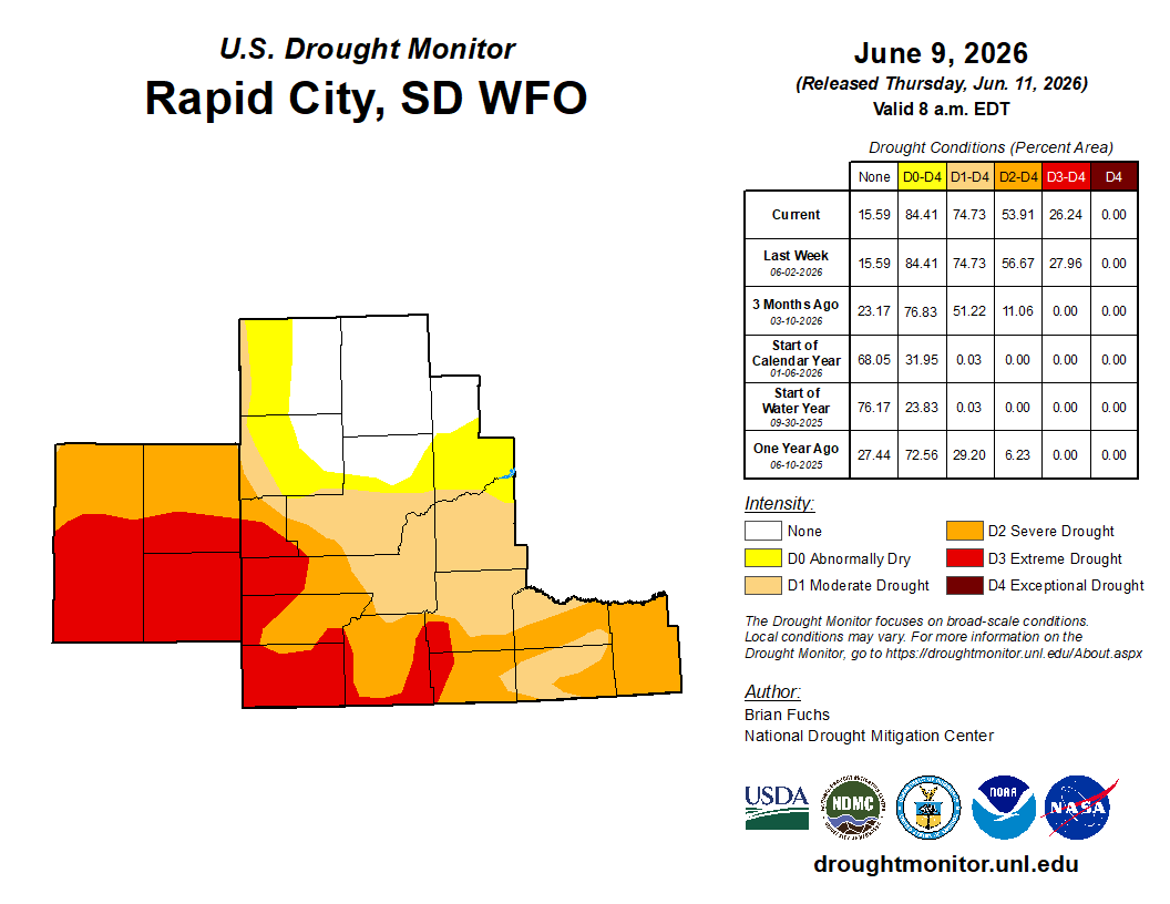


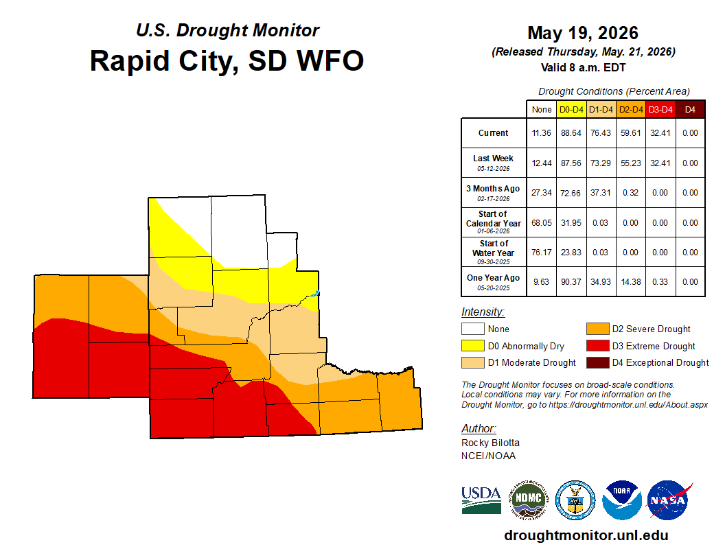


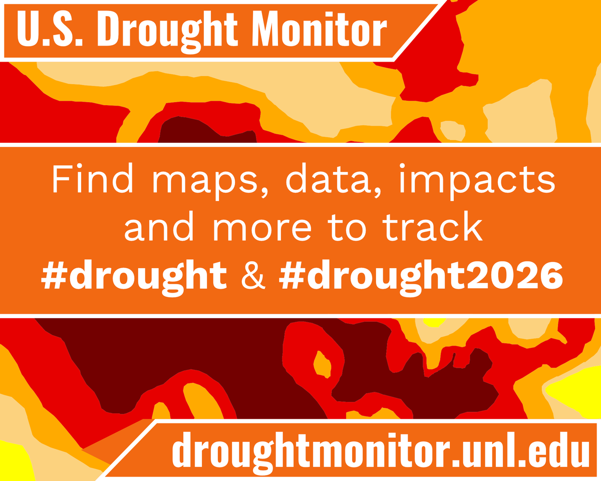
ALT US Drought Monitor. Find maps, data, impacts and more to track #drought and #drought2026. Droughtmonitor.unl.edu. The orange, yellow and red colors of the U.S. Drought Monitor are in the background.


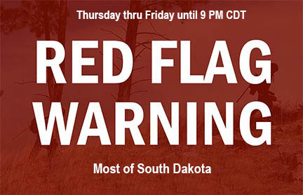
ALT Red Flag Warning today thru Friday evening

ALT A map of Red Flag Warning counties

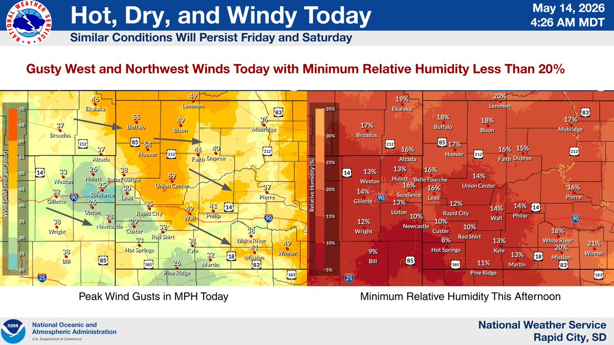
ALT Image titled "Hot, Dry, and Windy Today" indicating similar critical fire weather conditions will persist through Saturday with gusty winds and minimum relative humidity less than 20%. The slide contains visual representations of today's peak wind gusts and minimum relative humidity.
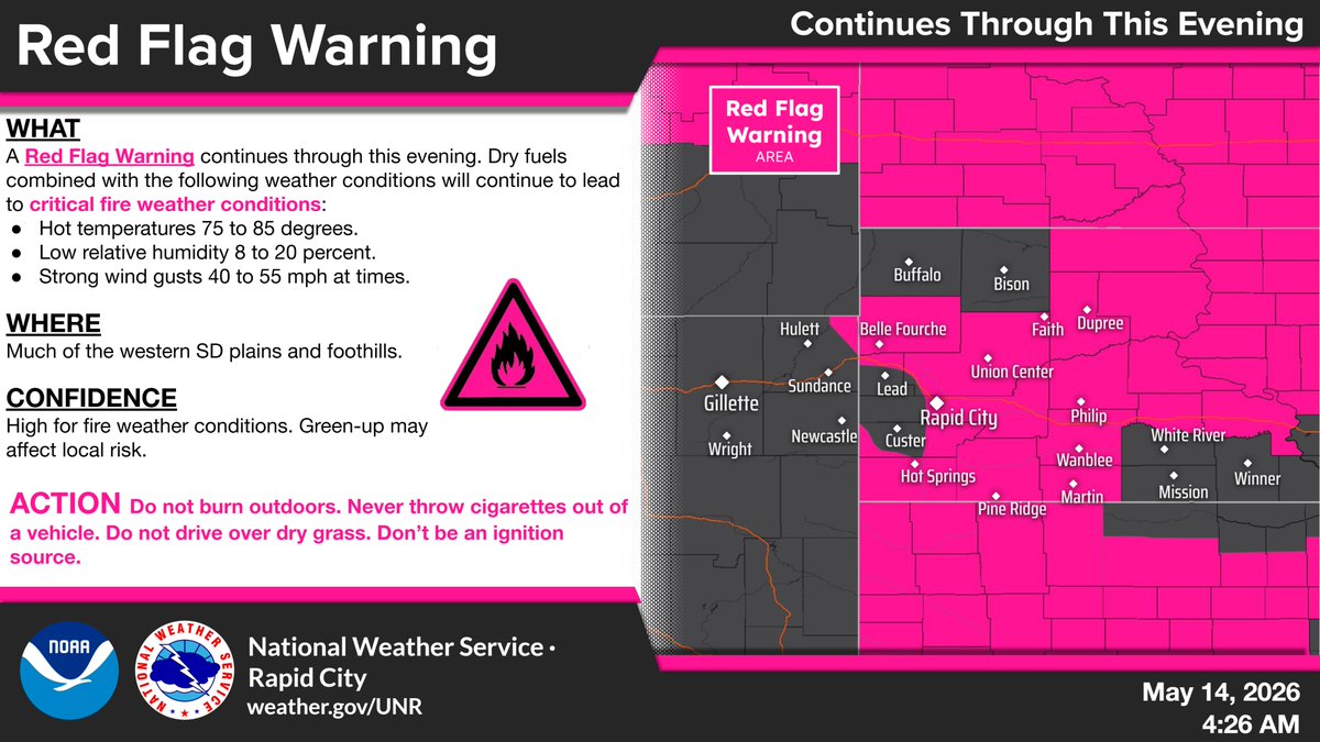
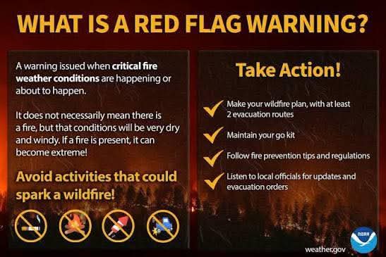
ALT Image titled "Red Flag Warning" detailing critical fire weather conditions persisting this evening for the western SD plains and foothills. Conditions include hot temperatures (75 to 85 degrees), low relative humidity (8 to 20 percent), and strong wind gusts (40 to 55 mph). The slide includes a map showing the warning area and a list of actions to prevent ignition.
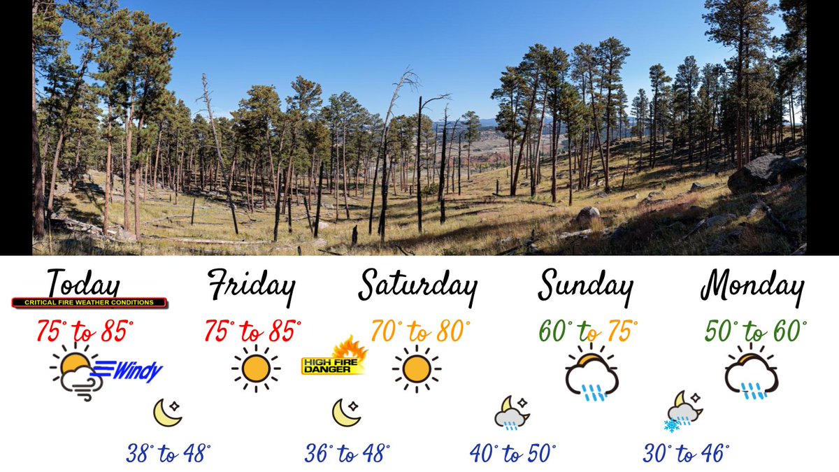
ALT A five-day weather forecast graphic displayed below a photo of a forested landscape with tall pine trees under a clear blue sky. The forecast shows: Today: 75° to 85°, windy, critical fire weather conditions, low 38° to 48°. Friday: 75°to 85°, sunny, high fire danger, low 36° to 48°. Saturday: 70°–80°, sunny, high fire danger, low 36° to 48°. Sunday: 60°–75°, partly cloudy with a chance of showers, low 40° to 50°. Monday: 50° to 60°, cloudy with a chance of rain and possible snow in the higher Black hills, low 30° to 46°. The image emphasizes a transition from warm, dry, fire-prone weather to cooler, wetter conditions later in the week.

ALT Map on the right shows areas in a Red Flag Warning through Thursday evening.
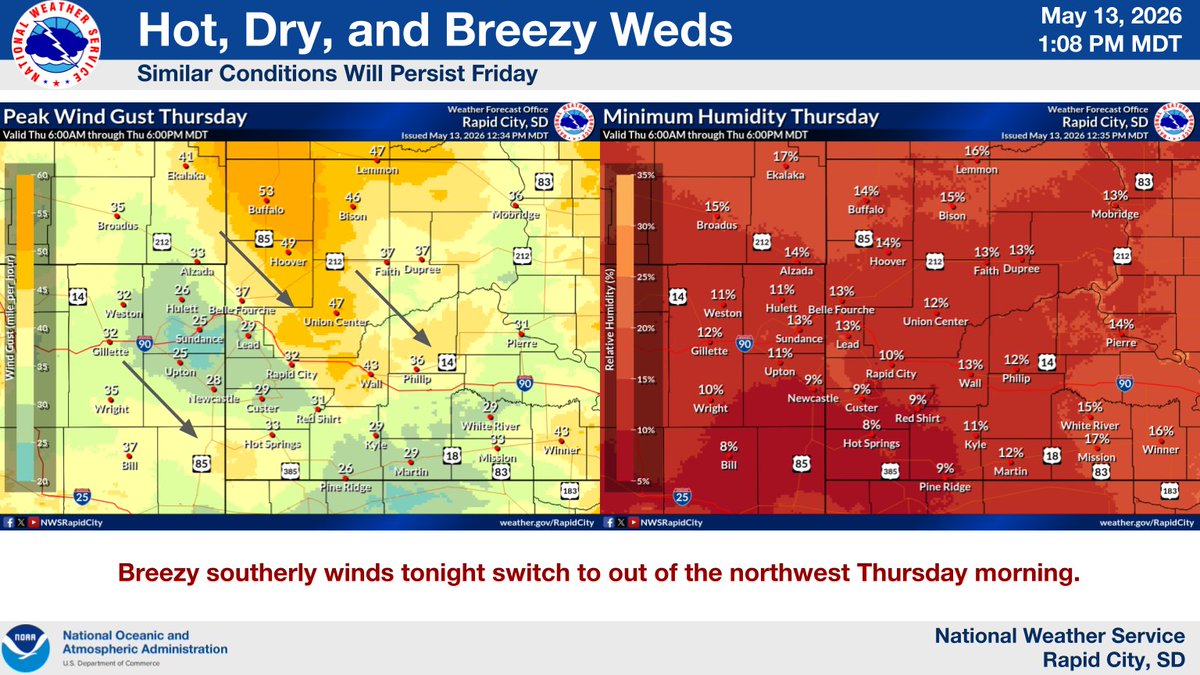
ALT Map on the left shows max wind gusts expected Thursday. Map on the right shows the minimum RH expected Thursday afternoon.

ALT Map on the right shows areas in a Red Flag Warning through Thursday evening.
ALT Map on the left shows max wind gusts expected Thursday. Map on the right shows the minimum RH expected Thursday afternoon.