
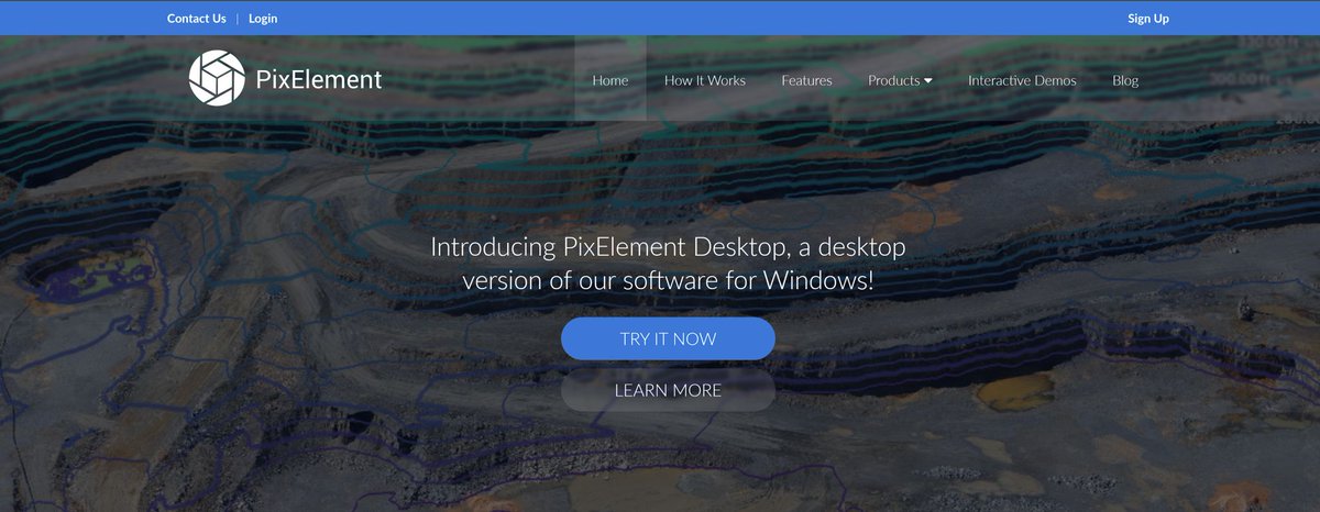
PixElement's patented algorithms convert aerial images from drones, planes, or satellites into precise 3D models.
Joined May 2024
- Tweets 80
- Following 309
- Followers 23
- Likes 102
36 Photos and videos


Apr 14
Turn your aerial data into deliverables that matter with FastDraft. #FastDraft provides professional 2D and 3D linework drafting directly from your PixElement projects, helping construction and planning teams move from scan to spec-ready CAD faster than ever.
#Linework #Drafting


7
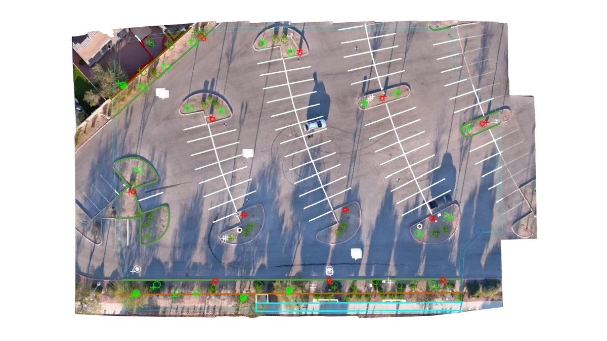
StockpileStudio with PixElement auto-detects stockpiles from terrain, lets you refine boundaries fast, and generates volume reports. Assign material, density, and cost to convert volumes into mass and value.
#DroneMapping #Photogrammetry #Surveying #Mining #StockpileMeasurement
2
5
Jan 27
Conductor sag, clearance & vegetation encroachment matter. This PixStory shows how hybrid LiDAR imagery in PixElement captures real corridor geometry for engineering analysis.
pixelement.com/blog/2025/12/…
#LiDAR #Photogrammetry #UtilityMapping #Geospatial
1
6
Jan 22
Urban mapping gets messy fast with narrow streets, reflective roofs, vertical facades.
This PixStory shows how a #LiDAR RGB workflow delivers cleaner, more complete urban models in Maysville, KY.
pixelement.com/blog/2025/11/…
#Photogrammetry #UrbanMapping #3DMapping #Geospatial
1
12
Jan 20
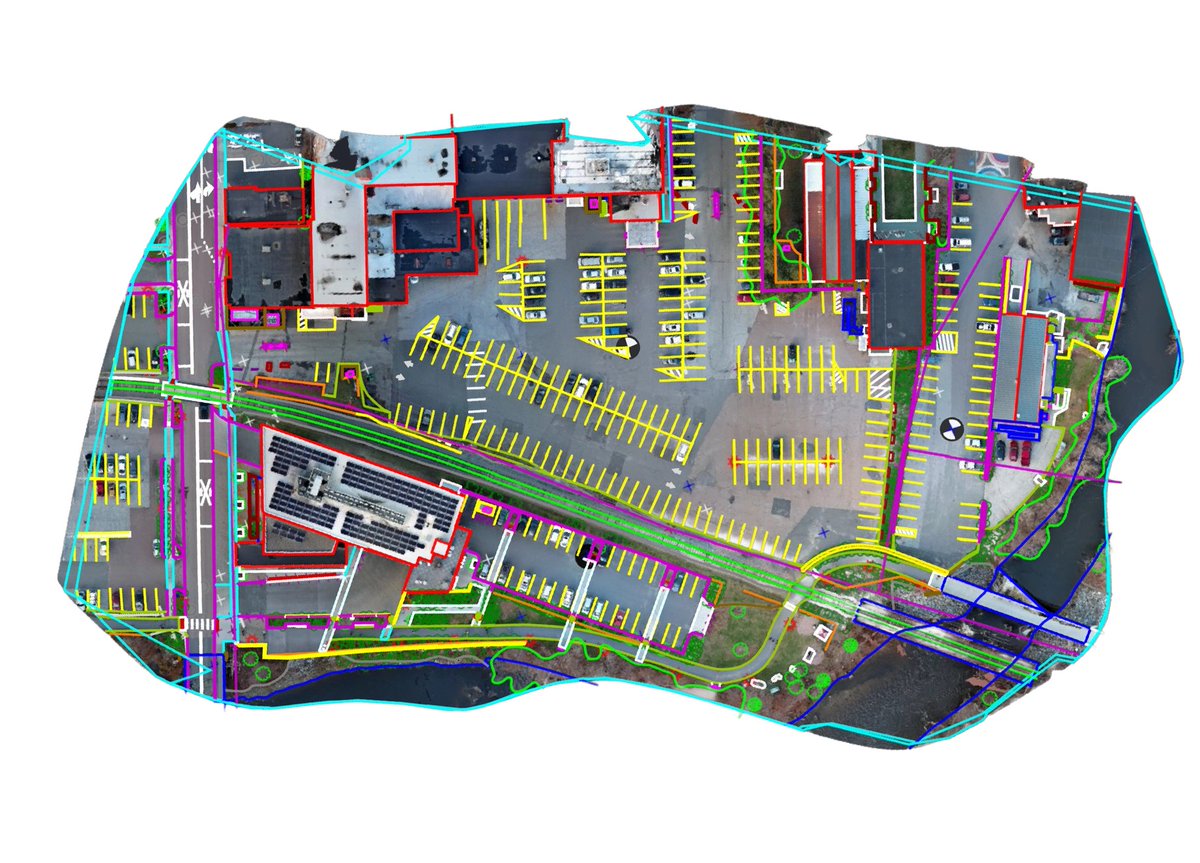
FastDraft in PixElement lets you request drafting directly inside a project — draw the boundary, add notes inline, and get DXF/DWG linework back without screenshots or separate field notes.
Learn more here: pixelement.com/blog/2025/10/…
1
7
Jan 14
We’ll be exhibiting at GeoWeek 2026 in Denver from February 16-18.
We’ll be highlighting recent updates across PixElement Cloud and Desktop, including FastDraft, plus a preview of StockpileStudio for stockpile analysis and reporting.
#GeoWeek #DroneMapping #Photogrammetry
10
Jan 12
PixElement now supports custom logo branding on exported Volume and Polygon Reports. Upload your logo once, check a box at export, and every PDF ships branded and ready to share. Check out the tutorial in the link below.
pixelement.com/blog/2025/12/…
#Branding #Reports #Export
5
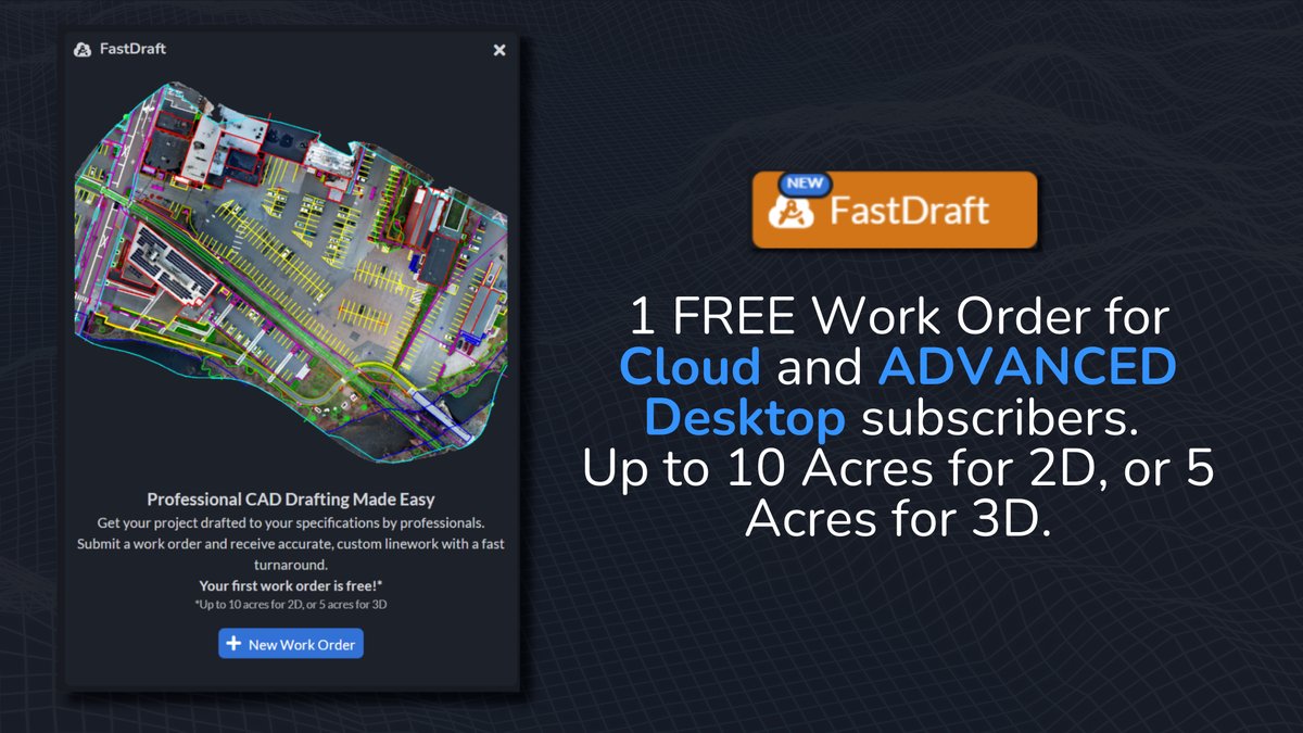
Introducing FastDraft!
Submit professional 2D & 3D #drafting requests directly from #PixElement cloud or desktop.
Draw boundaries, add notes, submit—receive CAD-ready vector files for downstream use.
First work order is free!
Tutorial: youtube.com/watch?v=qsNb_EXk…
10
29 Oct 2025
Coming November 2025 — FastDraft connects your photogrammetry projects to professional 2D & 3D drafting services for fast, precise linework. Built for teams who need structure and results.
Your first Work Order is FREE.
#FastDraft #Photogrammetry #Mapping #3DModeling #Linework
1
30
30 Sep 2025
Introducing PixElement's new and updated Generate TIN tool.
🔹Surface Model for full site detail.
🔹Bare Earth for clean topo.
🔹From Features for precise design.
pixelement.com/blog/_site/20… #AerialPhotogrammetry
#Surveying #ConstructionTech #GIS #PixElement
1
2
28
24 Sep 2025
Showcase your brand on every report. Now you can easily add your own logo to PixElement's Polygon and Volume Reports, giving your deliverables a polished, professonal look that reflects your company.
#AerialMapping #DroneSurveying #Photogrammetry #Volumetrics #Reporting
1
1
27
19 Sep 2025
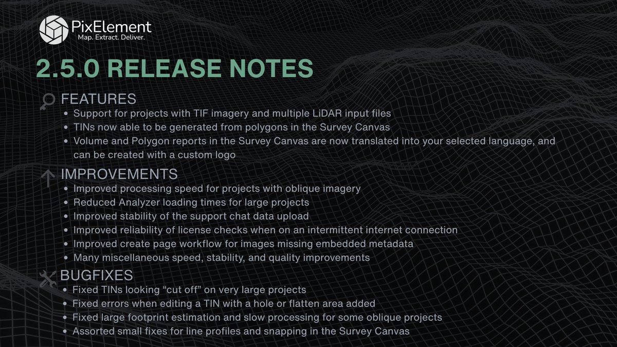
PixElement 2.5.0 is live.
This release delivers new feature support, faster performance, and fixes that make your workflows more reliable than ever.
Upgrade now to take advantage of the improvements.
#PixElement #Update #ReleaseNotes #AerialMapping #Software
1
2
175
12 Sep 2025
Check out our new tutorial on PixElement’s Stereo Reconstruction Tool, manually inspect & model structures from overlapping images for sharper results.
Read/Watch: pixelement.com/blog/_site/20…
#AerialPhotogrammetry #DroneMapping #3DModeling #PixElement #StereoReconstruction
1
15
5 Sep 2025
This PixStory features the #archaeological site of #Iximché, Guatemala. Captured by Aerial Image Solutions & processed with PixElement, the dataset provides 3D models for #culturalheritage.
#dronemapping #aerialphotogrammetry #mayanculture
pixelement.com/blog/_site/20…
1
24
28 Jul 2025
Edit orthos directly in your browser. Remove vehicles, shadows, or other unwanted features with PixElement’s new Orthoimage Editing Tool. No external software needed.
#Photogrammetry #GIS #PixElement #MappingTools #OrthoimageEditing
pixelement.com/blog/_site/20…
1
41
22 Jul 2025
New in PixElement: Add annotations directly to your 2D/3D scenes. Label features, set elevations, and export to various formats.
Clarity collaboration built in.
🔗 pixelement.com/blog/_site/20…
#GISWorkflows #3DMapping #GeospatialTools #Photogrammetry
1
30
15 Jul 2025
New at PixElement: export your polygon measurements as clean, shareable PDFs. Area, perimeter, coordinates, map previews — all in one report.
#DroneMapping #Surveying #Photogrammetry #PixElement
pixelement.com/blog/_site/20…
1
2
57
7 Jul 2025
PixElement 2.4.1 - Now Deployed.
This update focuses on stability, performance, and expanded reporting options, built to support high-demand mapping workflows from field to finish.
#Photogrammetry #Geospatial #SurveyTech #PixElement #3DMapping #AerialSurvey #Update
1
30
5 Jul 2025
Happy 4th of July from the PixElement team 🇺🇸
Today we honor the courage behind our independence, and those who continue to defend it.
We build geospatial tools for the mission.
We build for you.
#4thOfJuly #MissionReady #DefenseMapping #BlueUAS #MadeInUSA
1
2
54
2 Jul 2025
Photogrammetry isn’t just data, it’s documentation, storytelling, and insight. #PixStories is a new series on how users apply PixElement in the field.
📖 Read more: pixelement.com/blog/_site/20…
📤 Got a project? Submit it via the blog.
#PixElement #PixStories #DroneMapping
1
2
15