
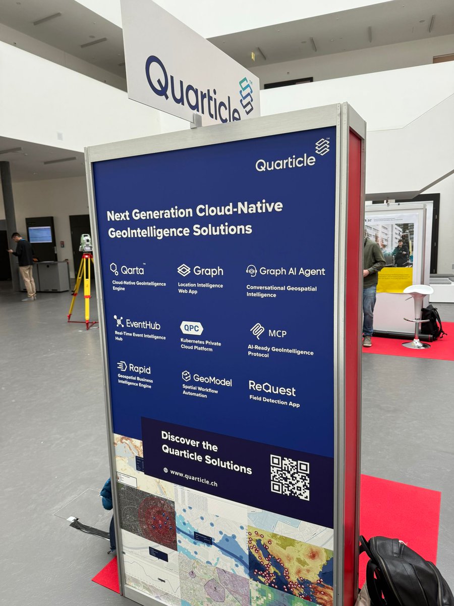
Transforming and translating complex geo data into valuable business insights through user-friendly geospatial solutions. Reach out at contact@quarticle.ch.
Joined February 2022
- Tweets 199
- Following 50
- Followers 31
- Likes 25
188 Photos and videos


Pinned Tweet

Feb 16
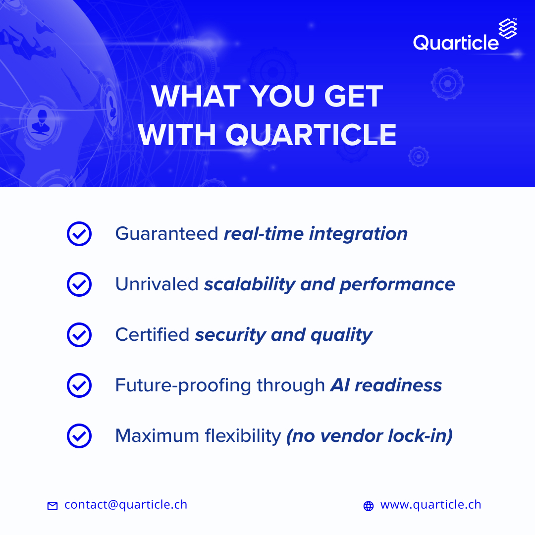
Move beyond outdated data updates.
Quarticle delivers real-time, secure, scalable, AI-ready data intelligence with no vendor lock-in.
Real-time integration, Kubernetes-native, ISO certified & multi-cloud flexible.
quarticle.ch/
#Insurance #InsurTech #AI #Cloud
63
Quarticle has joined the Santiago Network, helping developing countries with tailored, context-specific technical assistance on climate loss & damage.
We’re happy to support with practical geospatial solutions and cloud expertise.
#ClimateAction #Geospatial #SantiagoNetwork
6
Jun 12
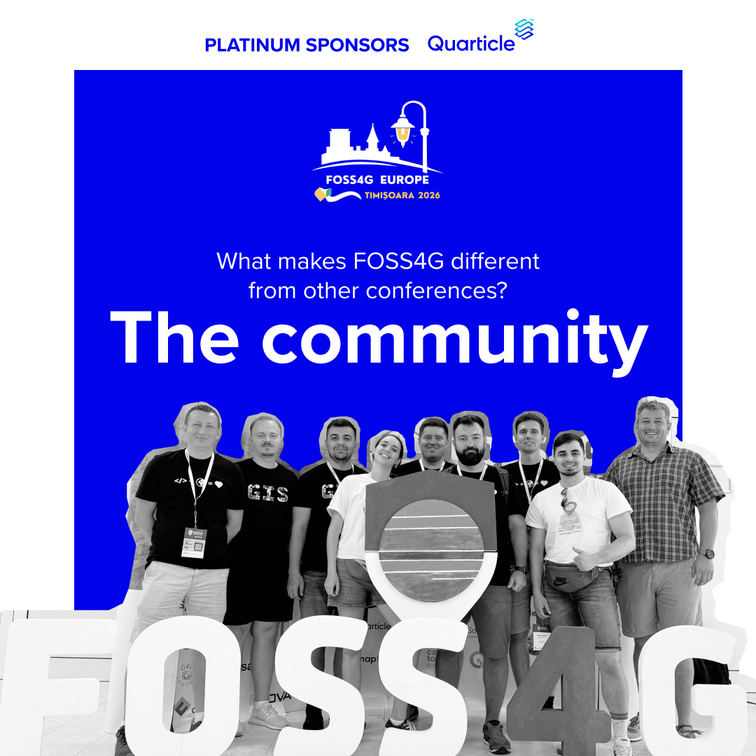
What makes FOSS4G different?
The community.
A place where developers, analysts, and teams come together around the same open geospatial ecosystem.
That’s why people keep coming back.
See you in Timișoara this June 👇
2026.europe.foss4g.org/
#FOSS4GE2026 #Quarticle
15
Jun 10
How efficient is your last-mile network?
With #Quarticle's Graph, you can visualize delivery points, evaluate hub coverage, & test the impact of adding micro-hubs to identify redundancies, gaps, and optimization opportunities.
Watch the full demo below
#LastMile #Logistics
11
Jun 5
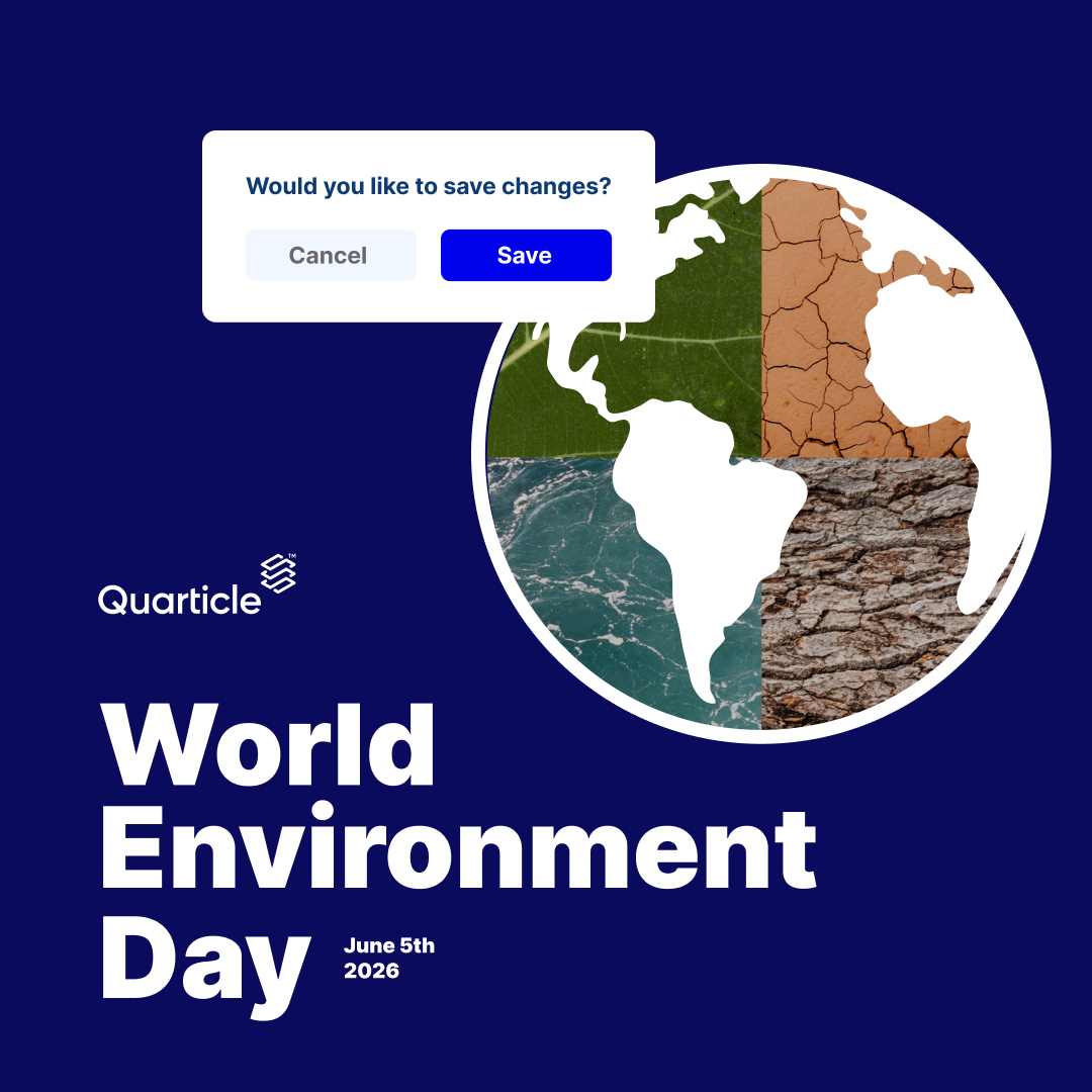
World Environment Day 🌍
A few practical things you can do today:
• Review how you use environmental data
• Cut unnecessary storage/processing
• Support open datasets
• Set one concrete improvement for the year ahead
#WorldEnvironmentDay #GIS #Sustainability
11
Jun 4
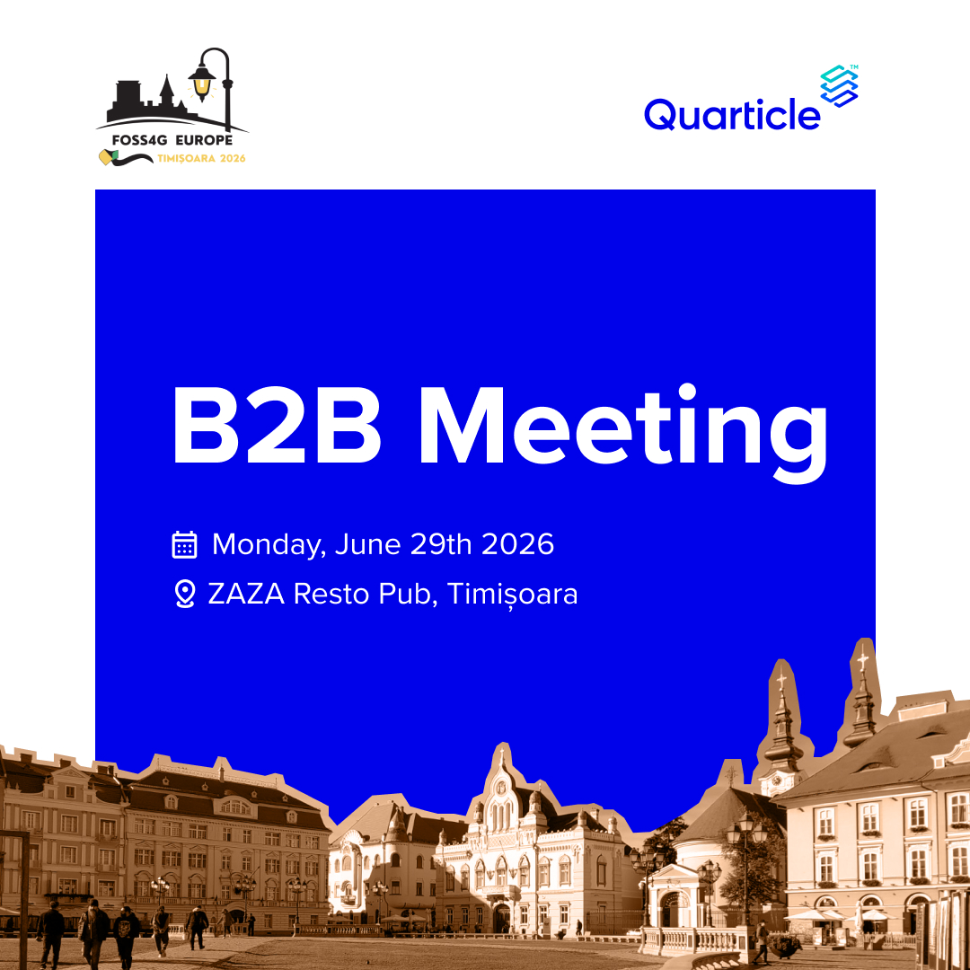
The best conference conversations don’t happen on stage.
The B2B sessions at FOSS4G Europe are where real discussions, ideas, and partnerships take shape.
We’re looking forward to it. Who else is joining? 👇
2026.europe.foss4g.org/sched…
#FOSS4GE2026 #Quarticle #GIS
10
May 29
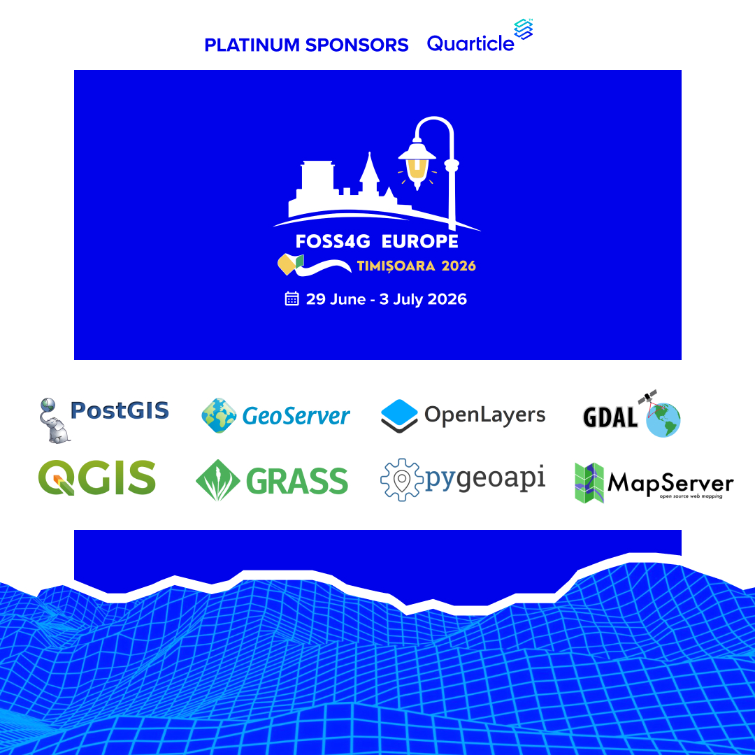
What does a production-ready geospatial stack actually look like?
At FOSS4G Europe (June 29–July 3), we dive into real workflows with PostGIS, QGIS, GeoServer, GDAL & more.
See it. Test it. Understand it.
We’ll be there. Who’s joining?
👉 2026.europe.foss4g.org/
27
May 25
Most geospatial tools stop at visualization.
Graph by Quarticle is built differently.
It's a cloud-native geospatial intelligence platform for interactive analysis, data enrichment, and spatial exploration at scale.
See more: quarticle.ch/products/graph
#GeoIntelligence #GIS
19
May 20
FOSS4G Europe is more than a conference; it’s where the open geospatial ecosystem comes together.
📍 This year, happening in Timișoara
📅 June 29 – July 3
We’re proud to be platinum sponsors for this event!
Learn more about the conference: 2026.europe.foss4g.org/
#Quarticle
1
6
May 18
Are your locker locations optimized for demand?
With Quarticle’s Graph, you can visualize networks in real time, spot gaps and overlaps, and optimize location strategy based on real demand.
Take a look:
youtube.com/watch?v=OLFR2KLC…
#LocationIntelligence #Logistics #GIS
9
May 15
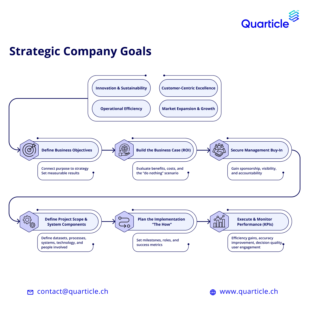
Geospatial projects usually don’t fail on tech; they fail on alignment.
These elements are vital:
Clear strategy. Business buy-in. Scalable execution.
Here’s a practical framework built from real-world experience: quarticle.ch/blog/how-to-pla…
#GeoIntelligence #GIS #Quarticle
19
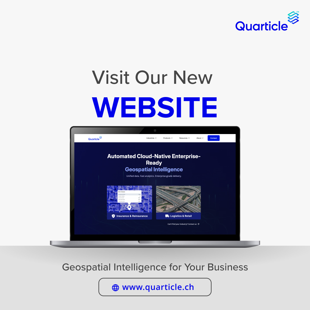
May 13
We’re excited to launch the new Quarticle website with a full overview of how we help organizations turn complex geospatial data into real-time, actionable insight.
Take a look: quarticle.ch/
#GeoIntelligence #Geospatial #CloudNative #GIS #LocationIntelligence
10
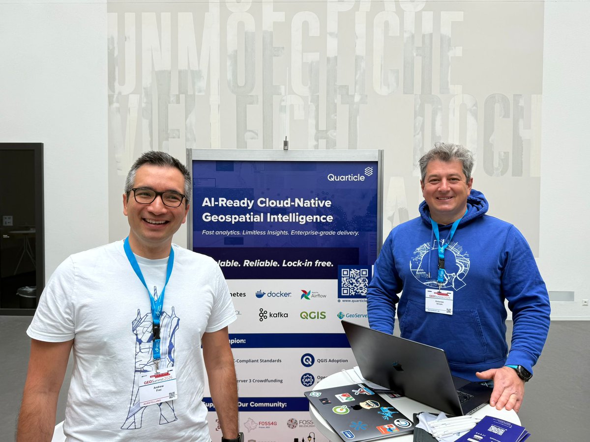
May 6
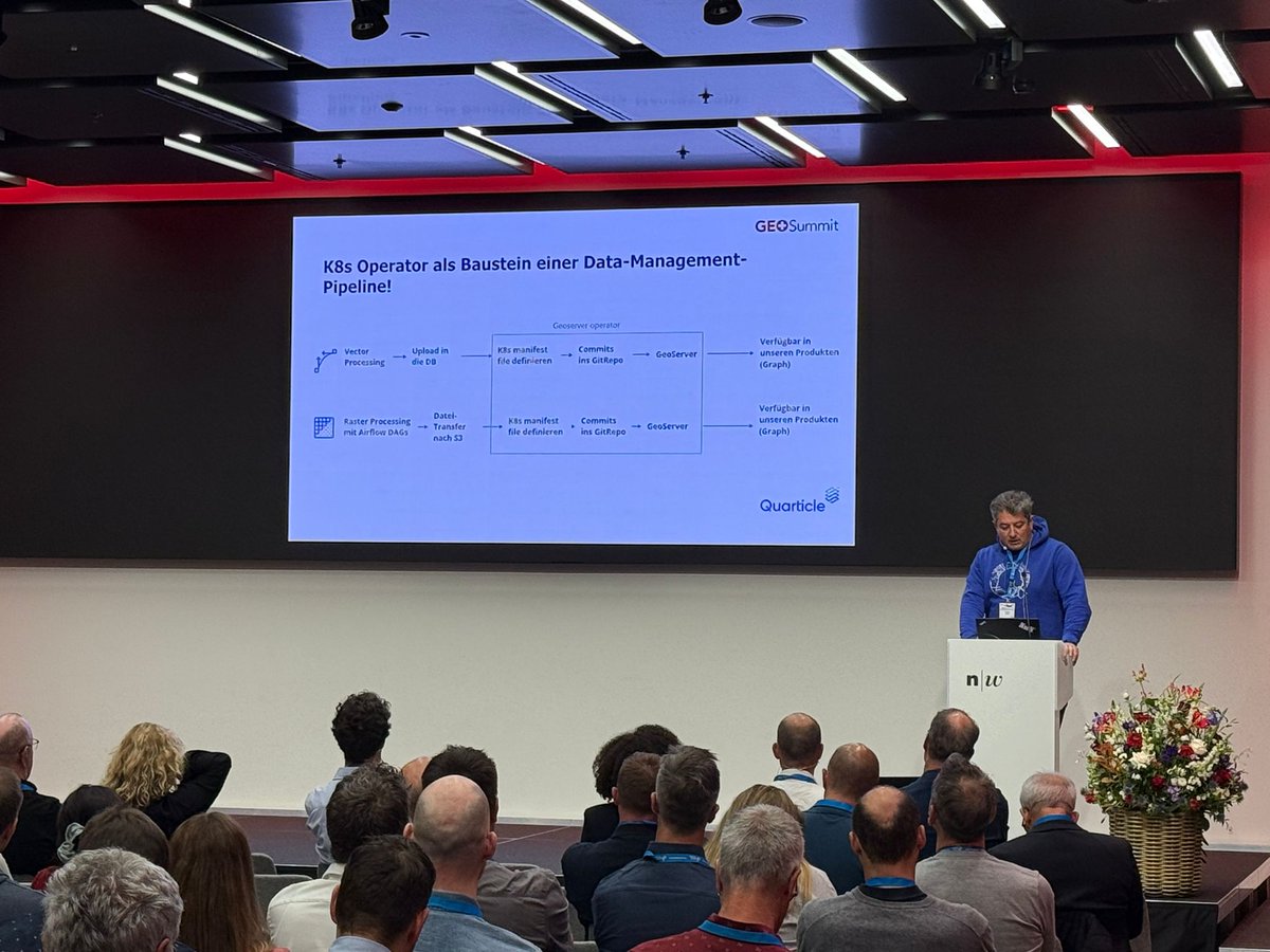
GEOSummit 2026 is in full swing, and it’s great to be part of it.
Our CEO, Octavian Iercan, and COO, Andrew Frei, are on-site and excited to connect with the community.
If you’re attending, swing by our booth.
#GEOSummit #GeoIntelligence #Geospatial #GIS

84
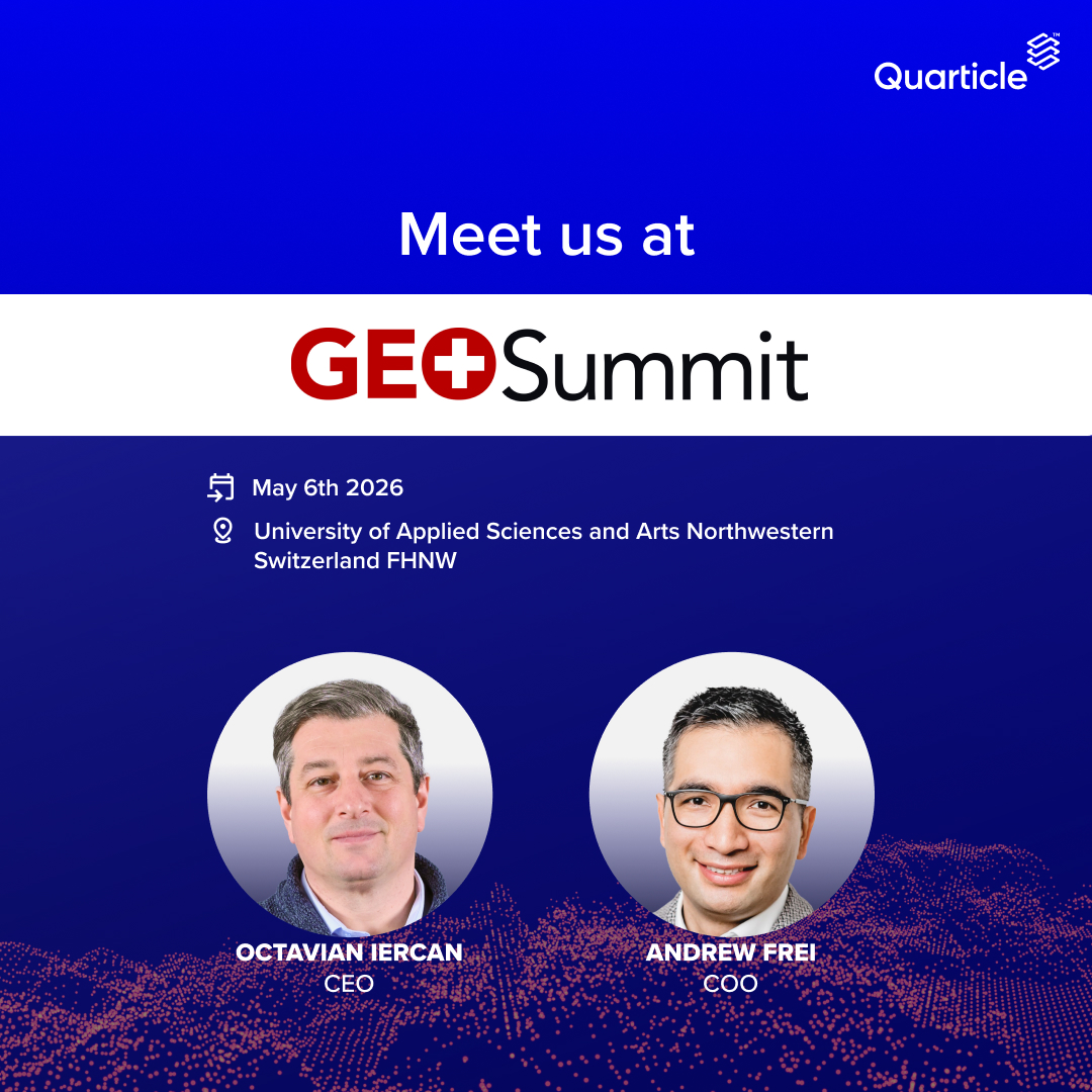
Apr 29
We’re pleased to share that Quarticle will be attending GEOSummit 2026.
Our CEO, @DrQuarticle, and COO, Andrew Frei, look forward to connecting.
#GEOSummit #GIS #GeoIntelligence #Quarticle
73
Apr 23
What if you could ask a question and instantly get maps, reports, and insights?
With #Quarticle’s Graph AI Agent, geospatial analysis becomes conversational.
Upload your data, explore it, and generate insights in real time.
Find out more: quarticle.ch/products/graph-…
#AI #GIS
1
68
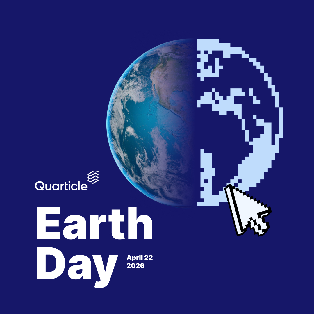
Apr 22
🌱 Happy Earth Day!
Today is a great reminder that data should do more than inform; it should drive action.
Better geospatial insights can help create meaningful impact for the planet.
11
Apr 20
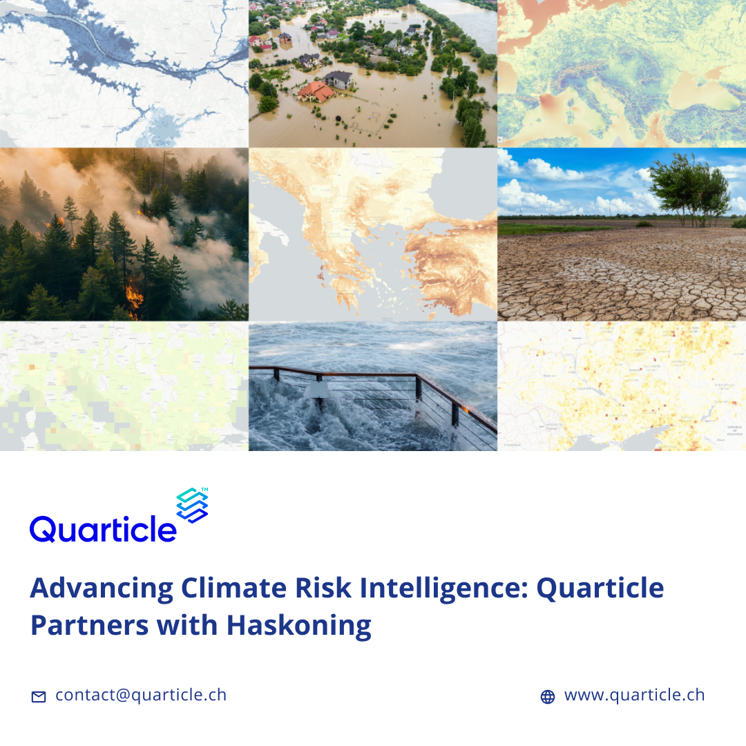
We’re pleased to share that Quarticle has partnered with @haskoning to integrate Twinn, their advanced climate risk data, into our platform.
Read more here: quarticle.ch/blog/advancing-…
20
Apr 17
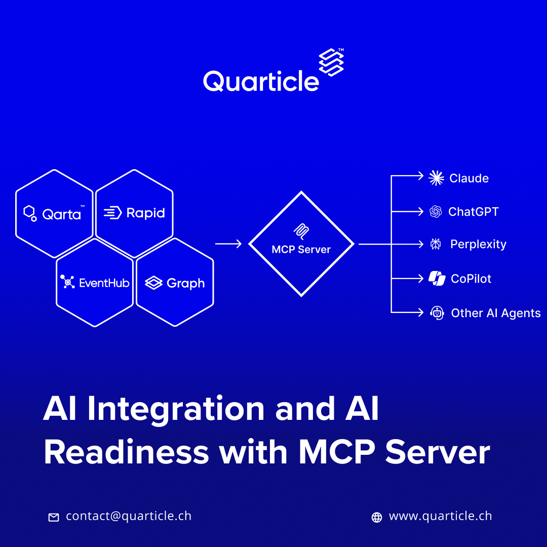
Why do most AI initiatives fail to deliver real business value?
It’s not the models, it’s the integration.
At #Quarticle, the Model Context Protocol (#MCP) solves this by unifying our solutions into a single AI-ready layer.
👉 quarticle.ch/products/mcp-se…
1
1
22
Apr 15
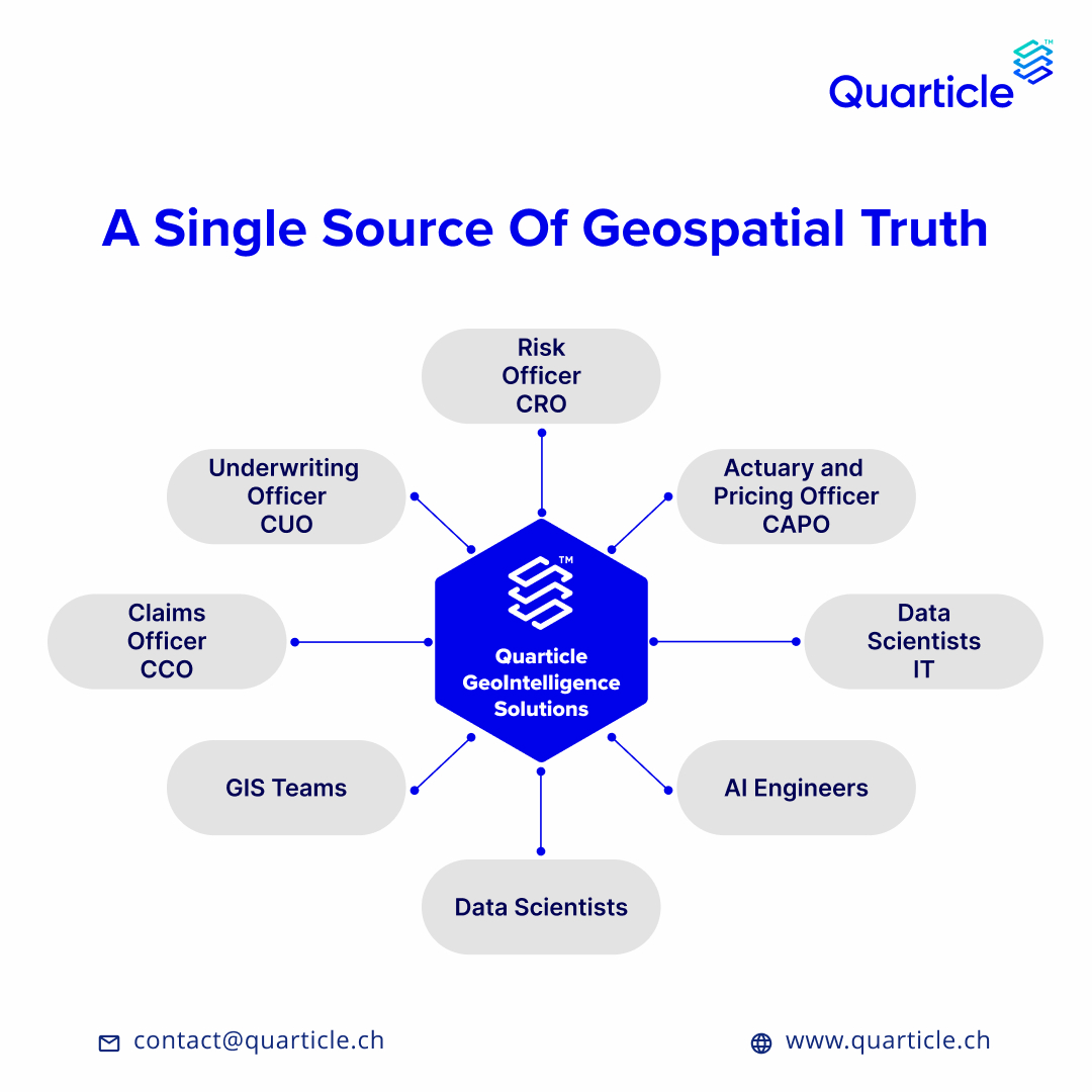
Insurance operations rely on vast geospatial & risk data, often fragmented across systems & teams.
At #Quarticle, we build a single source of geospatial truth that connects the entire insurance value chain.
👉 quarticle.ch/solutions/ai-ge…
#GeoIntelligence #Insurance #Insurtech
18
Apr 6
What does a modern #GeoIntelligence stack look like?
At #Quarticle, we use cloud-native #Kubernetes, enabling:
• scalability
• high availability
• multi-cloud flexibility
From fragmented tools → integrated GeoIntelligence platforms.
👉 quarticle.ch/

7
Apr 1
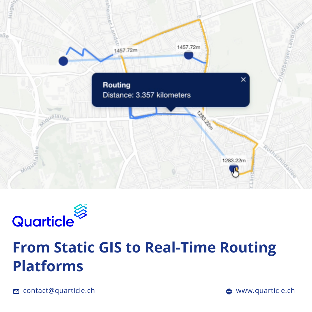
How often do your "optimized" routes rely on yesterday's data?
This article details the transition from static GIS to real-time routing and the implications when routing becomes an on-demand service.
Read more:
quarticle.ch/blog/from-stati…
#Logistics #LastMile #Routing
8