
36 Photos and videos


This is the twitter account for the open source Remote Sensing and GIS #python library. You can check us out at rsgislib.org and remotesensing.info for all your data processing needs :)
#remotesensing #EOChat #python #EarthObservation
6
13
RSGISLib 5.0.12 is out. Get it while it's hot: github.com/remotesensinginfo…
#python #opensource #remotesensing #GIS
3
7
649
Latest science from NASA with RSGISLib at it's heart ❤️
1
RSGISLib retweeted

14 Jun 2022
Had a great day scanning #trees with #TLS #lidar at the DC National Arboretum (@USDA_ARS #ARSArboretum) with a great field crew!
We are using #lasers and phone cameras to measure the angle of leaves 🍃 - what might we learn??
@jan_pisek @abarenblitt and Brian Lee.
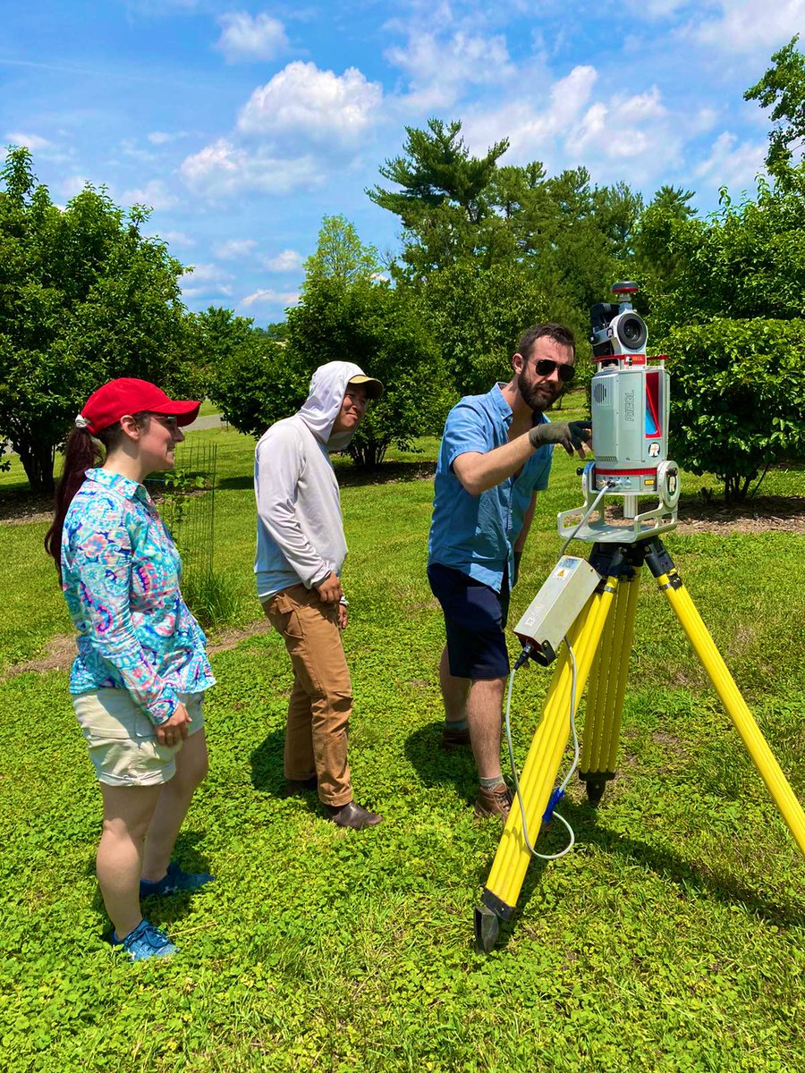
ALT Setting up the laser scanner to measure leaf angles.
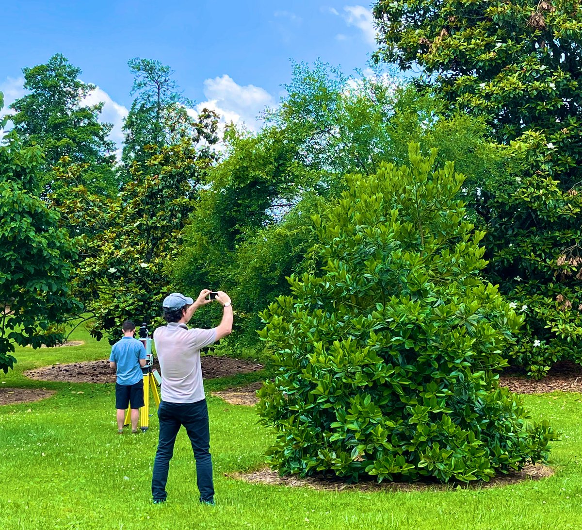
ALT Laser scanning and pictures of leaves help us measure the angle of leaves in a tree canopy.
1
3
21
RSGISLib retweeted

3 May 2022
We are looking for a full-time, open ended Field Survey Technician in Ecology and Environment. Come get your feet dirty with us @StirBES!
stir.ac.uk/about/work-at-sti…
15
17
RSGISLib retweeted

3 Mar 2022
Check out #DEALandCover! A new generation of operational #LandCover mapping for Australia. 30 years of #Landsat 25 m resolution #LandCover with over 100 attributions based on the UN @FAO LCCS. Immensely proud to be part of the team, so pleased to see our work come to fruition!
2 Mar 2022

We are very excited to announce the release of #DEALandCover! See Australia as never before with our new annual #LandCover maps from 1988–2020 at 25 m resolution. Based on #OpenData and created using #OpenSource software. Explore it for yourself 👉 bit.ly/35MjQu0!
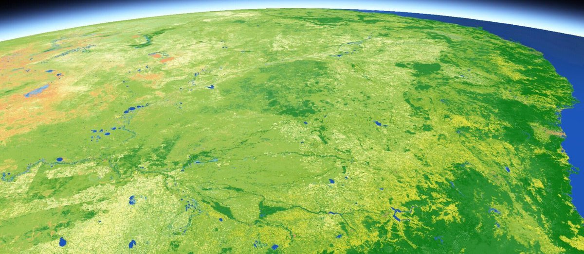
ALT A DEA Land Cover map of Eastern Australia, showing how the physical attributes of the surface change. This image is predominately shades of green, indicating vegetation, with some orange to the west, indicating bare. To the east there is blue to denote the ocean. The image appears to be taken from space, with some atmospheric detail in the background.
6
10
30
RSGISLib retweeted

21 Feb 2022
We had so much to say early on that we ran out of time in the latest #scenefromabove episode!
So we discuss news. Lots of it!
@RSGISLib
@USGSLandsat @NASA_Landsat
@Satellogic
@GEOSEC2025
@Microsoft #torchgeo
@OurRadiantEarth
#lidar

7
21
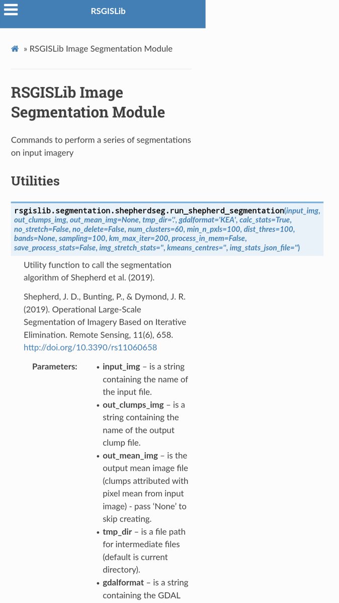
A week ago we launched V5 of RSGISLib!! Let us know if you've been trying it out!

We are pleased to announce the release of RSGISLib V5, available on the conda-forge channel and at rsgislib.org
Release notes are here (github.com/remotesensinginfo…) but below is a 🧵 of the highlights:
#python #opensource #geospatial #remotesensing #GIS #EOchat
1
5
We are pleased to announce the release of RSGISLib V5, available on the conda-forge channel and at rsgislib.org
Release notes are here (github.com/remotesensinginfo…) but below is a 🧵 of the highlights:
#python #opensource #geospatial #remotesensing #GIS #EOchat
1
17
42
We hope you enjoy RSGISLib V5 ♥️. This should be our most stable version moving forward, with new integrated tools for easier software management. We provide over 800 🤯free and open Python functions for all your RS and GIS needs. And as always, let us know if you have any issues
1
Finally, RSGISLib is developed for free on our time. If you like what we do and want to support us in keeping RSGISLib going, please consider buying us a coffee ☕️ : buymeacoffee.com/petebunting
Thank you
Pete, Dan (@danclewley ) and Nathan (@DrNASApants )
Still taking answers if you haven't already clicked an option
Ahead of the release of V5, we would really like to know what system you use RSGISLib on? This will help us develop RSGISLib #python #opensource #geospatial #FOSS #remotesensing #GIS #eochat
Ahead of the release of V5, we would really like to know what system you use RSGISLib on? This will help us develop RSGISLib #python #opensource #geospatial #FOSS #remotesensing #GIS #eochat
14%
Mac OS
29%
UNIX
57%
Windows
28 votes • Final results
7
2