
RedFox is a Geographic Information Systems (GIS) and Remote Sensing company specializing in custom software engineering and AI for geospatial applications.
Joined June 2015
- Tweets 1,019
- Following 543
- Followers 812
- Likes 2,217
122 Photos and videos


Free, Machine Learning Crash Course from Berkeley:
ml.berkeley.edu/blog/tag/cra…
No registration, no bullshit.
Just go to the site, and start learning from the very beginning!

85
1,188
4,901
RedFox GIS & Remote Sensing 🛰️🌎🇺🇸 retweeted

15 Apr 2022
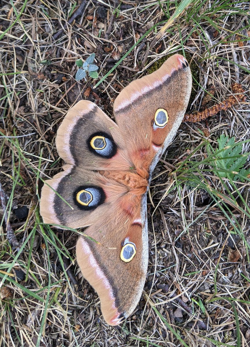
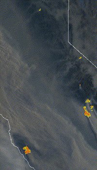
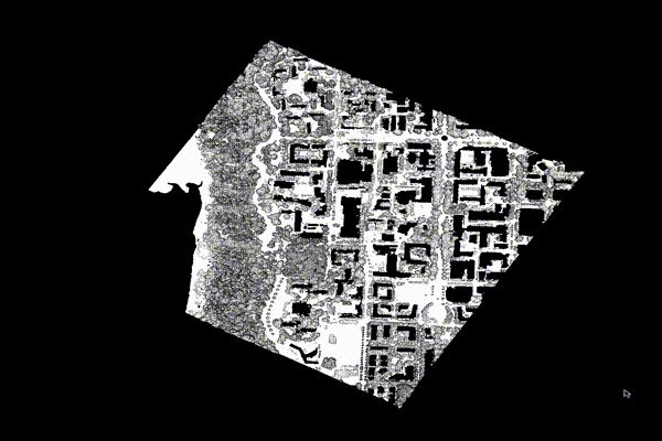
Now if someone could build an AI model to spot what's hiding in this image... :)
Can you see it?
18
9
81
RedFox GIS & Remote Sensing 🛰️🌎🇺🇸 retweeted

10 Jun 2022
GEE Tutorial 114 - How to create near real-time global 10-m land cover maps with #geemap and Dynamic World
Video: youtu.be/wmDus2qGyyU
Notebook: geemap.org/notebooks/114_dyn…
App: dynamicworld.app
#EarthEngine #eochat #geospatial #data #opensource
3
85
298
RedFox GIS & Remote Sensing 🛰️🌎🇺🇸 retweeted

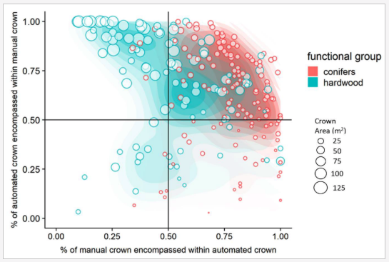
23 Feb 2022
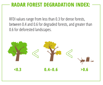
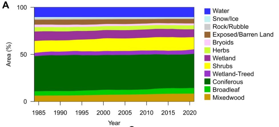
While it might look like the most boring graphic of all time, it is actually the most exciting. 🤓📢
Let me convince you. 🧵⬇️⬇️
3
18
103
RedFox GIS & Remote Sensing 🛰️🌎🇺🇸 retweeted

8 Mar 2021
👋 After a loooong break (🏚️👶), I'm back on my side projects with a brand new version of the Python Graph Gallery! 🧵
python-graph-gallery.com
ALT The Python Graph Gallery Preview
24
213
1,004
RedFox GIS & Remote Sensing 🛰️🌎🇺🇸 retweeted

15 Feb 2022
Google #EarthEngine tip 44: Are you using 'aside()'? It can save you a lot of time and lines! #Landsat9
2
30
167
RedFox GIS & Remote Sensing 🛰️🌎🇺🇸 retweeted
2 Feb 2022
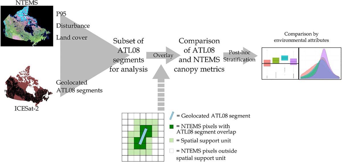
📢New: How can spaceborne #lidar inform, augment, improve national maps of canopy height from #Landsat and samples of airborne lidar? 🤔
Mulverhill et al. Evaluating #ICESat2 for monitoring, modeling, and update of large area forest canopy height products.
sciencedirect.com/science/ar…
2
12
46
RedFox GIS & Remote Sensing 🛰️🌎🇺🇸 retweeted

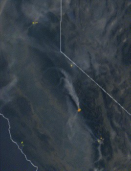
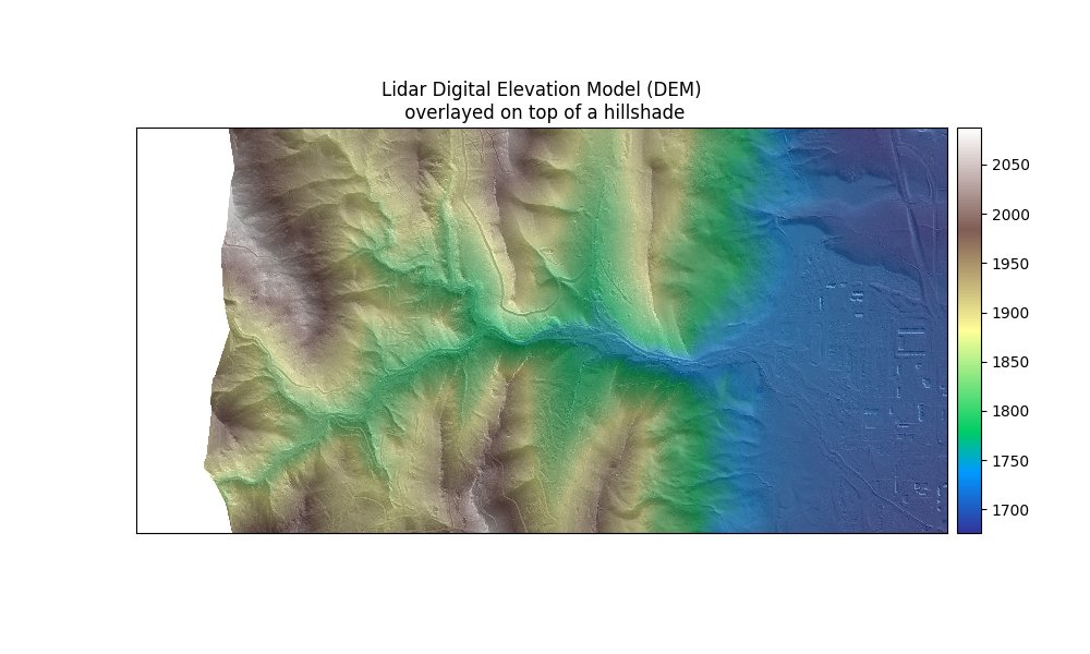
3 Nov 2020
If a coast redwood falls in a forest and no one is around to hear it, we can find out using #LiDAR.
7
26
RedFox GIS & Remote Sensing 🛰️🌎🇺🇸 retweeted

31 Jan 2022
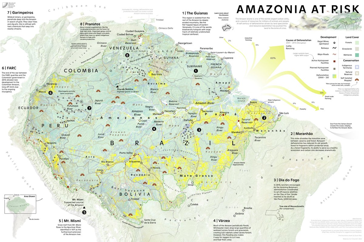
So excited to share a (downsized for twitter) #map I have been working on, with illustration work by @The_Ruizium. A picture of the #Amazon region in crisis. Not only the struggle to deal with #deforestation, but its geography, cultures, and political divisions.
21
82
320
RedFox GIS & Remote Sensing 🛰️🌎🇺🇸 retweeted

31 Jan 2022
I spent 500 hours on Kaggle competitions last year and just became a Kaggle Master.
Over those many hours, I learned a systematic process you can use to train any model on any dataset.
6 steps to train any model 🧵
25
431
2,340
RedFox GIS & Remote Sensing 🛰️🌎🇺🇸 retweeted

26 Jan 2022
Hey #geotwitter I've had it with shapefiles. Hit me with you favourite formats/packages for storing vectors.
#rstats #rspatial
5
3
8
RedFox GIS & Remote Sensing 🛰️🌎🇺🇸 retweeted

27 Jan 2022
Moving dynamic weather patterns AND cloud shadows? Sometimes even I'm like: "Wow! I did that with R?!?"😁
#RStats #rayshader
8
23
286

14 Jan 2022
Clouds!
14 Jan 2022

"Sorry boss, can't visualize any data today—It's a cloudy day inside my computer."
Clouds, coming to #rayshader? 100% chance😉
#RStats
1
RedFox GIS & Remote Sensing 🛰️🌎🇺🇸 retweeted

7 Jan 2022
Life is to short to use dated cli tools that suck
Try these instead 🧵
170
3,270
15,134
RedFox GIS & Remote Sensing 🛰️🌎🇺🇸 retweeted

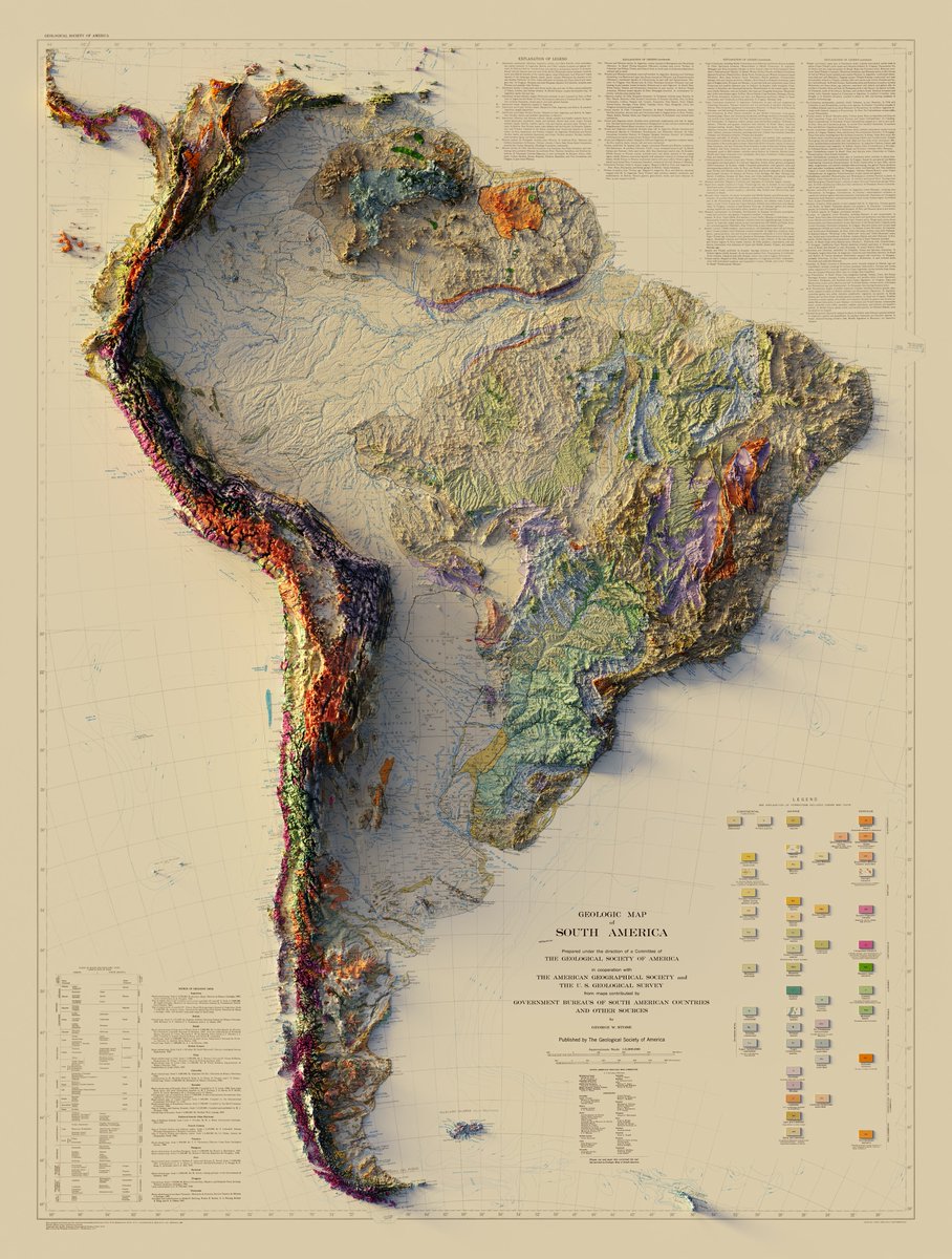
9 Nov 2021
1/2
Geologic Map of South America - The Geological Society of America / The American Geographical Society / USGS - 1950
3D Render
Close ups below
#arcgispro #b3d #geology #geography #gis #cartography #SouthAmerica
148
1,514
6,805
RedFox GIS & Remote Sensing 🛰️🌎🇺🇸 retweeted

1 Sep 2021
Wow - this is awesome! Full interactive functionality of #geemap and #leafmap in Colab notenooks! As someone who works almost exclusively in a browser with cloud services, this is huge.
1 Sep 2021

Exciting news! After years of waiting, Google #Colab finally supports custom widgets (e.g., #ipyleaflet). That means now you can enjoy the full interactively functionality of #geemap and #leafmap on Colab.
Try it out:gishub.org/leafmap_colab
#EarthEngine #gischat #geospatial
2
16
59
RedFox GIS & Remote Sensing 🛰️🌎🇺🇸 retweeted

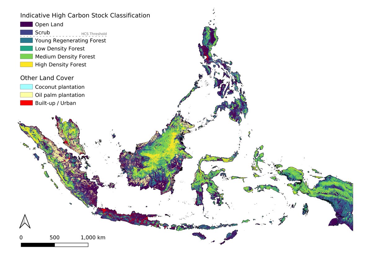
19 Jul 2021
Happy to share the outcome of our new work: “High carbon stock mapping at large scale with optical satellite imagery and spaceborne LIDAR” with Konrad Schindler and @JanDirkWegner1 @EcoVisionETH. Thread👇
Preprint: arxiv.org/abs/2107.07431
#conservation #forests #DeepLearning
3
24
55
RedFox GIS & Remote Sensing 🛰️🌎🇺🇸 retweeted
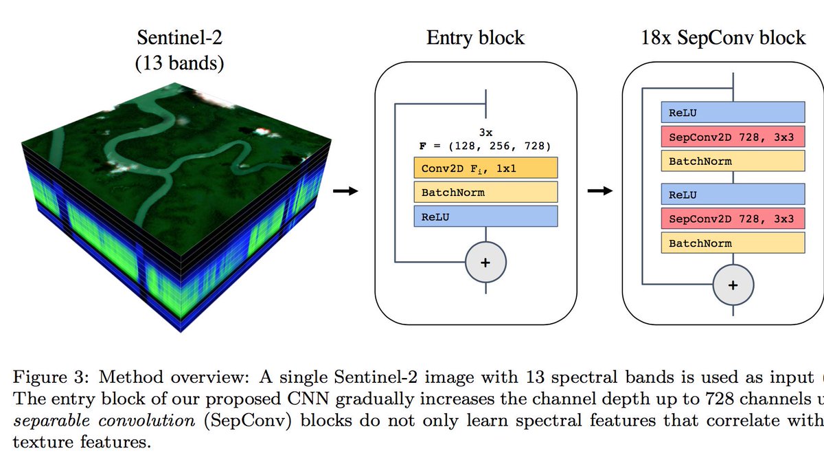
21 Aug 2019
I’m happy to share my first journal paper about #mapping vegetation height at country-scale using #DeepLearning and #Sentinel2. --> arxiv.org/abs/1904.13270
Looking forward to the first data release from @GEDI_Knights .
5
24
RedFox GIS & Remote Sensing 🛰️🌎🇺🇸 retweeted
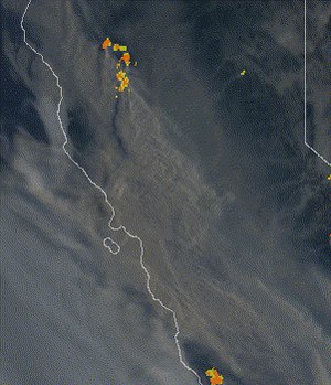
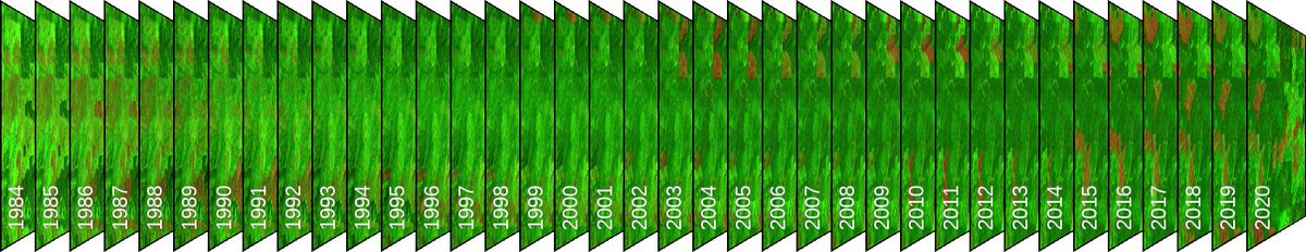
15 Jul 2021
...here is the static image
1
19