Meteorologist - Streamline Weather Consulting, LLC / FSU / NWS /GLERL / AMS CCM #775 / Former NWS Science & Operations Officer. streamlineweather.com
Joined January 2022
- Tweets 732
- Following 2,173
- Followers 790
- Likes 577
417 Photos and videos


21 Mar 2025
Are you working on a slip and fall case? My latest blog post dives into the importance of forensic meteorology and how Streamline Weather Consulting, LLC can help turn your slip-and-fall case into a winning one!
streamlineweather.com/post/f…
#SlipAndFall #WinningCases #Lawyers
1
117
4 Aug 2024
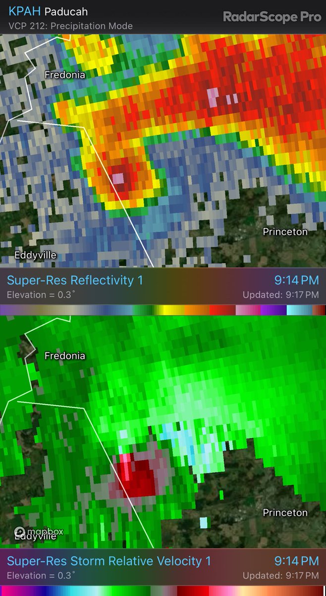
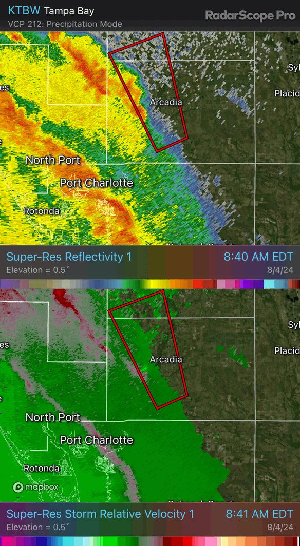
#Debby starting to pump out the tornadic supercells within the outer bands across Charlotte & DeSoto Counties. Could be a big problem if this behavior continues with these bands up into the much more populated Tampa Bay Area / Sarasota corridor. #FLwx #weather #hurricane #tornado
2
3
769
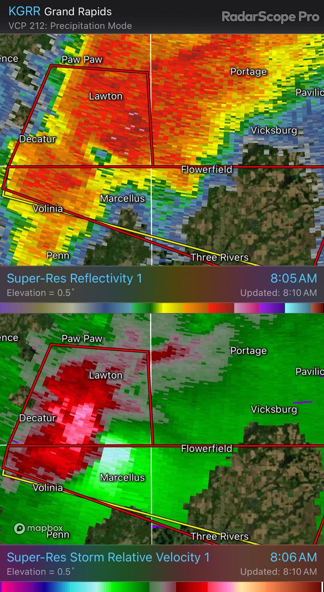
25 Jun 2024
Fantastic cloud structure with the squall-line passing through the #Detroit Michigan suburbs this morning. #MIwx #weather @weatherchannel @WeatherNation

1
4
7
491
24 Jun 2024
Great example of persistent right of mean flow propagation by the intense supercell moving through the middle of this loop. Compare it to the movement of every other cell. #SKStorm #weather #supercell #meteorology
1
7
1,772
22 Jun 2024
A lot would have to happen to change the overall forecast…but…but…I will say that velocity data is suggestive of the center attempting to reorganize farther SE along the GA coast in closer proximity to the convective burst. Likely just going to be short term trend. #AL92
1
2
164
21 Jun 2024
Historic flooding visited Sarasota, FL on the evening of June 11th, 2024. Check out my blog post in which we take a look at the meteorology of the event and determine how rare the rain was across this part of Florida. #FLwx #Flooding #record #weather
wix.to/69F1UfM
2
4
140
17 Jun 2024
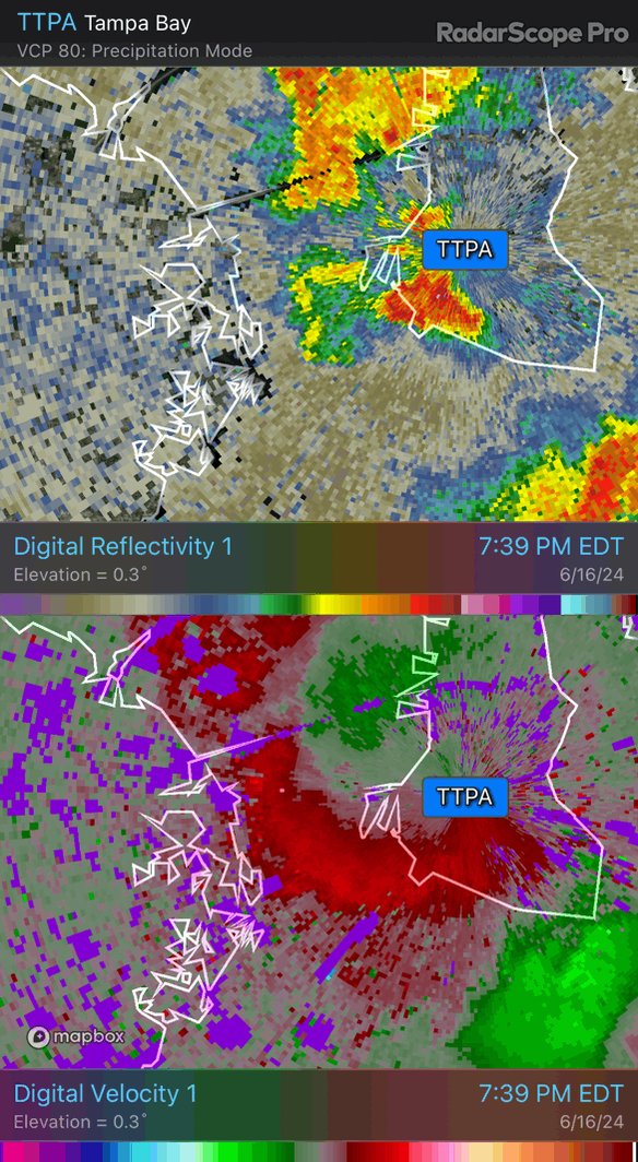
This is an awesome display of rapid cyclical downbursts from intense pulse convection over the northwest portion of Tampa Bay. TTPA radar was in perfect position to capture the event this evening. #radar #thunderstorm #FLwx
2
3
180


9 Jun 2024
This weekend marks the anniversary of the tragic tornado outbreak that impacted Michigan and Massachusetts in June 1953. In today's blog we take a deep dive into this tragic series of tornadoes. #MAwx #MIwx #tornado #weather
streamlineweather.com/post/u…
2
3
208
9 Jun 2024
1
279
8 Jun 2024
1
3
298
6 Jun 2024
A single hole in the clouds on a grey dreary morning illuminating the beautiful sunny day ongoing just above
1
89