
Streamline Weather Consulting, LLC is a comprehensive forensic & consulting meteorology company, providing clear and accurate client-based weather information.
Joined March 2021
- Tweets 209
- Following 39
- Followers 17
- Likes 195
94 Photos and videos


7 Dec 2024
1
18
27 Aug 2024
Timelapse of the severe storms rolling through Northville, MI this afternoon. @NWSDetroit @WeatherGeeks @WeatherNation @weatherchannel #MIwx #OHwx #INwx
54
27 Aug 2024
Time lapse of the severe storms as they past through Northville, MI shortly after 5pm. @weatherchannel @weathernation @nwsdetroit #MIwx #OHwx #INwx
53
streamlineweather retweeted

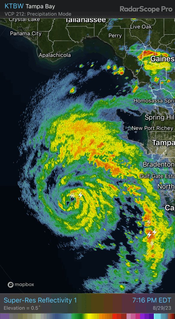
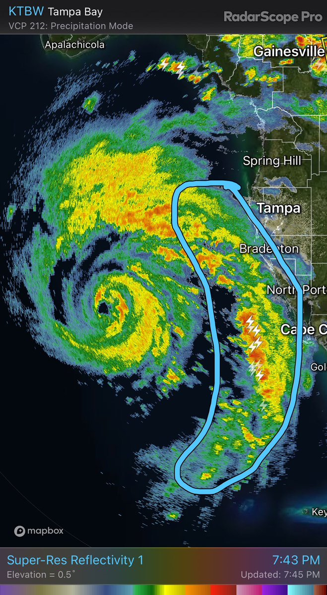
4 Aug 2024
#Debby starting to pump out the tornadic supercells within the outer bands across Charlotte & DeSoto Counties. Could be a big problem if this behavior continues with these bands up into the much more populated Tampa Bay Area / Sarasota corridor. #FLwx #weather #hurricane #tornado
2
3
769
streamlineweather retweeted
25 Jun 2024
Fantastic cloud structure with the squall-line passing through the #Detroit Michigan suburbs this morning. #MIwx #weather @weatherchannel @WeatherNation


1
4
7
491
streamlineweather retweeted
24 Jun 2024
Great example of persistent right of mean flow propagation by the intense supercell moving through the middle of this loop. Compare it to the movement of every other cell. #SKStorm #weather #supercell #meteorology
1
7
1,772
streamlineweather retweeted
23 Jun 2024
This is what happens when you get dewpoints near 70 moving over sea surface temps in the middle 60s. Unlike typical land-based fog, which likes calm conditions, advection sea-fog like this, requires wind be present to progress the air over the water. #MAwx #RIwx #weather #fog
1
1
205
streamlineweather retweeted
22 Jun 2024
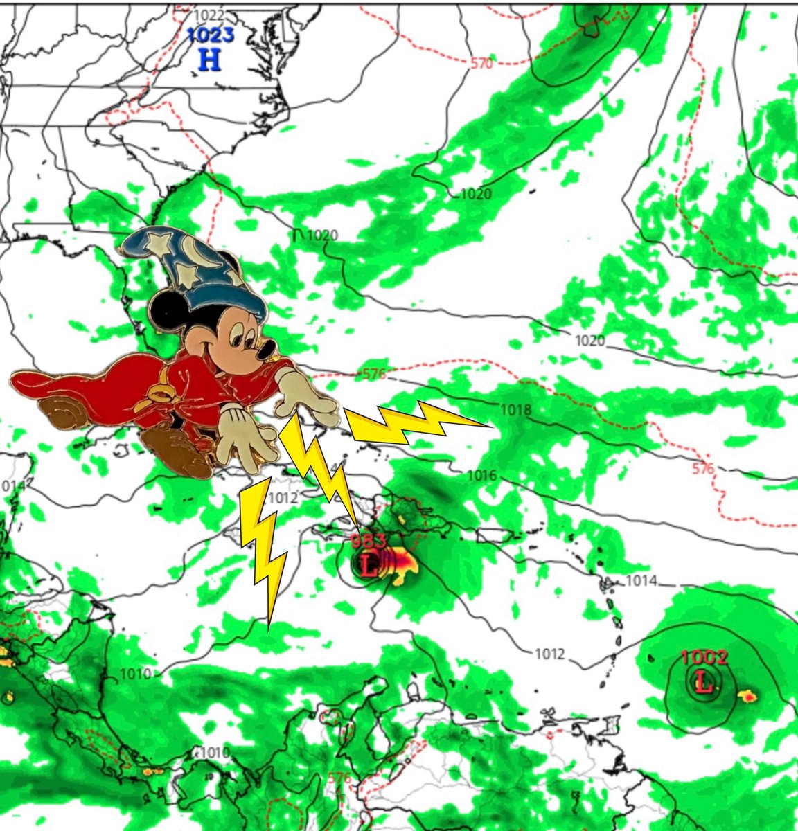
A lot would have to happen to change the overall forecast…but…but…I will say that velocity data is suggestive of the center attempting to reorganize farther SE along the GA coast in closer proximity to the convective burst. Likely just going to be short term trend. #AL92
1
2
164
streamlineweather retweeted
21 Jun 2024
Historic flooding visited Sarasota, FL on the evening of June 11th, 2024. Check out my blog post in which we take a look at the meteorology of the event and determine how rare the rain was across this part of Florida. #FLwx #Flooding #record #weather
wix.to/69F1UfM
2
4
140
streamlineweather retweeted
17 Jun 2024
This is an awesome display of rapid cyclical downbursts from intense pulse convection over the northwest portion of Tampa Bay. TTPA radar was in perfect position to capture the event this evening. #radar #thunderstorm #FLwx
2
3
180
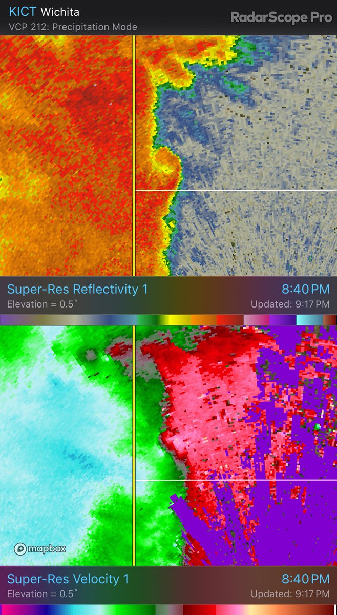
9 Jun 2024
9 Jun 2024

128
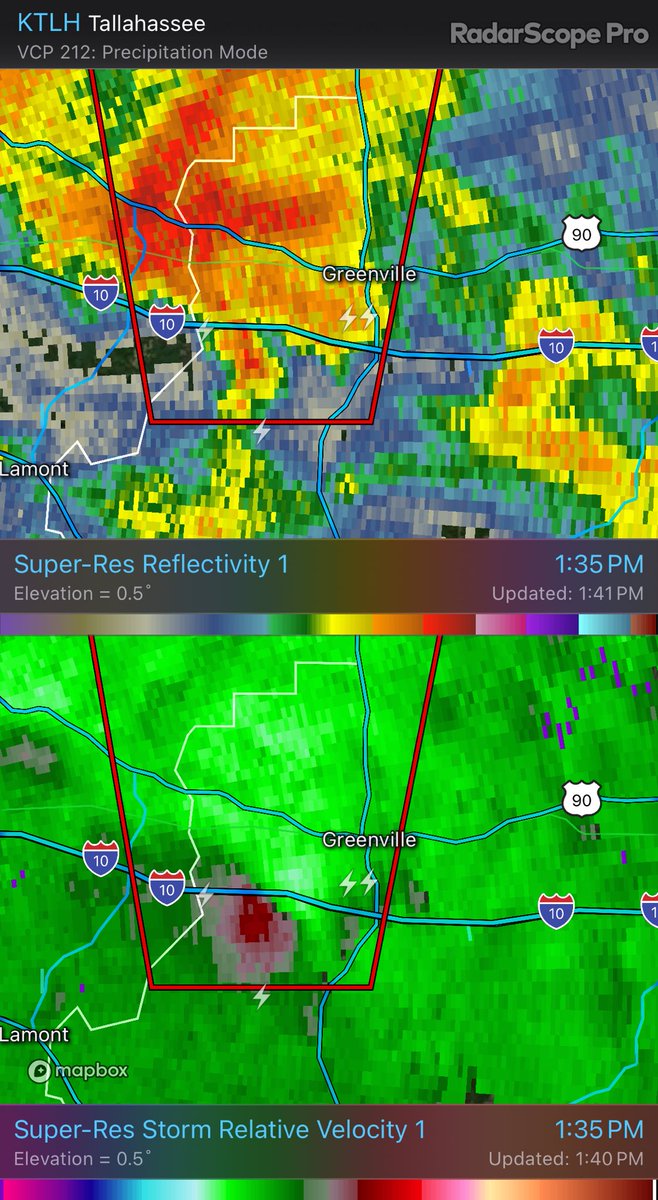
streamlineweather retweeted
8 Jun 2024
1
3
298
streamlineweather retweeted
20 May 2024
Someone could use this radar loop to write a fairly complete textbook on QLCS storm structure, associated features, and low level shear interaction #SevereWeather #kswx #weather
2
30
238
9,873