
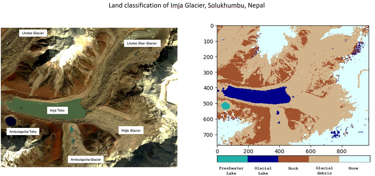
A passion for all things #SAR | #WomeninSAR | @eoscenefrom | We 💜@LadiesofLandsat & @DamesofDrones| Tweets by @LDR1, @SAR_ahBanks, @Go__Pika & @ant_dasgupta |
Joined August 2019
- Tweets 6,712
- Following 3,740
- Followers 9,739
- Likes 6,115
871 Photos and videos


Pinned Tweet

20 Nov 2023
👋Sisters of SAR will be taking a pause from our weekly schedule of tweeting as life has gotten a lot more busy for all of us here! We will still tweet when we can about #SAR & #SAR news but not as formal as before! 😊Thanks for following! We will be back! #EOChat
1
2
13
2,494
Sisters of SAR retweeted

27 Sep 2024
🔔The 8th edition of the @DLR_en and @esa open PolinSAR training course 2024 is ready to accept applications!
This hands-on course is organised around 11 sessions over 11 weeks
Apply now at👉eo4society.esa.int/event/8th…
📅deadline 11/10/2024
@ESA_EO @SistersofSAR @InSARinfo
7
21
1,763
Sisters of SAR retweeted

4 Sep 2024
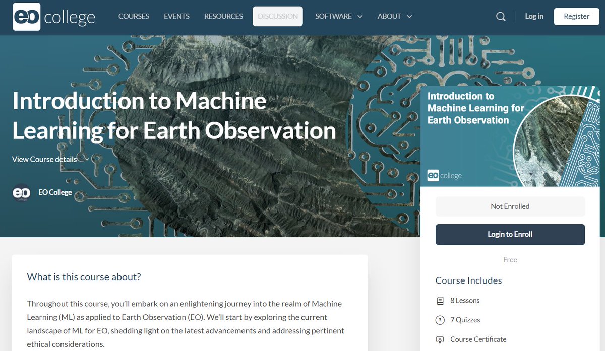
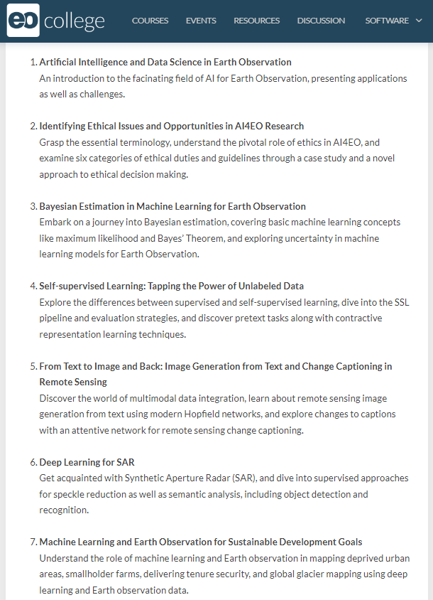
#EOchat 📢 - ICYMI, @EO_College just launched a new massive open online course (MOOC): "Introduction to #MachineLearning for #EarthObservation." Sign up! 😉
eo-college.org/courses/intro…
3
45
157
10,897
Sisters of SAR retweeted

4 Sep 2024
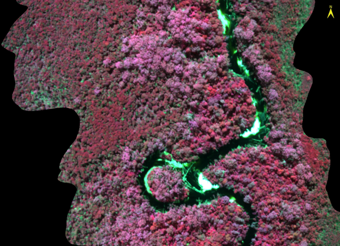
Dive into this 9-look CSI of Porto Turistico di Oristano, Italy, brought to life with colormaps optimized for CSI interpretation. See the unseen in vivid detail with Capella by your side!
#CapellaSpace #SARdata #EarthObservation

8
24
3,202
Sisters of SAR retweeted

4 Sep 2024
I am looking for a new PhD student to work on an exciting remote sensing project using airborne hyperspectral imagery and machine learning/AI to find ancient trees in the rugged and remote Tasmanian landscape. More information here: utas.edu.au/research/degrees…
8
137
307
29,137
Sisters of SAR retweeted

4 Sep 2024
🥳Congratulations to @SAR_ahBanks for her recent paper: "New insights into distinguishing temperate deciduous swamps from upland forests and shrublands with SAR" doi.org/10.1016/j.rse.2024.1… @GeoKoreen @JasonDuffe @CarletonDGES @SistersofSAR #Wetlands #Swamps #SAR 🌾🌳🛰️
6
18
1,001
Sisters of SAR retweeted

14 Jul 2024
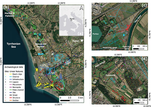
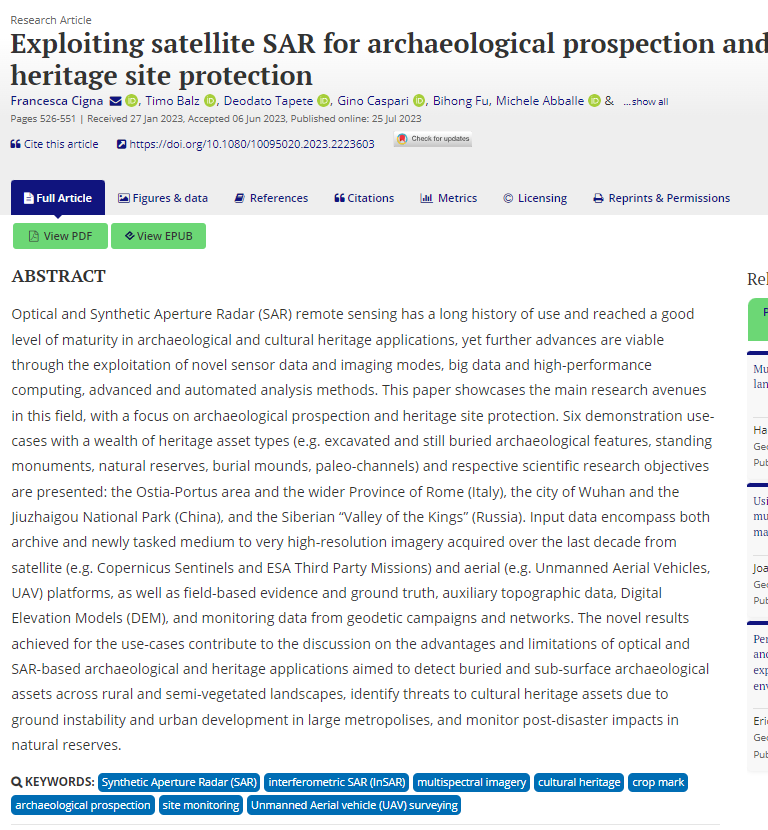
Visit OUR NEW PAPER: Exploiting #SATELLITE #SAR for archaeological prospection and #heritage site protection
The researchers focus on Rome (#Italy), #Wuhan (China), the Jiuzhaigou National Park (#China), and the Siberian “Valley of the Kings” (#Russia)
doi.org/10.1080/10095020.202…
2
6
457
Sisters of SAR retweeted

18 May 2023
🆕GRSS article of the week
📰Title: Explainable, Physics-Aware, Trustworthy Artificial Intelligence: A paradigm shift for synthetic aperture radar
✍️Authors: M. Datcu, Z. Huang, A. Anghel, J. Zhao, R. Cacoveanu
📎 DOI: doi.org/10.1109/MGRS.2023.32…
#SAR #XAI #IEEE

7
20
2,004
Sisters of SAR retweeted
30 Jul 2024
🌍🔍 Excited to share our latest research on #Landslides using space-borne SAR interferometry! This study, part of the ESA-MOST Dragon-5 initiative, enhances landslide detection and early warning systems. 🚨🏞️ #RemoteSensing #Geohazards #SAR #InSAR
👉 doi.org/10.1080/10095020.202…
2
6
306
Sisters of SAR retweeted

24 Apr 2023
#SAR is important for operational applications in the cloudy tropics, but Sentinel-1's C-band doesn't do a good job of detecting deforestation where the biomass remains on the ground. They are eagerly looking forward to NISAR for better deforestation data
1
1
3
327
Sisters of SAR retweeted

7 Aug 2024
High-Performance #Segmentation for #Flood Mapping of HISEA-1 #SAR Remote Sensing Images
by Suna Lv et al.
Read the full paper: brnw.ch/21wLIH0

12
61
3,300
Sisters of SAR retweeted

16 Aug 2024
Launch success! Communication has been established with all four ICEYE #SAR satellites sent into orbit on SpaceX's Transporter-11 mission.
Read more in our press release: hubs.li/Q02LDgrS0
(Video:SpaceX)
1
19
90
23,257
Sisters of SAR retweeted

18 Aug 2024
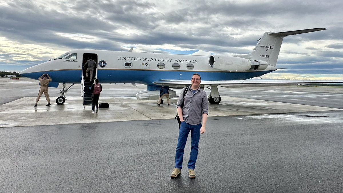
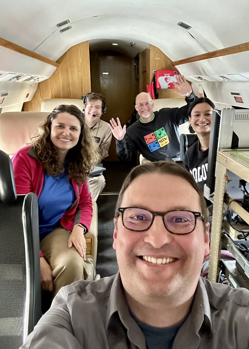
‼️#SAR folks‼️
Excited 🥳 to fly along with @seeoh2, @NASAJPL Chip Miller, and @hoy_elizabeth on @NASA @UAVSAR plane 🛩️ today. About to take off 🛫 from Fairbanks to fly some lines for the NASA #ABoVE program!
#GoldenAgeOfSAR
4
7
61
2,014
Sisters of SAR retweeted
13 Mar 2024
How can you elevate your flood response with ICEYE's integrated data layers?
Discover our AI-powered, multi-source approach that combines radar satellite imagery and advanced data sets into actionable flood intelligence. Learn more at hubs.li/Q02pg1yn0.
2
5
1,372
Sisters of SAR retweeted
4 Mar 2024
The various leads of @LadiesOfLandsat @SistersofSAR @geospatialwomen @ISPRS_SC (incl @morganahcrowley @flasmendes @Go__pika @LDR1 @sar_ahbanks @cavrinceanu @SabrinaSzeto @srcreyes) also did 🔥 jobs in organizing #GeoMixer[s] w/ the broader #EO community.
x.com/LadiesOfLandsat/status…
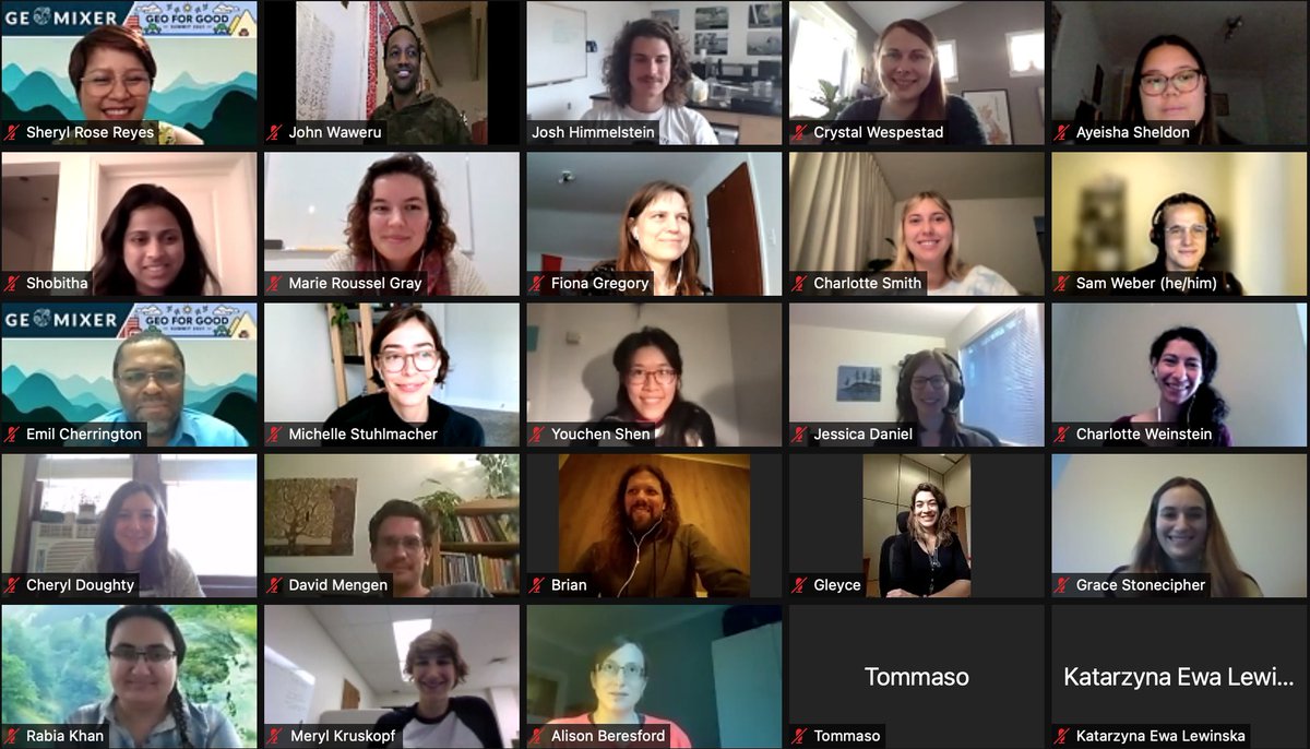
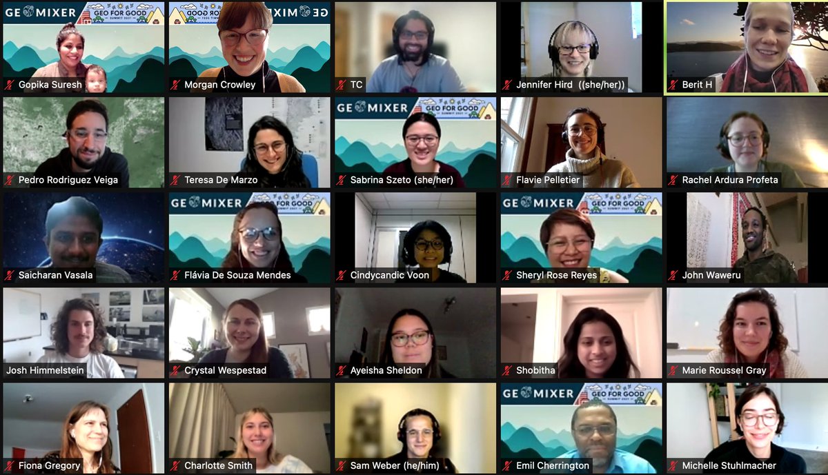
19 Nov 2021

We had an amazing time at today's #GeoMixer virtual meetup for #GeoforGood21! Thanks to our co-hosts @Go__pika, @SabrinaSzeto, @BzGEO, @srcreyes, @flasmendes & @morganahcrowley🛰️🤩
It was wonderful to meet everyone,🤞we can all meet in person.... maybe at #GeoforGood22!
3
3
11
1,541
Sisters of SAR retweeted

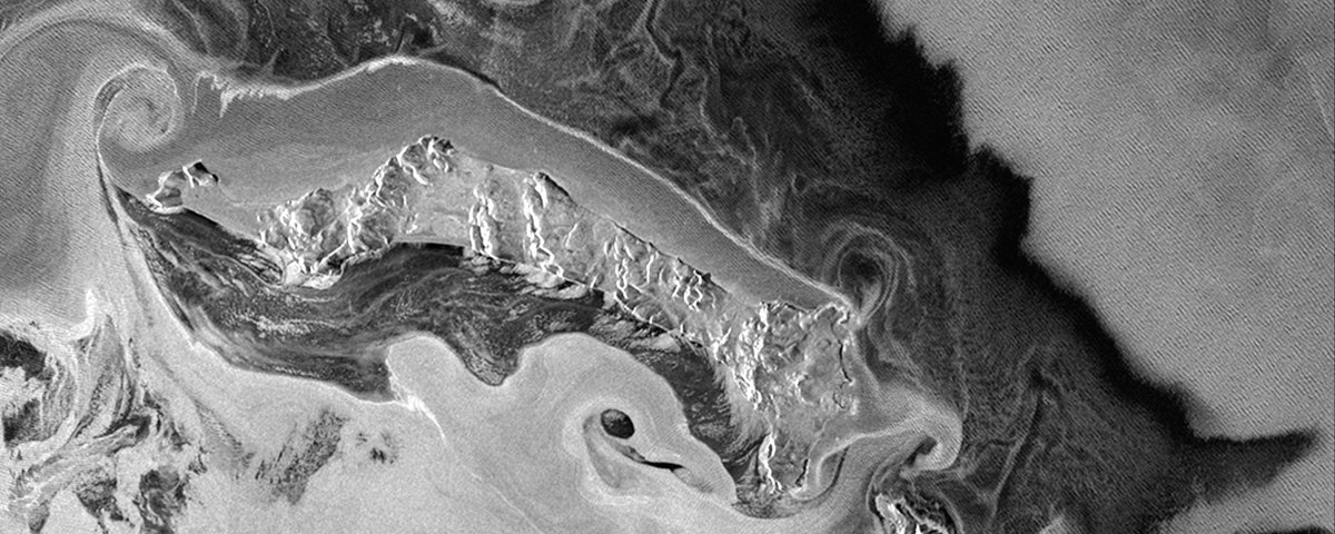
12 Mar 2024
Incredible view of Baffin Bay area captured by @DLR_en @AirbusSpace's TerraSAR-X 🛰️ in May 2021. Ice cover 🧊 makes navigation difficult most of the year due to the high density of floating ice and icebergs.
Learn more: earth.esa.int/eogateway/miss…
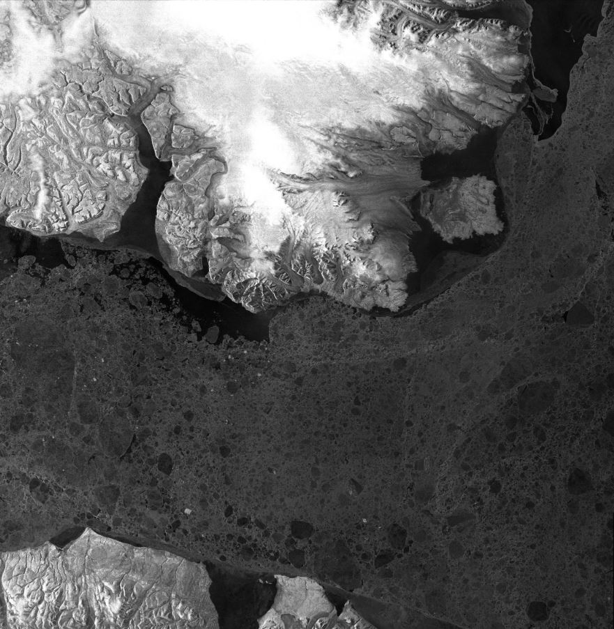
ALT TerraSAR-X image captured on 25 May 2021 over the Baffin Bay area
4
8
1,093
Sisters of SAR retweeted

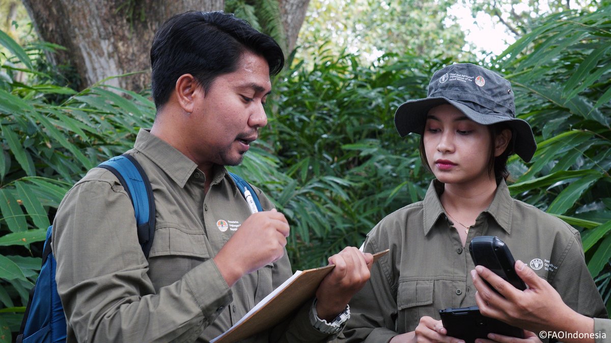
9 Jan 2024
With support from @theGEF, @FAO has launched a new phase of work to assist developing countries to monitor & report data on the state & changes in their forest cover more effectively & transparently.
Read more 👉 ow.ly/wXlr50Qp8Im
#CBITForest #ClimateAction
@UNFCCC
45
92
7,025
Sisters of SAR retweeted

31 Dec 2023
And huge thanks to @SARevangelist for trainining the next generation of SAR scientists!
2
15
1,286
Sisters of SAR retweeted
30 Dec 2023
#SAR Twitter
Tnx to #Twittercircle for a fantastic 2023. In 2024, @NASAJPL NISAR will add to #GoldenAgeOfSAR!!
Shout-out to y’all for all the amazing work you do! @gfun @SistersofSAR @EricFielding @EarthScope_sci @aJollyAdventure @UAFGI @mouthofmorrison @BzGEO
@snowradar & more

2
11
52
6,592
Sisters of SAR retweeted
2 Jan 2024
.@ICEYEfi's SAR Radar (VHR) captured Myanmar's Irrawaddy region, a major rice-producing area. The 4 states in the Irrawaddy River Delta contribute significantly to the country's rice crop.
@ESA's catalog access: earth.esa.int/eogateway/cata…
Dissemination map: tpm-ds.eo.esa.int/smcat/ICEY…
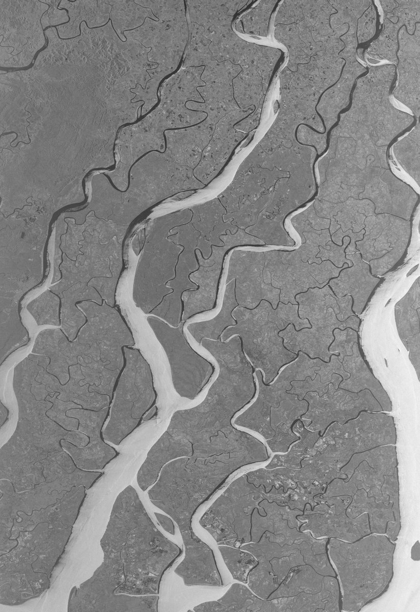
ALT ICEYE image - Start Date: 2020-02-14T20:44:32.741Z | Stop Date: 2020-02-14T20:44:42.737Z
3
10
1,508
Sisters of SAR retweeted
2 Jan 2024
Did you know? Synthetic Aperture Radar (SAR) interferometric (InSAR) technique can detect surface deformations with millimeter-level accuracy. It's crucial for monitoring infrastructures like railways. 🛰️🚄
Data access: earth.esa.int/eogateway/cata…
📷@dlr_en @airbusspace #TerraSARX
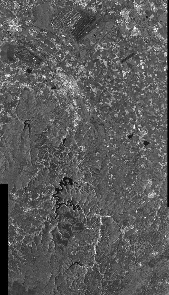
ALT Cologne, Germany – Railway Deformations captured by TerraSAR-X on 18 September 2020
3
8
684