
- Tweets 45,788
- Following 439
- Followers 6,885
- Likes 1,728
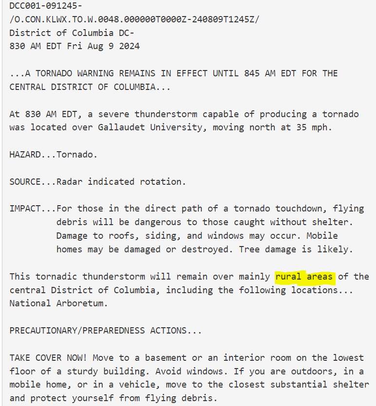


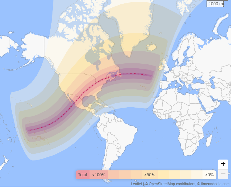


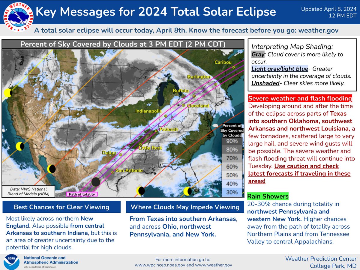
ALT Key Messages for 2024 Total Solar Eclipse A total solar eclipse will occur today, April 8th. Know the forecast before you go: weather.gov Interpreting Map Shading: Gray: Cloud cover is more likely to occur. Light gray/light blue- Greater uncertainty in the coverage of clouds. Unshaded- Clear skies more likely. Severe weather and flash flooding Developing around and after the time of the eclipse across parts of Texas into southern Oklahoma, southwest Arkansas and northwest Louisiana, a few tornadoes, scattered large to very large hail, and severe wind gusts will be possible. The severe weather and flash flooding threat will continue into Tuesday. Use caution and check latest forecasts if traveling in these areas! Rain Showers 20-30% chance during totality in northwest Pennsylvania and western New York. Higher chances away from the path of totality across Northern Plains and from Tennessee Valley to central Appalachians.