
Operational forecaster in the private sector | OSINT |Millersville University alum | Tweets consist of cyclones, ⚜ Saints, and other spinning clouds.
Joined August 2013
- Tweets 7,048
- Following 1,007
- Followers 3,559
- Likes 63,768
2,785 Photos and videos


Pinned Tweet

28 Oct 2025
This has to be one of the most incredible and terrifying satellite loops that I've seen in a while. You can see 5 violent mesovorts spinning around the eye of #Melissa this morning.
13
324
2,617
173,632
Steve Copertino retweeted

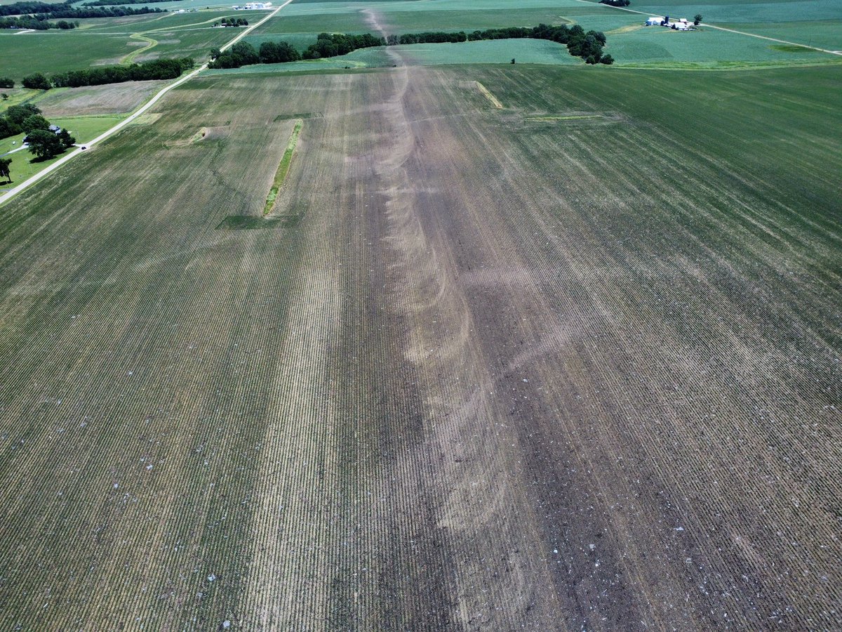
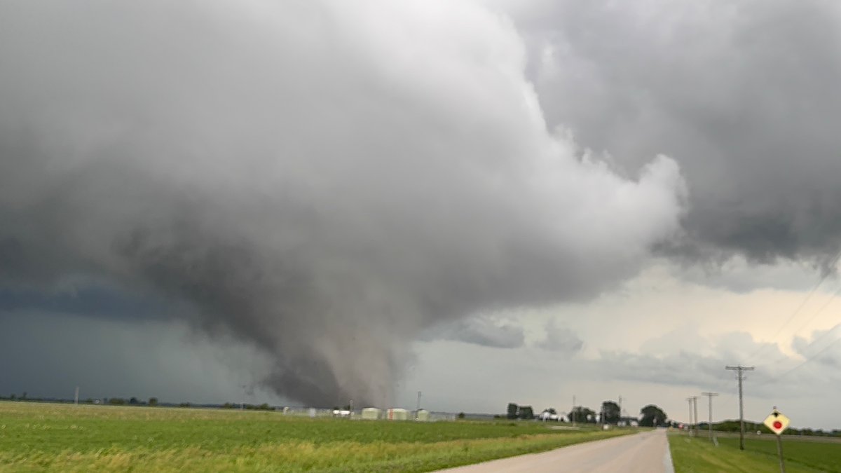
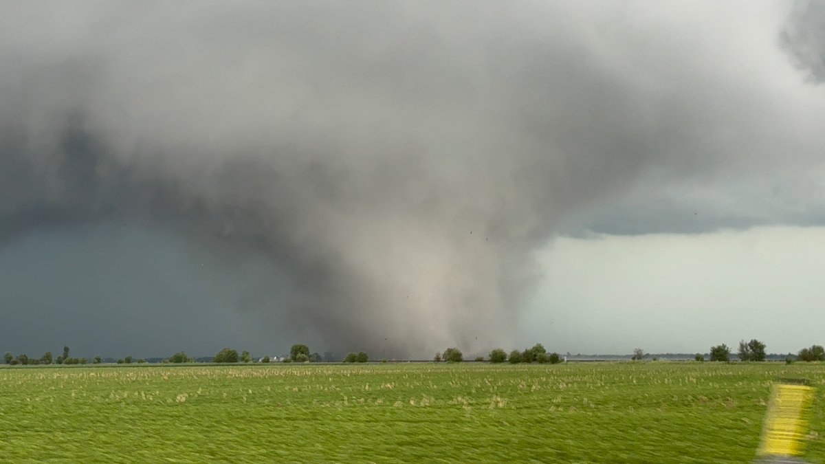
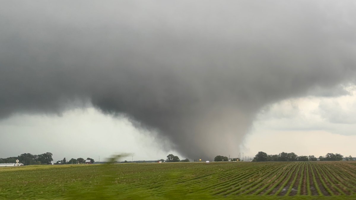
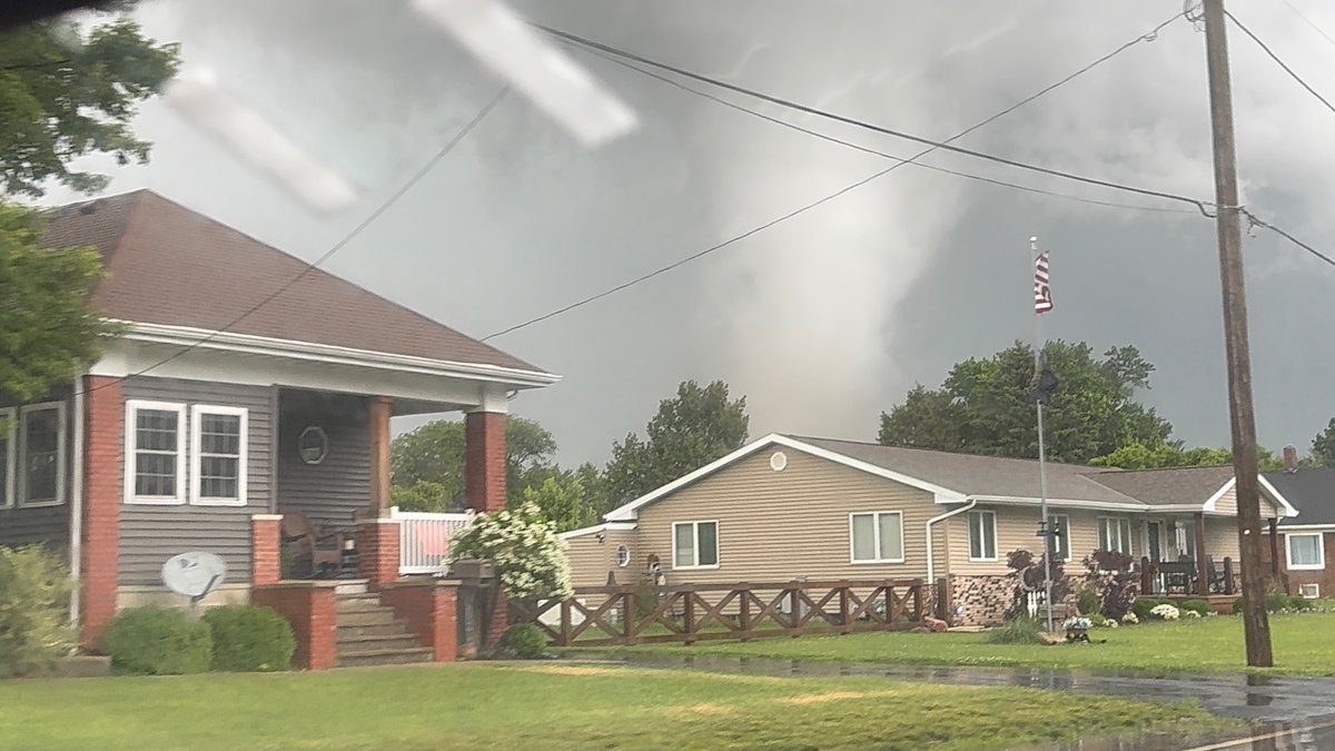
INCREDIBLE cycloidal markings left behind by a powerful tornado in Washburn, Illinois from yesterday. This is the most impressive tornado damage I’ve ever seen, I’m in awe of these photos I took.


6
77
501
12,579
Steve Copertino retweeted

Jun 12
Super excited to announce that we have received the preliminary results from SPC's Spring Forecasting Experiment!
StormNet scored 1st place overall, plus:
-1st place at each lead-time.
-1st place each week of the experiment.
Even beating CSU-MLP (GEFS-MLP) and WxNext2!

31
59
376
39,425

This actually wound up being a relatively impressive damaging wind event with ~300 wind reports across a good chunk of the region.

The remnant MCS over the Ohio Valley should help scattered thunderstorms fire across portions of PA and NY later this afternoon as it travels east.
We'll have to see just how far east this activity can get, but the main threat today would be locally damaging winds.

2
6
3,849
The remnant MCS over the Ohio Valley should help scattered thunderstorms fire across portions of PA and NY later this afternoon as it travels east.
We'll have to see just how far east this activity can get, but the main threat today would be locally damaging winds.
4
4,080
Steve Copertino retweeted

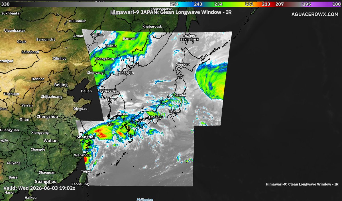
Jun 3
Aguacero 5.8 is live.
🛰 GOES-West & Himawari, satellite coverage across the whole Pacific
⚡ Lightning counter for layouts & popups
🎨 Brightness/contrast/saturation sliders for satellite basemaps
📦 Bundles can now save the model they were built with
aguacerowx.com

2
10
58
6,019
Steve Copertino retweeted

May 30
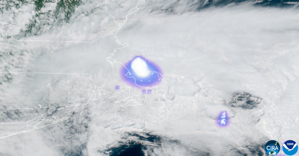
Reports of an explosion hears around Boston I believe are going to be a rather significant bolide/meteor entering the atmosphere. Very large "flash" detected by GOES-19 GLM that does not correlate with active thunderstorms. #MAwx
142
699
3,106
3,670,868
Steve Copertino retweeted

May 21
Had some classic unpredictable spring weather today in Yellowstone.
13
176
1,739
28,329
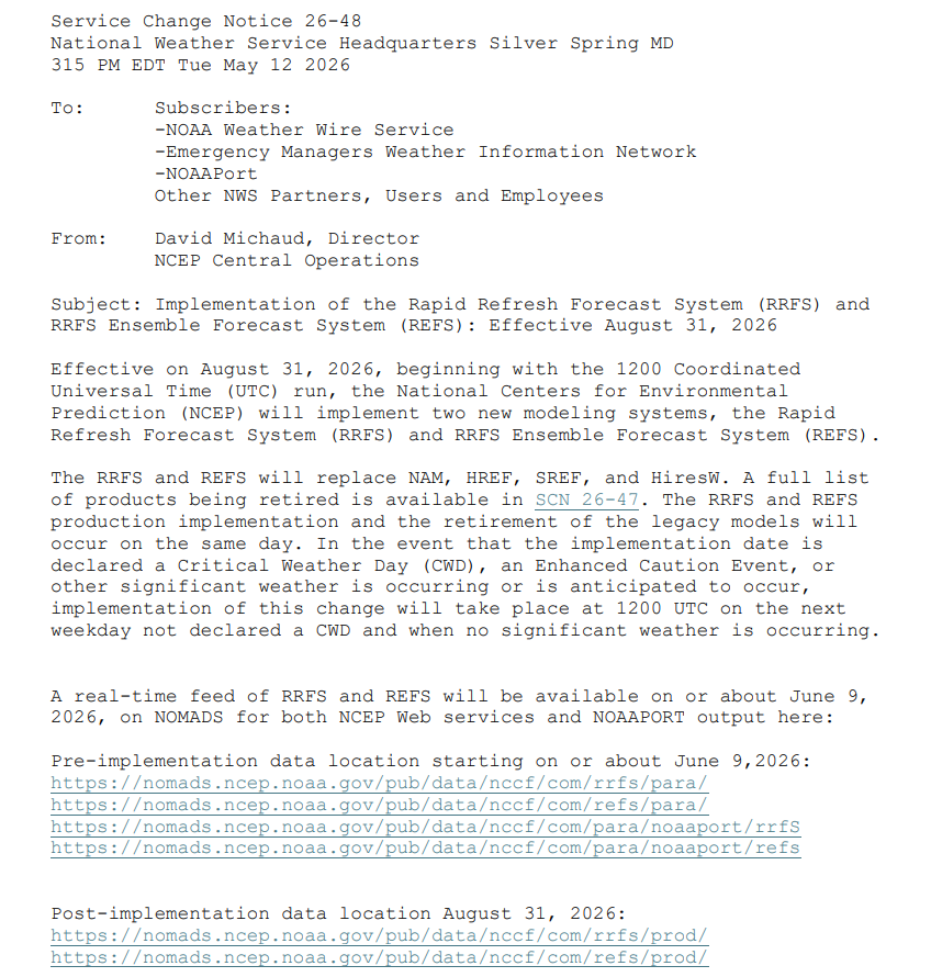
May 12
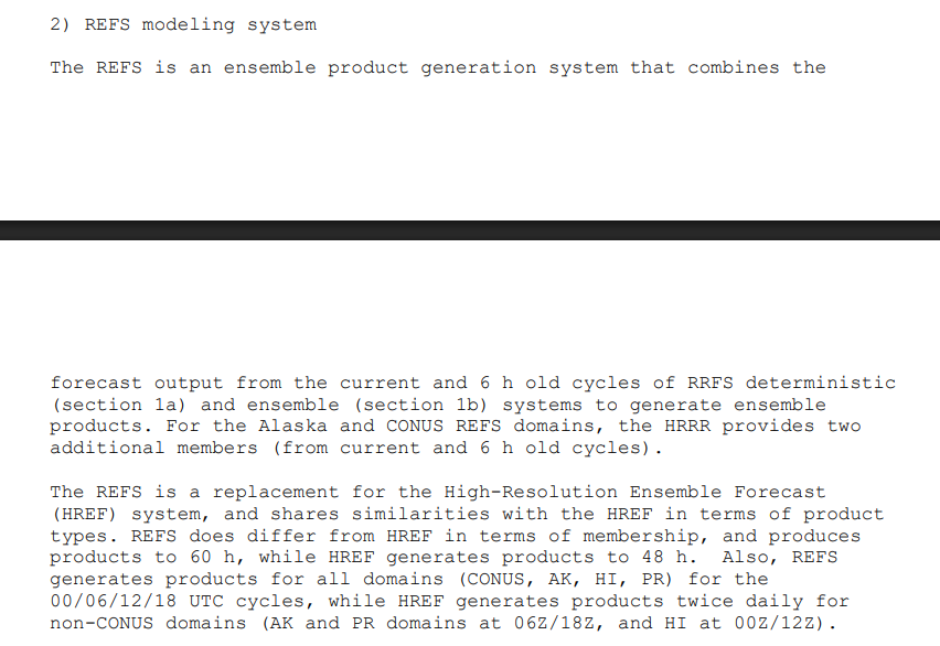
So...uh...how are all the mets and forecasters out there feeling about this one?
Not having the HREF anymore is going to take me a long, long time to get used to. 😬
weather.gov/media/notificati…
2
4
440
Steve Copertino retweeted

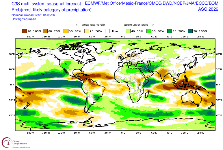
May 10
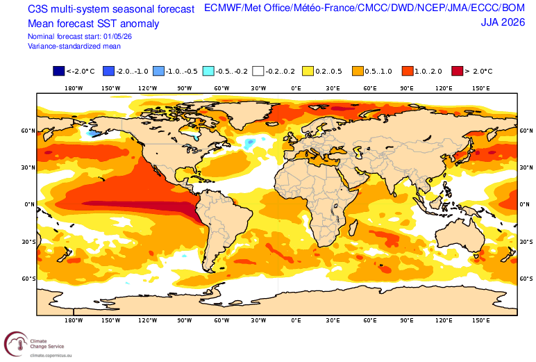
Two things jump out to me in the latest C3S climate model means:
1) This is easily the most hostile pre-season forecast Atlantic look I have ever seen in this composite: MDR cooler SST than the subtropics, large-scale subsidence from El Niño, enhanced trade winds on top of the upper level shear.
2) This is probably about as favorable of a large-scale setup for Hawaii hurricane threats as you will ever see, with a strong Niño and PMM.
18
50
280
25,217
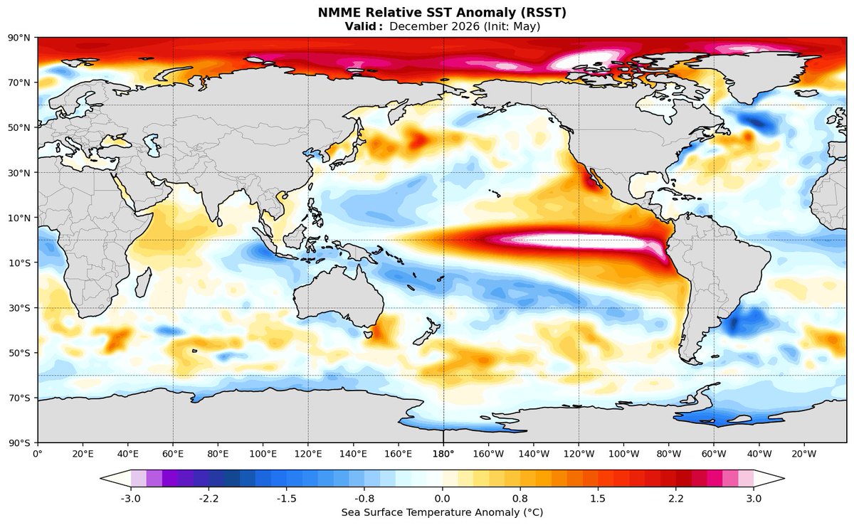
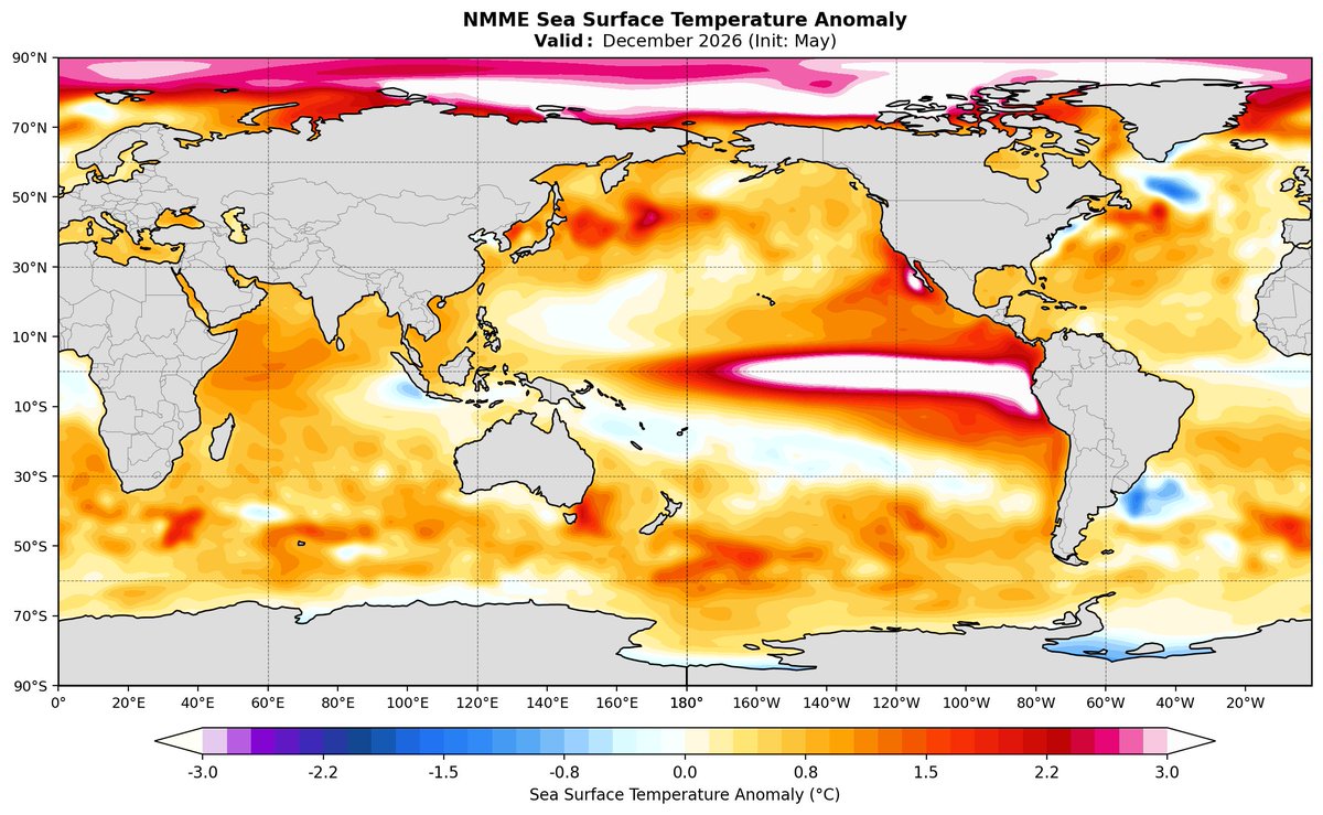
The NMME has Niño 3.4 peaking in December around 3.1°C and roughly 2.41°C with the global mean removed (RONI).
This El Niño certainly looks like it could be one for the books!
8
57
241
14,678
Steve Copertino retweeted

Comparing some of the latest forecast runs to past strong El Niño events shows we are in for quite a historic ride, if verified. Both the BOM and CFSv2 use the Relative ENSO index forecast. Interesting to see how close the new BOM forecast is to the ECMWF.
@AndyHazelton
@webberweather
@PaulRoundy1
@tcrawf_nh
@BenNollWeather

4
12
51
5,777
The updated ECMWF seasonal model continues to show a *very* strong El Niño developing through the summer months.
This is just about as unfavorable as it gets for the Atlantic hurricane season, and the current SST configuration certainly won't help the situation.
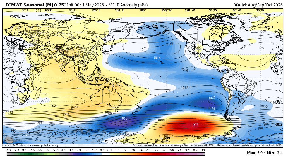

The progression of ECMWF seasonal VP200 forecasts shows the strengthening of this summer's atmospheric El Niño signal in recent months
3
7
49
4,276
Steve Copertino retweeted

May 1
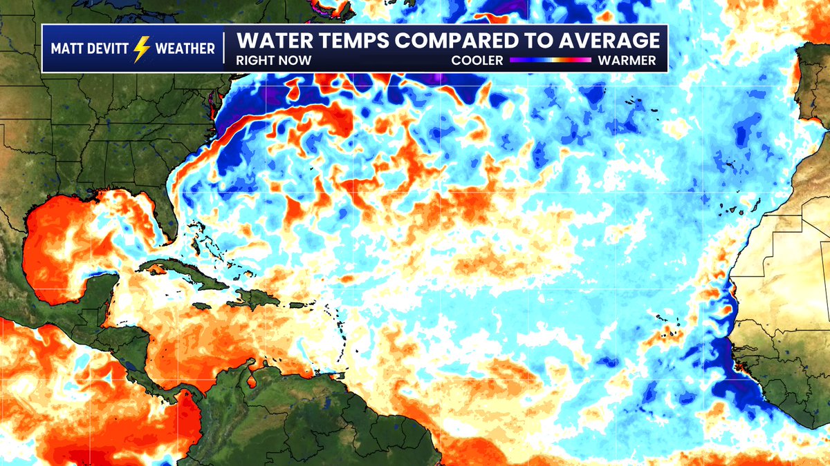
Andy is right, this is actually a very important detail. Most TV stations have built in the standard look on the left...which makes it look too warm because it compares it to an outdated average. Look what happens when I adjusted it to Andy's recommendation for a more accurate assessment (right). Pretty sizable change that tells a different story.
Apr 29

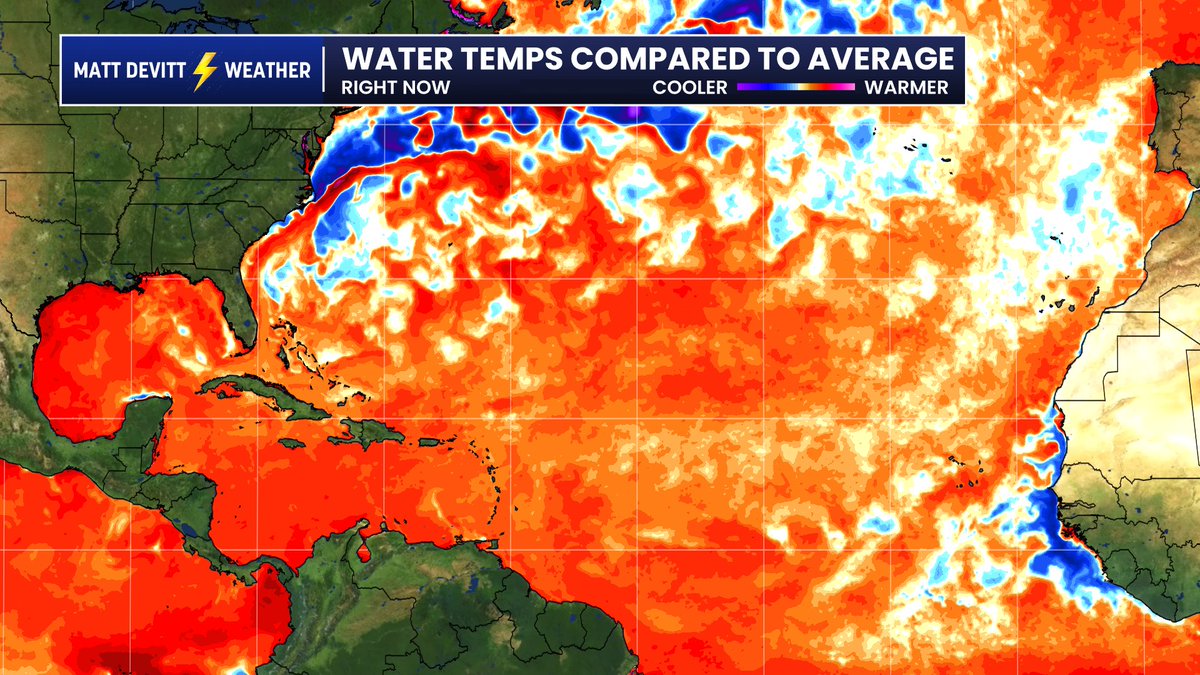
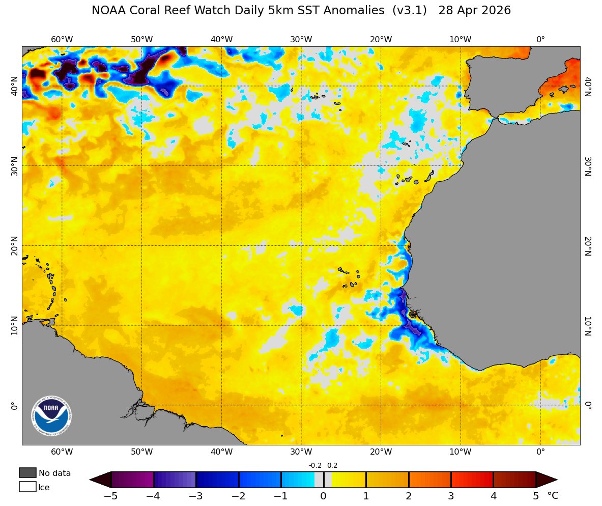
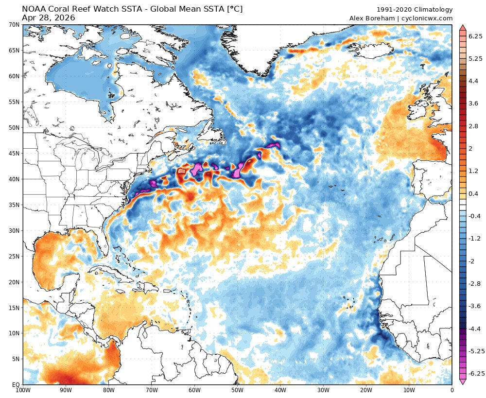
PSA, I would avoid using this CRW SST anomaly product. It makes things look unrealistically warm for two reasons:
1) Outdated climo average of 1985-1990 1993.
2) Slightly deceptive colorbar where anything slightly above zero is yellow.
For a more realistic look, use the same plot from @cyclonicwx with a more realistic climatology, preferably the one with the global mean anomaly removed (which is what matters for comparing basins).
coralreefwatch.noaa.gov/prod…
11
30
222
30,836
Apr 30
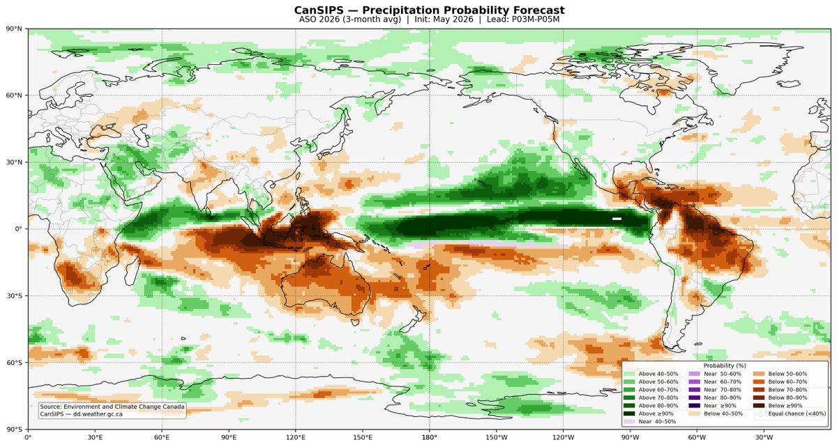
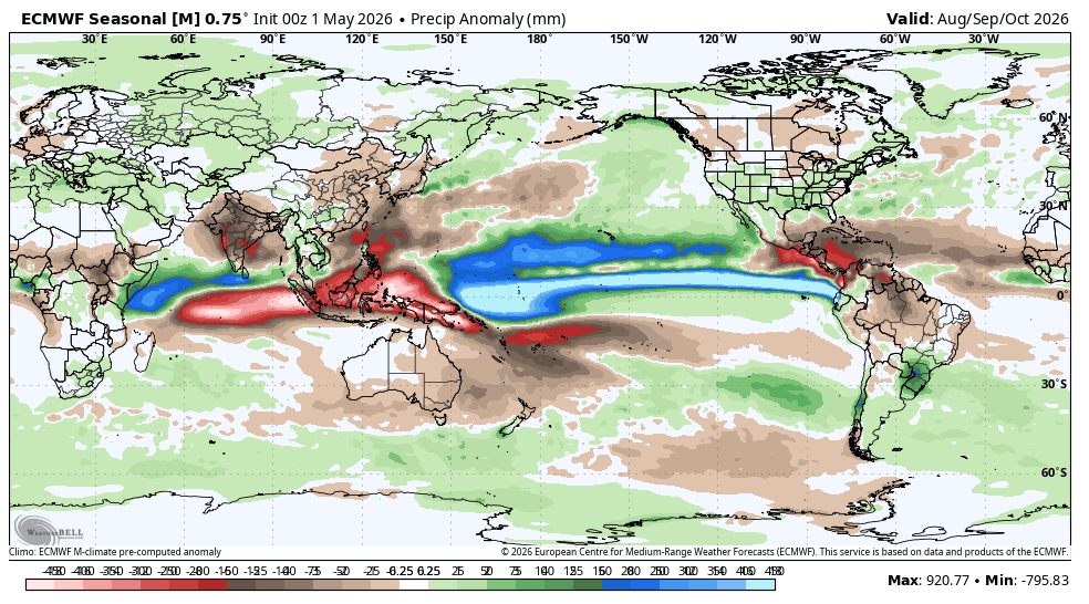
Precipitation output from the CanSIPS also shows a strong signal for reduced activity in the Atlantic from August to October.
The East Pacific and Central Pacific may have quite the year, especially given sea surface temperatures well above normal for this time of year.
Apr 30

New CanSIPS outlook now shows a super El Niño this year.
The ensemble mean of the new run peaks at 2.0˚C in the central equatorial Pacific during December, whereas the previous run had 1.6˚C.
The most extreme ensemble member nearly reaches 4.0˚C.
3
7
63
11,845
Steve Copertino retweeted
Apr 29
PSA, I would avoid using this CRW SST anomaly product. It makes things look unrealistically warm for two reasons:
1) Outdated climo average of 1985-1990 1993.
2) Slightly deceptive colorbar where anything slightly above zero is yellow.
For a more realistic look, use the same plot from @cyclonicwx with a more realistic climatology, preferably the one with the global mean anomaly removed (which is what matters for comparing basins).
coralreefwatch.noaa.gov/prod…
10
16
144
44,122
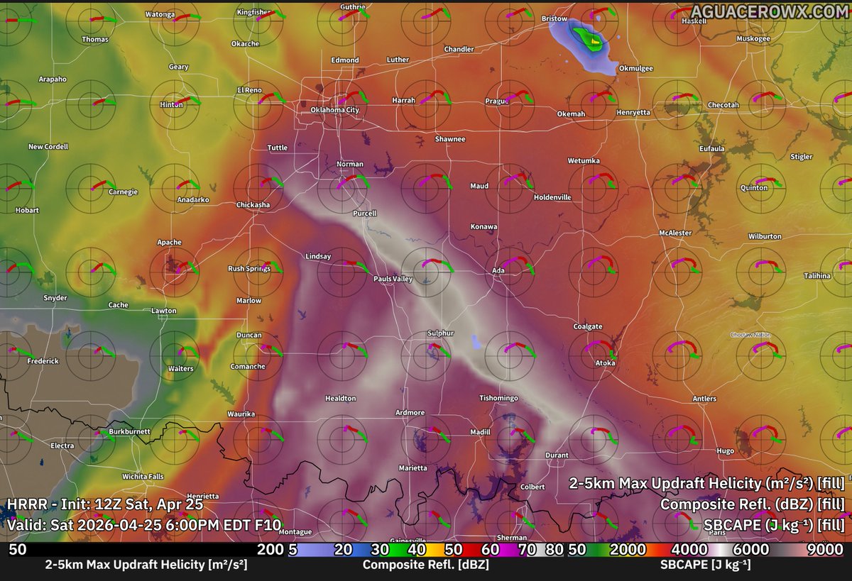
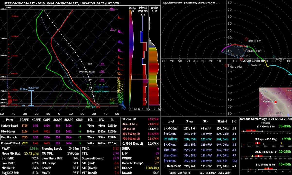
Apr 25
The environment just south of Lyndsay is absolutely primed right now. Impressive overlap of 3CAPE and surface vorticity right where we have some very agitated CU developing.
Very high potential for anything that can go up there.
2
13
525
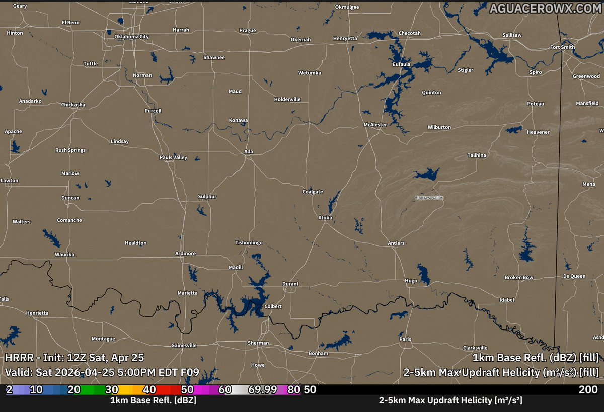
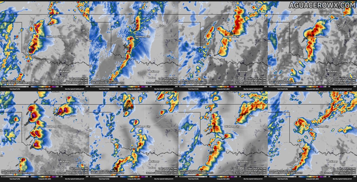
Apr 25
The 12z HRRR shows an exceptionally favorable environment for intense supercells across central and southern #Oklahoma later this evening.
All hazards will be in play, with very large hail and even a few strong tornadoes possible given the impressive thermodynamics.
1
4
17
845