
@NWSSanAntonio Partner • SKYWARN® Spotters • Daily/severe wx info for Austin & Travis County • NOAA Weather-Ready Nation Ambassador™ #ewxspotter #VOST #atxwx
- Tweets 41,525
- Following 237
- Followers 16,349
- Likes 22,369


ALT This graphic displays a flash flood warning plotted on a map. The warning is in effect until 9:00 AM CDT. The warning includes Round Rock TX, Cedar Park TX and Georgetown TX. This warning is for Southwestern Burnet County in south central Texas, Northern Travis County in south central Texas and Southwestern Williamson County in south central Texas. Avoid walking or driving through flood waters! Move immediately to higher ground! There are 1,069,912 people in the warning along with 224 schools and 9 hospitals.

ALT The graphic shows today's weather forecast. There is a medium to high confidence on heavy rainfall and the potential for flooding. Stay weather aware.


ALT This graphic displays a flash flood warning plotted on a map. The warning is in effect until 8:15 AM CDT. The warning includes Taylor TX, Elgin TX and Manor TX. This warning is for North Central Bastrop County in south central Texas, Northwestern Lee County in south central Texas, East Central Travis County in south central Texas and Southeastern Williamson County in south central Texas. Avoid walking or driving through flood waters! Move immediately to higher ground! There are 62,751 people in the warning along with 26 schools and 1 hospital.


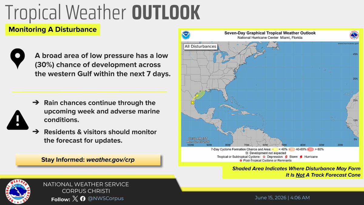
ALT The National Hurricane Center has highlighted an area over the western Gulf with 30% chance of development in the next 7 days. While the chances for development remains low, rain chances increase across the Texas coast through at least mid-week.


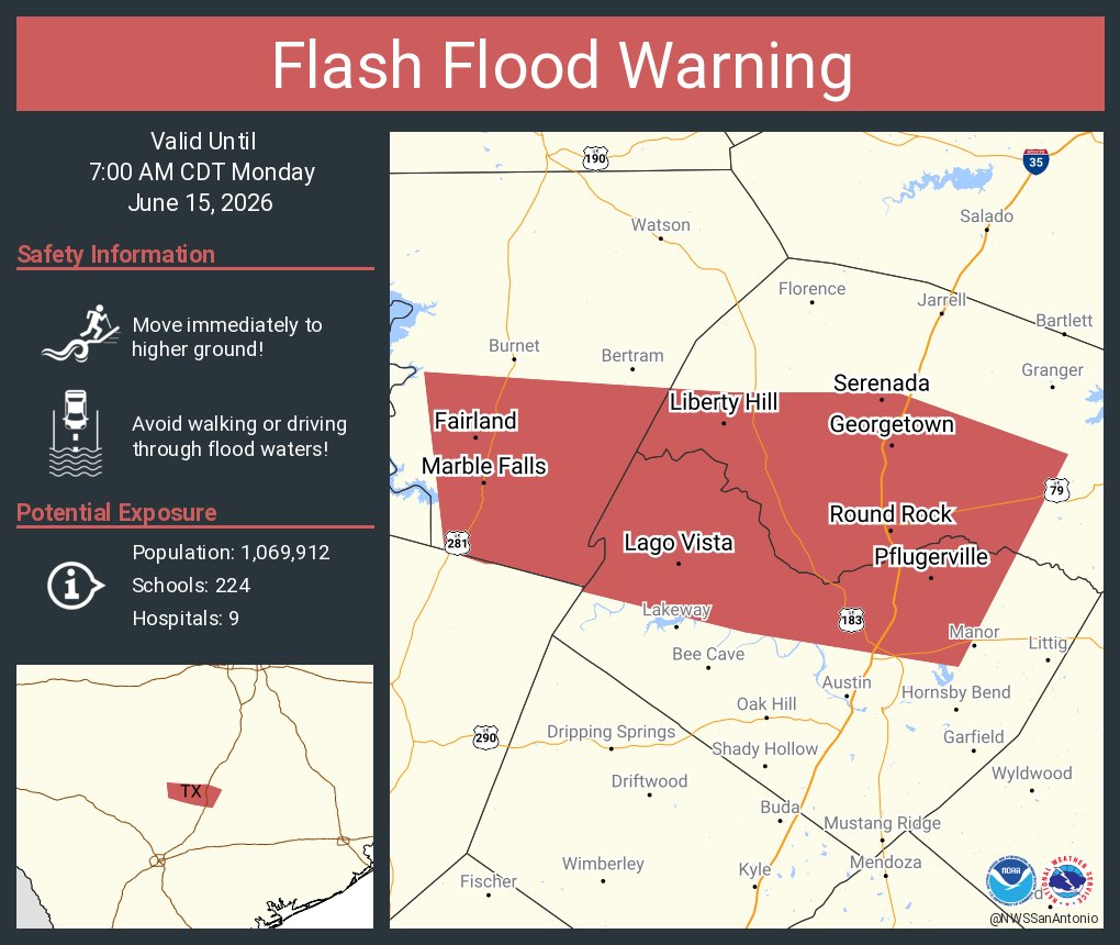
ALT This graphic displays a flash flood warning plotted on a map. The warning is in effect until 7:00 AM CDT. The warning includes Round Rock TX, Cedar Park TX and Georgetown TX. This warning is for Southwestern Burnet County in south central Texas, Northern Travis County in south central Texas and Southwestern Williamson County in south central Texas. Avoid walking or driving through flood waters! Move immediately to higher ground! There are 1,069,912 people in the warning along with 224 schools and 9 hospitals.

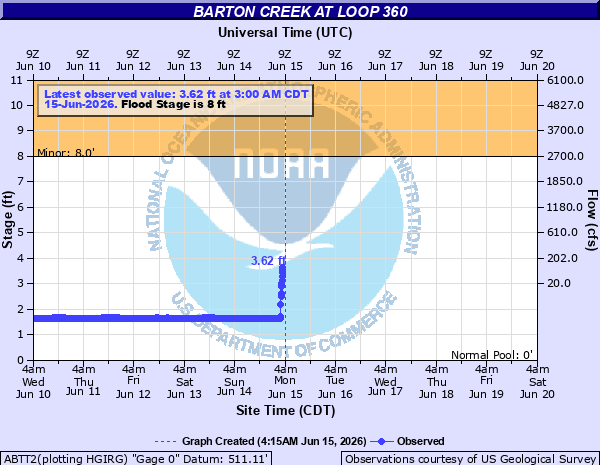
ALT This graphic displays a flash flood warning plotted on a map. The warning is in effect until 6:00 AM CDT. The warning includes Austin TX, Lakeway TX and Buda TX. This warning is for Northern Blanco County in south central Texas, Northeastern Hays County in south central Texas and Southern Travis County in south central Texas. Avoid walking or driving through flood waters! Move immediately to higher ground! There are 878,385 people in the warning along with 168 schools and 18 hospitals.